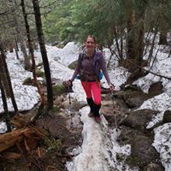
meta

Monroe Trail

based on 80 tracks & routes
3.1 mi
Distance
1 hrs 10 min
Time
terrain
2,531 ft
Elev Gain

Overview

This is a moderate one way trail in Vermont.


Sights to See


    Rate this Hike

    user_profile
    3 years, 8 months ago
    A nice hike, steady up - the summit trail was more challenging. Thunderstorm on the return - the water really rushes down the trail, which is very slick on the rocks. Fun hike, great view from the top.
    ★ ★ ★ ★ ★

    user_profile
    1 year, 7 months ago

    user_profile
    6 years, 9 months ago
    ★ ★ ★ ★ ★


Public Tracks

user_profile
Jane 6 years, 10 months ago
Camel's Hump Rd (East)
Carrying 30.8 lbs, drank all my camelback. I had a third liter in a canteen. Tony drank most of his water too. Tony carried 30.2lbs.
user_profile
Dan Saul 3 years, 7 months ago
user_profile
Davey 4 years, 2 months ago
user_profile
sarahhersey 5 years, 1 month ago
user_profile
aaron.stein21 5 years, 2 months ago
user_profile
lwancheck 5 years, 7 months ago
user_profile
bberndt 5 years, 7 months ago
user_profile
btzimr 6 years, 1 month ago
user_profile
cgwils 6 years, 1 month ago
user_profile
emilyzeman 6 years, 7 months ago
user_profile
Nate 6 years, 9 months ago
user_profile
Melissa 6 years, 9 months ago
user_profile
Brian Joseph 6 years, 9 months ago
user_profile
chbcmio 7 years, 6 months ago
user_profile
cfis 7 years, 8 months ago
user_profile
Jeff O! 10 years ago
user_profile
Michelle 10 years, 7 months ago