United States
›
Arkansas
›
Nfm 1301

Nfm 1301(edit)

based on 40 tracks & routes   |   |  
DIFFICULT
   #175 hike out of 221 in   |   
DIFFICULT
link Copy Link email Email directions Driving Directions
  • GPX
  • KML

9.2 mi
Distance

5 hrs 39 min
Time
terrain
757 ft
Elev Gain

Overview

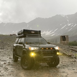
This is a difficult one way trail in Arkansas.


    Rate this Hike

    ★★★★★


Public Tracks

user_profile
Vader_Runner 7 years, 5 months ago
Line 1.5
user_profile
x3overland 7 years, 6 months ago
Line 1.5
user_profile
macgyver 7 years, 8 months ago
Line 1.5
user_profile
blackbear80 11 years, 2 months ago
oot1.5

Elevation Profile

Seasonal Popularity

Nearby Hiking Trails

  1. Middle Fork
    ★ ★ ★ EASY 3.1 mi
  2. Indian Creek Road
    ★ ★ ★ ★ ★ DIFFICULT 97.4 mi
  3. Lindsey Motorway
    ★ ★ ★ ★ ★ MODERATE 6.0 mi
  4. Pilot Rock Mountain Road
    ★ ★ ★ ★ ★ DIFFICULT 68.7 mi
  5. SR 124
    ★ ★ ★ DIFFICULT 41.9 mi
  6. Felkins/Myer Br
    ★ ★ ★ MODERATE 5.1 mi
  7. Old Hwy 27
    ★ ★ ★ ★ MODERATE 7.1 mi
  8. Grapevine Mountain via Lindsey Motorway
    ★ ★ ★ ★ ★ EASY 4.7 mi
  9. White Oak Mountain via Nfm 1301 and Evans Mountain Road
    ★ ★ ★ ★ ★ DIFFICULT 14.4 mi
  10. Lake Dardanelle via AR 7
    ★ ★ ★ DIFFICULT 23.9 mi