United States
›
Arizona
›
Prescott National Forest

Best Hiking Trails in Prescott National Forest

406 reviews


link Copy Link email Email directions Driving Directions

Seasonal Popularity

Overview

Prescott National Forest is a national forest in Arizona.


  • Hiking Trails (209)
  • Reviews (406)
  1. 1
    Lower Goldwater Lake Loop via 396
    ★ ★ ★ ★ ★ EASY 4.6 mi
  2. 2
    Lower Goldwater Lake Loop via 396 and Feldmeier
    ★ ★ ★ MODERATE 5.5 mi
  3. 3
    Granite Basin Dam Loop via Granite Basin Road
    ★ ★ ★ ★ ★ EASY 2.7 mi
  4. 4
    B01 via Forest Service Rd 318A
    ★ ★ ★ DIFFICULT 23.6 mi
  5. 5
    Woodchute Tank via Woodchute Trail #102
    ★ ★ ★ ★ ★ EASY 4.8 mi
  6. 6
    Granite Mountain
    ★ ★ ★ ★ ★ MODERATE 6.0 mi
  7. 7
    Lynx Lake Loop via Lynx Recreation Trail
    ★ ★ ★ ★ ★ EASY 2.5 mi
  8. 8
    Spruce Mountain via 297
    ★ ★ ★ ★ ★ DIFFICULT 8.4 mi
  9. 9
    106 and North Mingus Trail Loop
    ★ ★ ★ ★ ★ EASY 4.2 mi
  10. 10
    Wolverton Mountain via 9415
    ★ ★ ★ ★ ★ MODERATE 6.1 mi
    user_profile
    craiglathrop218 1 year, 9 months ago
    West Dearing Road to Forest Road 47, Yavapai County, AZ, USA
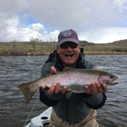
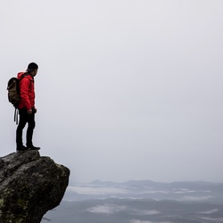
    This is a really pretty hike. About 1.5KM in, there's a long stretch with wild flowers, butterflies, and a bunch of birds.
    ★ ★ ★ ★ ★

    user_profile
    Steven 1 year, 11 months ago
    Perkinsville to Williams
    Bouncy, not too bad. Some nice spots to stop in the forest for lunch or camping.
    ★ ★ ★ ★

    user_profile
    TJ 2 years ago
    Cancer’s Back. Found out today.
    Too many people
    ★

    user_profile
    oldhikerhb 2 years ago
    Track (5/22/24, 11:29:17AM)
    I give high marks for being able to loose the crowds. Within a mile you are in the pines and oaks. Areas are rocky so not recommended for runners and mountain bikers.
    ★ ★ ★ ★

    user_profile
    my4bayhorses 2 years, 1 month ago
    Bk Cnyn Trail from Orme North 4/23/24, 10:52:02AM)
    Great place to explore, easy trails
    ★ ★ ★ ★ ★

    user_profile
    ching_lien_chen 2 years, 2 months ago
    Spruce Mountain via Groom Creek
    Lovely hike. At about 200 m elevation. The snow pack starts and the ground is more rocky. We got sun, thunder, wind, rain, and snow.
    ★ ★ ★ ★

    user_profile
    laurabgossman 2 years, 3 months ago
    Track (3/8/24, 2:42:23PM)
    This is the close loop around Goldwater. I love this hike. Great for older kids. Would be tough with littles. Couple places where you are on a narrow dirt trail that has a steep drop off on one side. Beautiful views of the water, birds, and I saw several deer. If you prefer seeing less people, do the bigger Goldwater Loop. If you want a little shorter hike you can start at the lake but you have to pay for parking.
    ★ ★ ★ ★

    user_profile
    Steve 2 years, 5 months ago
    1/13/24 Blue Monster to Mingus Mountain Loop
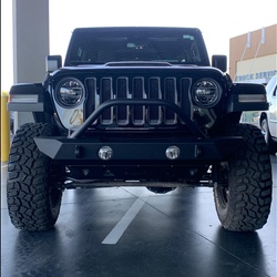
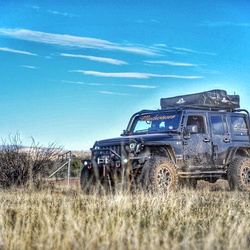
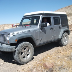
    This is a great loop for a sxs or jeep. Expect a full day in a Jeep or half day in a side by side. Full of great trails that go from town to the high desert, then pines back through Jerome. Great loop!
    ★ ★ ★ ★ ★

    user_profile
    cstearns27450 3 years ago
    Track (6/7/23, 10:28:48AM)
    Trail is old two track but straight up & rocky. Not really much fun.
    ★

    user_profile
    bentz3 3 years, 1 month ago
    Granite Mtn. Hotshots Juniper Tree (Giant Alligator) — Prescott, AZ Track (5/4/23, 9:24:36AM)
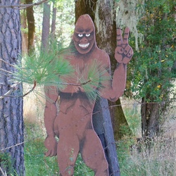
    Granite Mountain Hotshots Juniper Tree (Giant Alligator) — Prescott, AZ. Excellent hiking conditions (clear day, albeit windy on the return from the Memorial Site). Overall, fairly good terrain w/ the exception of a couple of rocky points (scree).
    ★ ★ ★ ★ ★

    user_profile
    drew.j.klug 3 years, 1 month ago
    Track (5/6/23, 5:34:13PM)
    Beautiful
    ★ ★ ★ ★ ★

    user_profile
    sedonaberg15 3 years, 6 months ago
    Quartz Mountain
    Nice hike from 89.
    ★ ★ ★

    user_profile
    sedonaberg15 3 years, 6 months ago
    Track (11/29/22, 10:05:3)
    Good hike but trail has a lot of loose rock. Great for conditioning and views.
    ★ ★ ★ ★

    user_profile
    57celt 3 years, 11 months ago
    Track (7/13/22, 10:40:04AM)
    I like this trail, not too long, not too short. It has a few climbs but not too many and not too steep. In short it’s a nice average hike, it’s close to home for me so I can be on it quickly and get out into the forest without having to travel too far.
    ★ ★ ★ ★

    user_profile
    alanapplv 3 years, 11 months ago
    Track (6/26/22, 8:58:04AM)
    Great hike. Beautiful views. Bring extra water in the summer, lots of sun.
    ★ ★ ★ ★ ★

    user_profile
    freightmover02 4 years, 1 month ago
    Long wknd smiley rock/ perkinsville/sycamore canyon
    Great ride with beautiful views. Smiley rock is a lot of rocky washes. Recommend atleast37s
    ★ ★ ★ ★ ★

    user_profile
    freightmover02 4 years, 1 month ago
    Back way to Crown King
    Way tougher than you think it’s gonna be. Some obstacles have by passes. Some do not. Beautiful though. Very crowded, be prepared.
    ★ ★ ★ ★ ★

    user_profile
    OptoCC 4 years, 2 months ago
    Fireplace Spring Loop via 318 West Trail and Javelina Trail #332
    Beautiful, well maintained trail, moderate (almost easy). Not steep. Smell of pine trees and beautiful sound of wind in the tree tops. Found the fireplace and spring about half way. Couple of small water crossings. We did it in 2 hours versus the 3 that was shown. 5.15 miles per Gaia, 5.44 miles per Apple Watch. Some shade, some exposure. 55 deg, am. March 31.
    ★ ★ ★ ★ ★

    user_profile
    evan.w.burgess 4 years, 3 months ago
    Spruce Mountain via 307
    This trailhead offers plenty of parking, and it’s a well used, well marked trail. Restrooms are available at both the trailhead and up at Spruce Mt. lookout. Hiking the loop clockwise offers a fairly steep climb up to the lookout, then a more gradual decent as you follow the loop around.
    ★ ★ ★ ★

    user_profile
    Mardin "Bend zee Knees" Zwiebel 4 years, 3 months ago
    Granite Basin Dam Loop via N. Skyline Drive
    Perfectly straightforward, well signed, moderate hike. My favorite part is the walk along Mint Creek.
    ★ ★ ★ ★ ★

    user_profile
    Mardin "Bend zee Knees" Zwiebel 4 years, 3 months ago
    Granite Mountain Loop via Fr 374B
    Very nice walk up to a small outcrop above the climbing cliffs. Trail all the way. Although it is rated difficult it is really straightforward and not very challenging. For more of a challenge bushwhack over to the Summit of Granite Mountain.
    ★ ★ ★ ★ ★

    user_profile
    cindy5839 4 years, 7 months ago
    Track (11/1/21, 8:27:41AM)
    Beautiful views of Prescott Valley and parts of Prescott!!!
    ★ ★ ★ ★ ★

    user_profile
    barefootboy13 4 years, 7 months ago
    Track (10/29/21, 12:18:17PM)
    These trails are epic for your average afternoon stroll, conditioning runs or better yet a shred with your friends on some bikes! The trails are well maintained and very accessible through visible markers and signage. Highly recommend butte trail system to people of the area 😎
    ★ ★ ★ ★ ★

    user_profile
    msundst 4 years, 9 months ago
    Track (9/13/21, 10:20:10AM)
    I would not recommend. The trail going to Jerome is very sketchy and over grown.
    ★

    user_profile
    Mark F 4 years, 9 months ago
    01271243
    We ended up on this trail due to a navigation error and I’m glad we did. What an epic trail through the Bradshaws. Very remote, I would not recommend doing this trail alone. The trail offers sandy washes, narrow shelf roads, boulder fields, steep climbs, off camber and washouts. Plus much more. Expect pinstripes. A stock high clearance rig can make it. That said a lift and minimum 33” tires will reduce the chance of scraping skid plates. We did it in my JLUR with a 2” lift on 33’s and had no issues.
    ★ ★ ★ ★ ★

    user_profile
    joseph.goldberger.1 5 years ago
    Spruce Mountain via 297
    Instead of the Spruce Mountain loop trail 307 which takes off from Groom Creek on Senator Highway, we decided to go the 8.8 mile trail from Smith Ravine to FR 52 aka Spruce Mountain Road. The trail is well maintained and easy to follow. Once on FR 52 it is a steady climb to the top of Spruce Mountain. We were greeted by about 6 adult deer at the top. As we were descending toward the Smith Ravine parking area a gentleman on his way up reported seeing a black bear that was good sized. We did not encounter the bear but this area of the forest is replete with a wide variety of critters so it is important to pay attention.
    ★ ★ ★ ★ ★

    user_profile
    Red Dirt Roadz 5 years, 1 month ago
    Track (2/22/21, 3:40:40PM)
    Great down and back quick hike to some amazing falls.
    ★ ★ ★ ★

    user_profile
    my4bayhorses 5 years, 2 months ago
    Grief Hill Loop 4/2/21, 9:44:14AM)
    Lots of potential for exploring. Lots of washes. Rocky of course in Some spots.
    ★ ★ ★ ★ ★

    user_profile
    Red Dirt Roadz 5 years, 2 months ago
    Track (2/22/21, 3:40:40PM)
    Great down and back quick hike to some amazing falls.
    ★ ★ ★ ★

    user_profile
    Red Dirt Roadz 5 years, 2 months ago
    Track (2/22/21, 3:40:40PM)
    Great down and back quick hike to some amazing falls.
    ★ ★ ★ ★

    user_profile
    leparulo1 5 years, 3 months ago
    Horse thief
    Great trail
    ★ ★ ★ ★ ★

    user_profile
    Red Dirt Roadz 5 years, 3 months ago
    Track (2/22/21, 3:40:40PM)
    Great down and back quick hike to some amazing falls.
    ★ ★ ★ ★

    user_profile
    reserve 5 years, 3 months ago
    Track
    R1 two tiered drop of ~20', then ~30' - can be split into two drops to aid in rope pull DC1 40' falls can be bypassed on the left or rappelled from a chockstone on the right DC2 15' elevator downclimb with a pool to swim after the drop. This can also be bypassed on canyon left with some easy scrambling. R2 another two tiered section with two 15 foot drops through some large boulders. Rope pull is difficult again here - a second anchor can be added or the first 15' drop can be bypassed on canyon left. R3 ~160' anchored from a small tree on canyon left
    ★ ★ ★ ★ ★

    user_profile
    oliviasdad426 5 years, 4 months ago
    4600 S Genesis Dr, Yavapai County to 115 Jerome Ave, Jerome, AZ, USA
    Great trail. Little narrow on some shelf roads.
    ★ ★ ★ ★ ★

    user_profile
    scottgregory1950 5 years, 5 months ago
    Little Yeager Loop
    This is a good exercise loop with elevation ups and downs, Forest, and some nice views. All good, clear trail with little traffic.
    ★ ★ ★

    user_profile
    txpov 5 years, 5 months ago
    Friendly Pines ( Section # 1 )
    I tried to continue up this trail but there was a few boulders blocking the path maybe when I get my wish I will move them to open up the trail so I can go further.
    ★ ★ ★

    user_profile
    txpov 5 years, 5 months ago
    Friendly Pines ( Section #2 )
    This is a little hidden trail that gets tight quickly and there is also no one around and I couldn’t go further because it was to tight.
    ★ ★

    user_profile
    txpov 5 years, 5 months ago
    FSR 41
    This is a bumpy boring road in the desert.
    ★

    user_profile
    txpov 5 years, 5 months ago
    Trail 78
    Please don’t do this trail! This trail is tight and there is a deep water crossing towards the end. The water was up to my hood on my truck and the water was pushing my truck down stream but I pushed through it and made it to the other side, and then of top of that there is 3 locked gates.
    ★

    user_profile
    txpov 5 years, 5 months ago
    Granite Mountain Loop Trail
    This was a long scenic hike. It is a very beautiful trail to hike part of the trail that crosses over into cougar trail is hard to follow and when you are walking along the bottom of the trail you might see an occasional person walking from a different trail. I didn’t see anyone on this trail. There is also 2 lakes along the trail which are nice to stop at and take a break.
    ★ ★ ★

    user_profile
    txpov 5 years, 5 months ago
    Trail 384 Loop
    This is a nice scenic trail with very minimal traffic on the trail. It does cross over a few off-road trails so you might see an occasional off-road vehicle but other than that the length and incline is a nice workout.
    ★ ★ ★

    user_profile
    txpov 5 years, 5 months ago
    Garden Grove Loop 392
    This is a nice hiking trail with nice views. The beginning of the trail looks like a dirt road but the end of the trail is a scenic trail overlooking thumb butte.
    ★ ★ ★

    user_profile
    txpov 5 years, 5 months ago
    Cougar Trail
    The start of the trail is nice and wide and easy to follow and then once you tart climbing up the hill the trail is hard to follow because of the light foot traffic. When you start coming down the other side the trail is easier to follow and it has nicer scenery. When I went on this trail with friends we also saw a Big Black Bear.
    ★ ★ ★

    user_profile
    txpov 5 years, 5 months ago
    Horse Camp Loop 383
    This is a nice trail. The trail is not very well maintained but that is also because there is almost nobody on the trail. Every time I went it was empty. There is nothing spectacular about this trail, but it is a nice relaxing hike in the woods.
    ★ ★ ★

    user_profile
    txpov 5 years, 5 months ago
    Trail 318 Loop
    This is one of my favorite hikes because it is not to long and not to short. It is also very scenic with very few people on the trail. If you get lucky you will be alone on the trail. You also see a nice view of thumb butte coming around the end of the trail.
    ★ ★ ★ ★

    user_profile
    txpov 5 years, 5 months ago
    Lynx Lake Loop
    This is a beautiful trail. It is free parking on Wednesday and there is still a few people out on the trails. It is a nice trail around the lake.
    ★ ★ ★ ★

    user_profile
    txpov 5 years, 5 months ago
    Trail 444
    A nice beautiful hike with beautiful views. The is a little pond off of the trail with a small little waterfall. I only saw one person on the trail the whole time.
    ★ ★ ★ ★

    user_profile
    emil322 5 years, 5 months ago
    Mingus mountain to jerome
    Great trail. Very narrow and would be very hard if there were someone coming from the other direction. But we really loved it.
    ★ ★ ★ ★ ★

    user_profile
    kjmusic 5 years, 6 months ago
    Crown King & Horse Thief Lake(12/3/20, 12:10:49PM)
    Great easy ride...graded roads all the way to Crown King. To Horse Thief Lake from Crown King gets bumpy but not a bad ride. Challenge rating 1-2 for all of it. Bring a picnic or get food at the general store in Crown King. They also have gas but only 87 octane. There is a bar/restaurant in town.
    ★ ★ ★ ★ ★

    user_profile
    my4bayhorses 5 years, 6 months ago
    Granite Lake Trail from Williamson Bly TH. 11/25/20, 11:02:30AM)
    Lovely ride! About 2 miles in and the rest of the way to the lake has some quite technical places for the horses through the rocks but all managed quite well Nice spot to stop just by the lake and tie up the horses, sit on the rocks and have lunch. Easier ride back tho still a few tricky places, and met a few men bikers. Several hikers out as well. Awesome weather and great ride!
    ★ ★ ★ ★ ★

    user_profile
    Jon Todd 5 years, 9 months ago
    Easy and scenic trail, good for stock 4x4 vehicles. Go for the views on your way to Jerome. Tight in spots, expect AZ pinstripes. Some smallish rocks to climb over on occasion. Nothing technical.
    ★ ★ ★ ★

    user_profile
    Cindy 5 years, 10 months ago
    Granit basin loop
    This was a great hike. Not too strenuous, probably 75% in the shaded pine trees. Some beautiful boulders and a rest stop not far from the lake.
    ★ ★ ★ ★

    user_profile
    denniswchisholm 5 years, 10 months ago
    Mingus 105 loop
    The best views in the area all along the trail. Many tree species; Douglas Fir, Ponderosa Pine, Spruce, Oak, Locust. Well defined trail and a nice escape from the heat.
    ★ ★ ★ ★ ★

    user_profile
    medrzycki3 5 years, 10 months ago
    Trail 260 Mt. Francis loop
    Great loop to avoid people entirely. Trail 260 is unmaintained and steep and that’s the charm. Stunning views.
    ★ ★ ★ ★ ★

    user_profile
    txpov 5 years, 10 months ago
    Trail 396 Loop
    This is a nice trail with a good length. I didn’t see anyone on this trail and it is also scenic but there was nothing special about it.
    ★ ★ ★

    user_profile
    txpov 5 years, 11 months ago
    Trail #37
    I love everything about this trail.
    ★ ★ ★ ★ ★

    user_profile
    txpov 5 years, 11 months ago
    Trail #37
    I love everything about this trail but I didn’t complete the loop because it is 9 miles. I might take out the mountain bike someday to complete it. The trail portion that I did do is really beautiful and there is barely anyone on the trail. It is very scenic as well. I would rate it higher if the distance was less but I still might be able to complete it with a mountain bike someday.
    ★ ★ ★ ★

    user_profile
    txpov 5 years, 11 months ago
    Friendly Pines ( Connector )
    This is a technical off-roading spot and there is even a very steep area with big rocks to climb over. This connector will take you from the Friendly Pines trail to Wolf Creek
    ★ ★ ★ ★

    user_profile
    txpov 5 years, 11 months ago
    Dearing Park
    I love this trail there is almost no one on the trail and it’s is a little technical and it’s also scenic.
    ★ ★ ★

    user_profile
    txpov 5 years, 11 months ago
    Trail 503A
    Scenic trail with a nice overlook. There was nobody else on the trail but it’s was really tight almost the whole way and it scratched up the truck a lot but there is a nice scenic overlook near the end.
    ★ ★

    user_profile
    txpov 5 years, 11 months ago
    Thumb Butte Loop
    Very scenic but it’s just a bumpy dirt road and it’s usually busy. I don’t usually do this trail unless I want to show someone new the trail.
    ★ ★

    user_profile
    txpov 5 years, 11 months ago
    Trail 9403
    Really tight trail I would never do this again and there was no turn around. I was scrapping my truck the whole way up.
    ★ ★ ★

    user_profile
    txpov 5 years, 11 months ago
    Trail 79
    Mainly a dirt trail. It’s kinda scenic and there may be 3 camping spots but they are usually taken. It’s in the desert of Wilhoit.
    ★ ★

    user_profile
    txpov 5 years, 11 months ago
    Trail 682
    Loved this trail. It’s easy but very very quite and peaceful. I saw nobody on this trail and if you sit around and wait the cows will come up and say hi.
    ★ ★ ★ ★

    user_profile
    txpov 5 years, 11 months ago
    Mingus lookout
    Beautiful Trail with a nice lookout at the end.
    ★ ★ ★

    user_profile
    txpov 5 years, 11 months ago
    Dandrea Ranch / Big Bug Mesa
    This is a nice trail but it gets tight in some areas. It is really scenic and there is a seasonal creek that runs through it. Occasionally you will see some other people on the trail.
    ★ ★ ★ ★

    user_profile
    txpov 5 years, 11 months ago
    Schoolhouse Gulch Trail
    This trail got closed and now it is way to tight in some areas and you can no longer complete it unfortunately.
    ★

    user_profile
    freightmover02 5 years, 11 months ago
    Bloody Basin
    Long, very long. Start early. Lots of climbs and switchbacks. Rocky after you get into the trail. End is worth it. Pretty views. A few small water crossings. Was very hot and busy.
    ★ ★ ★ ★

    user_profile
    rd_redford 5 years, 11 months ago
    Lynx Lake Trail 311
    Very pleasant casual hike. Mostly flat with a few steep but short sections. Overall I’d rate it “easy.” Trail is narrow so some issues maintaining proper social distancing with oncoming traffic but nothing too difficult to manage. Nice views. We hiked this on a Tuesday and both parking lots were nearly full, showing what a popular destination this is.
    ★ ★ ★ ★

    user_profile
    Chris 6 years, 1 month ago
    Track (4/26/20, 8:59:20AM)
    Mostly two wheel drive route alt route to crown king.
    ★ ★ ★

    user_profile
    Halvie 6 years, 1 month ago
    School House Trail
    Nice walk if you only have 10 minutes or walk. Also has benches and information about the area if you want to spend a little more time. The tail is paved so it is wheelchair accessible.
    ★ ★ ★ ★ ★

    user_profile
    txpov 6 years, 1 month ago
    Friendly Pines ( 9403M )
    Steep inclines at 35 degrees up hill and I got stuck but I was able to get free I wouldn’t recommend this trail again.
    ★

    user_profile
    txpov 6 years, 1 month ago
    Western American Trail
    This was a rocky road the whole way and you drive through trees and past old mine locations then you end up in the woods in Williams. I wouldn’t do this trail again because it was very boring and long. I would go around and do the Williams side because that side is beautiful.
    ★ ★ ★

    user_profile
    Halvie 6 years, 1 month ago
    Upper Goldwater Lake
    Beautiful location but very popular.
    ★ ★ ★ ★ ★

    user_profile
    Halvie 6 years, 1 month ago
    Prescott City Trail - Lake Loop
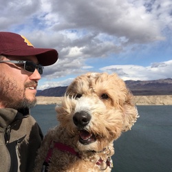
    Nice easy walk through the pines and along the Goldwater Lake shoreline. Our dog enjoyed the walk too.
    ★ ★ ★ ★ ★

    user_profile
    Halvie 6 years, 1 month ago
    Prescott City Trail - Lake Loop
    Nice easy beautiful hike through the woods and along the shoreline.
    ★ ★ ★ ★ ★

    user_profile
    txpov 6 years, 2 months ago
    Mingus Lookout
    Pretty rough terrain with lots of rock but there is a cool campsite at the end. Pretty easy to do its just really bumpy.
    ★ ★ ★

    user_profile
    txpov 6 years, 2 months ago
    Cooper Creek
    Some tight spots and some technical spots but it was fun to do overall. I really like doing this trail and going under the tunnel has to be my favorite part. The rest of the trail is pretty standard for an off-roading trail and you see an occasional camper.
    ★ ★ ★ ★

    user_profile
    txpov 6 years, 2 months ago
    Friendly Pines ( Main )
    This trail is very scenic and it has nice water crossings some nice offroading but not it’s technical enough. It’s definitely more scenic than it is technical and thats why I still rate it so high. You can also take other routes along this trail system and there is even a waterfall and nice places to stop and relax. Unfortunately camping is not aloud on this trial. You will also see the occasional off-roadie or hiker on this trail but it is usually empty.
    ★ ★ ★ ★

    user_profile
    txpov 6 years, 2 months ago
    Wolverton Mtn
    I love this trail. It has technical spots and amazing views. It’s also close to town and it’s a short fun trail to off-road. This is one of my favorite trails. Whenever I am in town I try to do this trail because it is so beautiful. I also try to show new people this trail and everyone seems to love it. It does have more technical stuff near the top.
    ★ ★ ★ ★ ★

    user_profile
    txpov 6 years, 2 months ago
    Trail 64
    Technical in a few places but nothing the trucks couldn’t handle. I didn’t scrap at all. If you go from white spar you will pass through the homeless camp area end then end up in the backside of a camp on senator highway and you will pass behind a baseball field. This is a nice scenic trail to do.
    ★ ★ ★

    user_profile
    txpov 6 years, 2 months ago
    Poland Rd
    This is a beautiful trail with a few technical spots where 4WD is required and I used 4WD-LO in 1 spot. The views are also amazing as you climb up the mountains from Dewey into Prescott. I would do this trail again because its very beautiful and scenic and there is many detours you can take along the way.
    ★ ★ ★ ★ ★

    user_profile
    txpov 6 years, 2 months ago
    Cooper Basin 2 Thumb Butte
    This trail is very very long trail and very scenic but not technical enough of offroading. I wouldn’t do this trail ever again because it is so boring and long and there is no shortcuts to take to get done sooner.
    ★

    user_profile
    txpov 6 years, 2 months ago
    Trail 82
    This is a decent trail with a few closed gates that you have to open. It’s mainly dirt road and in the desert but in the woods it’s a cool trail. I would do this trail again only if I had nothing better to do. There is also a cool sandstone part of the trail that I really liked doing.
    ★ ★ ★

    user_profile
    txpov 6 years, 2 months ago
    Mingus to Campspot
    It’s a little technical nothing to bad all you need is 4WD. There is a nice lookout at the end possibly for camping otherwise I wouldn’t do this trail again.
    ★ ★ ★

    user_profile
    txpov 6 years, 2 months ago
    Bannie Mine Rd
    This trail has some technical spots and it gets a little tight in some spots but its nothing that you can’t handle. The road also turns into a logging road so it gets boring quick.
    ★ ★ ★

    user_profile
    txpov 6 years, 2 months ago
    Golden Eagle Rd
    Very scenic but it’s short and steep in some spots and it’s also very tight. You are also unable to complete it. If you want to complete it I recommend a winch and another vehicle. It’s very steep at the end and I just would turn around instead of going further.
    ★ ★

    user_profile
    joe32224 6 years, 3 months ago
    Lake trail
    Beautiful forested hills with a moderate climb and scenic views of Prescott.
    ★ ★ ★ ★

    user_profile
    thechrisstoutfamily 6 years, 3 months ago
    Spruce Mtn lookout via 297
    Really nice hike for a lot of reasons 1. Only saw 1 person in 5 hours over 10 miles 2. Dogs were off leash the entire time and only other dog we saw was also off leash 3. Trail was well maintained and mostly well marked So to begin with this is a very secluded area with very few houses and/or traffic. The parking area is small and only 8-10 vehicles could fit but it was fairly easy to find but GAIA was of by only a bit and we drove just a bit far before turning around and finding the trailhead. I have added quite a few photos to show markers etc but I don’t think they all were attached. This is my first review and only second recorded hike so I am still learning. The trailhead for this is actually “Smith Ravine” Trailhead. SO look for that at the parking area on the west side of 297 (Walker Road) Go thru the gate and the trail is really well defined for just over 3 miles. Once you hit 3 miles be on the lookout for a few postings. 1 is on a fence right by a dirt road (Spruce Mountain Road) and 1 is a wooden sign facing away from you for others coming toward you. This sign is telling others that Walker road is 3 miles from where you stand via the Smith Ravine Trail. On the fence you should see a yellow sign that says “Please! Close the gate”. You will need to go thru this gate and follow Spruce Mountain Road until you get to the US Forest Service road that will most likely be gated shut. Proceed under the gate and continue on until you reach the picnic area right be the lookout tower......return the way you came. There is a restroom at the picnic site but not guaranteed to be open and not sure what season they open consistently. It was closed at this was on a weekend at 11am so just another sign that not many people frequent this trail due to length, stress of ascent....basically difficulty. This is a strenuous hike of roughly 10 miles total. Over 2200 (per Garton but only 1800 per GAIA) vertical ft of ascent so it will work your heart and your legs pretty well as well as working up a sweat. We ran into quite a bit of snow so check if you are going in the winter as there could be a lot more if there was a s storm that went thru. Suggest wearing good waterproof boots that can take a lot of water and mud. Dress in layers and bring energy snacks and plenty of water. There are indicators that there are 2 springs along the trail off a ways but we did not run into any of them nor did we go looking for them so not sure if there is accessible water along the trail if you run out.
    ★ ★ ★ ★ ★

    user_profile
    mlaffin 6 years, 7 months ago
    Wolf Creek Trail Loop
    Unremarkable. Very rocky trail.
    ★ ★ ★ ★

    user_profile
    ericzimmer851 6 years, 7 months ago
    Track (10/26/19, 10:12:37AM)
    NE side of Granite Mountain Williamson.
    ★ ★ ★ ★

    user_profile
    Larry 6 years, 8 months ago
    Lynx lake hike
    Cold morning with temperatures starting at 27 degrees. The east side of the lake is the best side with only dirt and rock trails.
    ★ ★ ★ ★ ★

    user_profile
    txpov 6 years, 11 months ago
    Trail 78
    This is a fun trail but it is short and it ends with a dead end. I wouldn’t do this trail again because it is so short and you have to turn around.
    ★

    user_profile
    txpov 6 years, 11 months ago
    Trail 97B
    I attempted 97B to Golden Eagle and the trail 667 Turns into a dirt bike trail and gets to tight. This trail has scenic spots and is very beautiful overlooking the valley and there is also a house deep in the woods. I wish I could rate this trail higher but you can’t complete it because it gets way to tight.
    ★ ★

    user_profile
    connorz1 6 years, 11 months ago
    Lower Goldwater Dam via 396
    We hiked this trail on June 25 2019, The trail started on Senators Hwy and as we continued on the trail it went though a recent logged area which opened up the landscape and provided an extended view of the land. Along the hike we saw asclepias (milkweed) and aquilegia (yellow columbine) and many other wildflowers. The trail passes Upper and Lower Goldwater lakes which requires a side trail the hike to. The trail ended at White Spar campground and made for a pleasant hike.
    ★ ★ ★

    user_profile
    tsg29492 1 year, 8 months ago
    Groom Creek Loop
    ★ ★ ★ ★ ★

    user_profile
    jon.boldenow 1 year, 8 months ago
    Spruce Mountain via 307
    ★

    user_profile
    Kris 1 year, 8 months ago
    KTM ride
    ★ ★ ★ ★ ★

    user_profile
    Scott and Cass Wander 1 year, 9 months ago
    Upper and lower Goldwater lake loop
    ★ ★ ★ ★ ★

    user_profile
    michael.j.novotny 1 year, 9 months ago
    Track (8/24/24, 7:06:56AM)
    ★ ★ ★ ★ ★

    user_profile
    kmclaughlin 1 year, 9 months ago
    Dog town lake to home via smiley Rock.
    ★ ★ ★ ★ ★

    user_profile
    craiglathrop218 1 year, 9 months ago
    Standard Creek Hike
    ★ ★ ★ ★ ★

    user_profile
    hndjbs 1 year, 10 months ago
    Aspen Creek Trailhead Parking Lot to Aspen Creek Trail, Yavapai County, AZ, USA
    ★ ★ ★ ★ ★

    user_profile
    sedonaberg15 1 year, 10 months ago
    Track (7/15/24, 08:19:12)
    ★ ★ ★ ★ ★

    user_profile
    cowboyfam 1 year, 11 months ago
    Senator Hwy Loop on the 74Payoff
    ★ ★ ★ ★ ★

    user_profile
    adeliezechmann 1 year, 11 months ago
    Lynx Lake Loop 6/24/24
    ★ ★ ★ ★ ★

    user_profile
    henrycls5 2 years ago
    Circle Trail Seg 4
    ★ ★ ★ ★ ★

    user_profile
    bmlk58 2 years, 1 month ago
    Groom Creek Trish
    ★ ★ ★ ★ ★

    user_profile
    connorz1 2 years, 1 month ago
    Track (5/4/24, 12:10:33PM)
    ★ ★ ★ ★ ★

    user_profile
    denniswchisholm 2 years, 1 month ago
    Mingus loop
    ★ ★ ★ ★ ★

    user_profile
    Jorel 2 years, 1 month ago
    Turkey Creek Trail w/ JD & Fulton’s
    ★ ★ ★ ★ ★

    user_profile
    andymilleriii 2 years, 3 months ago
    Granite Mountain Prescott Az
    ★ ★ ★ ★ ★

    user_profile
    ML727 2 years, 3 months ago
    Deering Park - 9405M
    ★ ★

    user_profile
    rogers.david.lee 2 years, 3 months ago
    Lynx lake prescott
    ★ ★ ★ ★

    user_profile
    ryanbiggs.az 2 years, 3 months ago
    Track (12/1/22, 8:47:18AM)
    ★

    user_profile
    thomas.m.lemar 2 years, 4 months ago
    Senator Hwy to Crown king
    ★ ★ ★ ★ ★

    user_profile
    johannes.falkenberg101 2 years, 4 months ago
    Back Road to Crown King 3.0
    ★ ★ ★ ★ ★

    user_profile
    bsh398 2 years, 5 months ago
    Day 1
    ★ ★ ★ ★ ★

    user_profile
    my4bayhorses 2 years, 5 months ago
    169 East Sheep Trail ride 1/2/24, 12:06:16PM)
    ★

    user_profile
    angelmomfor2 2 years, 6 months ago
    Limestone kiln
    ★ ★ ★ ★ ★

    user_profile
    fisharizona 2 years, 6 months ago
    Bruce lighting bradshaws
    ★ ★ ★ ★ ★

    user_profile
    philip.corrin 2 years, 6 months ago
    Granite Mountain
    ★ ★

    user_profile
    daphne122012 2 years, 7 months ago
    Track (10/31/23, 10:36:10AM)
    ★ ★

    user_profile
    my4bayhorses 2 years, 7 months ago
    169 Fort Rock Ride 10/31/23, 11:20:19AM)
    ★ ★ ★ ★ ★

    user_profile
    rtjproperty01 2 years, 8 months ago
    The grinder
    ★ ★ ★ ★ ★

    user_profile
    sedonaberg15 2 years, 8 months ago
    Track (9/3/23, 09:10:4)
    ★

    user_profile
    daphne122012 2 years, 8 months ago
    Track (10/1/23, 1:45:10PM)
    ★ ★ ★ ★ ★

    user_profile
    samboge79 2 years, 8 months ago
    Track (9/25/23, 2:14:39PM)
    ★ ★ ★

    user_profile
    Rita 2 years, 8 months ago
    Woodchute Tank via Woodchute Trail #102
    ★

    user_profile
    cheeeeeeeeerio 2 years, 8 months ago
    Track (9/22/23, 1:09:24PM)
    ★ ★ ★ ★ ★

    user_profile
    NBWHikerAZ 2 years, 8 months ago
    Lower Goldwater Lake Loop via 396
    ★ ★ ★ ★

    user_profile
    Daniel Sarich 2 years, 9 months ago
    Little Granite Mountain Loop 09/10/2023
    ★ ★ ★ ★ ★

    user_profile
    dirklawyer 2 years, 9 months ago
    Maiden ride w/David’s mini up Mingus Mt
    ★ ★ ★

    user_profile
    rtjproperty01 2 years, 9 months ago
    Number one single track ever
    ★ ★ ★ ★ ★

    user_profile
    zsgott 2 years, 9 months ago
    Granite Basin
    ★ ★ ★ ★ ★

    user_profile
    nperkins17 2 years, 9 months ago
    Track (8/17/23, 4:24:45AM)
    ★ ★ ★ ★ ★

    user_profile
    N5MKH 2 years, 10 months ago
    Bumble Bee To Crown King to Cordes and Bloody Basin
    ★ ★ ★ ★ ★

    user_profile
    derekjohn8567 2 years, 11 months ago
    Lynx Lake, Prescott, AZ
    ★ ★ ★ ★ ★

    user_profile
    kenparis17 2 years, 11 months ago
    Track (6/19/21, 06:01:48)
    ★

    user_profile
    sedonaberg15 2 years, 11 months ago
    Track (7/5/23, 09:14:47)
    ★

    user_profile
    cheeeeeeeeerio 2 years, 11 months ago
    Track (6/22/23, 3:24:55PM)
    ★ ★ ★ ★ ★

    user_profile
    ddvllrrl 2 years, 11 months ago
    Track (6/18/23, 5:25:35PM)
    ★ ★ ★ ★

    user_profile
    Melissa 2 years, 11 months ago
    Mingus Mountain #17
    ★ ★ ★ ★ ★

    user_profile
    kenparis17 3 years ago
    Groom Creek Loop
    ★ ★

    user_profile
    medicpenn 3 years ago
    Track (6/11/23, 09:27:38. DU 2023
    ★ ★ ★ ★ ★

    user_profile
    Lord Muta 3 years ago
    Senator highway
    ★ ★ ★ ★

    user_profile
    sedonaberg15 3 years ago
    Track (5/2/23, 09:50:17) Deering Park
    ★ ★

    user_profile
    angie3hopkins 3 years ago
    307 cross Stagecoach 5/17/23
    ★ ★ ★ ★ ★

    user_profile
    cstearns27450 3 years, 1 month ago
    Track (5/14/23, 11:03:10AM)
    ★ ★ ★ ★

    user_profile
    jojohnson27 3 years, 1 month ago
    Cooper Canyon loop
    ★ ★ ★ ★ ★

    user_profile
    akaldenbaugh 3 years, 1 month ago
    Grief hill to thousand trails exploring
    ★ ★ ★ ★

    user_profile
    Swan 60 3 years, 1 month ago
    l-17 to trail head county rd 171/ 4.34mi ascent 268'
    ★ ★ ★ ★

    user_profile
    coachorama 3 years, 1 month ago
    Burnt Tank via Fr 413
    ★

    user_profile
    coatimundi3 3 years, 2 months ago
    Surprise Spring 4/12/23, 6:52:00PM)
    ★ ★ ★ ★ ★

    user_profile
    bryanyarbro 3 years, 2 months ago
    Perkinsville to Williams
    ★ ★ ★ ★ ★

    user_profile
    rjshiff58 3 years, 2 months ago
    Kirkland Crown King
    ★ ★ ★ ★ ★

    user_profile
    darbypattn2 3 years, 3 months ago
    Track (3/12/23, 2:48:27PM)
    ★ ★ ★ ★

    user_profile
    Dana 3 years, 3 months ago
    Track (3/4/23, 6:13:37AM)
    ★

    user_profile
    4Nboy 3 years, 4 months ago
    Track (1/27/23, 9:53:09AM)
    ★ ★ ★

    user_profile
    kili 3 years, 4 months ago
    Water fall
    ★ ★ ★ ★

    user_profile
    russ 3 years, 6 months ago
    Crown king, big loop
    ★ ★ ★ ★ ★

    user_profile
    Bill 3 years, 6 months ago
    Tonto Skull rock canyon Track (11/30/22, 10:42:21AM)
    ★ ★ ★ ★ ★

    user_profile
    chuckgorman2 3 years, 7 months ago
    Dugas 10/22/22 10:31:33 AM
    ★ ★ ★

    user_profile
    loganoverlands 3 years, 8 months ago
    Mark’s Birthday
    ★ ★ ★ ★

    user_profile
    jmerrilllynch 3 years, 8 months ago
    Grapevine Creek Gila Trout hike
    ★ ★ ★

    user_profile
    dgdeleon 3 years, 8 months ago
    Skull Valley Overlook Loop
    ★ ★ ★ ★ ★

    user_profile
    cstearns27450 3 years, 8 months ago
    White Spar 396 to Schoolhouse gulch loop
    ★ ★ ★ ★ ★

    user_profile
    m.kay123 3 years, 8 months ago
    Hell's Hole Overlook via South Horsethief Basin Road and Horse Thief Road
    ★ ★ ★ ★ ★

    user_profile
    alt5423 3 years, 8 months ago
    Hazlett Hollow Campground via Horse Thief Road and South Horsethief Basin Road
    ★

    user_profile
    philip.corrin 3 years, 8 months ago
    Johns Tank Loop via Salida Gulch Trail #95
    ★ ★

    user_profile
    cstearns27450 3 years, 8 months ago
    Trail 396 near Goldwater lake
    ★ ★ ★ ★ ★

    user_profile
    Frankie_S911 3 years, 8 months ago
    Bumble Bee Prescott
    ★ ★ ★ ★ ★

    user_profile
    57celt 3 years, 10 months ago
    Track (8/16/22, 10:42:10AM)
    ★ ★ ★ ★ ★

    user_profile
    sedonaberg15 3 years, 10 months ago
    FR51-328-333Loop08/14/22
    ★ ★ ★ ★ ★

    user_profile
    mdpolski 3 years, 10 months ago
    Track (8/6/22, 7:57:52AM)
    ★ ★ ★ ★ ★

    user_profile
    joshe 3 years, 10 months ago
    Whiskey row course
    ★ ★ ★ ★ ★

    user_profile
    prescottstyle 3 years, 10 months ago
    Muni 2
    ★ ★ ★ ★

    user_profile
    Bill 3 years, 11 months ago
    By Bute ride
    ★ ★ ★ ★

    user_profile
    James 3 years, 11 months ago
    Crown king
    ★ ★ ★ ★ ★

    user_profile
    Jeff Vander Kooi 3 years, 11 months ago
    Wolverton Mountain via 9415
    ★ ★ ★ ★ ★

    user_profile
    James 3 years, 11 months ago
    Crown king
    ★ ★ ★ ★ ★

    user_profile
    prescottstyle 3 years, 11 months ago
    48b to Porter Mnt
    ★ ★ ★ ★ ★

    user_profile
    Mark Emanuele 3 years, 11 months ago
    Track (6/18/22, 9:12:46AM)
    ★ ★ ★ ★

    user_profile
    Jon Luksch 4 years ago
    Woodchute Trail
    ★ ★ ★ ★ ★

    user_profile
    Jorge 4 years ago
    Burnt Tank via Fr 413
    ★ ★

    user_profile
    jim.alaniz 4 years ago
    Track (5/15/22, 10:03:47AM)
    ★ ★ ★ ★ ★

    user_profile
    connorz1 4 years, 1 month ago
    Track (5/12/22, 9:45:33AM)
    ★ ★ ★ ★

    user_profile
    desertracer840 4 years, 1 month ago
    Hold Strong Poker Run
    ★ ★ ★ ★ ★

    user_profile
    prescottstyle 4 years, 1 month ago
    Mine exploring
    ★ ★ ★

    user_profile
    kpracemaster1 4 years, 1 month ago
    Horseshoe Canyon T2S
    ★ ★ ★ ★ ★

    user_profile
    amy 4 years, 1 month ago
    07-Copper Creek to Whiskey Row
    ★

    user_profile
    Josh King 4 years, 2 months ago
    Track (4/9/22, 11:56:39AM)
    ★ ★ ★ ★ ★

    user_profile
    jontmantle 4 years, 2 months ago
    7mile - lap 2 with the crew
    ★ ★ ★ ★ ★

    user_profile
    jontmantle 4 years, 2 months ago
    7Mile Gulch - Prescott Az. Met Travis Prescott
    ★ ★ ★ ★ ★

    user_profile
    cbassett 4 years, 2 months ago
    Crown King Full Day
    ★ ★ ★ ★ ★

    user_profile
    Bill 4 years, 3 months ago
    Track (3/14/22, 10:39:56AM)
    ★ ★ ★ ★ ★

    user_profile
    jgohm 4 years, 3 months ago
    Track (3/13/22, 09:33:23)
    ★ ★ ★ ★ ★

    user_profile
    Scott 4 years, 3 months ago
    AZ 2/12/22
    ★ ★ ★ ★ ★

    user_profile
    hbmikenspike 4 years, 3 months ago
    Groom Creek to Mount Tritle Road
    ★ ★ ★ ★ ★

    user_profile
    albertzbill 4 years, 3 months ago
    Oxbow Spring via Fr 493
    ★ ★

    user_profile
    Bill 4 years, 4 months ago
    Brewery powerlie 41 Rancho diamanté
    ★ ★ ★ ★ ★

    user_profile
    dlcisw 4 years, 4 months ago
    Spruce Mountain Loop via 307
    ★ ★ ★ ★ ★

    user_profile
    mjones 4 years, 4 months ago
    Hotshots memorial juniper
    ★ ★ ★ ★ ★

    user_profile
    mjones 4 years, 4 months ago
    Lynx Lake (1/17/22, 2:09:48PM)
    ★ ★ ★ ★

    user_profile
    cyclegems 4 years, 4 months ago
    Granite Mountain Loop via Fr 374B
    ★ ★ ★ ★

    user_profile
    Turbo S 4 years, 4 months ago
    666 Tailholt Trail
    ★ ★ ★ ★

    user_profile
    e.Higgs.e 4 years, 5 months ago
    Spruce Mountain Loop via 307
    ★ ★ ★ ★ ★

    user_profile
    skipatrl 4 years, 5 months ago
    General CrookTrail
    ★ ★ ★ ★ ★

    user_profile
    eaglesnest 4 years, 6 months ago
    November Training.gpx
    ★ ★ ★

    user_profile
    nealh 4 years, 6 months ago
    Mingus Substation to 12205 W Forest Service Road 106, Yavapai County, AZ, USA
    ★ ★ ★ ★ ★

    user_profile
    jimpresley63 4 years, 7 months ago
    Smith Ravine Trailhead to 297 (Smith Ravine Trail), Yavapai County, AZ, USA
    ★ ★ ★ ★ ★

    user_profile
    Greg Stewart 4 years, 7 months ago
    Trail 326 and Trail 322 Loop
    ★ ★ ★ ★

    user_profile
    jimpresley63 4 years, 7 months ago
    Noodle to Vista Loop
    ★ ★ ★ ★

    user_profile
    jimpresley63 4 years, 7 months ago
    Thumb Butte North Loop
    ★ ★ ★ ★

    user_profile
    beth.scott 4 years, 7 months ago
    Mingus Mountain to parking lot at summit/ PNF sign
    ★ ★ ★ ★ ★

    user_profile
    davidhafner 4 years, 8 months ago
    Salina Gulch Loop
    ★ ★ ★ ★ ★

    user_profile
    tsurfs 4 years, 8 months ago
    Track (10/14/21, 8:15:02AM)
    ★ ★ ★ ★ ★

    user_profile
    795west 4 years, 8 months ago
    Track (9/3/21, 7:18:45AM)
    ★ ★ ★ ★

    user_profile
    sharissej 4 years, 8 months ago
    1350 N Jerome Perkinsville Rd to Jerome Grande Shaft, Yavapai County, AZ, USA
    ★

    user_profile
    yrnehrenraw 4 years, 8 months ago
    AZM087 Back way to Crown King - April 11 2021
    ★

    user_profile
    dhpierce1 4 years, 9 months ago
    Ogden Ranch to Black Canyon TH
    ★ ★ ★ ★

    user_profile
    bestcea 4 years, 9 months ago
    Poland Road - © Trails Offroad
    ★ ★ ★ ★ ★

    user_profile
    Michael 4 years, 9 months ago
    Track (8/14/21, 11:05:07AM)
    ★ ★ ★ ★

    user_profile
    mayohance 4 years, 10 months ago
    Track (8/14/21, 3:51:19PM)
    ★ ★ ★ ★ ★

    user_profile
    smith.elijah42 4 years, 10 months ago
    Track (8/5/21, 12:43:46PM)
    ★ ★ ★ ★ ★

    user_profile
    smith.elijah42 4 years, 10 months ago
    Track (8/5/21, 12:43:46PM)
    ★ ★ ★ ★ ★

    user_profile
    Gizmo 4 years, 10 months ago
    White horse lake 8/4/2021
    ★ ★ ★

    user_profile
    roxynelson 5 years ago
    Smiley Rock Night Ride
    ★ ★ ★ ★

    user_profile
    mjones 5 years ago
    Groom Creek to Crown King
    ★ ★ ★ ★

    user_profile
    elliott.beaty 5 years ago
    Aspen Creek Trailhead Parking Lot to Aspen Creek Trail, Yavapai County, AZ, USA
    ★ ★ ★ ★ ★

    user_profile
    boovandegraaff 5 years ago
    Prescott Single Track
    ★ ★ ★ ★ ★

    user_profile
    hartword 5 years ago
    Track (5/24/21, 12:26:21PM)
    ★ ★ ★ ★ ★

    user_profile
    ctdooley 5 years ago
    Track (5/21/21, 9:59:54AM)
    ★ ★ ★ ★

    user_profile
    hbmikenspike 5 years ago
    Skyline Dr. to Skull Valley
    ★

    user_profile
    dhpierce1 5 years, 1 month ago
    Ogden Ranch Rd. to Black Canyon TH
    ★ ★ ★ ★

    user_profile
    dodsonkimberly 5 years, 1 month ago
    Smiley Rock Trail, lots of rocks
    ★ ★ ★ ★

    user_profile
    napergary 5 years, 1 month ago
    Blowout Wash, Cottonwood, AZ
    ★ ★ ★ ★

    user_profile
    jmast1313 5 years, 1 month ago
    Track (2/27/21, 10:40:00AM)
    ★ ★ ★ ★ ★

    user_profile
    elliott.beaty 5 years, 1 month ago
    Lynx Recreation Trail to Lynx Lake - North Shore Picnic Site, Yavapai County, AZ, USA
    ★ ★ ★ ★

    user_profile
    ericamwilliams 5 years, 1 month ago
    Fr 374C to Granite Mountain Trail #261
    ★ ★ ★ ★ ★

    user_profile
    jnrfritz 5 years, 2 months ago
    Track (4/13/21, 8:44:35AM)
    ★ ★ ★ ★ ★

    user_profile
    justinserfass 5 years, 2 months ago
    Track (4/10/21, 9:16:43AM)
    ★ ★ ★ ★ ★

    user_profile
    sailboat23sport 5 years, 2 months ago
    Waterfall
    ★

    user_profile
    justinserfass 5 years, 2 months ago
    2 day camp
    ★ ★ ★ ★ ★

    user_profile
    Tlodestro 5 years, 2 months ago
    Crown King AZ
    ★ ★ ★

    user_profile
    Anonymous User 5 years, 2 months ago
    Grief Hill Loop-Cherry Creek, Yavapai County
    ★ ★ ★ ★

    user_profile
    pratte1 5 years, 2 months ago
    JEEP-DAY 2013
    ★ ★ ★ ★ ★

    user_profile
    oliviasdad426 5 years, 2 months ago
    Camp Verde-Bridgeport Highway, Cottonwood to Conoco, Camp Verde, AZ, USA
    ★ ★ ★ ★ ★

    user_profile
    joshvaughan3 5 years, 3 months ago
    Track (3/14/21, 15:05:38)
    ★ ★ ★ ★ ★

    user_profile
    oliviasdad426 5 years, 3 months ago
    Monroe Place, Camp Verde to 5000 South Genesis Drive, Yavapai County, AZ, USA
    ★ ★ ★ ★ ★

    user_profile
    glenncalvin 5 years, 3 months ago
    Loop Camp Wood Rd to FS 9
    ★ ★ ★ ★ ★

    user_profile
    Turbo S 5 years, 3 months ago
    Back way to Barnstar
    ★ ★ ★ ★

    user_profile
    hikerted 5 years, 3 months ago
    Turkey Creek run to Crown King
    ★ ★ ★ ★

    user_profile
    oliviasdad426 5 years, 3 months ago
    East Perkinsville Road, Chino Valley to AZ 260, Yavapai County, AZ, USA
    ★ ★ ★ ★ ★

    user_profile
    oliviasdad426 5 years, 3 months ago
    Old Highway 279, Cottonwood to Wilbur Well, Yavapai County, AZ, USA
    ★ ★ ★ ★ ★

    user_profile
    griffith928 5 years, 3 months ago
    White Rock Loop
    ★ ★ ★ ★ ★

    user_profile
    griffith928 5 years, 3 months ago
    Garden Trail
    ★ ★ ★ ★ ★

    user_profile
    mhinton73 5 years, 4 months ago
    Verde River Trail from Rd 164
    ★ ★ ★ ★

    user_profile
    oliviasdad426 5 years, 4 months ago
    Track (2/14/21, 12:13:06PM)
    ★ ★ ★ ★ ★

    user_profile
    hikerted 5 years, 4 months ago
    Trails 105 to 106 Mingus Mtn 9-9-2020
    ★ ★ ★ ★

    user_profile
    nateleavitt 5 years, 4 months ago
    Track (2/7/21, 1:51:12PM)
    ★ ★ ★ ★ ★

    user_profile
    strattok 5 years, 4 months ago
    walkaround
    ★

    user_profile
    j.snyder 5 years, 4 months ago
    Front rd to crown king
    ★ ★ ★

    user_profile
    w0lfheart 5 years, 4 months ago
    Crown King Road
    ★ ★ ★

    user_profile
    w0lfheart 5 years, 4 months ago
    Turkey Creek Trail
    ★ ★ ★ ★

    user_profile
    james.kear 5 years, 5 months ago
    Hell's Hole Overlook via South Horsethief Basin Road and Horse Thief Road
    ★

    user_profile
    rlw136 5 years, 5 months ago
    Tacoma Crown King
    ★ ★ ★ ★ ★

    user_profile
    smith.elijah42 5 years, 5 months ago
    Track (1/12/21, 10:45:29AM)
    ★ ★ ★ ★ ★

    user_profile
    afink615 5 years, 5 months ago
    Back Road to Crown King 3.0
    ★ ★ ★ ★ ★

    user_profile
    lsilva6 5 years, 5 months ago
    Granite mountain
    ★ ★ ★ ★ ★

    user_profile
    osvaldoesala 5 years, 6 months ago
    Granite Mountain Prescott,Arizona
    ★ ★ ★ ★ ★

    user_profile
    mikearmentano 5 years, 6 months ago
    Track (12/9/20, 1:02:34PM)
    ★ ★ ★ ★ ★

    user_profile
    georgriedel1949 5 years, 6 months ago
    Track (12/5/20, 13:07:15)
    ★ ★ ★ ★ ★

    user_profile
    coronadrms 5 years, 6 months ago
    Spruce Mountain Loop via 307
    ★ ★ ★ ★ ★

    user_profile
    joseph.goldberger.1 5 years, 6 months ago
    Government Canyon Spring Loop via Ranch Trail - 62
    ★ ★ ★ ★ ★

    user_profile
    speasleern 5 years, 7 months ago
    Blue Monster to Goat Peak
    ★ ★ ★ ★ ★

    user_profile
    JL735 5 years, 7 months ago
    Bumble Bee Creek to Crown king - fast route
    ★ ★ ★ ★ ★

    user_profile
    Photo1181 5 years, 7 months ago
    Towers Mountain, Yavapai County, AZ, USA
    ★ ★ ★ ★ ★

    user_profile
    billygoatrocklanding 5 years, 7 months ago
    Back Road to Crown King trip
    ★ ★ ★ ★ ★

    user_profile
    Fatboy 5 years, 7 months ago
    DOWN TO SKULL VALLEY & BACK UP TO PRESCOTT
    ★ ★ ★ ★ ★

    user_profile
    bigski85324 5 years, 7 months ago
    YMCA Sky-Y Camp via South Senator Highway
    ★

    user_profile
    ton1605 5 years, 7 months ago
    Track (10/31/20, 9:33:36AM)
    ★ ★ ★ ★ ★

    user_profile
    norman4th 5 years, 7 months ago
    Burnt Tank via Fr 413
    ★ ★ ★

    user_profile
    fngiants 5 years, 7 months ago
    Clarkdale to Sycamore Lookout
    ★ ★ ★ ★ ★

    user_profile
    fngiants 5 years, 7 months ago
    Mingus to Cottonwood Cherry
    ★ ★ ★ ★ ★

    user_profile
    michael.tapp26 5 years, 7 months ago
    Mount Union- Summit Breast Cancer
    ★ ★ ★ ★

    user_profile
    Cindy 5 years, 7 months ago
    Mingus Mountain Campground to 8350 W Forest Service Road 104a, Yavapai County, AZ, USA
    ★ ★ ★ ★

    user_profile
    steveanderson1839 5 years, 8 months ago
    Trail free 45 with Jim, Tim .16.20
    ★ ★ ★ ★

    user_profile
    leparulo1 5 years, 8 months ago
    Penny
    ★ ★ ★ ★ ★

    user_profile
    gkloster7 5 years, 8 months ago
    690 W State Route 89a, Cottonwood to 327 Remington Way, Jerome, AZ, USA
    ★ ★ ★

    user_profile
    Jesee 5 years, 8 months ago
    Mingus Mountain Trail (10/8/20)
    ★ ★ ★ ★ ★

    user_profile
    Maya 5 years, 8 months ago
    Buttemaps and have course. Butte Creek to Thumb Butte Road, Yavapai County, AZ, USA
    ★ ★ ★ ★ ★

    user_profile
    paulpatriceaubrecht 5 years, 8 months ago
    Little Italy (10/1/20)
    ★ ★ ★ ★ ★

    user_profile
    glom120 5 years, 8 months ago
    Groom Creek 1 9/23/20, 7:55:40AM)
    ★ ★ ★ ★ ★

    user_profile
    glom120 5 years, 8 months ago
    Groom Creek 1 9/23/20, 7:55:40AM)
    ★ ★ ★ ★ ★

    user_profile
    Bruce 5 years, 8 months ago
    Track (9/20/20, 10:14:03AM)
    ★

    user_profile
    landonwilkerson 5 years, 8 months ago
    Crown king
    ★ ★ ★ ★ ★

    user_profile
    calvincent 5 years, 8 months ago
    Johns Tank Loop via Salida Gulch Trail #95
    ★ ★ ★ ★ ★

    user_profile
    allen.shpigel 5 years, 9 months ago
    Exploring RE in Sedona (9/15/20, 10:48:34)
    ★ ★ ★ ★ ★

    user_profile
    Swan 60 5 years, 9 months ago
    Track (9/8/20, 8:49:24AM)
    ★ ★ ★ ★

    user_profile
    garen383 5 years, 9 months ago
    Powerline Tank via Woodchute Trail #102
    ★ ★ ★

    user_profile
    Derty Offroad 5 years, 9 months ago
    Smiley Rock
    ★ ★ ★ ★

    user_profile
    joseph.goldberger.1 5 years, 9 months ago
    Johns Tank Loop via Salida Gulch Trail #95
    ★ ★ ★ ★

    user_profile
    iyvm2020 5 years, 9 months ago
    Miller Creek to 317 Ridge Top, Yavapai County, AZ, USA
    ★ ★ ★ ★ ★

    user_profile
    telescog 5 years, 10 months ago
    Jerome to Williams
    ★ ★ ★ ★

    user_profile
    Richard 5 years, 10 months ago
    Groom Creek Equestrian Trailhead, Yavapai County, AZ, USA
    ★ ★ ★ ★ ★

    user_profile
    ctdooley 5 years, 10 months ago
    Track (8/11/20, 9:32:54AM)
    ★ ★ ★ ★

    user_profile
    iyvm2020 5 years, 10 months ago
    Track (8/9/20, 6:51:06AM)
    ★ ★ ★ ★ ★

    user_profile
    iyvm2020 5 years, 10 months ago
    Track (8/2/20, 6:27:10AM)
    ★ ★ ★ ★

    user_profile
    dennis.gregory 5 years, 10 months ago
    Goldwater lake on the water
    ★ ★ ★ ★

    user_profile
    MojaveJK 5 years, 10 months ago
    SV-Prescott via Wilhoit
    ★ ★ ★

    user_profile
    ton1605 5 years, 10 months ago
    7 Mile gulch (8/1/20, 7:31:46AM)
    ★ ★ ★ ★ ★

    user_profile
    robinfitch 5 years, 10 months ago
    Cougar Trail
    ★ ★ ★ ★

    user_profile
    motomobile4102 5 years, 10 months ago
    Firewater Loop
    ★ ★ ★ ★ ★

    user_profile
    cbay5003 5 years, 10 months ago
    Track (7/25/20, 10:16:24AM)
    ★ ★ ★ ★ ★

    user_profile
    clm52az 5 years, 10 months ago
    Track (7/25/20, 9:19:26AM)
    ★ ★ ★ ★ ★

    user_profile
    motomobile4102 5 years, 10 months ago
    Track (7/24/20, 11:22:06AM)
    ★ ★ ★ ★ ★

    user_profile
    Pepper-J 5 years, 10 months ago
    Track (7/19/20, 10:07:03AM)
    ★ ★ ★ ★

    user_profile
    Kevin Whiteley 5 years, 11 months ago
    X Woodchute Trail X Do not go (7/8/19, 2:10:20PM)
    ★ ★

    user_profile
    dave.vitale 5 years, 11 months ago
    Track (7/8/20, 10:34:34AM)
    ★ ★ ★ ★

    user_profile
    telescog 5 years, 11 months ago
    Senator Highway Crown King Rd.
    ★ ★ ★ ★ ★

    user_profile
    fernandezrodolo870 5 years, 11 months ago
    33.38410,-111.75235
    ★ ★ ★ ★ ★

    user_profile
    mstan6565 5 years, 11 months ago
    Track (7/5/20, 7:41:06AM)
    ★ ★ ★ ★ ★

    user_profile
    ajoypatton820 5 years, 11 months ago
    Perkinsville (7/4/20, 3:58:47PM)
    ★ ★ ★ ★ ★

    user_profile
    goblue_1 5 years, 11 months ago
    July 3rd - Breezy Pine
    ★ ★ ★ ★

    user_profile
    bmcclellan 5 years, 11 months ago
    Cabin to Palace Station
    ★

    user_profile
    dmobryan65 5 years, 11 months ago
    Track (7/2/20, 10:01:57AM)
    ★ ★ ★ ★ ★

    user_profile
    stealthmoto 5 years, 11 months ago
    Hema Explorer - Map Patrol Cherry-Williams
    ★ ★ ★ ★ ★

    user_profile
    mary.hill 5 years, 11 months ago
    Goldwater Lakes Loop (Trail #396)
    ★ ★ ★ ★ ★

    user_profile
    noah_w 5 years, 11 months ago
    Little granite mountain loop
    ★ ★ ★ ★ ★

    user_profile
    chase 5 years, 11 months ago
    Back way CL
    ★ ★ ★ ★ ★

    user_profile
    Kodydog 5 years, 11 months ago
    Track (6/28/20, 7:26:00AM)
    ★ ★ ★ ★ ★

    user_profile
    Mickey 6 years ago
    New River trail
    ★ ★ ★ ★

    user_profile
    Aircherokee 6 years ago
    Michael, Sandy, Jason and me 6/10/20 4:09:37 PM
    ★ ★ ★ ★ ★

    user_profile
    zauatc 6 years ago
    Track (6/10/20, 08:57:8)
    ★ ★ ★ ★ ★

    user_profile
    Conner 6 years ago
    4/19/2020 Prescott to Crown King Senator HWY
    ★ ★ ★ ★ ★

    user_profile
    cybis 6 years ago
    Track (6/5/20, 2:36:36PM)
    ★ ★ ★ ★ ★

    user_profile
    Pepper-J 6 years ago
    Track (6/3/20, 5:10:56PM)
    ★ ★ ★ ★

    user_profile
    Halvie 6 years ago
    Granite Mountain Loop via Fr 374B
    ★ ★ ★

    user_profile
    capartnh 6 years ago
    Track (5/23/20, 8:54:15AM)
    ★ ★ ★ ★ ★

    user_profile
    dianne5280 6 years ago
    Bill Williams Loop 5.28.20
    ★ ★ ★ ★ ★

    user_profile
    tom.davis.737001 6 years ago
    Track (5/31/20, 10:57:16AM)
    ★ ★ ★ ★

    user_profile
    Pepper-J 6 years ago
    Track (5/30/20, 12:40:26PM)
    ★ ★ ★ ★

    user_profile
    matthart 6 years ago
    Wold Creek bike loop with dog
    ★ ★ ★

    user_profile
    brooks.grivet 6 years ago
    Verde river trip with Toni (5/25/20, 11:32:23AM)
    ★ ★ ★ ★

    user_profile
    Bill F. 6 years ago
    Woodchute Trail to Potato Patch Campground, Yavapai County, AZ, USA
    ★ ★ ★ ★ ★

    user_profile
    Jorel 6 years ago
    Turkey Creek Trail
    ★ ★ ★ ★ ★

    user_profile
    smith.elijah42 6 years ago
    Track (5/19/20, 4:53:55PM)
    ★ ★ ★ ★ ★

    user_profile
    my72kw 6 years ago
    Track (5/19/20, 8:35:04AM)
    ★ ★ ★

    user_profile
    DMJustice 6 years, 1 month ago
    Santa Maria Loop, Prescott AZ
    ★ ★ ★ ★ ★

    user_profile
    my72kw 6 years, 1 month ago
    Track (5/12/20, 9:25:15AM)
    ★ ★ ★ ★

    user_profile
    sorrell.sma 6 years, 1 month ago
    Track (5/9/20, 9:04:17AM)
    ★ ★ ★ ★

    user_profile
    Trevor 6 years, 1 month ago
    Big Bug Mesa Trail
    ★ ★ ★ ★ ★

    user_profile
    racatk 6 years, 1 month ago
    Mingus Mtn. 11-14-2019
    ★ ★ ★ ★ ★

    user_profile
    Chris 6 years, 1 month ago
    Track (5/9/20, 10:14:21AM)
    ★ ★ ★

    user_profile
    racatk 6 years, 1 month ago
    Mingus Mtn. 11-14-2019
    ★ ★ ★ ★ ★

    user_profile
    joseph_w_gettler 6 years, 1 month ago
    Gas Tank via CR 70
    ★ ★ ★ ★ ★

    user_profile
    prayingmantisboy 6 years, 1 month ago
    Smiley Rock 4/2_4/3
    ★ ★ ★ ★ ★

    user_profile
    friend.josh93 6 years, 1 month ago
    Track (5/2/20, 8:59:59AM)
    ★ ★ ★

    user_profile
    decaro_sap 6 years, 1 month ago
    4/26/20 Spruce Mtn. Rod/All
    ★ ★ ★

    user_profile
    bultacobob 6 years, 1 month ago
    Marva’s trail
    ★ ★ ★ ★ ★

    user_profile
    dcmtfam 6 years, 1 month ago
    ★ ★ ★ ★

    user_profile
    debsreb 6 years, 1 month ago
    Goldwater Tr #396
    ★ ★ ★ ★ ★

    user_profile
    rick.martorano 6 years, 2 months ago
    Turkey Creek Arrastra Trail
    ★ ★ ★ ★ ★

    user_profile
    txpov 6 years, 2 months ago
    Quartz Mtn
    ★ ★ ★ ★ ★

    user_profile
    Bbmklein 6 years, 2 months ago
    Woodchute Trail
    ★

    user_profile
    Max 6 years, 2 months ago
    Track (3/9/20, 10:46:43AM)
    ★ ★ ★ ★

    user_profile
    Jacob_C 6 years, 2 months ago
    Woodchute Trail (3/16/20, 13:18:11)
    ★ ★ ★ ★ ★

    user_profile
    txpov 6 years, 3 months ago
    Trail 78
    ★ ★ ★

    user_profile
    jyjohny 6 years, 3 months ago
    Santa Fe Reservoir via Perkinsville Road
    ★

    user_profile
    my72kw 6 years, 3 months ago
    Track (2/29/20, 8:42:13AM)barnstar
    ★ ★ ★

    user_profile
    ddavis 6 years, 3 months ago
    Granite Mountain Loop via Fr 374B
    ★

    user_profile
    chasers 6 years, 3 months ago
    Turkey Creek
    ★ ★ ★ ★ ★

    user_profile
    paulpatriceaubrecht 6 years, 4 months ago
    Granite Mountain Loop via Fr 374B
    ★ ★ ★ ★ ★

    user_profile
    Derty Offroad 6 years, 4 months ago
    Crown King
    ★ ★ ★ ★ ★

    user_profile
    Ron 6 years, 4 months ago
    Monroe Lane to Arizona Veterans Highway
    ★ ★ ★ ★ ★

    user_profile
    cinandalton 6 years, 5 months ago
    Track (12/31/19, 16:19:53)
    ★ ★ ★ ★ ★

    user_profile
    sschick502 6 years, 5 months ago
    Burnt Tank via Fr 413
    ★ ★ ★

    user_profile
    brendad25 6 years, 5 months ago
    Track (12/26/19, 9:27:50AM)
    ★ ★ ★ ★ ★

    user_profile
    Dulcykatt 6 years, 5 months ago
    Old Forest Rd off Copper Creek (12/10/19, 16:19:47)
    ★ ★ ★

    user_profile
    paulpatriceaubrecht 6 years, 6 months ago
    Iron Springs Trailhead (12/15/19)
    ★ ★ ★

    user_profile
    Turbo S 6 years, 6 months ago
    Campwood 95A & B
    ★ ★ ★ ★

    user_profile
    jdmac31109 6 years, 6 months ago
    Track (11/23/19, 8:21:29AM)
    ★ ★ ★

    user_profile
    Joshua Sargent 6 years, 7 months ago
    Swastika
    ★ ★ ★ ★ ★

    user_profile
    Leah.madison 6 years, 7 months ago
    Prescott National Forest Hike
    ★ ★ ★ ★ ★

    user_profile
    my72kw 6 years, 7 months ago
    Track (10/27/19, 9:06:16AM)
    ★ ★ ★ ★ ★

    user_profile
    Dj 6 years, 7 months ago
    Trail 396
    ★ ★ ★ ★ ★

    user_profile
    txpov 6 years, 8 months ago
    Dunkirk Mine
    ★ ★ ★

    user_profile
    timjusa 6 years, 8 months ago
    Track (10/12/19, 10:18:14AM)
    ★

    user_profile
    benprestridge 6 years, 8 months ago
    Baby Granite 2.0
    ★ ★ ★ ★

    user_profile
    aaronz28 6 years, 8 months ago
    Track (10/11/19, 11:48:39)
    ★ ★ ★ ★

    user_profile
    mschiavoni 6 years, 8 months ago
    Track (9/19/19, 7:12:39AM)
    ★ ★ ★ ★ ★

    user_profile
    Joshua Sargent 6 years, 8 months ago
    Indian Ruin Search
    ★ ★ ★ ★ ★

    user_profile
    deand.deakins 6 years, 8 months ago
    Track (7/2/19, 7:58:10AM)
    ★ ★ ★ ★ ★

    user_profile
    neilcarboaz 6 years, 8 months ago
    Smiley Rock / Martin Canyon
    ★ ★ ★ ★ ★

    user_profile
    danquinn627 6 years, 8 months ago
    Honey Bucket Tr 333, 326, Prescott, AZ
    ★ ★ ★

    user_profile
    mschiavoni 6 years, 8 months ago
    Track (9/19/19, 7:12:39AM)
    ★ ★ ★ ★ ★

    user_profile
    benprestridge 6 years, 9 months ago
    Baby Granite 2.0
    ★ ★ ★ ★

    user_profile
    kyfho76 6 years, 9 months ago
    Blu Bell Mine - Tower Mountain (9/1/19, 8:27:07AM)
    ★ ★ ★ ★ ★

    user_profile
    rpkland 6 years, 11 months ago
    Crown king
    ★ ★ ★ ★ ★

    user_profile
    rkgarneraz 6 years, 11 months ago
    Spruce Mountain Loop
    ★ ★ ★ ★ ★

    user_profile
    davek672 6 years, 11 months ago
    Track (7/6/19, 10:01:50AM)
    ★ ★ ★

    user_profile
    Don 6 years, 11 months ago
    Track (7/5/19, 7:10:35AM)
    ★ ★ ★ ★ ★

    user_profile
    rljphx 7 years ago
    Father’s Day
    ★ ★ ★ ★ ★

    user_profile
    Turbo S 7 years ago
    East Perkinsville Road
    ★ ★ ★ ★ ★

    user_profile
    cactusaz59 7 years ago
    Sycamore point Jerome to Williams
    ★ ★ ★ ★ ★