
United States
›
California
›
Los Padres National Forest

Best Hiking Trails in Los Padres National Forest

283 reviews


link Copy Link email Email directions Driving Directions

Seasonal Popularity

Overview

Los Padres National Forest is a national forest in California.


Resources

  • fs.usda.gov
  • wikipedia

  • Hiking Trails (391)
  • Reviews (283)
  1. 1
    Willet Hot Spring via Sespe River Trail
    ★ ★ ★ ★ ★ DIFFICULT 10.0 mi
  2. 2
    Little Sur Camp via Camp Road
    ★ ★ ★ ★ ★ MODERATE 3.5 mi
  3. 3
    Arroyo Seco Road
    ★ ★ ★ ★ ★ MODERATE 5.6 mi
  4. 4
    Cone Peak
    ★ ★ ★ ★ ★ MODERATE 2.2 mi
  5. 5
    Mount Carmel Loop via Skinner Ridge Trail
    ★ ★ ★ ★ ★ DIFFICULT 8.5 mi
  6. 6
    Trail and Santa Lucia Trail
    ★ ★ ★ ★ ★ MODERATE 5.0 mi
  7. 7
    Arroyo Seco Primitive Camp via The Lakes Trail
    ★ ★ ★ ★ ★ EASY 2.0 mi
  8. 8
    Hi Mountain Campground via Hi Mountain Lookout Road
    ★ ★ ★ ★ ★ DIFFICULT 12.4 mi
  9. 9
    Little Pine Mountain via Forest Route 9N11
    ★ ★ ★ ★ ★ DIFFICULT 10.5 mi
  10. 10
    Figueroa Mountain via Forest Service Route 8N02
    ★ ★ ★ ★ ★ EASY 2.5 mi
    user_profile
    Pat Morgan 2 years, 2 months ago
    Pinots and Sawmill Peaks - Peak 1 of 6
    Beautiful trail and a beautiful day for it.
    ★ ★ ★ ★ ★

    user_profile
    Diego 2 years, 2 months ago
    Lake Piru 5/18/24
    Worst hike ever
    ★ ★ ★ ★ ★

    user_profile
    george 2 years, 2 months ago
    Frazier Mountain ride
    Great mountain biking for average riders. Nice pine forest through out and some great views sometimes. Even on a Saturday in May, I only encountered 3 other parties, on motorbikes and OHVs.
    ★ ★ ★ ★

    user_profile
    pete 2 years, 3 months ago
    Track (4/24/24, 9:03:33AM)Cerro Alto hike
    Steep, rugged coastal hills east of Morro Bay. Worth it!!!
    ★ ★ ★ ★

    user_profile
    Temecula_Dan 2 years, 4 months ago
    Frazier Mountain
    Solo day hiked Thurs 3/14/2024 – More of a road walk than a hike that starts on pavement, transitions to dirt and then snow at the 7500 ft elevation level. Was a great day to do this trek under blue skies with some manageable wind gusts. Since Frazier Mountain Road (Forest Rd 8N04) is closed for the season right now, it’s a nice time to go for anyone not interested in exercising the post-winter “drive up” option. The abandoned lookout tower and radio tower installations on the Frazier summit are interesting sights, making it worth the stroll up. While the stairs to the lookout are long gone, it is possible to scale the platform (tank side) for a nice, panoramic bird’s eye view. Early morning summit gusts were strong and cold enough to switch to heavier gloves, really nipping fingers when taking gloves off for less than a minute at a time. Another highlight of this hike are the spectacular views on the way down, looking across Cuddy Valley towards the towering summits of Mt Pinos, San Emigdio, Antimony and Escapula. This hike would be great for taking a group on an easy hike/stroll through the forest, with or without snow. Logged 13.1 miles/2594 vertical ft with Gaia.
    ★ ★ ★ ★ ★

    user_profile
    Temecula_Dan 2 years, 4 months ago
    Frazier Mountain Road
    Solo day hiked Thurs 3/14/2024 – More of a road walk than a hike that starts on pavement, transitions to dirt and then snow at the 7500 ft elevation level. Was a great day to do this trek under blue skies with some manageable wind gusts. Since Frazier Mountain Road (Forest Rd 8N04) is closed for the season right now, it’s a nice time to go for anyone not interested in exercising the post-winter “drive up” option. The abandoned lookout tower and radio tower installations on the Frazier summit are interesting sights, making it worth the stroll up. While the stairs to the lookout are long gone, it is possible to scale the platform (tank side) for a nice, panoramic bird’s eye view. Early morning summit gusts were strong and cold enough to switch to heavier gloves, really nipping fingers when taking gloves off for less than a minute at a time. Another highlight of this hike are the spectacular views on the way down, looking across Cuddy Valley towards the towering summits of Mt Pinos, San Emigdio, Antimony and Escapula. This hike would be great for taking a group on an easy hike/stroll through the forest, with or without snow. Logged 13.1 miles/2594 vertical ft with Gaia.
    ★ ★ ★ ★ ★

    user_profile
    Temecula_Dan 2 years, 4 months ago
    Chorro Grande Trail
    Solo day hiked Thurs 3/14/2024 – Highly recommend the Chorro Grande Trail before the heat! Hiked it in the afternoon in sunny but cooler weather after a morning trek up Frazier Mtn. The trail has a nice, classic slope climbing layout that takes you from a start in the chaparral off Hwy 33, through small oak groves via switchbacks and then to a northern finish in the pines at Pine Mountain Road (Forest Road 6N06). The elevation gain on the way up was constant but well distributed over the trail distance. Much thanks to caretakers of this trail who have trimmed back most of the bushy segments and removed the fallen trees. There are several small stream crossings, a few muddy areas and some slightly overgrown grassy segments, all of which can be easily crossed or bypassed. Extended the trek at the northern end by heading east on Pine Mtn Road and then using micro spikes to directly ascend the SW slope of Pine Mountain. Going down Chorro Grande in the late afternoon is gorgeous with the trail heading S-SW under a constant stream of filtered sunlight and several interesting boulder groups easier seen on the descent. Had to take the long way around to this trail from Frazier Mtn on Mil Potrero Hwy since Lockwood Valley was closed to through traffic (mudslide). Hwy 33 still has active reconstruction with several short delays but not too bad. Logged 12.8 miles/3528 vertical ft with Gaia.
    ★ ★ ★ ★ ★

    user_profile
    Temecula_Dan 2 years, 4 months ago
    Reyes Peak via Chorro Grande Trail
    Solo day hiked Thurs 3/14/2024 – Highly recommend the Chorro Grande Trail before the heat! Hiked it in the afternoon in sunny but cooler weather after a morning trek up Frazier Mtn. The trail has a nice, classic slope climbing layout that takes you from a start in the chaparral off Hwy 33, through small oak groves via switchbacks and then to a northern finish in the pines at Pine Mountain Road (Forest Road 6N06). The elevation gain on the way up was constant but well distributed over the trail distance. Much thanks to caretakers of this trail who have trimmed back most of the bushy segments and removed the fallen trees. There are several small stream crossings, a few muddy areas and some slightly overgrown grassy segments, all of which can be easily crossed or bypassed. Extended the trek at the northern end by heading east on Pine Mtn Road and then using micro spikes to directly ascend the SW slope of Pine Mountain. Going down Chorro Grande in the late afternoon is gorgeous with the trail heading S-SW under a constant stream of filtered sunlight and several interesting boulder groups easier seen on the descent. Had to take the long way around to this trail from Frazier Mtn on Mil Potrero Hwy since Lockwood Valley was closed to through traffic (mudslide). Hwy 33 still has active reconstruction with several short delays but not too bad. Logged 12.8 miles/3528 vertical ft with Gaia.
    ★ ★ ★ ★ ★

    user_profile
    Temecula_Dan 2 years, 5 months ago
    San Emigdio Mountain via Forest Route 9N34
    Solo day hiked Thurs 2/29/2024 – Chose this hike to stay out of the increasing gusts at the higher elevations and it was a gentle one with great views. Started on forest road 9N34 from Mil Potrero Highway heading north and then east to San Emigdio Mountain for a nice sunrise. Next, west on 9N34 to 9N52 and further west to Brush Mtn and Brush Mtn – North peaks. Went up 8 provincial peaks (bus stops/bumps with views) along the way since they’re on the east-west route. Great weather and only a few snow patches left from the last storm. 9N34 is in the best shape of any forest road I’ve been on in the last year which would be a great snowshoe route just for fun after the next snowfall. The only steep part of this route is a short section of 9N52 going out to the Brush Mtn peaks, before and after the Marian Campground area. Forced myself to relax for a much longer than normal lunch break on Brush-North and enjoy the great views out towards Cerro Noroeste, Grouse, Sawmill and Mt Pinos peaks. Some strong winds started coincidentally with my leaving the summit but disappeared shortly after dropping down a bit. Very pleasant hike in a beautiful area that would be perfect for taking a group on an easy hike/stroll through the forest, with or without snow. There is a nice dirt parking area on the north side of the highway, a few hundred yards east of the locked forest road 9N34 gate. Logged 14.1 miles/2546 vertical ft. with Gaia.
    ★ ★ ★ ★ ★

    user_profile
    Thad Herber 2 years, 5 months ago
    Track (2/17/24, 11:25:02AM)
    Road to Dough Flats was closed down to flood debris. Hiked the creek at the closure point east. Bear and deer sign, no trail, only way through was to hike knee deep in the creek. Not for beginners.
    ★ ★ ★ ★

    user_profile
    marstontaylor 2 years, 5 months ago
    Cuesta Pass, San Luis Obispo County, CA, USA
    The hike had some nice views of the county. It was one of the highest points around. The views of the Morro’s were a highlight. The road was mostly hard dirt. It was a bit of surprise to me that cars were allowed there. The east side of 101 they are not. There were several transient like encampments on the route. It looks like they are allowed. I think next time I will take the trails from Calpoly going up and avoid the road atmosphere.
    ★ ★ ★

    user_profile
    Temecula_Dan 2 years, 7 months ago
    Sawmill Mountain Loop via Vincent Tumamait Trail
    Solo day hiked Fri 12/15/23 – Early start on the Condor Summit/Mt Pinos dirt road to the Mt Pinos summit and then the Condor Observation Site. No register on Pinos, just the survey benchmark and the Edwards range antenna/solar panel array. From here, it was down the Vincent Tumamait Trail into the Chumash Wilderness and up to the spectacular summit cairn on Sawmill Mountain which was a great place to watch the start of a nice sunrise. The north-south-east views from the summit were equally spectacular since it was a clear weather morning. Found a faint use trail that departed the main trail which went south all the way up to the Sawmill West summit which had only views to the south. After getting back to the main trail and heading northwest for a bit, there was a well-defined spur trail that led up to both the Lower Grouse Mtn south summit and the official Grouse Mtn summit which is marked by a branch teepee with the register tucked into its side. It was a long descent from here to the saddle between Cerro Noroeste and Grouse Mtns and then the steep ascent up to Cerro Noroeste Road. While this part makes you work, the trail is nice but with a few tree crossings. Once at the road, there is a short, lesser used gully trail heading west, directly up to the Cerro Noroeste Summit which is much shorter and safer than going up the road. After walking around the summit through the trees and the Campo Alto campground, I found a 6 ft high boulder stack that seemed to be the high point so I climbed it for fun but didn’t find a register before heading back down. Taking the same route back to the Chula Vista trailhead meant a little extra work on the steep ascents that had allowed for the earlier fast descents. Some extra calories and a steady pace made it a pleasant hike back. Took an out and back detour to Sheep Camp on the trip back and found that the Sheep Camp Spring pipe still had a steady trickle of water coming out of it. While I don’t have a dog, this seems like a great trail on which to bring your canine friend. Didn’t see anyone else on the trail during my trip. Highly recommend this trail and it would’ve been nice to camp for a night before the hike instead of the drive in from Temecula but wasn’t an option for me this week. Logged 15.4 miles/3513 vertical ft. with Gaia.
    ★ ★ ★ ★ ★

    user_profile
    Temecula_Dan 2 years, 7 months ago
    Sawmill Mountain via Condor Summit and Vincent Tumamait Trail
    Solo day hiked Fri 12/15/23 – Early start on the Condor Summit/Mt Pinos dirt road to the Mt Pinos summit and then the Condor Observation Site. No register on Pinos, just the survey benchmark and the Edwards range antenna/solar panel array. From here, it was down the Vincent Tumamait Trail into the Chumash Wilderness and up to the spectacular summit cairn on Sawmill Mountain which was a great place to watch the start of a nice sunrise. The north-south-east views from the summit were equally spectacular since it was a clear weather morning. Found a faint use trail that departed the main trail which went south all the way up to the Sawmill West summit which had only views to the south. After getting back to the main trail and heading northwest for a bit, there was a well-defined spur trail that led up to both the Lower Grouse Mtn south summit and the official Grouse Mtn summit which is marked by a branch teepee with the register tucked into its side. It was a long descent from here to the saddle between Cerro Noroeste and Grouse Mtns and then the steep ascent up to Cerro Noroeste Road. While this part makes you work, the trail is nice but with a few tree crossings. Once at the road, there is a short, lesser used gully trail heading west, directly up to the Cerro Noroeste Summit which is much shorter and safer than going up the road. After walking around the summit through the trees and the Campo Alto campground, I found a 6 ft high boulder stack that seemed to be the high point so I climbed it for fun but didn’t find a register before heading back down. Taking the same route back to the Chula Vista trailhead meant a little extra work on the steep ascents that had allowed for the earlier fast descents. Some extra calories and a steady pace made it a pleasant hike back. Took an out and back detour to Sheep Camp on the trip back and found that the Sheep Camp Spring pipe still had a steady trickle of water coming out of it. While I don’t have a dog, this seems like a great trail on which to bring your canine friend. Didn’t see anyone else on the trail during my trip. Highly recommend this trail and it would’ve been nice to camp for a night before the hike instead of the drive in from Temecula but wasn’t an option for me this week. Logged 15.4 miles/3513 vertical ft. with Gaia.
    ★ ★ ★ ★ ★

    user_profile
    Temecula_Dan 2 years, 7 months ago
    Mount Pinos via Vincent Tumamait Trail
    Solo day hiked Fri 12/15/23 – Early start on the Condor Summit/Mt Pinos dirt road to the Mt Pinos summit and then the Condor Observation Site. No register on Pinos, just the survey benchmark and the Edwards range antenna/solar panel array. From here, it was down the Vincent Tumamait Trail into the Chumash Wilderness and up to the spectacular summit cairn on Sawmill Mountain which was a great place to watch the start of a nice sunrise. The north-south-east views from the summit were equally spectacular since it was a clear weather morning. Found a faint use trail that departed the main trail which went south all the way up to the Sawmill West summit which had only views to the south. After getting back to the main trail and heading northwest for a bit, there was a well-defined spur trail that led up to both the Lower Grouse Mtn south summit and the official Grouse Mtn summit which is marked by a branch teepee with the register tucked into its side. It was a long descent from here to the saddle between Cerro Noroeste and Grouse Mtns and then the steep ascent up to Cerro Noroeste Road. While this part makes you work, the trail is nice but with a few tree crossings. Once at the road, there is a short, lesser used gully trail heading west, directly up to the Cerro Noroeste Summit which is much shorter and safer than going up the road. After walking around the summit through the trees and the Campo Alto campground, I found a 6 ft high boulder stack that seemed to be the high point so I climbed it for fun but didn’t find a register before heading back down. Taking the same route back to the Chula Vista trailhead meant a little extra work on the steep ascents that had allowed for the earlier fast descents. Some extra calories and a steady pace made it a pleasant hike back. Took an out and back detour to Sheep Camp on the trip back and found that the Sheep Camp Spring pipe still had a steady trickle of water coming out of it. While I don’t have a dog, this seems like a great trail on which to bring your canine friend. Didn’t see anyone else on the trail during my trip. Highly recommend this trail and it would’ve been nice to camp for a night before the hike instead of the drive in from Temecula but wasn’t an option for me this week. Logged 15.4 miles/3513 vertical ft. with Gaia.
    ★ ★ ★ ★ ★

    user_profile
    Temecula_Dan 2 years, 7 months ago
    Mount Pinos via Condor Summit
    Solo day hiked Fri 12/15/23 – Early start on the Condor Summit/Mt Pinos dirt road to the Mt Pinos summit and then the Condor Observation Site. No register on Pinos, just the survey benchmark and the Edwards range antenna/solar panel array. From here, it was down the Vincent Tumamait Trail into the Chumash Wilderness and up to the spectacular summit cairn on Sawmill Mountain which was a great place to watch the start of a nice sunrise. The north-south-east views from the summit were equally spectacular since it was a clear weather morning. Found a faint use trail that departed the main trail which went south all the way up to the Sawmill West summit which had only views to the south. After getting back to the main trail and heading northwest for a bit, there was a well-defined spur trail that led up to both the Lower Grouse Mtn south summit and the official Grouse Mtn summit which is marked by a branch teepee with the register tucked into its side. It was a long descent from here to the saddle between Cerro Noroeste and Grouse Mtns and then the steep ascent up to Cerro Noroeste Road. While this part makes you work, the trail is nice but with a few tree crossings. Once at the road, there is a short, lesser used gully trail heading west, directly up to the Cerro Noroeste Summit which is much shorter and safer than going up the road. After walking around the summit through the trees and the Campo Alto campground, I found a 6 ft high boulder stack that seemed to be the high point so I climbed it for fun but didn’t find a register before heading back down. Taking the same route back to the Chula Vista trailhead meant a little extra work on the steep ascents that had allowed for the earlier fast descents. Some extra calories and a steady pace made it a pleasant hike back. Took an out and back detour to Sheep Camp on the trip back and found that the Sheep Camp Spring pipe still had a steady trickle of water coming out of it. While I don’t have a dog, this seems like a great trail on which to bring your canine friend. Didn’t see anyone else on the trail during my trip. Highly recommend this trail and it would’ve been nice to camp for a night before the hike instead of the drive in from Temecula but wasn’t an option for me this week. Logged 15.4 miles/3513 vertical ft. with Gaia.
    ★ ★ ★ ★ ★

    user_profile
    joshberna6 2 years, 8 months ago
    Cerro Alto (11/19/23, 15:25:4)
    Steepmageemaleemee
    ★ ★ ★ ★ ★

    user_profile
    justslm 2 years, 9 months ago
    Cobblestone #1
    How r
    ★

    user_profile
    Thad Herber 2 years, 9 months ago
    Dough Flat-Cow Spring waterfall find
    Not for beginners! Snakes and bears are prevalent in this area. No cell or radio service. Stunning views of the Sespe Condor Sanctuary in all directions, dramatic rock formations and patterning. Has become a real favorite!
    ★ ★ ★ ★ ★

    user_profile
    Thad Herber 2 years, 10 months ago
    Track (9/3/23, 12:11:59PM)
    Alder Creek north from Dough Flat. Left at fork to Cow Springs camp. Very wild trail, Bear sign, rattle snakes, birds and lizards all over. Beautiful hike, not bad hills.
    ★ ★ ★ ★ ★

    user_profile
    rlochert 3 years, 9 months ago
    Prewitt Ridge Campground
    This track is from the camp ground to Hwy 1. Easily done in a stock 4x4. One lane mostly so watch for oncoming traffic.
    ★ ★ ★ ★ ★

    user_profile
    Thad Herber 3 years, 9 months ago
    Sespe Creek Trail - Bear Creek
    Very exposed trail. Bring more water than you think you need. BEAUTIFUL. And I can’t wait to come back when the water is a little higher for swimming.
    ★ ★ ★ ★ ★

    user_profile
    Thad Herber 3 years, 10 months ago
    Sespe Creek Trail - Bear Creek
    Very exposed trail. Bring more water than you think you need. BEAUTIFUL. And I can’t wait to come back when the water is a little higher for swimming.
    ★ ★ ★ ★ ★

    user_profile
    sonomamac 3 years, 11 months ago
    Figueroa Lookout via 8N16
    A pleasant dirt road hike. Going out is all up hill but not too tough. Wonderful vista views all the way to the ocean.
    ★ ★ ★ ★

    user_profile
    jimmyhiggins4 4 years ago
    First real off-road trail
    This was the first time taking my stock Pro4x off-roading. The trail was designated as “more” difficult. It is tight in some points and you will get some scratches. Truck made it through with no issues. Would do it again.
    ★ ★ ★

    user_profile
    Sara 4 years, 1 month ago
    Reyes Peak
    The views are stunning! As we gain altitude, a blanket of clouds was seen from many of the hike points. Isolated trail, hardly any wildflowers, lots of mosquitos, shady with some fully exposed to the sun areas. Bring lots of water and bug repellent.
    ★ ★ ★ ★ ★

    user_profile
    Thad Herber 4 years, 1 month ago
    Sespe Creek Trail - Bear Creek
    Very exposed trail. Bring more water than you think you need. BEAUTIFUL. And I can’t wait to come back when the water is a little higher for swimming.
    ★ ★ ★ ★ ★
    user_profile
    gwoottonla 4 years, 1 month ago
    Haddock Camp via Gene Marshall Piedra Blanca National Recreation Trail
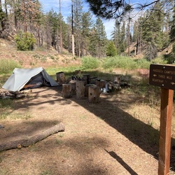
    This hike takes you through some fairly remote terrain and I didn’t see anyone for my hike. The section between Twin Forks and Haddock is especially beautiful. I encountered a rattlesnake on Piedra Blanca and spotted two bears about a 1/4 mile from camp so bring a Ursack for food protection. Heads up, the trail is faint in some places. Water wasn’t flowing but pooled in areas to easily filter.
    ★ ★ ★ ★

    user_profile
    mdtagg91 4 years, 2 months ago
    Pinos, Sawmill and Grouse Peaks (5/15/22, 10:51:54AM)
    Great hike, beautiful area with great views and almost no snow. Only drawback was that the peaks did not have much prominence but overall a must do for locals in the 805.
    ★ ★ ★ ★
    user_profile
    Land crushing trails 4 years, 3 months ago
    Jeep Miller Trail to Gorman
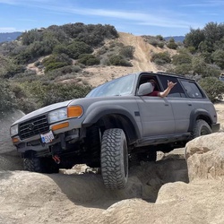
    Amazing trouble but definitely not for beginners intermediate to advanced need apply only
    ★ ★ ★ ★ ★

    user_profile
    MT805 4 years, 6 months ago
    Track (1/16/22, 7:31:30AM)
    Hiked Sisar to white Ledge a few times but always in the dry time. Today, went to Nordhoff Rd. Made it a 7 mile one way. Lots of color and water made it for a great experience.
    ★ ★ ★ ★ ★

    user_profile
    bearbear 4 years, 9 months ago
    Agua Blanca Trail
    Report coming soon...
    ★ ★ ★ ★ ★

    user_profile
    junewlove 4 years, 10 months ago
    6+ mi, training: iPhone died
    Good hike on paved roads: forest closed because of fire danger
    ★ ★ ★

    user_profile
    junewlove 4 years, 10 months ago
    Morning wake up, Pine Mountain Club
    Wake up, adjusting to altitude before heading into Sierra. Pine Mountain Club is surrounded by Los Padres National Forest, sadly closed because of fires and fire danger. 8000+ ridges close when conditions permit.
    ★ ★ ★
    user_profile
    Will 5 years, 1 month ago
    Adobe trail
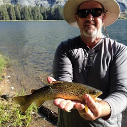
    Adobe trail is located off Hwy 166, in Santa Barbara / San Luis Obispo County. This hike is most enjoyable if started early in the morning before the heat of the day. This part of the Los Padres Nat Forest would be considered coastal mountainous high desert with chaparral & scattered oaks. 6 mile out & back hike. Part the hike skirts a creek but is mostly dry year round.
    ★ ★ ★ ★

    user_profile
    cvinay12 5 years, 3 months ago
    Track (4/27/21, 12:19:14PM)
    This hike 0.5 mile hike to the waterfall is beautiful!
    ★ ★ ★ ★ ★

    user_profile
    Mark Pestrella 5 years, 4 months ago
    Piedra Blanca Camp to Piedra Blanca Trailhead
    Nice place when the weather is right and the water is high. Tough when the temp is over 75.
    ★ ★ ★ ★

    user_profile
    dgdelacruz 5 years, 4 months ago
    Willet Hot Spring via Sespe River Trail
    Comfortable weather for this exposed hike 3/24-25. Still a well-travelled path; we pitched camp at a site a little too close to the trail to avoid the noise of late comers and goers to the spring. A few nice campsite options along the way. If the water is high enough in hotter weather seems worth camping along Sespe creek just for swimming holes.
    ★ ★ ★

    user_profile
    mcfbea 5 years, 4 months ago
    Cielo Vista
    This short out-and-back hike was a really nice surprise. The short hike was well worth the views of the California Coast at the end. We really enjoyed a lot of different plants, many in bloom; on the way up and back. I would definitely recommend this hike. There was even a little picnic bench at the end so you could have lunch and enjoy the view. The trail itself was well maintained and easy to follow. We parked in a nice dirt parking spot on the opposite side of the road.
    ★ ★ ★
    user_profile
    egran71 5 years, 5 months ago
    Track (2/27/21, 3:59:27PM)
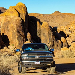
    Apparently this camp site is closed bc of artillery rounds were found. Probably never to be open for a very very long time 😢
    ★

    user_profile
    Pat Fish & Tobe Mule 5 years, 6 months ago
    2021/1/10 Live Oak short stroll
    Jamie on Mosca Patfish on Tobe Bunnie on Gretzky Shayna on Winston
    ★ ★ ★ ★
    user_profile
    1942 Overlanders 5 years, 7 months ago
    Track (12/20/20, 10:14:04AM)
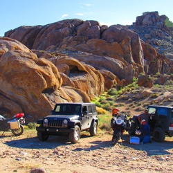
    This was a great ride with a little bit of everything from easy to moderate difficulty. $5 to enter the area was worth the work they have done to the area ( bathrooms, camp area, signage etc etc ). Can be busy but the amount of space made it seem remote. Remember to stay to your side on the corners and watch for criss traffic and you’ll be fine.
    ★ ★ ★ ★

    user_profile
    localcrew2000 5 years, 8 months ago
    Howard creek hike
    Great moderate hike poison oak on north facing slopes
    ★ ★ ★ ★

    user_profile
    josh_rosas 5 years, 9 months ago
    Mount Pinos
    Easy hike for newbies, well maintained trail.
    ★ ★ ★ ★ ★

    user_profile
    ginagkkelly 5 years, 10 months ago
    Willet Hot Spring via Sespe River Trail
    Took this only as far as Willet Hot Spring. Difficult in the heat, lots of sand to hike through on the trail, best bet is to hike out in the morning hours and jump in the creek in various spots along the way at the day progresses. Beautiful area, Willet was clean and incredible.
    ★ ★ ★ ★
    user_profile
    pablo06199 5 years, 11 months ago
    Ranger Point
    It was hot and lots of bugs. Probably wrong time of the year for this area. Also, the views were hampered by the smoke from fires.
    ★ ★ ★

    user_profile
    kennybeal 5 years, 11 months ago
    Willet Hot Spring via Sespe River Trail
    Hiking this weekend.
    ★ ★ ★

    user_profile
    gkloster7 6 years ago
    Old TV Tower Road
    Beautiful views, great for picnics or an overnight. Can be done in a car, Jeep, hike or bike.
    ★ ★ ★ ★ ★

    user_profile
    efriedman1234 6 years, 1 month ago
    Thorn Point - Los Padres
    Great day! Was about 82 at the trailhead. Couldn’t get all the way to the trailhead campground. The road ends at the corral. Saw a fox snag a quail and run off it with. Was pretty wild.
    ★ ★ ★ ★

    user_profile
    efriedman1234 6 years, 2 months ago
    Alamo Mt
    Gorgeous on top of this ridge. Would nice to camp up there! Waypoint for register
    ★ ★ ★ ★

    user_profile
    efriedman1234 6 years, 2 months ago
    McDonald Peak
    McDonald is a nice view down into the condor wilderness and some gorgeous terrain! Also I forgot to finish my track sorry about that >.< Waypoint for register. Which was eaten up by mice so isn’t really intact
    ★ ★ ★ ★

    user_profile
    efriedman1234 6 years, 2 months ago
    Beartrap Bluff
    Great hike and awesome camp grounds for thru hikers. The scramble description from hps doesn’t explain well enough how steel and difficult that is
    ★ ★ ★ ★

    user_profile
    Foose! 6 years, 3 months ago
    Freeman water tower to Bernini trail head
    Nice little hike up to the snow line and back.
    ★ ★ ★ ★ ★

    user_profile
    lukeclementphoto 6 years, 6 months ago
    Cerro Alto Campground to Bridge Trail, San Luis Obispo County, CA, USA
    One of my favorite local hikes for sure. 360 degree view. You can see from Pismo to ragged point, and on clear days all the way to the sierras.
    ★ ★ ★ ★

    user_profile
    Brennan Nerhus 6 years, 7 months ago
    Track (10/20/19, 11:08:15AM)
    Easy hike to get above it all
    ★ ★ ★ ★ ★

    user_profile
    Jim 6 years, 7 months ago
    San Cayetano
    Amazing
    ★ ★ ★ ★ ★

    user_profile
    DMillerJd 6 years, 8 months ago
    Refugio Road to West Camino Cielo to CA154 (10/27/19, 4:04:34PM)
    This road is paved half of the way, almost to Broadcast Peak. Then it turns into a fun rocky and dirt road. I’m a novice wheeler in a stock JKU and had no problems. Took a little longer than I expected.
    ★ ★ ★ ★ ★

    user_profile
    Jim 6 years, 9 months ago
    Frazier Mountain
    Started at 8 in the parking lot. This is a steady uphill grind for 7 miles. The views on top was very nice.
    ★ ★ ★ ★

    user_profile
    junewlove 6 years, 11 months ago
    Mt pinos
    Drove in to campground, sauntered over, achieved the peak! Then moved car to Chumash Wilderness and Grouse Mountain followed by Sawmill: no strolling involved on that part.
    ★ ★ ★ ★ ★

    user_profile
    junewlove 6 years, 11 months ago
    Cerro Noroeste, Grouse Mountain, Sawmill Peak
    Steep grades, good trails, beautiful views with alpine flowers and lots of shade. Only one rattlesnake.
    ★ ★ ★ ★ ★

    user_profile
    junewlove 6 years, 11 months ago
    Potrero Seco, Pine Mt Camp & Beyond
    Lots of thistle on nice, flat part of trail near the campground. Beautiful views, old road.
    ★ ★ ★ ★ ★

    user_profile
    RyanCasey22 7 years, 1 month ago
    Cuyama River to Cable Corral Road
    Pretty sweet off road trail. Took my 97 4Runner on it stock, except 31” all terrains. Clearance was good except for the trailer hitch. I probably hit that every other bump lol. Good views and trail kept well
    ★ ★ ★ ★ ★

    user_profile
    BuilderBee 7 years, 2 months ago
    Matilija Trailhead to Matilija Creek
    Great trail, will get feet wet crossing over the creek on several crossings.
    ★ ★ ★ ★ ★

    user_profile
    dxtremist2 7 years, 4 months ago
    Add 2.5 miles or so to the hike because the access road may be closed getting to the trailhead. This hike is very difficult. I had to turn back about 6 miles in, as there was a very long narrow ledge with a steep drop I didn’t think my pup and I would be able to make. Just wasn’t worth the risk to me. It rained often and was chilly in March when I went through in the upper 40’s 😭. I’ll be back and will take the other trail in instead.
    ★ ★ ★ ★ ★

    user_profile
    hebbringwood 1 year, 10 months ago
    Mount Pinos via McGill Trail
    ★

    user_profile
    emed2019 1 year, 11 months ago
    Monday Morning Activity
    ★ ★ ★ ★ ★

    user_profile
    s.hoeschele 2 years ago
    Dry Canyon Road
    ★

    user_profile
    mtrentschler 2 years ago
    Sespe River Trail
    ★ ★ ★ ★ ★

    user_profile
    kpeliks 2 years, 1 month ago
    Plaskett Creek Campground via Cabrillo Highway
    ★ ★ ★ ★ ★


    user_profile
    jmt5220 2 years, 1 month ago
    Pendola drive and hike
    ★ ★ ★ ★


    user_profile
    iheartbutton 2 years, 2 months ago
    Haddock Camp via Reyes Peak Trail 23W04
    ★ ★ ★ ★ ★

    user_profile
    smikeys 2 years, 2 months ago
    Track (5/1/24, 4:08:59PM)
    ★ ★ ★ ★ ★

    user_profile
    glensheeler 2 years, 4 months ago
    Piru Ohv
    ★ ★ ★ ★ ★

    user_profile
    asurfgrl 2 years, 4 months ago
    Track (3/17/24, 10:50:39AM)
    ★ ★ ★ ★ ★

    user_profile
    sellingcandybars 2 years, 4 months ago
    Willet Hot Spring via Sespe River Trail
    ★ ★ ★ ★

    user_profile
    bennetschlesinger 2 years, 5 months ago
    Matilija Trailhead via Matilija Canyon Road North
    ★

    user_profile
    casey.whipple 2 years, 5 months ago
    Nordhoff Peak via Nordhoff Ridge Road and Chief Peak Road
    ★ ★

    user_profile
    alexmu66 2 years, 5 months ago
    Dog walk
    ★ ★ ★

    user_profile
    harrisoncbray 2 years, 5 months ago
    Sespe River Trail
    ★ ★

    user_profile
    bardopondmoby 2 years, 5 months ago
    Track (1/19/24, 8:48:30AM)
    ★ ★ ★ ★ ★

    user_profile
    ptrkwong 2 years, 6 months ago
    Sespe Hot Springs via Sespe River Trail
    ★ ★ ★ ★ ★

    user_profile
    package-riyal.0 2 years, 6 months ago
    Willet Hot Spring via Sespe River Trail
    ★ ★ ★ ★ ★

    user_profile
    cadenrhailey 2 years, 6 months ago
    Kirk Creek Campground via Nacimiento-Fergusson Road and Plasket Ridge Road
    ★ ★

    user_profile
    ngranner 2 years, 6 months ago
    Pozo Summit via Pine Mountain Road
    ★

    user_profile
    gdanielbrown 2 years, 6 months ago
    Plaskett Creek Group Campground via Plaskett Ridge Road
    ★ ★

    user_profile
    estatelawyer 2 years, 8 months ago
    Miller
    ★ ★ ★ ★ ★

    user_profile
    cbeaty2480 2 years, 8 months ago
    Chester Spring via Pine Mountain Road and Pine Mountain
    ★

    user_profile
    Eagles 2 years, 9 months ago
    Beartrap Campsite via Gene Marshall Piedra Blanca National Recreation Trail
    ★ ★ ★ ★ ★

    user_profile
    dizzy.prod02 2 years, 9 months ago
    Haddock Camp via Gene Marshall Piedra Blanca National Recreation Trail
    ★

    user_profile
    Joe Adones 2 years, 10 months ago
    Prewitt Ridge Trail
    ★ ★

    user_profile
    KATZ 2 years, 11 months ago
    Track (8/5/23, 6:45:31AM)
    ★ ★ ★ ★ ★

    user_profile
    emmajane.gonzalez3 3 years, 1 month ago
    Track (6/23/23, 7:08:20AM)
    ★ ★ ★ ★ ★

    user_profile
    jshirlemy 3 years, 1 month ago
    Saturday Forest exposure
    ★ ★ ★

    user_profile
    djfino_real1 3 years, 2 months ago
    San Emigdio Mountain via Forest Route 9N34
    ★ ★

    user_profile
    adamhladek10 3 years, 3 months ago
    Gene Marshall Piedra Blanca Trailhead Parking, Ventura County to Ventura County, CA, USA
    ★ ★ ★

    user_profile
    claramthomann 3 years, 3 months ago
    Fig mountain willow springs loop wildflowers
    ★ ★ ★ ★ ★

    user_profile
    Margaritox 3 years, 3 months ago
    Frazier mines
    ★

    user_profile
    jrocque 3 years, 4 months ago
    McKinley Springs Camp via Forest Service Route 8N08
    ★ ★ ★ ★ ★

    user_profile
    Dylan 3 years, 4 months ago
    Bike to Nira
    ★ ★ ★

    user_profile
    fdevans 3 years, 5 months ago
    Ballinger Canyon 24-31-40
    ★ ★ ★ ★ ★

    user_profile
    jmt5220 3 years, 5 months ago
    NIRA Manzana so 2/3/23
    ★ ★ ★ ★ ★

    user_profile
    Matt Harding 3 years, 6 months ago
    Franklin Trail
    ★ ★ ★ ★ ★

    user_profile
    kathleen.imanishi 3 years, 7 months ago
    Figueroa Lookout
    ★ ★ ★ ★ ★

    user_profile
    JS 3 years, 7 months ago
    Yoshie Trip
    ★ ★ ★ ★ ★

    user_profile
    Steve 3 years, 8 months ago
    Buzzard’s Roost
    ★ ★ ★ ★

    user_profile
    Warrenize 3 years, 9 months ago
    Lockwood Route 100
    ★ ★ ★ ★

    user_profile
    4011021 3 years, 9 months ago
    Track (10/8/22, 6:13:18AM)
    ★ ★ ★ ★ ★

    user_profile
    matthew.lamson22 3 years, 10 months ago
    San Martin Top to Prewitt Ridge Campground
    ★ ★ ★ ★ ★

    user_profile
    Chris 3 years, 10 months ago
    Willet Hot Spring via Sespe River Trail
    ★

    user_profile
    monarca1973 3 years, 10 months ago
    Mount Pinos via Condor Summit
    ★ ★

    user_profile
    naidutnn 3 years, 10 months ago
    My. Pinos to alt. CG Camp
    ★ ★ ★ ★ ★

    user_profile
    Wmcfarland259 3 years, 10 months ago
    Santa Ynez Peak via West Camino Cielo
    ★ ★ ★ ★ ★

    user_profile
    ianmacd12 3 years, 11 months ago
    Plaskett fire road
    ★ ★ ★ ★ ★

    user_profile
    kruse.overload 3 years, 11 months ago
    Mount Pinos via McGill Trail
    ★ ★

    user_profile
    piambro 4 years ago
    2022-07-03 Hard Ride Northwest Gorman
    ★ ★ ★ ★ ★

    user_profile
    yankeec77 4 years ago
    Prewitt Ridge Trail
    ★ ★ ★ ★ ★

    user_profile
    slapshotdave72 4 years, 1 month ago
    Misfits Hungry Valley
    ★ ★ ★ ★

    user_profile
    ameliab05 4 years, 1 month ago
    Track (1/6/21, 8:06:18AM)
    ★ ★ ★ ★ ★

    user_profile
    Yipee_Ki_Yay 4 years, 2 months ago
    *D_Lockwood_Miller_Jeep_Trail
    ★ ★ ★ ★ ★

    user_profile
    MFD 4 years, 2 months ago
    OJMiddleSespeT220511
    ★ ★ ★ ★

    user_profile
    MFD 4 years, 2 months ago
    OJPiedraBlancaFormationsT220511
    ★ ★ ★ ★

    user_profile stars

    Gordon Alexander 4 years, 2 months ago
    Fishbowls on Cedar Creek
    ★ ★ ★ ★

    user_profile
    csi91335 4 years, 3 months ago
    Sawmill Mt
    ★ ★ ★ ★ ★

    user_profile
    camstrong583 4 years, 3 months ago
    Mt. Pinos (4/8/22, 10:32:0)
    ★ ★ ★ ★ ★

    user_profile
    e.salud 4 years, 3 months ago
    Plaskett Ridge Road
    ★

    user_profile
    lg19 4 years, 4 months ago
    Track (3/6/22, 09:13:58)
    ★ ★ ★ ★ ★

    user_profile
    jmt5220 4 years, 4 months ago
    Track Indian creek March 2022
    ★ ★ ★ ★ ★

    user_profile
    Scott 4 years, 4 months ago
    McKinley Mountain
    ★ ★ ★ ★ ★

    user_profile
    karl 4 years, 5 months ago
    Boulder canyon with Kaleb
    ★ ★ ★ ★ ★

    user_profile
    Pat Fish & Tobe Mule 4 years, 5 months ago
    2022/2/27 cow day at live oak
    ★ ★ ★ ★

    user_profile
    amyheraly 4 years, 5 months ago
    Cerro Alto
    ★ ★

    user_profile
    bentorres 4 years, 5 months ago
    Prewitt Ridge Campground Track
    ★ ★ ★ ★ ★

    user_profile
    doctorguier 4 years, 5 months ago
    Romero Saddle to Little Caliente via Camuesa Road; Luc and Christian TREK 5
    ★ ★ ★ ★

    user_profile
    doctorguier 4 years, 5 months ago
    Gibraltar Connector Trail
    ★ ★ ★ ★ ★

    user_profile
    Dahn Han 4 years, 5 months ago
    경로 (2/4/22 오전 6:25:12)
    ★ ★ ★ ★ ★

    user_profile
    robertdervin 4 years, 6 months ago
    White Ledge Campground via Red Reef Trail and Sisar Canyon Road
    ★ ★

    user_profile
    robertdervin 4 years, 6 months ago
    Chorro Grande Trail
    ★ ★

    user_profile
    jessehmorrison 4 years, 6 months ago
    My Pinos Trail
    ★ ★ ★ ★

    user_profile
    Edger S 4 years, 6 months ago
    Track (1/6/22, 9:06:43AM)
    ★ ★ ★ ★ ★

    user_profile
    skylarvanhook04 4 years, 7 months ago
    Track (12/18/21, 09:36:11)
    ★ ★ ★ ★

    user_profile
    ikan_ 4 years, 7 months ago
    Alamo Mountain -Dutchman Camp
    ★ ★ ★ ★ ★

    user_profile
    josephtirone 4 years, 7 months ago
    Los Burros Road
    ★ ★ ★ ★

    user_profile
    jlsarner 4 years, 8 months ago
    Track (11/24/21, 8:57:15AM)
    ★ ★ ★ ★ ★

    user_profile
    ikan_ 4 years, 8 months ago
    8N43 Sulphur Springs 23W29
    ★ ★ ★ ★ ★

    user_profile
    ikan_ 4 years, 8 months ago
    6N03 Potrero Seco (Private)
    ★ ★ ★ ★ ★

    user_profile
    ikan_ 4 years, 8 months ago
    7N04 Tinta Cyn / Rancho Nuevo CG
    ★ ★ ★ ★ ★

    user_profile
    dlinstrom 4 years, 8 months ago
    Track (11/20/21, 2:54:18PM)
    ★ ★ ★ ★ ★

    user_profile
    BarefootBassist 4 years, 8 months ago
    Sawmill Mountain (Mount Pinos, Grouse Mountain)
    ★ ★ ★ ★ ★

    user_profile
    BarefootBassist 4 years, 9 months ago
    Sawmill Mountain (Mount Pinos, Grouse Mountain)
    ★ ★ ★ ★ ★

    user_profile
    MRoth 4 years, 9 months ago
    Track (10/28/21, 9:50:38AM)
    ★ ★ ★ ★

    user_profile
    raulnava94 4 years, 10 months ago
    Chester Spring via Pine Mountain Road and Pine Mountain
    ★ ★ ★ ★ ★

    user_profile
    rainey.hoffman 4 years, 10 months ago
    Santa B hike with O
    ★ ★ ★ ★ ★

    user_profile
    Jon Lieberg 4 years, 11 months ago
    Track (8/29/21, 7:33:40AM)
    ★

    user_profile
    schawson 4 years, 11 months ago
    3 Peaks from Nordic Base
    ★ ★ ★ ★ ★

    user_profile
    TheSoloist 5 years ago
    Matilija Trailhead to Jamison lake out and back
    ★ ★ ★ ★

    user_profile
    tyrellbraker 5 years ago

    Thorn Meadows via Forest Route 7N03B
    ★ ★ ★ ★ ★

    user_profile
    angelofmine12707 5 years, 1 month ago
    Dry Canyon Road
    ★

    user_profile
    zachtrow 5 years, 1 month ago
    ATV Campground via Forest Route 8N01
    ★ ★

    user_profile
    cundy48 5 years, 1 month ago
    Miller Jeep Trail
    ★ ★ ★ ★ ★

    user_profile
    fiddlefestival 5 years, 1 month ago
    Fishbowls Camp Loop via 21W05
    ★ ★ ★ ★ ★

    user_profile
    jimcontour 5 years, 1 month ago
    Frazier lookout
    ★ ★ ★ ★

    user_profile
    jimcontour 5 years, 1 month ago
    Frazier lookout
    ★ ★ ★ ★

    user_profile
    1942 Overlanders 5 years, 2 months ago
    Frazier Mtn Ride
    ★ ★ ★ ★ ★

    user_profile
    davidgordon 5 years, 2 months ago
    AB Track Edited
    ★ ★ ★ ★ ★

    user_profile
    Katerina 5 years, 2 months ago
    Track (5/16/21, 13:03:9)
    ★ ★ ★ ★ ★

    user_profile
    blagudas 5 years, 2 months ago
    Prewitt Ridge Trail
    ★

    user_profile
    cpietro45 5 years, 2 months ago
    Pleito Creek
    ★ ★ ★ ★

    user_profile
    Pat Fish & Tobe Mule 5 years, 2 months ago
    2021/5/9 Mothers’ Day MeetUp at 2021/5/9 Mothers’ Day MeetUp Rancho Oso
    ★ ★ ★

    user_profile
    jl 5 years, 3 months ago
    Maricopa Highway to Reyes Peak Trail
    ★ ★ ★ ★ ★

    user_profile
    clarkda 5 years, 3 months ago
    Little Pine Spring Camp to Santa Cruz Guard Station, Santa Barbara County, CA, USA
    ★ ★ ★ ★

    user_profile
    ajritzz 5 years, 3 months ago
    Sespe Hot Springs via Alder Creek Trail
    ★

    user_profile
    mdbekins 5 years, 3 months ago
    Piedra Blanca Trailhead via Rose Valley Road and NFD6N31
    ★ ★ ★ ★

    user_profile
    a.burt7123 5 years, 3 months ago
    Buckhorn ridge(4/17/21, 10:35:15AM)
    ★ ★ ★ ★

    user_profile
    Owen 5 years, 3 months ago
    Sespe Hot Springs via Alder Creek Trail
    ★ ★ ★ ★

    user_profile
    beritng 5 years, 4 months ago
    Enchanted Forest, 3/29
    ★ ★ ★ ★ ★

    user_profile
    nathanh983 5 years, 4 months ago
    San Emigdio Mountain via Forest Route 9N34
    ★ ★ ★ ★ ★

    user_profile
    stoneyb83 5 years, 4 months ago
    Snyder Trail
    ★ ★ ★ ★

    user_profile
    seanhaney81 5 years, 4 months ago
    Nordhoff Peak via Nordhoff Ridge Road and Chief Peak Road
    ★

    user_profile
    claire.hall 5 years, 4 months ago
    Mount Pinos Trail
    ★ ★ ★ ★ ★

    user_profile
    Steven 5 years, 4 months ago
    Track (3/16/21, 11:06:56AM)
    ★ ★ ★ ★ ★

    user_profile
    dilutionofgrandeur 5 years, 4 months ago
    Nordhoff Tower
    ★ ★ ★

    user_profile
    Pablo 5 years, 4 months ago
    Track (3/6/21, 8:43:12AM)
    ★

    user_profile
    egran71 5 years, 5 months ago
    Track (2/28/21, 5:01:36PM)
    ★ ★ ★ ★ ★

    user_profile
    djkusicki 5 years, 5 months ago
    Sepse hot springs
    ★ ★

    user_profile
    sar30 5 years, 5 months ago
    Mount Pinos via Condor Summit
    ★

    user_profile
    bdkeefe 5 years, 5 months ago
    Track (2/15/21, 11:45:14)
    ★ ★ ★

    user_profile
    fkhodaei 5 years, 5 months ago
    Tecuya Mountain Loop via Cold Springs Canyon
    ★

    user_profile
    CoachDale 5 years, 5 months ago
    Sawmill Mountain, Los Padres National Forrest, Kern County CA, USA
    ★ ★ ★ ★ ★

    user_profile
    dilutionofgrandeur 5 years, 5 months ago
    First ride at the ranchos
    ★ ★ ★

    user_profile
    a88e 5 years, 5 months ago
    Middle Santa Ynez Campground via Forest Route 5N33 and Romero Camuesa Road
    ★

    user_profile
    dinferno 5 years, 6 months ago
    Track (1/2/21, 10:19:32AM)
    ★ ★ ★ ★ ★

    user_profile
    akdk9090 5 years, 6 months ago
    Piru Canyon Road
    ★ ★ ★ ★

    user_profile
    Scott 5 years, 6 months ago
    Tequepis Trail to Santa Ynez Peak (1/3/21, 7:51:14AM)
    ★ ★ ★ ★ ★

    user_profile
    melmel_nv 5 years, 6 months ago
    Horn Canyon Trail
    ★ ★ ★

    user_profile
    Scott 5 years, 7 months ago
    Cachuma Mtn from Cachuma Saddle (12/26/20, 7:58:52AM)
    ★ ★ ★

    user_profile
    wesley.dowell 5 years, 7 months ago
    Frazier park
    ★ ★ ★ ★ ★

    user_profile
    eltonmdoi 5 years, 7 months ago
    Sespe River Trail to Piedra Blanca Creek
    ★ ★ ★ ★ ★

    user_profile
    jl 5 years, 7 months ago
    Franklin (1913 Route)
    ★ ★ ★ ★

    user_profile
    Jim 5 years, 7 months ago
    Buck creek, Sewert Peak
    ★ ★ ★ ★ ★

    user_profile
    Leo 5 years, 8 months ago
    Fishbowls Springs Trail
    ★ ★ ★ ★

    user_profile
    Jason Bub 5 years, 8 months ago
    Snowy to Piru
    ★ ★ ★ ★

    user_profile
    Blake Murphy 5 years, 8 months ago
    Our First Adventure (11/14/20, 9:12:42AM)
    ★ ★ ★ ★ ★

    user_profile
    joelpacheco 5 years, 8 months ago
    Chief Peak Track (11/6/20, 9:41:09AM)
    ★ ★ ★ ★

    user_profile
    hmrockwood 5 years, 9 months ago
    Willet Hot Spring via Sespe River Trail
    ★ ★

    user_profile
    jsobolow 5 years, 9 months ago
    Figueroa Los Padres NF
    ★ ★ ★ ★

    user_profile
    johnmiller434 5 years, 9 months ago
    Track (10/17/20, 6:40:49AM)
    ★ ★ ★ ★ ★

    user_profile
    joseavsqz 5 years, 9 months ago
    Willet Hot Spring via Sespe River Trail
    ★ ★

    user_profile
    cvinay12 5 years, 10 months ago
    Track (9/27/20, 6:34:29AM)
    ★ ★ ★

    user_profile
    oaldana902 5 years, 10 months ago
    Track (9/26/20, 8:37:35AM)
    ★ ★ ★ ★ ★

    user_profile
    symphonydecks 5 years, 10 months ago
    Days Inn, Lost Hills to 1641 E Daily Dr, Camarillo, CA, USA
    ★ ★ ★ ★ ★

    user_profile
    d.lopezdearenosa 5 years, 10 months ago
    Lockwood creek 8/15/20
    ★ ★ ★ ★

    user_profile
    mannynunez07 5 years, 10 months ago
    Track (9/5/20, 09:58:50)
    ★ ★ ★ ★ ★

    user_profile
    eghazarian10 5 years, 10 months ago
    Track (9/5/20, 9:19:42AM)
    ★

    user_profile
    runhard12341 5 years, 11 months ago
    Sisar Rd, Nordoff Ridge Road, Topa Topa
    ★ ★ ★ ★

    user_profile
    lauriefrye 5 years, 11 months ago
    Alto Cerro Campground
    ★ ★ ★ ★ ★

    user_profile
    jmbergsgaard 5 years, 11 months ago
    Track (8/14/20, 7:49:33AM)
    ★ ★ ★ ★ ★

    user_profile
    gkloster7 5 years, 11 months ago
    Cuesta Pass to San Luis Obispo Creek, San Luis Obispo County, CA, USA
    ★ ★ ★ ★

    user_profile
    ka333d 5 years, 11 months ago
    Prewitt Ridge campground area
    ★ ★

    user_profile
    fespaco1 5 years, 11 months ago
    Cedar creek fish bowl loop
    ★ ★ ★ ★ ★

    user_profile
    dcota1094 5 years, 11 months ago
    Sawmill Mountain via Condor Summit and Vincent Tumamait Trail
    ★ ★ ★ ★ ★

    user_profile
    dcota1094 5 years, 11 months ago
    Track (8/6/20, 1:33:08PM)
    ★ ★ ★ ★ ★

    user_profile
    pvrp.trip 5 years, 11 months ago
    Willet Hot Spring via Sespe River Trail
    ★ ★ ★ ★ ★

    user_profile
    eelderziggy 5 years, 11 months ago
    Willet Hot Spring via Sespe River Trail
    ★ ★ ★ ★ ★

    user_profile
    camboyd 6 years ago

    West Pozo Road to Pozo Creek
    ★ ★ ★ ★ ★

    user_profile
    a.burt7123 6 years ago
    Track (7/25/20, 07:29:59)
    ★ ★ ★

    user_profile
    a.burt7123 6 years ago
    Track (7/17/20, 09:55:47)
    ★ ★ ★

    user_profile
    darrendelin 6 years ago
    Prewitt Ridge Campground Loop via Plaskett Ridge Road
    ★ ★ ★ ★ ★

    user_profile
    orion77 6 years ago
    Track (7/15/20, 9:12:08AM)
    ★ ★ ★ ★ ★

    user_profile
    johnkoenig80 6 years ago
    Dutchman Campsite to Dutchman Campground, Ventura County, CA, USA
    ★ ★ ★ ★ ★

    user_profile
    pjmj 6 years, 1 month ago
    Alamo mountain exit
    ★ ★ ★ ★

    user_profile
    nbarratt 6 years, 1 month ago
    Cerro Alto Loop via AT&T Trail
    ★ ★ ★ ★ ★

    user_profile
    jlc2585 6 years, 1 month ago
    3-2-1 Challenge
    ★ ★ ★ ★ ★

    user_profile
    imchuckblack 6 years, 1 month ago
    Sespe Hot Springs 1
    ★ ★ ★ ★ ★

    user_profile
    eunicetheasian 6 years, 1 month ago
    Willet Hot Spring via Sespe River Trail
    ★ ★ ★

    user_profile
    jeff.hubauer 6 years, 1 month ago
    Anniversary hike
    ★ ★ ★ ★ ★

    user_profile
    Pat Fish & Tobe Mule 6 years, 1 month ago
    2020/6/14 Flag Day at Live Oak Camp
    ★ ★ ★ ★ ★

    user_profile
    robert.pelletier2 6 years, 1 month ago
    Track (6/9/20, 08:53:40)
    ★ ★ ★ ★ ★

    user_profile
    Aviatrix 6 years, 1 month ago
    Sespe Hot Springs
    ★ ★ ★ ★ ★

    user_profile
    efriedman1234 6 years, 1 month ago
    Mt Pinos, Grouse and Sawmill
    ★ ★ ★ ★

    user_profile
    4191209 6 years, 2 months ago
    Davy Brown Campground via Forest Route 8N03
    ★ ★ ★

    user_profile
    bikebuckets 6 years, 2 months ago
    Track (5/22/20, 5:49:14PM)
    ★ ★ ★

    user_profile
    mattjvisuals 6 years, 2 months ago
    Quatal Canyon Road
    ★ ★ ★ ★ ★

    user_profile
    Pat Fish & Tobe Mule 6 years, 2 months ago
    Live Oak Eastern Plateau (5/24/20, 11:39:50AM)
    ★ ★ ★ ★ ★

    user_profile
    emailcorbett 6 years, 2 months ago
    Ballinger trail 24
    ★ ★ ★ ★ ★

    user_profile
    harrisonto 6 years, 2 months ago
    Track (5/16/20, 12:18:32PM)
    ★ ★ ★ ★ ★

    user_profile
    efriedman1234 6 years, 2 months ago
    Antimony peak
    ★ ★ ★ ★

    user_profile
    Ritam 6 years, 3 months ago
    Matilija creek north fork
    ★ ★ ★ ★ ★

    user_profile
    dakotafeldmar 6 years, 3 months ago
    Carrizo Plane
    ★ ★ ★ ★ ★

    user_profile
    lam2958 6 years, 3 months ago
    Sespe Condor Trail
    ★ ★ ★

    user_profile
    dakotafeldmar 6 years, 3 months ago
    Hunting trip 4.17.20
    ★ ★ ★ ★ ★

    user_profile
    n8rogers 6 years, 3 months ago
    Track (3/14/20, 12:07:55PM)
    ★ ★ ★

    user_profile
    gohikingprn 6 years, 4 months ago
    Mount Pinos Snow Shoeing
    ★ ★ ★ ★ ★

    user_profile
    Curtis 6 years, 5 months ago
    Track (2/18/20, 10:21:52AM)
    ★ ★ ★

    user_profile
    4191209 6 years, 5 months ago
    Timber Peak via Sierra Madre Road
    ★

    user_profile
    twolfson 6 years, 6 months ago
    El carrizo plain - final night camping to home
    ★ ★ ★ ★

    user_profile
    dillonmlong 6 years, 6 months ago
    Track (1/4/20, 12:56:32PM)
    ★ ★ ★ ★ ★

    user_profile
    dillonmlong 6 years, 7 months ago
    Willett Hot Springs and back
    ★ ★ ★ ★ ★

    user_profile
    bichobago 6 years, 8 months ago
    Track (11/27/19, 9:36:41AM)
    ★ ★ ★ ★ ★

    user_profile
    Jim 6 years, 8 months ago
    Track (11/25/19, 09:02:42)
    ★ ★ ★ ★

    user_profile
    gussvendsen 6 years, 8 months ago
    Track (11/17/19, 7:12:11AM)
    ★ ★ ★ ★ ★

    user_profile
    socalcuda 6 years, 8 months ago
    118 trail Maricopa
    ★ ★ ★ ★ ★

    user_profile
    kentaroadun 6 years, 8 months ago
    Sespe Hot Springs via Sespe River Trail
    ★ ★ ★

    user_profile
    Frixton 6 years, 9 months ago
    La Panza Campground via East Pozo Road
    ★

    user_profile
    kiyoshi 6 years, 10 months ago
    9/25/19, 8:01 Mt. Pinos, Sawmill Mt. Grouse Mt.
    ★ ★

    user_profile
    jake.ortiz96 6 years, 10 months ago
    Mount Pinos via Vincent Tumamait Trail
    ★

    user_profile
    BuilderBee 6 years, 10 months ago
    Matilija Trailhead to Matilija Creek
    ★ ★ ★ ★ ★

    user_profile
    junewlove 6 years, 11 months ago
    3 peaks 2 counties Track (8/31/19, 07:25:41)
    ★ ★ ★ ★ ★

    user_profile
    zolicsoo 7 years ago
    Pozo Summit via Pine Mountain Road
    ★ ★ ★ ★ ★

    user_profile
    pjmj 7 years ago
    ★ ★ ★ ★

    user_profile
    sailor 7 years ago
    Seymour Creek to Lockwood / Miller Jeep Trail
    ★ ★ ★

    user_profile
    alyssasmith531 7 years, 1 month ago
    Sespe forced march
    ★ ★ ★

    user_profile
    tge96 7 years, 1 month ago
    Lockwood Miller Jeep Trail
    ★ ★ ★ ★ ★

    user_profile
    tanner.yould 7 years, 1 month ago
    ★ ★ ★ ★ ★

    user_profile
    fishininmammoth676 7 years, 1 month ago
    Lockwood Valley Road to Forest Route 7N11
    ★ ★ ★ ★ ★

    user_profile
    fishininmammoth676 7 years, 1 month ago
    Chief Peak via Nordhoff Ridge Road
    ★

    user_profile
    RyanCasey22 7 years, 1 month ago
    Awesome extra trail
    ★ ★ ★ ★ ★

    user_profile
    RyanCasey22 7 years, 1 month ago
    Cable Corral Road to Thirty Five Canyon Road
    ★ ★ ★ ★ ★

    user_profile
    Mike Fair 7 years, 1 month ago
    Lockwood / Miller Jeep Trail
    ★ ★

    user_profile
    Pchrisbea 7 years, 1 month ago
    ★ ★ ★ ★ ★

    user_profile
    mglikin 7 years, 1 month ago
    Grouse Mountain via Vincent Tumamait Trail and Condor Summit
    ★ ★ ★ ★ ★

    user_profile
    Mountain goat mami 7 years, 2 months ago
    Willet Hot Spring via Sespe River Trail
    ★ ★ ★ ★ ★

    user_profile
    tajared1 7 years, 2 months ago
    ★ ★ ★ ★

    user_profile
    pacificober 7 years, 3 months ago
    ★

    user_profile
    am 7 years, 4 months ago
    ★ ★ ★