United States
›
California
›
San Bernardino National Forest

Best Hiking Trails in San Bernardino National Forest

1562 reviews


link Copy Link email Email directions Driving Directions

Seasonal Popularity

Overview

San Bernardino National Forest is located east of Los Angeles, CA, and is bordered on the east by Joshua Tree National Park.

Getting Started

It's no hassle to go hiking in San Bernadino National Forest. Pick a hike, and park at or near the trailhead.

When to Go

Most hiking trails are open year-round, but access to trailheads may to limited during Winter months.

Permits

Hiking and backpacking in San Bernardino National Forest doesn't generally require a permit, but cars parked in a developed parking lot, picnic area, or campground will need to display a Forest Adventure Pass . Be sure to check the Interactive Map of Recreation Fee Sites.

The San Jacinto, Santa Rosa, San Gorgonio, and Cucamonga Wilderness Areas require a free wilderness permit for day-hiking and overnight camping.

Dog Info

Dogs are allowed in, except in the Mount San Jacinto State Park Wilderness.


Resources

  • fs.usda.gov
  • wikipedia

  • Hiking Trails (448)
  • Reviews (1,562)
  1. 1
    Marion Mountain Campground via Marion Mountain Trail
    ★ ★ ★ ★ ★ MODERATE 2.6 mi
  2. 2
    Suicide Rock
    ★ ★ ★ ★ ★ MODERATE 3.4 mi
  3. 3
    Dobbs Cabin Camp via Momyer/Alger Creek Trail
    ★ ★ ★ ★ ★ MODERATE 5.5 mi
  4. 4
    Mount San Antonio via North Backbone Trail
    ★ ★ ★ ★ ★ MODERATE 3.5 mi
  5. 5
    Grays Peak via Gray's Peak Trail 1W06
    ★ ★ ★ ★ ★ EASY 3.4 mi
  6. 6
    Alger Creek Camp via Momyer/Alger Creek Trail
    ★ ★ ★ ★ ★ MODERATE 3.9 mi
  7. 7
    Grand View Point Loop via 2N17
    ★ ★ ★ ★ ★ MODERATE 7.8 mi
  8. 8
    Exploration Trail 2W09X
    ★ ★ ★ ★ ★ EASY 4.4 mi
  9. 9
    skyline view trails
    ★ ★ ★ ★ ★ EASY 3.0 mi
  10. 10
    Halfway Camp via Vivian Creek Trail
    ★ ★ ★ ★ ★ MODERATE 3.0 mi
    user_profile
    eric 1 year, 11 months ago
    Camp Spot: Big Bear
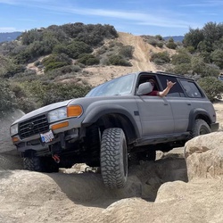
    Good 4X4 and location
    ★ ★ ★

    user_profile
    Temecula_Dan 2 years, 1 month ago
    Cucamonga Peak
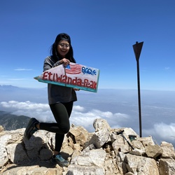
    Solo hiked Thurs 8/8/2024 – Cucamonga-Icehouse-Etiwanda-8386-Alta Loma peaks. Trail out to Cucamonga Peak was in good shape except for the scree slide area where it traverses the east side of Bighorn. This section is totally doable, just requiring a little extra focus on foot placement unless you’re up for scree skiing. From Cucamonga Peak to the wilderness border near Alta Loma, the trail will get you there with some cairns/ducks marking the more obscured parts where using gps really helps. Some scree slide areas here as well. Recommend leaving the trail right at the Cucamonga/SB Forest border to start the direct descent to the Alta Loma Saddle, followed by the direct ascent up Alta Loma. First time hitting Icehouse, 8386 and Alta Loma Peaks, all worth climbing up. Etiwanda & Alta Loma were the only peaks with registers. Very nice weather but much warmer than forecasted. Last water source going up is Columbine Spring which is trailside, 2.4 miles from the trail head (34.24326, -117.60459) and flowing nicely right now. I carried and finished 5L water and 2 half liters of electrolyte for this trek but would have taken a 2.5 - 3L bladder for just doing an out and back to Cucamonga Peak. Took frequent breaks in the shade for the Alta Loma leg and never felt too hot. Views off the peaks were awesome and coming back down Icehouse Canyon in the afternoon was as beautiful as ever. Occasionally ran into bug swarms the entire way, almost putting on a head net a few times but just spit out several and relied on insect repellent. Filtered a few liters from Icehouse Creek on the way out to enjoy on the weekend. Really glad the Forest Service reopened Baldy/Icehouse-good decision.Logged 18.8 miles / 6002 vertical ft with Gaia
    ★ ★ ★ ★ ★

    user_profile
    aplusauto2020 2 years, 2 months ago
    Track (6/25/24, 7:12:40PM)
    ★ ★ ★

    user_profile
    Temecula_Dan 2 years, 3 months ago
    Holcomb Valley Campground via 3N43
    Solo hiked Thurs 5/23/2024 – I’ve wanted to go up the Arctic Point and John Benchmark summits for several months but the drive in to Holcomb Valley has always been snowbound. Instead of a quicker out & back trek, I opted to hike the longer loop for the approach and exit as it was still early enough to avoid getting dusted over by any ORV’s (although it would have been worth seeing someone make the crawl up the John Bull Flat route). The great views of the San Gorgonio Mountains, Delamar Mountain and Holcomb Valley from the Arctic Point summit were definitely worth the trip up. I followed a faint use trail part way up before finding a more frequently used route that was sufficiently ducked/cairned. I chose a more westerly cross-country descent down a wash towards the base of John Benchmark which had some interesting, climbable boulder formations along the way. The west and northwest views of White Mountain and Lucerne Valley from the John BM summit were also worth the climb up which was cross-country but quite intuitive with a few faint use trail segments but no bushwhacking. The rest of the loop out was on extremely quiet 4x4 forest roads that wound up through the trees to John Bull Flat and then down Hepburn Mine Road before the final segment on Van Dusen Creek Road. Unexpected was the stick figure made from broken suspension parts standing on top of the John Bull crawling hill. Stopped by Wilbur’s Grave and the settling pond on the drive out on the rougher but mud free stretches of Holcomb Valley & Polique Canyon Roads. Never switched over to 4 wheel drive and could have done the route in a mid-clearance vehicle. A very nice hike through a historic and very scenic forest area best done early on a weekday to avoid eating copious amounts of fine Holcomb ORV dust! Logged 9.0 miles / 1994 vertical ft with Gaia
    ★ ★ ★ ★ ★

    user_profile
    ARON 2 years, 4 months ago
    Miller Canypn Group Camp, San Bernardino County to 23927 Zurich Drive, Crestline, CA, USA
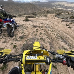
    Dual sport ride, fairly easy, rutted in places due to rains. Beautiful ride.
    ★ ★ ★ ★ ★

    user_profile
    baron.asher 2 years, 5 months ago
    WBC 2024 Snow Camp Day-2
    5” of fresh snow from last night’s blizzard: 24 degrees, 65+ knots of wind in the tree tops, Beautiful sunny snowshoe out to the trailhead after digging out the “dead man” stays. Great brunch at the Oaks Cafe and ride home with Marlene, Becca & Al.
    ★ ★ ★ ★ ★

    user_profile
    baron.asher 2 years, 5 months ago
    WBC 2024 Snow Camp @ Onyx Summit Day-1
    Alternating snow flurries and sunshine. Cold and windy tonight!
    ★ ★ ★ ★ ★

    user_profile
    lookmomnohouse 2 years, 7 months ago
    New Mesa Campground to Summit OHV Trailhead, San Bernardino County, CA, USA
    Easy hike without much to recommend other than decent footing, gradual elevation changes, and some nice views. Used as a shakedown trip ahead of longer late winter trips.
    ★ ★ ★

    user_profile
    Temecula_Dan 2 years, 7 months ago
    Constance Peak via Thomas Hunting Ground Road/ Forest Road 1N12
    Solo day hiked Sat 2/03/24 – Good hike for a time/weather limited day and today was it. Good powder to climb the steep NE ridgeline of Constance from forest road 1N12 and plunge step back down the east slope. Impressive views for a peak dwarfed by San B Peak. Wanted to extend the hike by a few miles with a trip to Point 5880 in the Thomas Hunting Grounds area. Bypassed part of 1N12 on the way to Pt 5880 by using the Lower Santa Ana River Trail (2E03.3) which was very nice in the snow. Stopped at The Oaks Restaurant for breakfast on the way out before the storm arrived. Nicer hike than I expected. Logged 10 miles/1710 vertical ft. with Gaia.
    ★ ★ ★ ★ ★

    user_profile
    Temecula_Dan 2 years, 8 months ago
    Gold Mountain via 3N16 and 3N69
    Solo day hiked Weds 1/10/24 – Wanted to spend less time road hiking and opted to use the PCT (Pacific Crest Trail), starting where it intersects Holcomb Valley Road just north of Baldwin Lake. Wow! What a nice route up Gold Mountain. A little snow on the trail but with great traction for bare boots. PCT dumps you out on Gold Mountain Road about a mile from the summit which is a scenic, straight forward road trek. Was lucky enough to do the road portion after 2 wide track 4x4 crawlers compacted the snow (much thanks). The views off the Gold Mountain summit are the best I’ve experienced in the entire Big Bear Area. Big Bear and Baldwin Lakes, Holcomb Valley and all the perimeter range groups can be seen from here. Definitely recommend this route and look forward to coming back to do it in the spring. Finding the PCT trail on Holcomb Valley Road can be hard as it’s a 3 foot wide gap in a barbed wire fence with a little PCT emblem on a round, rusty fence post. There are a few shoulder parking areas across from it. Logged 7.7 miles/1313 vertical ft. with Gaia.
    ★ ★ ★ ★ ★

    user_profile
    Temecula_Dan 2 years, 8 months ago
    Gold Mountain via 3N69
    Solo day hiked Weds 1/10/24 – Wanted to spend less time road hiking and opted to use the PCT (Pacific Crest Trail), starting where it intersects Holcomb Valley Road just north of Baldwin Lake. Wow! What a nice route up Gold Mountain. A little snow on the trail but with great traction for bare boots. PCT dumps you out on Gold Mountain Road about a mile from the summit which is a scenic, straight forward road trek. Was lucky enough to do the road portion after 2 wide track 4x4 crawlers compacted the snow (much thanks). The views off the Gold Mountain summit are the best I’ve experienced in the entire Big Bear Area. Big Bear and Baldwin Lakes, Holcomb Valley and all the perimeter range groups can be seen from here. Definitely recommend this route and look forward to coming back to do it in the spring. Finding the PCT trail on Holcomb Valley Road can be hard as it’s a 3 foot wide gap in a barbed wire fence with a little PCT emblem on a round, rusty fence post. There are a few shoulder parking areas across from it. Logged 7.7 miles/1313 vertical ft. with Gaia.
    ★ ★ ★ ★ ★

    user_profile
    Temecula_Dan 2 years, 8 months ago
    2N13D
    Solo day hiked Weds 1/10/24 – Sloppy snow almost all the way to Crafts summit in spite of a really early start. It was still enjoyable, just a little extra work. Knew it was going to be windy on the summit after checking Mountain Forecast but still was a spectacular sunrise with awesome views. Crafts has a nice overlook but the wind chill made for a short stay. Climbed through the rock pile N-NW of Crafts to avoid the sea of dense buckthorn and found a nice N-NW cross country route down the mountain towards West Point Peak. Used micro spikes to speed the descent over 3-4 inches of snow on top of a pine needle base. This route was very scenic and a lot of fun, leading right to the base Of West Point at Snow Slide Road (2N13). There’s a memorial sign here for Don West, a forestry firefighter who was struck by lightning in 1958. Took Snow Slide Road back to Green Valley Campground on a meandering route with surprisingly good snow which made up for the slog to Crafts. Recommend this loop hike as the elevation gain is evenly distributed over the entire length, except for the short cross-country descent which is all downhill. Logged 8.4 miles/1524 vertical ft. with Gaia.
    ★ ★ ★ ★ ★

    user_profile
    Temecula_Dan 2 years, 8 months ago
    Delamar Mountain via Pacific Crest Trail
    Solo day hiked Fri 1/5/24 – Cougar Crest-Bertha-Delamar-Little Bear Peaks in very powdery snow. Wanted to start on Polique Canyon Road where it crosses the PCT but the snow was just a little too much for the car. Instead, I started at Cougar Crest TH and used the well beaten path up to the PCT junction after which I headed east on the PCT until finding a good, short cross country route leading up to Cougar Crest Peak. Heading further east on the PCT to Bertha Peak Road and up to the summit in time to see a great sunrise. Nice views off Bertha Peak, especially the Snow Summit runs lit up (before sunrise) from across the lake. A longer trek NW in fres, untracked snow on the PCT eventually led to the start of the use trail going up Delamar Mtn which is well marked with an upward arrow carved into a log and a 2 ft high cairn stack. It’s a steep, direct and fun route up that was my only use of micro spikes for the day. Continuing further west on the PCT, Little Bear Spring Rd, and Little Bear Spring Spur Trail led to the Little Bear Peak summit. The spectacular views of the San Gabriel and San Bernardino Ranges made Little Bear Pk worth the effort. For the last 3 miles up Little Bear Pk, I followed the largest mountain lion tracks I’ve ever seen in all of the SoCal mtn ranges. The R-L pad width was 4-1/2 inches and deep as were the center tail dragging marks in the snow. They led all the way up to the Little Bear summit and then down easterly to the valley. Would’ve been nice to see that cat from a distance! Also found an 8 ft fir tree off the PCT with a red star on top. Saw several deer on the way out but no fellow hikers until the Cougar Crest Trail on which I passed 35 people. Great to see everyone enjoying the snow before it gets deeper. Some mild snowfall on Little Bear mid morning, clearing to blue skies by noontime. Even just doing the Cougar Crest Trail would be great right now, just don’t plan on using the trailhead porta- potties as they’re disgusting and all 5 lack toilet paper. Left a roll behind from the car but it probably didn’t last too long! Logged 20.8 miles/3271 vertical ft. with Gaia.
    ★ ★ ★ ★ ★

    user_profile
    Temecula_Dan 2 years, 8 months ago
    Cougar Crest Trail
    Solo day hiked Fri 1/5/24 – Cougar Crest-Bertha-Delamar-Little Bear Peaks in very powdery snow. Wanted to start on Polique Canyon Road where it crosses the PCT but the snow was just a little too much for the car. Instead, I started at Cougar Crest TH and used the well beaten path up to the PCT junction after which I headed east on the PCT until finding a good, short cross country route leading up to Cougar Crest Peak. Heading further east on the PCT to Bertha Peak Road and up to the summit in time to see a great sunrise. Nice views off Bertha Peak, especially the Snow Summit runs lit up (before sunrise) from across the lake. A longer trek NW in fres, untracked snow on the PCT eventually led to the start of the use trail going up Delamar Mtn which is well marked with an upward arrow carved into a log and a 2 ft high cairn stack. It’s a steep, direct and fun route up that was my only use of micro spikes for the day. Continuing further west on the PCT, Little Bear Spring Rd, and Little Bear Spring Spur Trail led to the Little Bear Peak summit. The spectacular views of the San Gabriel and San Bernardino Ranges made Little Bear Pk worth the effort. For the last 3 miles up Little Bear Pk, I followed the largest mountain lion tracks I’ve ever seen in all of the SoCal mtn ranges. The R-L pad width was 4-1/2 inches and deep as were the center tail dragging marks in the snow. They led all the way up to the Little Bear summit and then down easterly to the valley. Would’ve been nice to see that cat from a distance! Also found an 8 ft fir tree off the PCT with a red star on top. Saw several deer on the way out but no fellow hikers until the Cougar Crest Trail on which I passed 35 people. Great to see everyone enjoying the snow before it gets deeper. Some mild snowfall on Little Bear mid morning, clearing to blue skies by noontime. Even just doing the Cougar Crest Trail would be great right now, just don’t plan on using the trailhead porta- potties as they’re disgusting and all 5 lack toilet paper. Left a roll behind from the car but it probably didn’t last too long! Logged 20.8 miles/3271 vertical ft. with Gaia.
    ★ ★ ★ ★ ★

    user_profile
    Temecula_Dan 2 years, 8 months ago
    Cougar Crest Trail
    Solo day hiked Fri 1/5/24 – Cougar Crest-Bertha-Delamar-Little Bear Peaks in very powdery snow. Wanted to start on Polique Canyon Road where it crosses the PCT but the snow was just a little too much for the car. Instead, I started at Cougar Crest TH and used the well beaten path up to the PCT junction after which I headed east on the PCT until finding a good, short cross country route leading up to Cougar Crest Peak. Heading further east on the PCT to Bertha Peak Road and up to the summit in time to see a great sunrise. Nice views off Bertha Peak, especially the Snow Summit runs lit up (before sunrise) from across the lake. A longer trek NW in fres, untracked snow on the PCT eventually led to the start of the use trail going up Delamar Mtn which is well marked with an upward arrow carved into a log and a 2 ft high cairn stack. It’s a steep, direct and fun route up that was my only use of micro spikes for the day. Continuing further west on the PCT, Little Bear Spring Rd, and Little Bear Spring Spur Trail led to the Little Bear Peak summit. The spectacular views of the San Gabriel and San Bernardino Ranges made Little Bear Pk worth the effort. For the last 3 miles up Little Bear Pk, I followed the largest mountain lion tracks I’ve ever seen in all of the SoCal mtn ranges. The R-L pad width was 4-1/2 inches and deep as were the center tail dragging marks in the snow. They led all the way up to the Little Bear summit and then down easterly to the valley. Would’ve been nice to see that cat from a distance! Also found an 8 ft fir tree off the PCT with a red star on top. Saw several deer on the way out but no fellow hikers until the Cougar Crest Trail on which I passed 35 people. Great to see everyone enjoying the snow before it gets deeper. Some mild snowfall on Little Bear mid morning, clearing to blue skies by noontime. Even just doing the Cougar Crest Trail would be great right now, just don’t plan on using the trailhead porta- potties as they’re disgusting and all 5 lack toilet paper. Left a roll behind from the car but it probably didn’t last too long! Logged 20.8 miles/3271 vertical ft. with Gaia.
    ★ ★ ★ ★ ★

    user_profile
    Temecula_Dan 2 years, 8 months ago
    Hanna Flat Campground via Coxey Truck Trail and Rim of the World Drive
    Solo day hiked Weds 12/27/23 – Grays Peak, Butler Peak Lookout, Hanna Rocks. Wanted to go up Grays Peak so I had to take the back way as the Grays Peak Trail is closed for Jackie/Shadow and the rest of the nesting bald eagle pairs (https://www.youtube.com/watch?v=B4-L2nfGcuE). Parked at the locked gate across Forest Rd 2N13 at Rim of the World Drive, bypassed the sinkhole in the middle of the road and walked 2N13 until I found a nice use trail up the northwest drainage of Grays Peak. From there it was a straight forward northeast cross-country ascent to join the last bit of the Grays Peak Trail to the summit. Signed the register and took in a beautiful sunrise from the summit before heading back down to and continuing on 2N13 towards Butler Peak. Turned left onto 2N13b to reach Butler Peak and the lookout perch on top. Above 7800 feet, the trail was solidly covered with 2-3 inches of nice powdery snow that was perfect for bare boot travel. The final spur up to the lookout’s double staircase was all snow and no ice. Views from the lookout platform were spectacular in every direction. Signed the register on the platform and started back down 2N13 until I could make a cross-country ascent up the SE side of Hanna Rocks. Ditched my pack and free climbed up several boulder groups for fun before going up the true Hanna Rocks summit block was great fun. Found the register and was amazed that there were only 12 entries from the first entered in 2018. The views off Hanna were awesome. Used the closed Forest Road 2N68 to access the Hanna Flat/Grout Creek Cutoff trails back to my car at the 2N13 gate. Highly recommend all 3 peaks, time permitting, or just the Butler Lookout for something shorter. Logged 13.9 miles/2577 vertical ft. with Gaia.
    ★ ★ ★ ★ ★

    user_profile
    Temecula_Dan 2 years, 8 months ago
    Gray's Peak Group Campground via 2N13
    Solo day hiked Weds 12/27/23 – Grays Peak, Butler Peak Lookout, Hanna Rocks. Wanted to go up Grays Peak so I had to take the back way as the Grays Peak Trail is closed for Jackie/Shadow and the rest of the nesting bald eagle pairs (https://www.youtube.com/watch?v=B4-L2nfGcuE). Parked at the locked gate across Forest Rd 2N13 at Rim of the World Drive, bypassed the sinkhole in the middle of the road and walked 2N13 until I found a nice use trail up the northwest drainage of Grays Peak. From there it was a straight forward northeast cross-country ascent to join the last bit of the Grays Peak Trail to the summit. Signed the register and took in a beautiful sunrise from the summit before heading back down to and continuing on 2N13 towards Butler Peak. Turned left onto 2N13b to reach Butler Peak and the lookout perch on top. Above 7800 feet, the trail was solidly covered with 2-3 inches of nice powdery snow that was perfect for bare boot travel. The final spur up to the lookout’s double staircase was all snow and no ice. Views from the lookout platform were spectacular in every direction. Signed the register on the platform and started back down 2N13 until I could make a cross-country ascent up the SE side of Hanna Rocks. Ditched my pack and free climbed up several boulder groups for fun before going up the true Hanna Rocks summit block was great fun. Found the register and was amazed that there were only 12 entries from the first entered in 2018. The views off Hanna were awesome. Used the closed Forest Road 2N68 to access the Hanna Flat/Grout Creek Cutoff trails back to my car at the 2N13 gate. Highly recommend all 3 peaks, time permitting, or just the Butler Lookout for something shorter. Logged 13.9 miles/2577 vertical ft. with Gaia.
    ★ ★ ★ ★ ★

    user_profile
    Temecula_Dan 2 years, 8 months ago
    Grays Peak via Gray's Peak Trail 1W06
    Solo day hiked Weds 12/27/23 – Grays Peak, Butler Peak Lookout, Hanna Rocks. Wanted to go up Grays Peak so I had to take the back way as the Grays Peak Trail is closed for Jackie/Shadow and the rest of the nesting bald eagle pairs (https://www.youtube.com/watch?v=B4-L2nfGcuE). Parked at the locked gate across Forest Rd 2N13 at Rim of the World Drive, bypassed the sinkhole in the middle of the road and walked 2N13 until I found a nice use trail up the northwest drainage of Grays Peak. From there it was a straight forward northeast cross-country ascent to join the last bit of the Grays Peak Trail to the summit. Signed the register and took in a beautiful sunrise from the summit before heading back down to and continuing on 2N13 towards Butler Peak. Turned left onto 2N13b to reach Butler Peak and the lookout perch on top. Above 7800 feet, the trail was solidly covered with 2-3 inches of nice powdery snow that was perfect for bare boot travel. The final spur up to the lookout’s double staircase was all snow and no ice. Views from the lookout platform were spectacular in every direction. Signed the register on the platform and started back down 2N13 until I could make a cross-country ascent up the SE side of Hanna Rocks. Ditched my pack and free climbed up several boulder groups for fun before going up the true Hanna Rocks summit block was great fun. Found the register and was amazed that there were only 12 entries from the first entered in 2018. The views off Hanna were awesome. Used the closed Forest Road 2N68 to access the Hanna Flat/Grout Creek Cutoff trails back to my car at the 2N13 gate. Highly recommend all 3 peaks, time permitting, or just the Butler Lookout for something shorter. Logged 13.9 miles/2577 vertical ft. with Gaia.
    ★ ★ ★ ★ ★

    user_profile
    Temecula_Dan 2 years, 8 months ago
    Butler Peak Fire Lookout via Butler Peak Lookout tower trail
    Solo day hiked Weds 12/27/23 – Grays Peak, Butler Peak Lookout, Hanna Rocks. Wanted to go up Grays Peak so I had to take the back way as the Grays Peak Trail is closed for Jackie/Shadow and the rest of the nesting bald eagle pairs (https://www.youtube.com/watch?v=B4-L2nfGcuE). Parked at the locked gate across Forest Rd 2N13 at Rim of the World Drive, bypassed the sinkhole in the middle of the road and walked 2N13 until I found a nice use trail up the northwest drainage of Grays Peak. From there it was a straight forward northeast cross-country ascent to join the last bit of the Grays Peak Trail to the summit. Signed the register and took in a beautiful sunrise from the summit before heading back down to and continuing on 2N13 towards Butler Peak. Turned left onto 2N13b to reach Butler Peak and the lookout perch on top. Above 7800 feet, the trail was solidly covered with 2-3 inches of nice powdery snow that was perfect for bare boot travel. The final spur up to the lookout’s double staircase was all snow and no ice. Views from the lookout platform were spectacular in every direction. Signed the register on the platform and started back down 2N13 until I could make a cross-country ascent up the SE side of Hanna Rocks. Ditched my pack and free climbed up several boulder groups for fun before going up the true Hanna Rocks summit block was great fun. Found the register and was amazed that there were only 12 entries from the first entered in 2018. The views off Hanna were awesome. Used the closed Forest Road 2N68 to access the Hanna Flat/Grout Creek Cutoff trails back to my car at the 2N13 gate. Highly recommend all 3 peaks, time permitting, or just the Butler Lookout for something shorter. Logged 13.9 miles/2577 vertical ft. with Gaia.
    ★ ★ ★ ★ ★

    user_profile
    askromme 2 years, 9 months ago
    Green Valley (12/10/23, 13:33:7)
    Great little hike up to Little Green Valley. Burn about 500 calories and get some air. Just shy of 3 miles round trip. Turn around at the two-track.
    ★ ★ ★ ★

    user_profile
    Temecula_Dan 2 years, 9 months ago
    Onyx Peak via Pipes Road
    Solo day hiked Weds 11/29/2023 – Started at Hwy 38 on the dirt road 1 mi south of Onyx Summit to access the PCT southward. While it was 19°F when starting, it was dry with no wind so not too bad. Couldn’t pass the private dog compound next to the PCT quietly in the dark so I just powered by it, glad to have a 16 ft high fence between us. Made it to the summit of Wysup Peak in time to see a nice sunrise with the last 1/8 mile or 200 meters being an easy, direct scramble. From there, it took frequent navigating to link several, faint use trails along the ridges and saddles to ascend/descend Peaks 8745, 8763, and 8868. Neat to see the huge Sierra Junipers that grow on these peaks with their redwood-like trunks. After descending 8868, I followed a well-defined track up Heart Bar Peak which was the most relaxing part of the hike. It’s an old access road now partly covered by some good size mountain mahogany trees. Took a slightly different route back to the PCT using a few steep pitched, washed out roads to keep things interesting. After getting back on the PCT, it was a straight forward northbound hike to the base of Onyx Peak with the dogs pacing the perimeter at the compound but a little quieter than earlier. From the base of Onyx Peak, I took the well-worn east gully route to the saddle ridge and then a direct N-NE ascent up to the summit. For me, this was a much better and more challenging route than trekking up the Pipes Canyon access road to the summit. After finding the survey benchmark on the east side of the northernmost antenna group (there are several fenced areas on the summit) and walking around the other antenna groups, I used the same route down to PCT and back to Hwy 38. Definitely a more scenic hike and better weather than what I was anticipating! Logged 18.7 miles/3587 vertical ft. with Gaia.
    ★ ★ ★ ★ ★
    user_profile
    Temecula_Dan 2 years, 9 months ago
    Onyx Peak via Pacific Crest Trail
    Solo day hiked Weds 11/29/2023 – Started at Hwy 38 on the dirt road 1 mi south of Onyx Summit to access the PCT southward. While it was 19°F when starting, it was dry with no wind so not too bad. Couldn’t pass the private dog compound next to the PCT quietly in the dark so I just powered by it, glad to have a 16 ft high fence between us. Made it to the summit of Wysup Peak in time to see a nice sunrise with the last 1/8 mile or 200 meters being an easy, direct scramble. From there, it took frequent navigating to link several, faint use trails along the ridges and saddles to ascend/descend Peaks 8745, 8763, and 8868. Neat to see the huge Sierra Junipers that grow on these peaks with their redwood-like trunks. After descending 8868, I followed a well-defined track up Heart Bar Peak which was the most relaxing part of the hike. It’s an old access road now partly covered by some good size mountain mahogany trees. Took a slightly different route back to the PCT using a few steep pitched, washed out roads to keep things interesting. After getting back on the PCT, it was a straight forward northbound hike to the base of Onyx Peak with the dogs pacing the perimeter at the compound but a little quieter than earlier. From the base of Onyx Peak, I took the well-worn east gully route to the saddle ridge and then a direct N-NE ascent up to the summit. For me, this was a much better and more challenging route than trekking up the Pipes Canyon access road to the summit. After finding the survey benchmark on the east side of the northernmost antenna group (there are several fenced areas on the summit) and walking around the other antenna groups, I used the same route down to PCT and back to Hwy 38. Definitely a more scenic hike and better weather than what I was anticipating! Logged 18.7 miles/3587 vertical ft. with Gaia.
    ★ ★ ★ ★ ★

    user_profile
    Temecula_Dan 2 years, 9 months ago
    Rainbow Lane
    Solo day hiked Thurs 1/18/24 – Nice to finally make it to the Coon Creek Jumpoff area! Since Forest Road 1N02 is closed for winter, I used the Pacific Crest Trail from Rainbow Lane up to Wysup Peak and then down to the old Coon Creek log cabins that Charlie Tayles built in the early 1900’s. From there, I followed the older part of the 1N02 road that is now inaccessible by 4x4, blocked by some large fallen trees, rocks and brush but still has an animal use trail along it. Once the trail ended, it was a cross-country route along the eastern ridge separating Big and Little Morongo Canyons. First was the climb up Peak 8350 on good rock and then down and up Three Sisters and Three Sisters West peaks. Each of the three summits had great, long ranging views and little wind. Thanks to the 2015 Lake Fire, it was easy to find paths up the faces through the newer growth Manazanita and Ceanothus bushes with no bushwhacking required. Getting over/around the numerous blow downs was also not bad. Visiting the log cabins on the way back was interesting, especially the Tayles lodge cabin that is now the Coon Creek Group Campground. The Hilary storm washed out some impressively large sections of the 1N02 road east of the campground. Some ice and a lot of snow on the PCT up to Wysup from Hwy 38 but a dry trail down to Coon Creek. Brought but didn’t need micro spikes in spite of some stealthy ice. There are a few cairn marked segments between the peaks but constant navigation checks are necessary. Three Sisters West required some extra route navigation and scrambling on stable talus but made for the most fun on this trek. Logged 18.8 miles/4078 vertical ft. with Gaia _____________________________________________________________________________________________________________________________________________________________ Solo day hiked Weds 11/29/2023 – Started at Hwy 38 on the dirt road 1 mi south of Onyx Summit to access the PCT southward. While it was 19°F when starting, it was dry with no wind so not too bad. Couldn’t pass the private dog compound next to the PCT quietly in the dark so I just powered by it, glad to have a 16 ft high fence between us. Made it to the summit of Wysup Peak in time to see a nice sunrise with the last 1/8 mile or 200 meters being an easy, direct scramble. From there, it took frequent navigating to link several, faint use trails along the ridges and saddles to ascend/descend Peaks 8745, 8763, and 8868. Neat to see the huge Sierra Junipers that grow on these peaks with their redwood-like trunks. After descending 8868, I followed a well-defined track up Heart Bar Peak which was the most relaxing part of the hike. It’s an old access road now partly covered by some good size mountain mahogany trees. Took a slightly different route back to the PCT using a few steep pitched, washed out roads to keep things interesting. After getting back on the PCT, it was a straight forward northbound hike to the base of Onyx Peak with the dogs pacing the perimeter at the compound but a little quieter than earlier. From the base of Onyx Peak, I took the well-worn east gully route to the saddle ridge and then a direct N-NE ascent up to the summit. For me, this was a much better and more challenging route than trekking up the Pipes Canyon access road to the summit. After finding the survey benchmark on the east side of the northernmost antenna group (there are several fenced areas on the summit) and walking around the other antenna groups, I used the same route down to PCT and back to Hwy 38. Definitely a more scenic hike and better weather than what I was anticipating! Logged 18.7 miles/3587 vertical ft. with Gaia.
    ★ ★ ★ ★ ★

    user_profile
    Temecula_Dan 2 years, 9 months ago
    Heart Bar Peak
    Solo day hiked Weds 11/29/2023 – Started at Hwy 38 on the dirt road 1 mi south of Onyx Summit to access the PCT southward. While it was 19°F when starting, it was dry with no wind so not too bad. Couldn’t pass the private dog compound next to the PCT quietly in the dark so I just powered by it, glad to have a 16 ft high fence between us. Made it to the summit of Wysup Peak in time to see a nice sunrise with the last 1/8 mile or 200 meters being an easy, direct scramble. From there, it took frequent navigating to link several, faint use trails along the ridges and saddles to ascend/descend Peaks 8745, 8763, and 8868. Neat to see the huge Sierra Junipers that grow on these peaks with their redwood-like trunks. After descending 8868, I followed a well-defined track up Heart Bar Peak which was the most relaxing part of the hike. It’s an old access road now partly covered by some good size mountain mahogany trees. Took a slightly different route back to the PCT using a few steep pitched, washed out roads to keep things interesting. After getting back on the PCT, it was a straight forward northbound hike to the base of Onyx Peak with the dogs pacing the perimeter at the compound but a little quieter than earlier. From the base of Onyx Peak, I took the well-worn east gully route to the saddle ridge and then a direct N-NE ascent up to the summit. For me, this was a much better and more challenging route than trekking up the Pipes Canyon access road to the summit. After finding the survey benchmark on the east side of the northernmost antenna group (there are several fenced areas on the summit) and walking around the other antenna groups, I used the same route down to PCT and back to Hwy 38. Definitely a more scenic hike and better weather than what I was anticipating! Logged 18.7 miles/3587 vertical ft. with Gaia.
    ★ ★ ★ ★ ★

    user_profile
    Temecula_Dan 2 years, 9 months ago
    Onyx Peak via Pacific Crest Trail
    Solo day hiked Thurs 1/18/24 – Nice to finally make it to the Coon Creek Jumpoff area! Since Forest Road 1N02 is closed for winter, I used the Pacific Crest Trail from Rainbow Lane up to Wysup Peak and then down to the old Coon Creek log cabins that Charlie Tayles built in the early 1900’s. From there, I followed the older part of the 1N02 road that is now inaccessible by 4x4, blocked by some large fallen trees, rocks and brush but still has an animal use trail along it. Once the trail ended, it was a cross-country route along the eastern ridge separating Big and Little Morongo Canyons. First was the climb up Peak 8350 on good rock and then down and up Three Sisters and Three Sisters West peaks. Each of the three summits had great, long ranging views and little wind. Thanks to the 2015 Lake Fire, it was easy to find paths up the faces through the newer growth Manazanita and Ceanothus bushes with no bushwhacking required. Getting over/around the numerous blow downs was also not bad. Visiting the log cabins on the way back was interesting, especially the Tayles lodge cabin that is now the Coon Creek Group Campground. The Hilary storm washed out some impressively large sections of the 1N02 road east of the campground. Some ice and a lot of snow on the PCT up to Wysup from Hwy 38 but a dry trail down to Coon Creek. Brought but didn’t need micro spikes in spite of some stealthy ice. There are a few cairn marked segments between the peaks but constant navigation checks are necessary. Three Sisters West required some extra route navigation and scrambling on stable talus but made for the most fun on this trek. Logged 18.8 miles/4078 vertical ft. with Gaia __________________________________________________________________________________________________________________________________________ Solo day hiked Weds 11/29/2023 – Started at Hwy 38 on the dirt road 1 mi south of Onyx Summit to access the PCT southward. While it was 19°F when starting, it was dry with no wind so not too bad. Couldn’t pass the private dog compound next to the PCT quietly in the dark so I just powered by it, glad to have a 16 ft high fence between us. Made it to the summit of Wysup Peak in time to see a nice sunrise with the last 1/8 mile or 200 meters being an easy, direct scramble. From there, it took frequent navigating to link several, faint use trails along the ridges and saddles to ascend/descend Peaks 8745, 8763, and 8868. Neat to see the huge Sierra Junipers that grow on these peaks with their redwood-like trunks. After descending 8868, I followed a well-defined track up Heart Bar Peak which was the most relaxing part of the hike. It’s an old access road now partly covered by some good size mountain mahogany trees. Took a slightly different route back to the PCT using a few steep pitched, washed out roads to keep things interesting. After getting back on the PCT, it was a straight forward northbound hike to the base of Onyx Peak with the dogs pacing the perimeter at the compound but a little quieter than earlier. From the base of Onyx Peak, I took the well-worn east gully route to the saddle ridge and then a direct N-NE ascent up to the summit. For me, this was a much better and more challenging route than trekking up the Pipes Canyon access road to the summit. After finding the survey benchmark on the east side of the northernmost antenna group (there are several fenced areas on the summit) and walking around the other antenna groups, I used the same route down to PCT and back to Hwy 38. Definitely a more scenic hike and better weather than what I was anticipating! Logged 18.7 miles/3587 vertical ft. with Gaia.
    ★ ★ ★ ★ ★

    user_profile
    BumpItsportS: Str8uP & Whisky🥃Neat 2 years, 10 months ago
    Track (11/12/23, 10:19:36AM)
    Embark on a thrilling 3-hour Jeep adventure through the John Bull Trail in Big Bear, CA. Starting on the south side of Baldwin Lake, your journey unfolds with scenic views and encounters with exciting obstacles. As you air down near the dump on the north side of Baldwin Lake, the trail leads you past Gold Mountain Trail exit. Continue and a fork in the road will be ahead. Choosing the passenger side guides you to the gatekeeper of John Bull, while the driver's side brings you to the playful Tipsy Tree obstacle. Navigate through tight trail sections, reach a fork, and follow the passenger side to the Pumpkin Patch/Rock Garden, the gatekeeper of John Bull. This marks the beginning of challenging obstacles, requiring a spotter and equipment like high clearance and belly protection. The rock garden in the second obstacle field presents a signature John Bull experience with large boulders and powdery dirt. Continue past this rugged terrain, overcoming obstacles like Tin Man, where challenges become more manageable but clearance remains crucial. As you approach the exit, marked by a trail indicator, reflect on a day filled with technical driving, challenges, and camaraderie. In smaller groups (1-2,) the trail can be conquered in 2 hours, but for a more leisurely experience, 3 hours is ideal. Larger groups should plan for a minimum of 4 hours, ensuring ample time to enjoy the obstacles and revel in the camaraderie of a memorable off-road adventure.
    ★ ★ ★ ★
    user_profile
    Ted 2 years, 11 months ago
    Middle Fork Trail
    Unprotected from sun but shade at the end near the creek.
    ★ ★ ★ ★

    user_profile
    wbfourevrmor 2 years, 11 months ago
    Lytle Creek to the Notch w/Dave
    Nice hike with Dave from North Fork of Lytle Creek gate to Baldy Notch. Great hiking weather. The Jeep ride to the gate was a bit bumpy due to recent storms. Cool in the morning, mild in the return trip. Still some wildflowers along the trail. One washed out area on the trail about half mile up that will need repair. Water still running in canyon south of the trail. Enjoyable hike.
    ★ ★ ★ ★

    user_profile
    timothy.muckey 2 years, 11 months ago
    Track (9/19/23, 09:33:7)
    This set of fire roads, is not for the faint of heart. Make sure you are prepared for deep ruts, loose top soil, and fallen rocks/ trees. The entirety of this route has amazing views and several places to Camp/ be alone.
    ★ ★ ★ ★ ★

    user_profile
    Temecula_Dan 3 years ago
    Thunder Mountain via Three Ts Trail and Icehouse Canyon Trail
    Solo hiked Fri 08/18/2023 Up Bear Canyon Trail - West/East Baldy Peaks -Mt Harwood - down Devil’s Backbone Trail – up 3 T’s Trail (Thunder Mtn - Telepraph Pk - Timber Mtn) - Cucamonga Saddle - Icehouse Canyon Trail. Parked early at Icehouse Canyon and walked down Baldy Road to Baldy Village before traffic. Nice to finally go up the Bear Canyon Trail after putting it off for years - well worth the effort. The trail is unrelenting like a good drill sergeant, giving you a good workout the entire way. The narrows at the top of Cattle Canyon resemble Devil’s Backbone with great views off each side. Forgot how panoramic Telegraph Peak is on a clear day. Another nice loop of alternating ascending/descending hiking to keep things interesting. Besides the great views, the very cool breezes at each saddle were really NICE on a warm day. Went out to Cucamonga Saddle but hit my turn around time before going up the rest of Cucamonga Peak. Going down Icehouse Canyon is always a rocky end to a hike but also a beautiful exit in the afternoon along the shadowed stream. Met a lot of nice people on both sides of Baldy Notch as well as the exploding lizard population. Not too many bugs along the way. Careful with your head going under some of the Bear Canyon tree falls - hit the top of my head on one a mile up! Brought 4.5L water knowing things are dry until Icehouse (didn’t want to stop at the Notch). Logged 23.7 miles/8185 vertical ft. with Gaia
    ★ ★ ★ ★ ★

    user_profile
    browderjoe 3 years, 1 month ago
    Deep Creek Hot Springs via Pacific Crest Trail
    🐻🍑✅
    ★ ★ ★

    user_profile
    Temecula_Dan 3 years, 1 month ago
    Black Mountain
    Hiked Sat 07/15/2023 solo – Was looking for a short early morning hike offering a decent workout and this one was perfect. An early start avoided the heat but not the bugs! Swatting bugs on the way up and a mosquito net over my hat coming down as repellent wasn’t enough. Very nice trail with some shade and good sized boulders at the top. The fire lookout was closed but the views from the summit were great just after sunrise. Took the fire road to Boulder Basin Campground and then went up Boulder Basin Peak. There is a large boulder grouping at the top that can be climbed a couple of different ways (chimney vs foot holds on the north side). There are some great bouldering spots off the fire road between the lookout and Boulder Basin Peak. Surprised that I never considered this trail before – definitely worth the trip! Logged 9.7 miles/2969 vertical ft. with Gaia
    ★ ★ ★ ★ ★

    user_profile
    googley90039 3 years, 2 months ago
    Timber Mountain via Icehouse Canyon
    Total mileage includes parking on Mt. Baldy Rd. which added extra 0.5 mile. Vault toilets at trailhead. Decent amount of shade. Well traveled on a Sunday morning at 8:00am until the saddle. After that, nobody. Rocky trail. Plenty of water in the creek. Camping allowed.
    ★ ★ ★ ★

    user_profile
    sirloin-03.feuds 3 years, 2 months ago
    Cucamonga Peak
    My wife and I’s first real hiking adventure. Only saw a few other hikers total. Still enough snow in early June ‘23 to hide the trail near the top. About 7 hours round trip. Awesome.
    ★ ★ ★ ★

    user_profile
    cvsdive 3 years, 2 months ago
    New Track 6/25/23 9:15:26 AM
    Not much for camping. Tons of flies, bugs.
    ★ ★ ★

    user_profile
    teepoit_nalgene 3 years, 3 months ago
    Lower Lytle Creek Divide
    A fun trail to get a feel for your 4x4 rig. In pas years, it’s been quite easy — mainly a fire road with some rut obstacles. However, after the 2023 rainy season, the ruts are much more frequent, and have become extremely deep in some areas. I went recently in June 2023. Pick your lines wisely!
    ★ ★ ★ ★ ★

    user_profile
    fitwarriorbabe 3 years, 3 months ago
    HOLCOMB VALLEY 33 miler 1/2 way
    1/2 of the Holcomb Valley 33 miler ultra
    ★ ★ ★ ★ ★

    user_profile
    Sean 3 years, 3 months ago
    Track (5/29/23, Burns Canyon
    Pioneer town to Big Bear. I really relaxing off road trip. Really enjoyed the scenery.
    ★ ★ ★ ★ ★

    user_profile
    Temecula_Dan 3 years, 7 months ago
    Thunder Mountain Loop via Three Ts Trail
    Solo hiked Fri 08/18/2023 Up Bear Canyon Trail - West/East Baldy Peaks -Mt Harwood - down Devil’s Backbone Trail – up 3 T’s Trail (Thunder Mtn - Telepraph Pk - Timber Mtn) - Cucamonga Saddle - Icehouse Canyon Trail. Parked early at Icehouse Canyon and walked down Baldy Road to Baldy Village before traffic. Nice to finally go up the Bear Canyon Trail after putting it off for years - well worth the effort. The trail is unrelenting like a good drill sergeant, giving you a good workout the entire way. The narrows at the top of Cattle Canyon resemble Devil’s Backbone with great views off each side. Forgot how panoramic Telegraph Peak is on a clear day. Another nice loop of alternating ascending/descending hiking to keep things interesting. Besides the great views, the very cool breezes at each saddle were really NICE on a warm day. Went out to Cucamonga Saddle but hit my turn around time before going up the rest of Cucamonga Peak. Going down Icehouse Canyon is always a rocky end to a hike but also a beautiful exit in the afternoon along the shadowed stream. Met a lot of nice people on both sides of Baldy Notch as well as the exploding lizard population. Not too many bugs along the way. Careful with your head going under some of the Bear Canyon tree falls - hit the top of my head on one a mile up! Brought 4.5L water knowing things are dry until Icehouse (didn’t want to stop at the Notch). Logged 23.7 miles/8185 vertical ft. with Gaia ________________________________________________________________________________________________________________________ Hiked 11/22/22 solo. Started early at Icehouse Canyon and went up Timber, Telegraph, Thunder and North Thunder in absolutely awesome weather with no wind. Some ice but mainly snow to Timber so no micro spikes, just careful poled steps where necessary. Put on micro spikes on the way to Telegraph with very little post holing but then had to break out the ice axe because of semi-frozen snow sluffs taking out the trail up/down Telegraph. There just wasn’t a trail on the steeper slope traverses. Didn’t need to break out the crampons but if you don’t use an axe, you’re going to need them with poles. Once off Telegraph, bare hiking boots/shoes are good enough. Completed the loop by walking down the Baldy Ski access road and then Mount Baldy Road back to Icehouse Canyon. Logged 17 miles and 5056 vert ft. Very adventurous and fun hike!
    ★ ★ ★ ★ ★

    user_profile
    roadjaunt 3 years, 8 months ago
    Track (1/14/23, 10:12:01AM)
    Great trail and lots of fun 18 and Milpas
    ★ ★ ★ ★ ★

    user_profile
    Temecula_Dan 3 years, 8 months ago
    Ernie Maxwell Trail
    Hiked 01/07/23 – Headed up the Ernie Maxwell Trail from south to north as a way to access the Humber Park trailhead without getting caught up in Idyllwild’s annual “Winter War” with the snow playing crowd. The Maxwell Trail is more of a nice warm up walk for climbing or hiking and is beautiful this time of year with the stream flows and icicles hanging off the rocks and shallow snow. There are a few small stream crossings and one fallen tree to add some fun along the way. We were heading up Devil’s Slide enroute to start the climb of Marion, Shirley and Jean Peaks when one member of the group became noticeably sick so I chose to assist him off the mountain and abort my first trek of 2023. Anyways, it was nice to get out on the snow (with a little ice) and stretch my legs on a surprisingly quiet early morning. As it turned out, it was a quieter weekend for law enforcement and we probably could’ve parked in 1 of the 9 legal spaces and not have been towed (a few climbers and hikers came back to empty, legal parking spaces in this lot last year). FYI - a few parking turnouts for 1-2 cars each at the south end of Ernie Maxwell.
    ★ ★ ★ ★ ★

    user_profile
    vmonroy78 3 years, 8 months ago
    Track (11/20/22, 1:28:43PM)
    This is always a great trail to do over and over again. I don’t get tired of it
    ★ ★ ★ ★ ★

    user_profile
    vmonroy78 3 years, 8 months ago
    Track (11/20/22, 1:28:43PM)
    This is always a great trail to do over and over again. I don’t get tired of it
    ★ ★ ★ ★ ★

    user_profile
    LXFam 3 years, 9 months ago
    2N09 to 3N12 through Holcomb Valley Road 12/4/22, 4:06:16PM)
    This was a smooth road for Over-landing with the family. Any SUV or Cross Over can get around. Stay on the main road for the smoothest ride. More experienced drivers can enjoy some of the side roads.
    ★ ★ ★ ★ ★

    user_profile
    Temecula_Dan 3 years, 9 months ago
    Idyllwild Park via Spitler Peak Trail
    Solo day hiked Tues 3/5/2024 – Even after a few days of rain, the Spitler Peak and PCT trails were relatively dry and in great shape up to Apache - a few blowdowns and rime ice piles but no real mud. But of course things changed quickly on PCT at mile 169.5, north east of Apache where the steeper slopes were iced over with the snowfall having sloughed across the trail before the freezing rain iced over all of it. Good day for auto crampons for the “crampon/crampoff” march out to South Peak. Same 45-55 degree ice slopes as those encountered last year, here, and at Baldy/Cucamonga where there’s a long runout and very little chance of self-arrest, even with the best axe and technique. There were 3 traverses like this to be carefully crossed 2X, slowing things down a bit. The rest of the way along PCT out to South Peak had so many blowdowns over 4.5 miles that I lost count after the first 20. Most were at the 3-1/2 foot high level with multiple branches where it’s just as hard to crawl under with a winter climb pack as it is to hop over. Some had to be widely bypassed upslope for extra fun, 2 were cleared for extra credit. After getting near mile 174, there was a 2-1/2 foot diameter tree perched above the trail so I directly ascended the east slope of South Peak from there, relaxing fun with little snow. Awesome views from South Peak of Garner Valley, Tahquitz, Red Tahquitz, Antsell Rock and the desert floor. Had some fun bouldering at the South Peak/Antsell Rock saddle on the way back before climbing the east gully route to Antsell Rock which was still frozen enough to front point all the way up to the rock base. That’s when I noticed how shiny the rocks were with a nice, clear, verglas layer of ice still being actively chilled with the wind picking up. Easy decision to bail and descend back to the PCT and back to Apache. Was glad to cross the ice fields before dark and then go up Apache Peak to see the Palm Springs light show and last of a beautiful sunset. I had read Jon King’s always meticulous San Jacinto Trail Report before the trek and knew about the ice but didn’t plan on all the blow downs. Incredibly long day with some brutal stretches but still a lot of fun. Highly recommend Jon King’s incredibly detailed daily reports, https://sanjacjon.com/, and YouTube channel before heading out in the SJ Wilderness. Logged 20.0 miles/4374 vertical ft with Gaia ........................................................................................................................................................................................................ Hiked the Spitler Peak and Pacific Crest Trail segments of this hike on 12/04/22 – Went up both Apache Peaks (east and west) and then Spitler Peak (about 13 miles). The Spitler Peak Trail and Pacific Crest Trail (PCT) were in great shape. Good weather let us take in all of the fantastic panoramic views this hike offers but with windy summits. The use trail to the west Apache Peak summit (considered the primary one) from the PCT was fairly easy to pick up while the one leading to the top of east Apache was harder but possible. The beginning of the spur trail to Spitler Peak from the PCT is easy to spot but takes a little work to follow up to the peak. Like everyone says, this hike goes through a unique habitat that is as beautiful as the rewarding views it offers with a little work. Definitely off the beaten path as we saw nobody else all day.
    ★ ★ ★ ★ ★

    user_profile
    Temecula_Dan 3 years, 9 months ago
    Telegraph Peak via Three Ts Trail
    Solo hiked Fri 08/18/2023 Up Bear Canyon Trail - West/East Baldy Peaks -Mt Harwood - down Devil’s Backbone Trail – up 3 T’s Trail (Thunder Mtn - Telepraph Pk - Timber Mtn) - Cucamonga Saddle - Icehouse Canyon Trail. Parked early at Icehouse Canyon and walked down Baldy Road to Baldy Village before traffic. Nice to finally go up the Bear Canyon Trail after putting it off for years - well worth the effort. The trail is unrelenting like a good drill sergeant, giving you a good workout the entire way. The narrows at the top of Cattle Canyon resemble Devil’s Backbone with great views off each side. Forgot how panoramic Telegraph Peak is on a clear day. Another nice loop of alternating ascending/descending hiking to keep things interesting. Besides the great views, the very cool breezes at each saddle were really NICE on a warm day. Went out to Cucamonga Saddle but hit my turn around time before going up the rest of Cucamonga Peak. Going down Icehouse Canyon is always a rocky end to a hike but also a beautiful exit in the afternoon along the shadowed stream. Met a lot of nice people on both sides of Baldy Notch as well as the exploding lizard population. Not too many bugs along the way. Careful with your head going under some of the Bear Canyon tree falls - hit the top of my head on one a mile up! Brought 4.5L water knowing things are dry until Icehouse (didn’t want to stop at the Notch). Logged 23.7 miles/8185 vertical ft. with Gaia ______________________________________________________________________________________________________________________ Hiked 11/22/22 solo. Started early at Icehouse Canyon and went up Timber, Telegraph, Thunder and North Thunder in absolutely awesome weather with no wind. Some ice but mainly snow to Timber so no micro spikes, just careful poled steps where necessary. Put on micro spikes on the way to Telegraph with very little post holing but then had to break out the ice axe because of semi-frozen snow sluffs taking out the trail up/down Telegraph. There just wasn’t a trail on the steeper slope traverses. Didn’t need to break out the crampons but if you don’t use an axe, you’re going to need them with poles. Once off Telegraph, bare hiking boots/shoes are good enough. Completed the loop by walking down the Baldy Ski access road and then Mount Baldy Road back to Icehouse Canyon. Very adventurous and fun hike!
    ★ ★ ★ ★ ★

    user_profile
    founder 3 years, 9 months ago
    Bear Mtn Skiing Track (11/13/22, 12:02:15PM)
    Some early season skiing great coverage on the run that was open.
    ★ ★ ★ ★

    user_profile
    wbfourevrmor 3 years, 9 months ago
    Etiwanda Preserve Falls and Ridge (11/18/22, 11:05:16AM)
    Waterfall always worth the trip. A bit more water after last week’s rain. Traversed the northern route to take the ridge about one mile up with a 1400 foot elevation gain. Topped out at 4140 feet to a raging wind about 40 mph. Almost knocked me over a couple times. Quite the challenge coming down as well. Decent views with a ribbon of the ocean reflecting the sun. T
    ★ ★ ★ ★

    user_profile
    Temecula_Dan 3 years, 10 months ago
    Etiwanda Peak via Cucamonga Peak Trail and Icehouse Canyon Trail
    Solo hiked Thurs 8/8/2024 – Cucamonga-Icehouse-Etiwanda-8386-Alta Loma peaks. Trail out to Cucamonga Peak was in good shape except for the scree slide area where it traverses the east side of Bighorn. This section is totally doable, just requiring a little extra focus on foot placement unless you’re up for scree skiing. From Cucamonga Peak to the wilderness border near Alta Loma, the trail will get you there with some cairns/ducks marking the more obscured parts where using gps really helps. Some scree slide areas here as well. Recommend leaving the trail right at the Cucamonga/SB Forest border to start the direct descent to the Alta Loma Saddle, followed by the direct ascent up Alta Loma. First time hitting Icehouse, 8386 and Alta Loma Peaks, all worth climbing up. Etiwanda & Alta Loma were the only peaks with registers. Very nice weather but much warmer than forecasted. Last water source going up is Columbine Spring which is trailside, 2.4 miles from the trail head (34.24326, -117.60459) and flowing nicely right now. I carried and finished 5L water and 2 half liters of electrolyte for this trek but would have taken a 2.5 - 3L bladder for just doing an out and back to Cucamonga Peak. Took frequent breaks in the shade for the Alta Loma leg and never felt too hot. Views off the peaks were awesome and coming back down Icehouse Canyon in the afternoon was as beautiful as ever. Occasionally ran into bug swarms the entire way, almost putting on a head net a few times but just spit out several and relied on insect repellent. Filtered a few liters from Icehouse Creek on the way out to enjoy on the weekend. Really glad the Forest Service reopened Baldy/Icehouse-good decision.Logged 18.8 miles / 6002 vertical ft with Gaia ....................................................................................................................................................................................... Solo hiked the 4 ECBO peaks (Etiwanda, Cucamonga, Bighorn, Ontario) from Icehouse Canyon on 11/4/22. Alpine start with 25-35 mph wind gusts from Icehouse Saddle to Cucamonga Saddle (not too bad). Some slippery ice/snow patches on the Cucamonga Peak Trail climbing out of Cucamonga Saddle (used micro spikes). Beautiful hike through the snow forest to Etiwanda Peak – lots of icicles and snow drifts. Although the trail to Etiwanda can be hard to follow in winter, I found it easy to pick up as the snow was not yet very deep and the brush bordering the winding trail was trimmed back evenly - nice to go from rocks onto cushioning snow for a while. After great views from Etiwanda Peak, the good trail conditions never changed on the trip up Cucamonga Peak. Views of the valley from Cucamonga Peak lived up to their reputation. Snow and ice disappeared for the remainder of the trip on the way back to Cucamonga Saddle. From the saddle, I did the south-southeast climb straight up Bighorn Peak for 800 feet - a real leg burner as others have said (topo contours warned of the fun in store). When you’re on Bighorn Peak staring at Ontario, last of the four summits to ascend, it’s a little intimidating but Bighorn Peak to Ontario Peak seemed like the easiest climbing leg, just several trees to hop over and a few icy spots. The trip back to Icehouse Saddle from Ontario is a nice trail that lets you recover, taking you through Kelly Camp. Coming down to the trailhead from Icehouse Saddle was a scenic cruise with the fall colors and shady stream spots. Recorded 19 miles with a few side view spot excursions and 9-10 hours moving. Definitely recommend the ECBO trek – the trails are in good condition and take you through some beautiful, ever changing forest areas. Just wished I would have seen the usual herd of bighorn sheep!
    ★ ★ ★ ★ ★

    user_profile
    Temecula_Dan 3 years, 10 months ago
    Sugarloaf Mountain via Sugarloaf Trail - 2E18
    Hiked 10/14/22 - Found it to be a nice shaded forest hike with great views of San Gorgonio Mountain from across the valley. A good technical hike for anyone that presents rocky paths through a few false summits on the way up and several trekking pole skill test areas on the trip down. Parts of the trail may be hard to follow but the double notched tree markers, several red paint striped boulders and GPS tracking make it easier to pick up the trail. Several fallen trees across the trail but easily navigated. Parked just off Hwy 38 at the start of the service road to add a few miles to the trek.
    ★ ★ ★ ★ ★

    user_profile
    wbfourevrmor 3 years, 11 months ago
    Big tree Truck Trail(10/1/22, 9:22:06AM)
    Got to the saddle and hiked about a half a mile back. Went up the hill to the south to eat lunch. Nice view of valley and mountains in the distance. Hazy so the view of the ocean was blocked. Tried to hike down from the second hill and got stuck a couple hundred yards below the peak. Apparently there is no trail heading west to the saddle although I tried to forge one. All in all a good hike. Just over 11 miles. Perhaps a bit too long still.
    ★ ★ ★

    user_profile
    wbfourevrmor 3 years, 11 months ago
    Icehouse Canyon Loop, 9/1/22
    Left trailhead at 6:30 with Dave Scott. Actually traveled closer to 9 miles and 2500 elevation gain, started navigation late. Up via stream to Icehouse Saddle, down via Cedar Glen Camp, an additional two miles. The way down travels on a south facing slope well above the canyon. Very different terrain and plants. Great hike except for a twisted ankle with about one third a mile to complete hike. Soaked ankle in the stream.
    ★ ★ ★ ★

    user_profile
    jcashgrif 4 years ago
    Track (8/13/22, 3:24:19PM)
    K jmo
    ★ ★ ★ ★

    user_profile
    Scott, Sierra and Rilie 4 years ago
    Skyline to Fall Line
    It’s best if you start on Skyline and approach Fall Line from the West and head back to the east. That way you start off with a decently, but not terribly, steep uphill with Fall Line being a steeper downhill.
    ★ ★ ★ ★ ★

    user_profile
    houstonjb 4 years, 1 month ago
    Castle rock - 8/6
    This is a great hike for young ones and large groups. Short enough for most, challenging enough for the young adventurous ones. Plus great views at the top of the entire lake
    ★ ★ ★ ★

    user_profile
    gdbonnema 4 years, 1 month ago
    Cougar Crest Trail
    It was a fun hike. Trail well maintained and great views. The woods we’re beautiful also. Perfect for a couple hours with family and dog.
    ★ ★ ★ ★ ★

    user_profile
    Coto Clan 4 years, 1 month ago
    Mountain Bike’n (8/3/22, 2:28:23PM)
    Great for hiking and biking. dog friendly just please pick up your shhhh.
    ★ ★ ★ ★ ★

    user_profile
    wbfourevrmor 4 years, 1 month ago
    Baldy Notch near Thunder Mountain (7/12/22, 11:11:04AM)
    Hiked from ski lift parking lot, cutting off about a mile if starting from Manker Flats. Left at 11:10 am, too late for this warm day about 86. Hiked to the notch and explored. Ate lunch near ski lift number 2 (I think). Walked north to get a view of the desert. Hiked about half mile towards Thunder Mountain then took a ridge line back toward to water collection pool. Back to the Notch. Took a quick shortcut straight down to cut off about .65 mile. Returned to Jeep at 3:50. Only took 59 minutes to get down.
    ★ ★ ★ ★

    user_profile
    vmonroy78 4 years, 2 months ago
    Cucamonga Peak
    This was a very beautiful hike, lots of people, love all the different type of terrain you go through, tough but doable. Enjoy the creeks, waterfall, all the trees and birds singing
    ★ ★ ★ ★ ★

    user_profile
    pmcintire71 4 years, 2 months ago
    Little Bear Springs (7/3/22, 11:12:59AM)
    Short and sweet. Off the trail, a little bit of bush whacking. Great weather.
    ★ ★ ★ ★ ★

    user_profile
    a_dicus21291 4 years, 2 months ago
    Holcomb Pinnacles to Big Bertha Peak
    Fun hike! Steep at the end, but worth it.
    ★ ★ ★ ★ ★

    user_profile
    drhenzmann 4 years, 2 months ago
    Gold Mountain!
    First Badge of Honor trail… completed with the aid of a seasoned pro who helped spot and show the right lines. The Waterfall was fairly easy and provided some good learning for how to bump… which came in handy later on, at an obstacle he called “Brains.” Bypassed the bypass around the Boneyard (meaning we took the path over that rockfield, and it DID sounds like bones crunching). After reducing the summit, it was a nice little cruise down the backside to 3N16.
    ★ ★ ★ ★ ★

    user_profile
    Mike_Curatola 4 years, 2 months ago
    Black Mtn. Trail Idyllwild (6/25/22)
    The hike to the fire lookout tower had incredible views from start to the top and back. It was a hard climb but maybe coming back down was tougher. The afternoon heat was especially tough on the doggies. Also saw only one other hiker on the trail all day.
    ★ ★ ★ ★ ★

    user_profile
    uncle_samurai 4 years, 3 months ago
    Tool Mountain Trail
    Nice forest 3 miles in.
    ★ ★ ★ ★

    user_profile
    14fmdoc 4 years, 3 months ago
    Track (5/21/22, 8:58:45AM)
    Glad we did it but would not do it again. Very rocky.
    ★ ★

    user_profile
    BumpItsportS: Str8uP & Whisky🥃Neat 4 years, 3 months ago
    3N08
    Lame title, this was NOT a hike! This trail event is a 4x4 day. Holcomb Creek, travel East to West (going through the middle rock garden UP hill.) Our group had a great time and this trail was easier than John Bull… so if you like this trail Big Bear has more to offer. The “Playground” near West end was a nice treat, things to climb and grab snacks. Lots of big boulders and slabs to be creative. The Gatekeepers on either end are useful… if your rig struggles then this trail may not be for you, bring friends is highly recommended! John Bull requires more enjoyment of technical wheeling and experienced spotting a plus. As far as trails go, this ranks second most challenging trail in Big Bear. (Wasn’t a hike, need to change that option.)
    ★ ★ ★ ★

    user_profile
    googley90039 4 years, 4 months ago
    Icehouse Canyon to Cucamonga Peak
    Was able to find parking along Baldy Rd. at 8:15am on a Saturday. Icehouse Canyon was crazy busy...multiple groups 30 people deep 👎🏽 Cucamonga Peak Trail was much better with just a few people who were considerate and would let you pass. Cucamonga Trail was quite rocky with some super narrow sections that could be sketchy for those who are afraid of heights. But the views on this trail are amazing! Total hike time with a potty break, 2 snack breaks, and parking 1/2 mi from the trailhead was 6 hours. Vault toilets at the trailhead. Adventure Pass required at the actual parking lot.
    ★ ★ ★ ★

    user_profile
    googley90039 4 years, 4 months ago
    South Ridge Trail to Tahquitz Peak
    Parked along Tahquitz View Dr. to add some distance and elevation. 65F today, no toilets, bugs, snakes, or snow. Steady incline that wasn’t too difficult, but it got steeper closer to the peak. Shorts and a long sleeve were perfect for the weather on a sunny day. Drank 20oz. of water.
    ★ ★ ★ ★

    user_profile
    jdinning 4 years, 4 months ago
    Barton Flats Campground and West on Santa Ana River Trail
    No real destination, but really nice hike. The dirt road to the north looks good for mountain biking.
    ★ ★ ★ ★

    user_profile
    jdinning 4 years, 4 months ago
    Barton Flats Campground and West on Santa Ana River Trail
    No real destination, but really nice hike. The dirt road to the north looks good for mountain biking.
    ★ ★ ★ ★

    user_profile
    slapshotdave72 4 years, 4 months ago
    Gold Mountain BOH (Soul)
    Not an easy trail by any comparison, nicely challenging, but not super difficult either. I made it in a Jeep Gladiator Rubicon with 3.5” lift and 37’s, no bypasses used.
    ★ ★ ★ ★

    user_profile
    gabegedwards 4 years, 5 months ago
    Pineknot to Grand View plus Skyline
    A really pleasant hike. I’d recommend doing part of the skyline trail (head right at the junction near grand view point and head west). After a mile you reach a place called the Skyline Tetons. Beautiful views of the San Bernardino peaks.
    ★ ★ ★ ★

    user_profile
    ivanmocorro 4 years, 6 months ago
    Track (3/13/22, 2:45:02PM)
    Very doable. Good challenge for my first time driving on a 4x4 trail.
    ★ ★ ★ ★

    user_profile
    Heem 4 years, 6 months ago
    Cleghorn Mountain via Cleghorn Fire Road
    Shit was slight work in my 2WD Colorado, with only a 2.5 level kit.
    ★ ★ ★ ★ ★

    user_profile
    jarendsh 4 years, 7 months ago
    Track (2/12/22, 10:06:36AM)
    Great hike to see he peak with patches and f snow and ice throughout.
    ★ ★ ★ ★ ★

    user_profile
    waslater 4 years, 7 months ago
    Heart Rock Trail
    Fun little hike along the stream. Would be a nice to swim in warm weather.
    ★ ★ ★ ★

    user_profile
    gurneyjock 4 years, 7 months ago
    Arrowhead to Silverwood
    Great trail with off shoots for extra credit!
    ★ ★ ★ ★ ★

    user_profile
    William 4 years, 9 months ago
    Bee Canyon 2/1/20 10:55:31 AM
    This is a great beginner trail for off road folks. Just be careful and travel with others. A steep drop off can be dangerous if you go too fast. For those going down hill you MUST use lower gears and stay off your breaks or you will lose control and maybe lose your life.
    ★ ★ ★ ★

    user_profile
    tomjpaul 4 years, 9 months ago
    Cleghorn Mountain via Cleghorn Fire Road
    Great drive and would highly recommend it.
    ★ ★ ★ ★ ★

    user_profile
    mooredj08 4 years, 9 months ago
    Track (11/26/21, 2:58:22PM)
    Awesome bike trail for adults and children. Scenic views all away around. Trail is not a loop and return trip will be tough but well worth it.
    ★ ★ ★ ★ ★

    user_profile
    kellenm70 4 years, 10 months ago
    Keller Peak Loop
    Very nice and relaxing trail
    ★ ★ ★ ★ ★

    user_profile
    blakelacava92 4 years, 10 months ago
    Miller Canyon Track (10/24/21, 11:47:38AM)
    Dirt biked this trail. White a few side by sides Amal it’s of blond corners. Lots of whoops formed but still fun. Great conditions 10/24/21
    ★ ★ ★ ★
    user_profile
    sacamp14 4 years, 11 months ago
    Grays Peak (10/9/21, 8:37:27AM)
    Very nice hike! The views are nice the entire way. Good amount of shade. The incline is gradual not bad at all. I’d do this one again.
    ★ ★ ★ ★ ★

    user_profile
    m1613 4 years, 11 months ago
    hiking to the canyon
    it's pretty easy,good for kids,some nice views
    ★ ★ ★

    user_profile
    m1613 4 years, 11 months ago
    hiking to the canyon
    it's pretty easy,good for kids,some nice views
    ★ ★ ★

    user_profile
    ted 5 years, 1 month ago
    Delamar Mountain
    Short steep “trail”. Not an official trail but it’s well marked. View from the summit not that great with all the trees around, but it is a pretty spot.
    ★ ★ ★ ★
    user_profile
    danielb01172014 5 years, 1 month ago
    Lake Baldwin via 2N02 and Burns Canyon Road
    Great beginner trail.
    ★ ★ ★

    user_profile
    rondvu1 5 years, 1 month ago
    Big Bear (Heartbreak Ridge, John Bull) (7/31/21, 11:53:41AM)
    This was a great Wheeling Adventure with Chino Hills Buddies (Carl, Rob, Pat, Curtis, and Paris) My 1st 4-wheel trek on my 3” suspension and 37” Nitto Trail Grappler tires… all went well! Holcomb valley, Heartbreak Ridge (in the rain), and John Bull trail, out through Hwy. 173 and then home! Great trip!!!
    ★ ★ ★ ★ ★

    user_profile
    esperas.sean 5 years, 2 months ago
    Castle Rock, Big Bear CA (7/3/21, 9:36:05AM
    Nice moderate hike that leads to a beautiful view of big bear lake. Great place to strap up and get climbing, endless climbing possibilities.
    ★ ★ ★ ★

    user_profile
    Rallentando 5 years, 3 months ago
    6/5/21 Helen Luong Ice House Trail
    Helen, Lilly the dentist and Regina Le Nguyen the accountant hiked up to the Ice House saddle, ascending on a very densely used trail. Carried D7500 camera. Descended on a much less-used trail to the north.
    ★ ★ ★ ★

    user_profile
    bigedbass 5 years, 3 months ago
    Holcomb Creek Green Valley to Big Bear
    This OHV trail is a beast… huge rock piles and waterfalls… do NOT go unless you have a lift kit big tires and good clearance. Expect to hit many many rocks high center and get stuck if you don’t pick a great line. Go low and slow.. do not drive around the boulders make your lines on top of them. Very challenging had a blast!
    ★ ★ ★ ★

    user_profile
    Fatima 5 years, 3 months ago
    Lytle Creek (5/31/21, 1:03:01PM)
    Lytle Creek. Can’t ever go wrong w Lytle Creek
    ★ ★ ★ ★ ★

    user_profile
    nick.molinari 5 years, 3 months ago
    Cougar Crest Trailhead, San Bernardino County, CA, USA
    Nice steady climb. Couple great vistas of the mountains and lake. Hot middle of the day but nice breezes and spots for shade. Not as crowded as expected for holiday weekend, although mid-afternoon probably not the most popular time to be out there. Continued towards Bertha’s Peak but stopped at 8,000. Almost no one on the climb to Bertha’s. Very serene.
    ★ ★ ★ ★ ★

    user_profile
    rick.sarpolus 5 years, 3 months ago
    Track (5/23/21, 10:16:29AM)
    Pleasant hike to the summit of this HPS Peak.
    ★ ★ ★ ★

    user_profile
    stevetigerman 5 years, 3 months ago
    Track (5/25/21, 2:40:03PM)
    Great truck trail. 4wd not needed but a bit of ground clearance is. Ran it in a stock Wrangler 4xe.
    ★ ★ ★ ★

    user_profile
    jusrinszlasa 5 years, 4 months ago
    Ernie Maxwell Trail
    Easy and peaceful. Full of wildlife.
    ★ ★ ★ ★ ★

    user_profile
    Maria Preda 5 years, 4 months ago
    Black Mountain - via Black Mountain Trail
    I hiked with my two huskies. It was 47 F at start of the hike & lots of mountain fog, which made for an interesting vibe. It got warmer & sunnier. Fog dissipate as sun took over the skies. I parked on the parking lot, a little up the dirt road from the trail sign. Trail in excellent condition all through. Few patches of snow before the saddle intersection. No water source. No wildlife sightings except birds & lizards. The summit has amazing views all around. I took a detour on the way back, from the saddle, stopped at the Rock Basin Camp & visited the area. There were several rock climbers who were training there.
    ★ ★ ★ ★ ★

    user_profile
    xikwoketa 5 years, 4 months ago
    Icehouse Canyon Trail to Icehouse Creek
    We had very lucky weather. High of 64 and sunny. When we got up to the top we were the only ones there and were above the clouds. We only saw a few people. Started at 9:40pm and finished at 6.
    ★ ★ ★ ★ ★

    user_profile
    David 5 years, 4 months ago
    Mtbike trail 12/5/20 12:55:32 PM
    One best mtbike trail fun easy and moderate
    ★ ★ ★ ★ ★

    user_profile
    Carl 5 years, 4 months ago
    Track (4/23/21, 5:29:40PM)
    The trail is a combination between following cairns, and green tape markers, fire roads, and trails. I really enjoy that I don’t have to get in my car to hike Deer Springs Trail
    ★ ★ ★
    user_profile
    ShumNutz 5 years, 4 months ago
    063
    Z
    ★ ★ ★ ★

    user_profile
    Jorge 5 years, 5 months ago
    Crab Holcomb Valley End from Flats Road to Gold Mountain Road, San Bernardino County, CA, USA
    We went off roaring and started at Crab Flats to Holcomb Valley. It was a beautiful trail and weather. Sunny and clear blue skies. Views were above the clouds. Definitely recommend a high clearance vehicle and airing down. Optional obstacles for any enthusiast. The dirt road was clear and and dry. No snow or mud. Recommended trail for a day trip! It was 26 miles in 5 hours.
    ★ ★ ★ ★ ★

    user_profile
    sdpdben 5 years, 5 months ago
    John Bull Trail Big Bear CA 4/10/21
    The hardest trail in Big Bear. It’s an 8 or 9 depending on the time of year and how many people have mucked it up. This is the long version of the trail.
    ★ ★ ★ ★ ★

    user_profile
    xortizmena 5 years, 5 months ago
    San Jacinto ridge to idylwild
    Easy to medium trail ... nice part is that it’s not out and back ... you come out one a main road
    ★ ★ ★ ★ ★

    user_profile
    Fatima 5 years, 5 months ago
    1N09 through Mill Creek
    One of my favorites!
    ★ ★ ★ ★ ★

    user_profile
    alicesun99 5 years, 5 months ago
    Ice house saddle (4/10/21, 10:30:02AM)
    Temp at the trail head: 75 f Water, 1.25 - 1.5 liters
    ★ ★ ★ ★ ★

    user_profile
    ducoinggabe1 5 years, 5 months ago
    2N09 and Polique Canyon Road
    Drove up the trail for a bit of over landing. Was not disappointed. Tons of fun. Goes pretty deep into the forest and there’s tons of trees and really not too many people on the trail👍
    ★ ★ ★ ★ ★

    user_profile
    bigedbass 5 years, 6 months ago
    Cleghorn Rd to Sheep Creek Lytle Creek
    We entered the trail at Cleghorn Rd and went south through Lone Pine Canyon up to Sheep Creek Truck Trail at 7000’ elevation into the back of Lytle Creek on up 3N60B to the top. Finished the day at the firing range blowing shit up with high powered weapons of mass destruction.
    ★ ★ ★

    user_profile
    jtacason23 5 years, 6 months ago
    Pilot Rock - 02/28/21
    Easy trail in good weather, many offshoots for increased difficulty
    ★ ★ ★ ★

    user_profile
    jose-luis.gonzalez74 5 years, 6 months ago
    Thomas Mountain Trail
    Epic Ride. Beautiful views. You need really good legs to do this Trail on a mountain bike. You can drive in as well with an all wheel drive car or 4x4 vehicle.
    ★ ★ ★ ★ ★
    user_profile
    tavaresforby 5 years, 6 months ago
    Track (2/19/21, 7:43:52PM)
    Awesomeness
    ★ ★ ★ ★ ★

    user_profile
    jose-luis.gonzalez74 5 years, 7 months ago
    Burns Canyon Road (Track (2/15/21)
    I did this trail with my 2006 2wd Toyota Tacoma Prerunner. I have rear locking differential but did not have to engage. Easy trail, some Rocky portions and about 100 yards of compacted snow. No trouble at all. Plenty of places to stop and take in the view.
    ★ ★ ★ ★ ★

    user_profile
    Pertlbrian 5 years, 7 months ago
    Willow creek to hospital
    Stock Rubicon, but nothing short of that in the wet snow
    ★ ★ ★ ★ ★

    user_profile
    Gen4Lander 5 years, 7 months ago
    Lytle Creek Road
    Lots of fun. Out to explore and to the top of 3N06A. Snow run approx 1-2.5’.
    ★ ★ ★ ★ ★

    user_profile
    cpalacios7 5 years, 7 months ago
    Cucamonga Peak
    The scenery is otherworldly. The streams, greenery, rock, etc. Moreover, the landscape itself changes as you continue to summit. The view at the top is worth the strife. Highly recommend, even if you’re just doing a mile in.
    ★ ★ ★ ★ ★
    user_profile
    lorenwebb 5 years, 7 months ago
    Keller Peak Snow Hike
    Lots of snow
    ★ ★ ★ ★ ★

    user_profile
    vanessa61893 5 years, 7 months ago
    896 Jaybird Ln, Big Bear Lake to Grand View Point, San Bernardino County, CA, USA
    It was a bit slippery at certain points as there’s still snow, but hiking boots were just fine. Nothing too much of an incline and a nice weekday hike!
    ★ ★ ★ ★ ★
    user_profile
    marc_nitz 5 years, 8 months ago
    Ride with Gerard and Will
    Start 2N79>3N31>2N57>Lytle Creek Rd>2N56>3N31Y>To it’s end>3N31Y>____>3N47>Cleghorn Rd>Blue Cut Frontage Rd>Swarthout Canyon Rd>2N532N52>3N31>2N79 End
    ★ ★ ★ ★ ★

    user_profile
    chris_leflore 5 years, 8 months ago
    Bowen ranch to fawnskin
    Beautiful drive, easy enough for out stock jl sport.
    ★ ★ ★ ★ ★

    user_profile
    loenhorst 5 years, 8 months ago
    Lost and found
    Remote vehicle flashlight payload may have been to close to the avionics - flew straight south .20 miles - crash landed at new trail / Pee Tree crossing -
    ★ ★ ★ ★

    user_profile
    wfriley76 5 years, 8 months ago
    Thomas Mtn Trail
    Very nice trail that overlooks Anza.
    ★ ★ ★ ★ ★

    user_profile
    Gen4Lander 5 years, 8 months ago
    Pilot Rock Truck Trail 2N33 and Pilot Rock Truck Trail
    Drove it, nice scenic, can do in 2wd. I did the entire trail in 2wd. Pleasant drive and options to other trails. If you’re looking for a challenge, turn off on the X trail. This one is easy.
    ★ ★ ★ ★

    user_profile
    li.dongling 5 years, 8 months ago
    Cucamonga Peak (12/25/20, 11:16:44AM)
    Loved the view when getting up there!! Make sure you bring crampons, the trail gets icy when passed the icehouse saddle. Recommended.
    ★ ★ ★ ★ ★

    user_profile
    baron.asher 5 years, 8 months ago
    South Ridge Trail (10/31/20, 11:49:29AM)
    Great day hike in great weather with Tina, Frenchie and Mackanaw Mike.
    ★ ★ ★ ★

    user_profile
    frank.robledo 5 years, 8 months ago
    Eye of God to Erwin
    Fairly easy route. Some minor technical rock areas as you climb. Great views
    ★ ★ ★
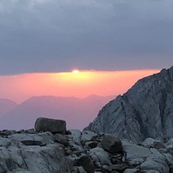
    user_profile
    Holeinmysock 5 years, 9 months ago
    Cucamonga Peak
    Great hike all round 👍
    ★ ★ ★ ★ ★

    user_profile
    smith.gffry 5 years, 9 months ago
    Icehouse TH to Ontario peak and back via Icehouse Canyon
    This hike starts on the normally high traffic Icehouse Canyon trail. After a 1/4 mile or so we leave the trail and go off trail and head up Falling Rock canyon. Yes, I don’t like the name either. Steep, lots of debris but very manageable. An obviously scree field presents itself at the top of Falling Rock. Head to the right and up the scree field to gain a saddle. From there follow the ridge to the top of Ontario’s Peak!
    ★ ★ ★ ★ ★
    user_profile
    Richard Barry 5 years, 10 months ago
    Pacific Crest Trail off Hwy 74
    This area is absolutely gorgeous - mile after mile of beautiful healthy natural chaparral and woodlands. Great hike, great trail, and hardly any other people.
    ★ ★ ★ ★ ★

    user_profile
    marisal.dobbins 5 years, 10 months ago
    Track (10/19/20, 9:56:19AM)
    On the last stretch of a this route we debated if it qualified as a hike. The verdict was an indifferent and technical yes. Two thirds of of this loop were on various vehicle roads. The views were lovely and the sun was hot, with very little coverage. We had a nice picnic at Serrano beach. There were two major elevation changes in the hike which was a welcome challenge. The scramble from the ridge down to the lake was not a real trail. Overall it was a good hike, not bad, but not life changing.
    ★ ★ ★

    user_profile
    Gen4Lander 5 years, 10 months ago
    2N10, Big Bear Lake to Cedar Lake Road, San Bernardino County, CA, USA
    It was a nice scenic easy trail. Start in Big Bear and end in Big Bear. Off chute trail heads along the way for options. Camp sites out there and places to take in views.
    ★ ★ ★ ★

    user_profile
    Ricardo Flores 5 years, 10 months ago
    The Pinnacles to Holcomb Valley Campground, San Bernardino County, CA, USA
    Nice easy ride mostly on fire roads.
    ★ ★ ★ ★ ★

    user_profile
    Ricardo Flores 5 years, 10 months ago
    Hanna Flats Loop
    Challenging course for my wife and I who are new to mountain biking.
    ★ ★ ★ ★ ★

    user_profile
    bigedbass 5 years, 11 months ago
    Sheep Creek Trail to 3N60A Lytle Creek
    Today we went up Sheep Creek to 6000’ elevation spectacular views. Followed down into Lytle Creek wash and up 3N60A for a fun afternoon. Great times!
    ★ ★ ★ ★

    user_profile
    bghesq 5 years, 11 months ago
    Cucamonga Peak via Chapman Trail to Icehouse Canyon Trailhead
    This hike was epic. I started at the Icehouse Trailhead, but forgot to hit “record” on the GAIA app. Doh. I did not realize it until the top at Cucamonga Peak. Oh well. At least I recorded the descent. At the top, there was very light wind, warmer than normal, it was around 80 degrees at the peak. There was just enough breeze to cool things off in the shade. Chapman Trail in the afternoon is hot and difficult due to the narrow trail and rock-slide traverses. It is not for beginners. After reaching Cedar Glen campground, the 2.5 mile hike to the trailhead was amazing. It had all the features: rock slide traverse, oak and pine forest, stream crossing twice, thick scrub brush maze-like narrow trail, switchbacks, and finally the last mile of Icehouse Canyon to the trailhead.
    ★ ★ ★ ★ ★

    user_profile
    Leon.Hampton 5 years, 11 months ago
    Woodland Trailhead to 41911 North Shore Drive, San Bernardino County, CA, USA
    An easy, enjoyable interpretive hike.
    ★ ★ ★ ★ ★

    user_profile
    emanuel.rohss 6 years ago
    Sugarloaf Mountain via Wildhorse Meadows Road
    This hike is okay, kinda just did it out of frustration since I didn’t get to do a through hike to Mt San Gorgonio from Vivian Creek Forest Falls bc they closed it again due to the El Dorado Fire. Ironically, as I was out hiking Sugarlof, they closed all the National Forrests including the San Bernardino one. Meaning you can’t hike anywhere at the moment... Anyways, I am sure the hike is more fun if you have views which seems to be pretty great in several directions unless there’s a milky smoke layer surrounding it all which was the case as I did it. The hike itself isn’t that strenuous, a few short switchback sections and steeper grade near the summit plateau and a lil up and down, I got up in 2.5 hrs and down in 2, still taking my time. Seems like people cross country ski this in the winter. If you happen to be in Big Bear and want to do a day hike this could be an option.
    ★ ★ ★

    user_profile
    Michael 6 years ago
    3/4 Wildhorse Trail before phone died!
    Such a great hike, you start out through arid manzanita thickets till you reach the Wildhorse Creek valley when it turns wet and full of flowers and ferns. You then climb to Wildhorse meadow with Ponderosa Pines. The views are amazing of the Angelus Oaks Area and San Gorgonio Peak are superb!
    ★ ★ ★ ★ ★
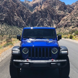
    user_profile
    Kappertb 6 years ago
    Track (7/4/20, 11:10:58AM)
    A lot of this path has been obscured by winter debris. Some of it follows a seasonal creek! Easy to lose the way
    ★ ★ ★ ★

    user_profile
    carly114 6 years ago
    Cedar Glen Campground via Chapman Trail and Icehouse Canyon Trail
    Not too difficult. Beautiful views throughout. Good workout.
    ★ ★ ★ ★

    user_profile
    reina.roberts 6 years ago
    Keller Peak Trail 8-16-20
    super nice and mellow for a morning hike.
    ★ ★ ★ ★ ★

    user_profile
    reina.roberts 6 years ago
    Keller Peak Trail 8-16-20
    super nice and mellow for a morning hike.
    ★ ★ ★ ★ ★

    user_profile
    bigedbass 6 years ago
    Track (8/23/20, 9:20:57AM)
    Great fun exploring new paths with the wifey. We hoped to find water and struck out but we did find amazing views in Gods country.
    ★ ★ ★ ★

    user_profile
    Michael 6 years ago
    South ridge trail - camp site to parking lot
    Great place to camp with an even better view
    ★ ★ ★ ★

    user_profile
    austin.steenport 6 years ago
    Big Bear 1N16/1N09, ride cut short
    Good moto ride. There is a waterfall I suggest going to, it’s near the concrete bridge at the bottom.
    ★ ★ ★ ★

    user_profile
    Aaron 6 years, 1 month ago
    Cool views!!
    Cool views! Doable with high clearance 2wd, many loose child's head size rocks
    ★ ★ ★ ★

    user_profile
    BluGutur 6 years, 1 month ago
    Cucamonga peak
    It was cool. A little crowded and brutal at some points. When we got back to the car temp said 106°F.
    ★ ★ ★ ★

    user_profile
    Kevin Zhu 6 years, 1 month ago
    Tool Box Springs Campground via Thomas Mountain Road
    easy offload trail, nice view and camping ground.
    ★ ★ ★ ★

    user_profile
    Kevin Zhu 6 years, 1 month ago
    Forest Route 6S16
    not very easy for bigger 4WD SUV.
    ★ ★ ★ ★

    user_profile
    Kevin Zhu 6 years, 1 month ago
    Forest Route 6S18
    good for small 4x4 car.
    ★ ★ ★ ★

    user_profile
    alcornadaptive 6 years, 1 month ago
    Miller Road to Pilot Rock Ridge Road, San Bernardino County, CA, USA
    Awesome beginner trail for all
    ★ ★ ★ ★ ★

    user_profile
    reina.roberts 6 years, 1 month ago
    Arrowbear to Running Springs
    walk don’t drive! 50 wonderful minutes on road and trail.
    ★ ★ ★ ★ ★

    user_profile stars
    cachetes73 6 years, 1 month ago
    Cougar Crest Trail
    Easy hike with gradual climb up until you hit the PCT. Soon after you begin a more aggressive climb to Bertha Peak. At that point I would say it becomes a moderate trail due to the climb. Not much shade throughout the trail. Wear plenty of sunscreen and go earlier during the day or later in the afternoon if you go during summer months. It was 82* the day I went. Temperature was fine, but the sun felt more intense. Take plenty of water if going to Bertha Peak, you will need it if you dehydrate easily like I do. My wife and kids, 6 and 8, climbed up with me until PCT and I continued on by myself after that to Bertha Peak. Met up with them on my way back down. Not many people on the trail that day, Friday. Almost everyone was wearing a face mask or would put one on as we approached. The trail was clean. Some rock and tree roots along the way, but overall very well maintained. Beautiful views from up top of Big Bear and surrounding areas. There are places along the trail to stop and have lunch. There are a few benches along the way to sit and take in the views as well. Overall great hike.
    ★ ★ ★ ★ ★

    user_profile
    Ed 6 years, 1 month ago
    Track (8/3/20, 8:34:28AM)
    Very nice hike. Easy to follow, not crowded.
    ★ ★ ★ ★ ★

    user_profile
    devlin48 6 years, 1 month ago
    2N84A to Yellow Post #5, San Bernardino County, CA, USA
    Good view of Big Bear Lake and you can also see a bit of lake Arrowhead. The trail was pretty forested in the first third, but after you got out of the trees there wasn’t too much shade. Good, short early morning hike.
    ★ ★ ★

    user_profile
    sglenniesmith 6 years, 1 month ago
    Big Bear 080220
    Very scenic easy 4x4 trail.
    ★ ★ ★ ★ ★

    user_profile
    michaelchoromokos 6 years, 1 month ago
    Clark’s Grade and Radford Rd 7/31/20 11:09:17 AM
    Chill ride with 70% easy green trails and 30% blue. 2N06 Radford road was rated a black diamond but felt like an easy blue (easier than Clark’s Grade). Little bit rocky, little bit sandy mostly hardback fire road. Ample roadside parking.
    ★ ★ ★ ★

    user_profile
    gurneyjock 6 years, 1 month ago
    Lytle Creek - Lone Pine to LC (7/31/20, 11:18:55AM)
    Great 4x4 run. Not a difficult trail but still apt of fun.
    ★ ★ ★ ★

    user_profile
    pwruve 6 years, 1 month ago
    Wildhorse Creek Trail (2N93)
    Easy dirt trail. Entered from Lightning Gulch. Nothing difficult, just a little “annoyingly”rocky on the way down. But, there is a big and nice yellow post camp around the middle of the trail with a lot of pines. A small trailer could make it up but would have to go back the same way.
    ★ ★ ★

    user_profile
    Ricardo Flores 6 years, 1 month ago
    Big Bear, Holecomb Valley and vicinity.
    3 days of camping and jeeping. Holcomb Valley and Hannah Flat Camp Grounds. Jeeping and a lot of fire roads 3N12, 3N14, 2N71, 2N09, 3N16, 3N09, 2N02, 2N01, and enjoying the family to the max!
    ★ ★ ★ ★ ★

    user_profile
    Ricardo Flores 6 years, 1 month ago
    Big Bear, Holecomb Valley and vicinity.
    3 days of camping and jeeping. Holcomb Valley and Hannah Flat Camp Grounds. Jeeping and a lot of fire roads 3N12, 3N14, 2N71, 2N09, 3N16, 3N09, 2N02, 2N01, and enjoying the family to the max!
    ★ ★ ★ ★ ★

    user_profile
    osuna_vince 6 years, 1 month ago
    Big Bear Lake to Snow Summi
    Chill little trail offering some great views of the lake. Plenty of places to pull off and camp or just hang out for the day.
    ★ ★ ★ ★

    user_profile
    heres.monica 6 years, 1 month ago
    South ridge to taquitz
    Hard but good. Scenery is amazing.
    ★ ★ ★ ★ ★

    user_profile
    pat_p_yuan 6 years, 1 month ago
    Timber Mountain via Icehouse (7/21/20, 8:03:24AM)
    Shady for the most part
    ★ ★ ★ ★ ★

    user_profile
    pat_p_yuan 6 years, 1 month ago
    Timber Mountain via Icehouse Canyon Trail
    Mostly in shade; make it a pleasant hike during hot weather. Be aware of snakes.
    ★ ★ ★ ★ ★

    user_profile
    Falcon1aaa 6 years, 1 month ago
    Cucamonga Peak
    Cucamonga Peak via Icehouse Saddle. About 25%-35% shaded. Creek water was clear but had a faint sewer smell. The view on top was breathtaking overlooking the urban grids. View from the Peak is magical at night! Descending took 2 hours 47 mins while Ascending took an hour more. Give yourself 8 hours minimum to Summit and return.
    ★ ★ ★ ★

    user_profile
    philiprilatos 6 years, 1 month ago
    Heart Rock - CA (7/19/20, 9:22:40AM)
    This trail was alright. It’s easy to miss it, so make sure you’re looking to the right. I suggest taking the right path as soon as possible. Once you get to the point where you see the, barely visible, sign you’ve gone too far. You CAN get down this point but it is steep and not for the very young or old. Getting back up that hill is a workout and if you’re not used to it you’ll struggle. So, take the lower path, unless you like a good challenge. Having said that, I can only assume the local Fire and Rescue must have their hands full from the upper trail. It’s just a 911 call waiting to happen. It’s not a path that is maintained, regardless of the fact there is a sign, haphazardly pointing down the hill. Giving it a sense of being, “Official.” TLDR; Stick to the right. Pack your trash out.
    ★ ★ ★ ★

    user_profile
    Ricardo Flores 6 years, 1 month ago
    Gold mountain 3N69 to the bat caves on Holcomb trail 3N16
    Gold mountain has some very challenging sections, a very rewarding ride.
    ★ ★ ★ ★ ★

    user_profile
    reina.roberts 6 years, 2 months ago
    top of the lake
    from deer lane to the music camp above arrowbear lake and back down cedar. nice 45 min loop.
    ★ ★ ★ ★ ★

    user_profile
    foodfirst 6 years, 2 months ago
    1458 Oklahoma Dr, Fawnskin to 339 North Shore Dr, Big Bear City, CA, USA
    It was not very difficult, with great views. Awesome camping spot in the beginning of trail, hard to get to. Very tight with lot of rocks.
    ★ ★ ★ ★

    user_profile
    reina.roberts 6 years, 2 months ago
    Half Dome
    up to the north from the national park fork to running springs to the top of the peak and down... evidence of human activity along the way including a half dome structure with chairs and hammock frame. also saw a bbq grill and picnic table. spectacular hike!
    ★ ★ ★ ★

    user_profile
    reina.roberts 6 years, 2 months ago
    bottom of the lake
    From Deer lane to the bottom of Arrowbear Lake and back along the 18 and then down Upper Boulder.
    ★ ★ ★ ★

    user_profile
    stevenjordanfelix 6 years, 2 months ago
    Track (7/5/20, 3:44:29PM)
    Trail off the beaten path to a river, Go in through the camping area next time.
    ★ ★ ★ ★

    user_profile
    Gunnar 6 years, 2 months ago
    Bee Canyon
    The Back way up to IDYLLWILD.
    ★ ★ ★ ★ ★

    user_profile
    arlene609 6 years, 2 months ago
    Clark’s Grade
    Clark’s Grade is a great moderate a Jeep trail.
    ★ ★ ★ ★ ★

    user_profile
    Tony Gualtieri 6 years, 2 months ago
    2N40 - Cloudland Truck Trail Crestline, California (San Bernardino County)
    Fun trail only did half. High up there and a ton of paraglider!!! Great views. No obstacles
    ★ ★ ★ ★

    user_profile
    Stirbo 6 years, 2 months ago
    Back way to Big Bear
    The trail starts off on a somewhat well maintained fire road. We never shifted out of 2WD. At the transition point, you should elect to air down and be ready for some moderate spots in the trail. Lifted Jeeps made this trip fine. Lots of shear cliffs and narrow roads with sharp switchbacks. Better then driving on the pavement up to Big Bear.
    ★ ★ ★ ★ ★

    user_profile
    migx333 6 years, 2 months ago
    White mountain
    Easy 3-4 obstacles. Locker made it easy
    ★ ★ ★ ★

    user_profile
    ccgraham 6 years, 2 months ago
    Cucamonga Peak
    This is a beautiful hike. Disappointingly crowded with hikers who don't know wilderness or trail etiquette. Please remember that the wilderness is here for everyone to enjoy, and be respectful of it. 1) Listening to music on a wilderness hike only serves to stress wildlife. 2) Right of way always goes to the uphill trekker. Happy trails!
    ★ ★ ★

    user_profile
    shawnmerwin 6 years, 2 months ago
    Cleghorn Mountain via Cleghorn Fire Road
    This trail was not to difficult with a full size Chevy. I did the whole trail in 2 wheel drive but the trail conditions had 3 difficult obstacles. Also the fire road was Not maintain like prior years most likely due to the COVID 19. Trail drove June 20th 2020
    ★ ★ ★ ★ ★

    user_profile
    aw_burck 6 years, 2 months ago
    Tool Box Spring via Ramona Trail
    Hot and buggy with swarms of gnats and biting flies. Views are beautiful but couldn’t stop to enjoy them because of all the bugs. This hike is better in cooler weather, early spring or late fall.
    ★ ★ ★

    user_profile
    jlauer358 6 years, 3 months ago
    PCT to Gold Mountain (6/15/20, 11:55:53AM)
    Great views from the top of Gold Mountain of Big Bear Lake, Moonridge, Sugarloaf and San Gorgonio Mountains and the Mohave desert to the north.
    ★ ★ ★ ★
    user_profile stars
    JG 6 years, 3 months ago
    Cucamonga Peak
    Leave early in the day, preferably well before 7 am to avoid the heat of the day. Remember that a self-issue wilderness permit (available at the trailhead) is required for Cucamonga Wilderness. Route is very steep in sections, and not a typical grade for a trail in this area. Some sections of the trail close to the summit have small rockslides on them — be careful crossing these sections. PLEASE don’t cut switchbacks and take your trash with you. Thanks!
    ★ ★ ★ ★

    user_profile
    danv_77 6 years, 3 months ago
    Big bear
    Great that the dogs could come along. Good incline.
    ★ ★ ★ ★ ★

    user_profile
    mikeyberylwave 6 years, 3 months ago
    Track (6/6/20, 10:34:17AM)
    Easy hike. Nice views. Not over crowded although there were several more hikers in the afternoon during the decent.
    ★ ★ ★ ★ ★

    user_profile
    cintabaik 6 years, 3 months ago
    Cucamonga Peak
    6/4/20 We start 7 Am,Me n my wife, we get back by 5 Pm, it's very challenging, is lot of rocks, hot day, but it's very rewarding.
    ★ ★ ★ ★ ★

    user_profile
    krmclamb 6 years, 3 months ago
    Track (5/31/20, 9:59:19AM)
    Very easy ride but plenty of views to take in.
    ★ ★ ★ ★ ★

    user_profile
    rfarsad 6 years, 3 months ago
    Track (5/25/20, 12:23:36PM)
    Beautiful viewpoint , only about 1.5 miles up from trail head.
    ★ ★ ★ ★ ★

    user_profile
    cghilty 6 years, 3 months ago
    Track (5/26/20, 10:15:32AM)
    Nice easy hike up to a beautiful overlook.
    ★ ★ ★ ★ ★

    user_profile
    wfriley76 6 years, 3 months ago
    Pilot Rock Truck Trail
    Nice easy trail with fun offshoots for experienced off-roaders.
    ★ ★ ★ ★ ★

    user_profile
    joshuatiqui 6 years, 4 months ago
    Holcomb valley Road to Big Pine through 2N09A
    Buddy in a tundra wanted to hit the trails, so we kept it nice and calm. Started on Holcomb valley trail, but took 2N09A and the scenery immediately changed. Red dirt and tall pines. Rougher trail, but still very doable in a stock Jeep and stock Tundra. WILL BE GOING BACK!
    ★ ★ ★ ★ ★

    user_profile
    bryansloan 6 years, 4 months ago
    Track (5/9/20, 6:03:35AM)
    My families first off-road trail and it was an absolutely great trail. 6:00am start from the 15 and it was peaceful and gorgeous. 4 hour trip and maybe saw 3 people traveling the opposite direction.
    ★ ★ ★ ★ ★

    user_profile
    nickgrimes7 6 years, 4 months ago
    Roman Deathmarch
    Solid Hike wearing sea gear and carrying tools. All the way to the top of the Truck trail.
    ★ ★ ★ ★ ★

    user_profile
    Travis 6 years, 4 months ago
    Track (5/3/20, 8:38:38AM)
    Great off road trail. Scenery was great!
    ★ ★ ★ ★ ★

    user_profile
    walterswilliam1 6 years, 4 months ago
    Cougar Crest Trail
    Starts out in the woods but after awhile you get some great views of Big Bear Lake
    ★ ★ ★ ★

    user_profile
    gurneyjock 6 years, 4 months ago
    Green Valley Lake to Fawnskin
    This was an easy fire road, great scenery.
    ★ ★ ★ ★

    user_profile stars
    Gordon Alexander 6 years, 4 months ago
    Icehouse Saddle via Middle Fork Trail
    I wrote the description, so read that. I nice strenuous hike with some hidden gems built in.
    ★ ★ ★ ★
    user_profile
    Justin 6 years, 4 months ago
    Wysup Peak and Coon Creek Cabin
    We started at Onyx Summit and hiked down to Wysup Peak, names after George Wysup a Sierra Club member who passed on. We made the Peak with a short off trail section, then we went further down to Coon Creek Cabin. From there we returned on different trail for a short ways, reconnected with the PCT and headed back the way we came.
    ★ ★ ★ ★ ★

    user_profile
    Justin 6 years, 5 months ago
    Lytle Creek Loop
    The trails are pretty good except the last section of the Old CC Spur after the area where it washed out. I had to do some bushwhacking to get through to Lytle Creek and poison oak is an issue. There might be a better way following the creek out from the wash out but I would have to try again some other time.
    ★ ★ ★ ★

    user_profile
    Justin 6 years, 5 months ago
    Silverwood State Park Office to Pacific Crest Trail, San Bernardino County, CA, USA
    Had a nice hike from Lake Silverwood to Camp Cajon near McDonalds off the 15 Freeway. Nice rolling hills, lots of Miners Lettuce, flowers, and seasonal springs.
    ★ ★ ★ ★ ★

    user_profile
    eagletee72 6 years, 5 months ago
    Bee Canyon 3/28/20, 11:39:27AM
    Nice off road trail with fantastic scenic views. Not very technical but fun with a few water crossings.
    ★ ★ ★

    user_profile
    Justin 6 years, 5 months ago
    Etiwanda Canyon & Etiwanda Ridge (3/22/20, 6:47:58AM)
    I love Etiwanda Preserve and exploring the canyons and I ended up making it all the way up to Dustin Springs but it was crazy and quite a bushwhack. I’m not sure I would want to do it again for a while, Lol. But I completed a goal and saw some amazing sights so that’s what counts.
    ★ ★ ★ ★ ★

    user_profile
    Justin 6 years, 6 months ago
    San Sevaine Rd to Dustin Springs
    I really like hiking in the San Sevaine area. There are cool forests and meadows and it’s not far from my home. I often walk up the road with my bike and then ride it down.
    ★ ★ ★ ★ ★

    user_profile
    sacamp14 6 years, 6 months ago
    Ernie Maxwell Trail
    3-7-20, Saturday..... This was a nice short trail. Reminded me of being in the Sierras a bit. Wasn’t to crowded. Possibly due to cool weather and a possible storm coming in. The temperatures was about 45. We started at the bottom off of Tahquitz View Dr. And hiked up to the parking area where we hung out for a rest and bite then hiked back down. Took us 4.5 hours with an hour hanging out up top. Had my 2 Boston’s with me and they did great. The town I went through on the was was super cute.... brewery, Shops, restaurants.
    ★ ★ ★ ★ ★

    user_profile
    Justin 6 years, 6 months ago
    Cloudland Truck Trail to Marshall Peak, San Bernardino County, CA, USA
    Started near Cal State San Bernardino on Cloudland Truck Trail and went up to Marshall Peak. We were definitely in the clouds and fog. Quite a nice hike in the local mountains and the trail is well maintained. Hang gliders like to go up this trail and take off from Marshall Peak. Highly recommend checking it out!!!
    ★ ★ ★ ★ ★

    user_profile
    Bo 6 years, 7 months ago
    Last Circle Mountain
    The only cure for a soul broken and needing to find the healing offered by the mountain.
    ★ ★ ★ ★ ★
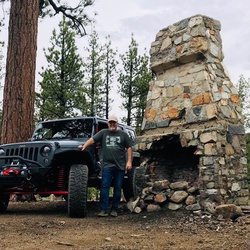
    user_profile
    richkinney 6 years, 8 months ago
    Track (11/9/19, 10:56:08AM)
    Scenic fire road from Pioneertown to Big Bear.
    ★ ★ ★

    user_profile
    Mako 6 years, 8 months ago
    High track
    Great conditioning with 50lb pack ever day
    ★ ★ ★ ★ ★

    user_profile
    gosser66 6 years, 9 months ago
    Cleghorn Mountain via Cleghorn Fire Road
    This trail would be of interest to both beginners and seasoned off-roaders. There are options all along the way for beginners to take the easy route in a stock 4x4.
    ★ ★ ★ ★ ★

    user_profile
    toby.a.dingle 6 years, 9 months ago
    Lytle Creek Trail
    Fun in the snow
    ★ ★ ★ ★ ★

    user_profile
    Bwong99 6 years, 9 months ago
    Big Bear Trail
    Good beginner/ intermediate trail. Relatively easy only a few hard parts. Mike shaft and abandoned trailer nearby
    ★ ★ ★ ★ ★

    user_profile
    eeedad 6 years, 10 months ago
    Skyline Trail
    Beautiful trails, forest and views.
    ★ ★ ★ ★

    user_profile
    eeedad 6 years, 10 months ago
    Castle Rock
    Nice views but way too crowded.
    ★ ★

    user_profile
    toby.a.dingle 6 years, 10 months ago
    Track (10/27/19, 8:51:15AM)
    Peaceful and relaxing trail.
    ★ ★ ★ ★ ★

    user_profile
    JP 6 years, 11 months ago
    Cougar Crest Trail
    This hike is erroneously classified as "Difficult". It is actually quite easy with a nice moderate elevation gain. Only the last .75 miles is a bit harder on the dirt road to Bertha Peak.
    ★ ★ ★ ★ ★

    user_profile
    Avila.mike 6 years, 11 months ago
    Track (9/20/19, 4:39:36PM)
    Easy connector road
    ★ ★ ★

    user_profile
    Avila.mike 6 years, 11 months ago
    2N86 to Yellow Post #30
    Semi well maintained path high clearance recommended. Kidd Creek yellow post camping site and Buff Mesa camping site on this trail
    ★ ★ ★

    user_profile
    Avila.mike 6 years, 11 months ago
    Cedar Lake Road to Edgemoor Road
    Much is paved
    ★ ★ ★

    user_profile
    Avila.mike 6 years, 11 months ago
    Track (9/20/19, 2:01:27PM)
    The trail is difficult to find as it’s not well maintained. We followed the app in order to guide us because it was difficult to find the trail. No great place to look out here. But we saw deer.
    ★ ★

    user_profile
    mulsurja 7 years ago
    Baldy Notch
    Easy breeze trail and constant uphill. Open trail with some shades from big trees. You can skip this trail and take the ski lift instead.
    ★ ★ ★
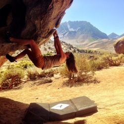
    user_profile
    Robyn 7 years ago
    KODIAK 100
    Thumbs up!
    ★ ★ ★ ★ ★

    user_profile
    nina.mozo.nm 7 years, 1 month ago
    Track (8/8/19, 15:46:35)
    Stayed overnight, very windy at the top all night long, didn’t sleep well, but it’s an amazing hike! It was really difficult for me on the way up. But a very well maintained trail. Awesome views!!
    ★ ★ ★ ★

    user_profile
    mcalkins 7 years, 1 month ago
    Track (8/6/19, 06:30:7)
    This is a campground, so it is easy walking for anyone.
    ★ ★ ★ ★ ★

    user_profile
    hobsongw 7 years, 1 month ago
    Pine Knot to Grand View
    This is a well-built trail. It climbs through open forest which afforded ample shade earlier in the day, but there were many sunny spots by noon. Still, there was plenty of shade to cool off.
    ★ ★ ★

    user_profile
    Mike Inman 7 years, 1 month ago
    Skyline Trail
    Best mountain bike trail around.
    ★ ★ ★ ★ ★

    user_profile
    johnmc621 7 years, 1 month ago
    Sugarloaf Mountain via Sugarloaf Trail - 2E18
    First half of the trail is easy walking surface Second half the walking surface is difficult being made of fractured granite rocks This a great 10 mile out and back hike
    ★ ★ ★ ★ ★

    user_profile
    mcalkins 7 years, 1 month ago
    Track (7/27/19, 10:32:7)
    Lake Arrowhead lake trail. Great trail and amazing lake views!
    ★ ★ ★ ★ ★

    user_profile
    Ben 7 years, 1 month ago
    Arrowhead Pinnacles Trail
    Cool little hike, only came out to 3.6 miles for me. (Was supposed to be 4.6) Pros: Good views of the mountains and high desert, good amount of wildlife (saw my first rattlesnake of the summer), fun boulder scrambling near the top. Interesting scenery, more like Joshua Tree or the high desert than the mountains. Cons: Very exposed, little shade, hot. I started at 8 and probably should have started a little earlier. Trail isn’t well marked, glad I was following the GPS track. Have to do some light boulder scrambling in a few spots and most of the way to the final peak.
    ★ ★ ★
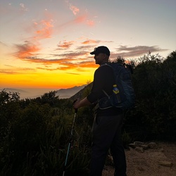
    user_profile
    foropeza19675 7 years, 1 month ago
    Cougar Crest Trailhead to Bertha Peak, San Bernardino County, CA, USA
    One of my favorite hikes of all time. Relatively easy grade for most of the hike with a steep section at the last half mile or so.
    ★ ★ ★ ★ ★

    user_profile
    William 7 years, 1 month ago
    Tool Box Springs Campground via Thomas Mountain Road
    nice drive with the Grand kids we saw baby humming birds feeding at some wild flowers (tried for picture but wasn't fast enough)
    ★ ★ ★ ★ ★

    user_profile
    yair 7 years, 2 months ago
    Big Bear (summer only) scenic drive (7/13/19, 17:15:28)
    Beautiful scenery, very easy trail. Any 4x4 can do it.
    ★ ★ ★ ★ ★

    user_profile
    d.adams20 7 years, 2 months ago
    Track (7/6/19, 10:49:57AM)
    Amazing day wheeling through big bear!
    ★ ★ ★ ★ ★

    user_profile
    nimoyandpizza 7 years, 2 months ago
    Cucamonga Peak (7/6/19, 6:59:45AM)
    Started at 6am, forgot to hit record until an hour in so this hike is actually 7hrs, 12miles. We also took a slight detour near Cucamonga Canyon area. Overall this trail currently in the Summer is easy. There are some steep bits, and some narrow trail areas but overall straight forward. Trail is much more challenging/fun in Winter.
    ★ ★ ★

    user_profile
    jevenhouse 7 years, 2 months ago
    Big Bear - Holcomb Valley
    Nice Jeep ride. Quite dusty in June but great views. Could do this with 2wd vehicle if you have decent clearance.
    ★ ★ ★ ★

    user_profile
    Scott macias 7 years, 3 months ago
    Forest Route 2E43
    Sic single track black diamonds are my best friend
    ★ ★ ★ ★ ★

    user_profile
    chasemwhite 7 years, 3 months ago
    Clark’s Grade to Big Bear
    Great 4x4 trail to Big Bear. Lockers not required in summer. Great views
    ★ ★ ★ ★ ★

    user_profile
    jflightdeck 7 years, 3 months ago
    Pine Knot Trail to Grand Point View
    Great trail. Really long. Be prepared for a workout. Lots of people, dogs, and bikes. The view at the top is amazing. Go all the way and don’t stop short.
    ★ ★ ★ ★ ★
    user_profile
    Nicholas 7 years, 3 months ago
    Arrow head to big bear
    Great easy 4x4 trail with lots of fun off shoots. Definitely a trail for the family. Nice and long with good views.
    ★ ★ ★ ★ ★

    user_profile
    Wesley 1 year, 11 months ago
    KODIAK 50K
    ★ ★

    user_profile
    rmatthews100 1 year, 11 months ago
    Ontario Peak 2
    ★ ★ ★ ★ ★

    user_profile
    quintanakoiponds 2 years ago
    Saturday Morning Activity
    ★ ★ ★ ★ ★

    user_profile
    tgregg 2 years ago
    Ernie Maxwell - Idyllwild
    ★ ★ ★ ★ ★

    user_profile
    newturv 2 years ago
    Toolbox Springs CA (9/3/24, 07:49:56)
    ★ ★ ★ ★ ★

    user_profile
    Airasys 2 years ago
    Track (8/20/24, 11:41:11PM)
    ★ ★ ★ ★

    user_profile
    juliochalino2093 2 years, 1 month ago
    Yellow Post #26 Loop
    ★ ★

    user_profile
    ARON 2 years, 1 month ago
    Track (7/27/24, 11:43:36AM)
    ★ ★ ★ ★

    user_profile
    JonathanPadilla 2 years, 1 month ago
    Icehouse Saddle via Icehouse Canyon Trail
    ★

    user_profile
    motorsportbylev 2 years, 2 months ago
    Gold Mountain via 3N16 and 3N69
    ★

    user_profile
    Ricardo Flores 2 years, 2 months ago
    Track (7/5/24, 15:00:24)
    ★ ★ ★ ★ ★

    user_profile
    andyprietojr 2 years, 2 months ago
    Track (6/30/24, 7:21:23PM)
    ★ ★ ★ ★ ★

    user_profile
    Playingranger 2 years, 2 months ago
    Big Bear Hiking - Cougar Crest Trail
    ★ ★ ★ ★ ★

    user_profile
    nickbousquet566 2 years, 2 months ago
    Yellow post camping me n dad 33249 Green Valley Lake, Green Valley Lake to Snow Play, Big Bear Lake, CA, USA
    ★ ★ ★ ★ ★

    user_profile
    john 2 years, 2 months ago
    Track (4/27/24, 10:59:07AM)
    ★ ★ ★ ★ ★

    user_profile
    sandy-cannon 2 years, 2 months ago
    Ice House Saddle Track (6/23/24, 7:30:46AM)
    ★ ★ ★ ★ ★

    user_profile
    emk.nico 2 years, 2 months ago
    San Antonio Falls 10:52AM
    ★ ★ ★ ★ ★

    user_profile
    mulsurja 2 years, 3 months ago
    Icehouse Canyon Trail to Chapman Trail (6/8/24, 6:49:49AM)
    ★ ★ ★ ★ ★

    user_profile
    tonyferrato 2 years, 3 months ago
    Big Bear Loop
    ★ ★ ★ ★ ★

    user_profile
    foutlogan883 2 years, 3 months ago
    Track (6/7/24, 6:30:58PM)
    ★ ★ ★ ★ ★

    user_profile
    tturchan96 2 years, 3 months ago
    Cleghorn Mountain via Cleghorn Fire Road
    ★

    user_profile
    drewpereze3 2 years, 3 months ago
    Thomas HG Trail Run (5/26/24, 10:44:51)
    ★ ★ ★ ★ ★

    user_profile
    afbc0888 2 years, 3 months ago
    Track (5/25/24, 09:14:49)
    ★ ★ ★ ★ ★

    user_profile
    Lijero1 2 years, 3 months ago
    Cleghorn Ridge to Silverwood Lake
    ★ ★ ★ ★ ★

    user_profile
    taeliacs31 2 years, 3 months ago
    3N08
    ★ ★

    user_profile
    philiplacruejr 2 years, 3 months ago
    Icehouse Saddle via Middle Fork Trail
    ★

    user_profile
    pscovolo 2 years, 3 months ago
    Track (5/20/24, 10:39:44)
    ★ ★ ★ ★ ★

    user_profile
    tdd_sctt 2 years, 3 months ago
    Track (5/19/24, 2:38:03PM)
    ★ ★ ★ ★

    user_profile
    mack29706 2 years, 3 months ago
    3N08
    ★ ★

    user_profile
    elleneeen 2 years, 4 months ago
    Mt. Baldy Ski Lifts Loop via Baldy Road and Devils Backbone Road
    ★

    user_profile
    rmhorvath 2 years, 4 months ago
    Track (5/11/24, 11:36:54AM)Pioneer Town to Big Bear
    ★

    user_profile
    christinatbrou 2 years, 4 months ago
    Ernie Maxwell Trail
    ★ ★ ★

    user_profile
    albertgge 2 years, 4 months ago
    Cucamonga Peak
    ★ ★

    user_profile
    melquisedececastillo93 2 years, 4 months ago
    Track (4/28/24, 10:31:33)
    ★ ★ ★ ★ ★

    user_profile
    pat 2 years, 4 months ago
    Lake Baldwin via 2N02 and Burns Canyon Road
    ★

    user_profile
    RobertHuang 2 years, 5 months ago
    Track (4/17/24, 6:10:33AM)
    ★ ★ ★ ★ ★

    user_profile
    RobertHuang 2 years, 5 months ago
    Track (3/20/24, 6:18:50AM)
    ★ ★ ★ ★ ★

    user_profile
    Benny boy 2 years, 6 months ago
    Ski snow valley 3-1-24
    ★ ★ ★ ★ ★

    user_profile
    Quartermaster 2 years, 6 months ago
    Track (4/18/23, 8:10:26AM) PCT 2023 AF
    ★ ★ ★ ★ ★

    user_profile
    hco716 2 years, 6 months ago
    Holcomb Valley Campground via 3N16
    ★

    user_profile
    drjoyful 2 years, 7 months ago
    2N02 - Burns Canyon - © Trails Offroad
    ★ ★ ★ ★ ★

    user_profile
    RobertHuang 2 years, 7 months ago
    Track (12/21/23, 6:04:45AM)
    ★ ★ ★ ★ ★

    user_profile
    suhanthanr 2 years, 7 months ago
    Cucamonga Peak
    ★ ★

    user_profile
    e.h.rabago 2 years, 7 months ago
    Track (1/25/24, 3:46:02PM)
    ★ ★ ★ ★ ★

    user_profile
    tonynav42 2 years, 7 months ago
    Big Bear Yellow post trails (1/24/24, 12:47:32PM)
    ★ ★ ★ ★ ★

    user_profile
    Arcos 2 years, 7 months ago
    Hw 74 ⛰️
    ★ ★ ★ ★ ★

    user_profile
    carlosg05 2 years, 8 months ago
    Lake Baldwin via 2N02 and Burns Canyon Road
    ★ ★ ★

    user_profile
    Ramon 2 years, 8 months ago
    Track (1/13/24, 2:40:42PM)
    ★ ★ ★ ★ ★

    user_profile
    khurley 2 years, 8 months ago
    Hanna Flat Campground via 3N14
    ★ ★ ★ ★ ★

    user_profile
    founder 2 years, 8 months ago
    Track (1/7/24, 11:44:48AM)
    ★ ★ ★ ★

    user_profile
    williamconway66 2 years, 8 months ago
    Track (1/1/24, 3:03:18PM)
    ★ ★ ★ ★ ★

    user_profile
    Julie Munson 2 years, 8 months ago
    Will Abell Memorial Trail at Arrowhead Ridge
    ★ ★ ★ ★ ★

    user_profile
    Scott, Sierra and Rilie 2 years, 8 months ago
    12/31/23 THE LAST WALK
    ★ ★ ★ ★ ★

    user_profile
    Scott, Sierra and Rilie 2 years, 8 months ago
    Christmas 2023
    ★ ★ ★ ★ ★

    user_profile
    Fatima 2 years, 8 months ago
    Dirty Jeeps night run pre run
    ★ ★ ★ ★ ★

    user_profile
    ianberry97 2 years, 8 months ago
    Track (12/21/23, 7:09:36AM)
    ★ ★ ★ ★ ★

    user_profile
    ianberry97 2 years, 8 months ago
    Cucamonga Peak
    ★ ★ ★ ★ ★

    user_profile
    pacopecoraro 2 years, 9 months ago
    Track (12/13/23, 12:05:09PM)
    ★ ★ ★ ★

    user_profile
    rcampbell 2 years, 9 months ago
    The Pinnacles, 2023-12-13
    ★ ★ ★

    user_profile
    kwanjaelee88 2 years, 9 months ago
    경로 (12/7/23 오전 8:53:40)
    ★ ★ ★

    user_profile
    jmendezusmc 2 years, 9 months ago
    Cucamonga Peak
    ★ ★ ★ ★

    user_profile
    johnrpantoja 2 years, 9 months ago
    2N10
    ★

    user_profile
    edmeng 2 years, 9 months ago
    Indian mountain
    ★ ★ ★ ★ ★

    user_profile
    soundenforcer1 2 years, 9 months ago
    Will Abrll park
    ★ ★ ★ ★

    user_profile
    jonathanreed9 2 years, 9 months ago
    Thanksgiving ride
    ★ ★ ★ ★ ★

    user_profile
    tpedward 2 years, 9 months ago
    Tanglewood Group Campround via Pacific Crest Trail
    ★

    user_profile
    mvahe77 2 years, 10 months ago
    Ontario peak -11-10-23
    ★ ★ ★ ★ ★

    user_profile
    rickf@dssar.org 2 years, 10 months ago
    Pacific Crest Trail- 11/2/23, 10:28:23AM)
    ★ ★ ★ ★ ★

    user_profile
    richcoyle18 2 years, 10 months ago
    Lake Baldwin via 3N69
    ★

    user_profile
    coolvf102 2 years, 10 months ago
    Track (9/13/23, 10:25:45AM)
    ★

    user_profile
    dennisjunker 2 years, 10 months ago
    2023 Big Bear White Mtn (10/20/23
    ★ ★ ★ ★ ★

    user_profile
    jbluth60 2 years, 10 months ago
    Track (8/18/23, 10:26:23AM)
    ★

    user_profile
    jiffandclean 2 years, 10 months ago
    Track (10/19/23, 9:49:08AM)
    ★ ★ ★

    user_profile
    BumpItsportS: Str8uP & Whisky🥃Neat 2 years, 11 months ago
    Gold Mt. and lil’ John Bull
    ★ ★ ★ ★

    user_profile
    FJSammy 2 years, 11 months ago
    City Creek Big Bear Spot
    ★ ★ ★ ★ ★

    user_profile
    michael88cabrera 2 years, 11 months ago
    Track (10/1/23, 8:55:55AM)
    ★ ★ ★ ★ ★

    user_profile
    jduarte6 2 years, 11 months ago
    Track (9/29/23, 3:46:44PM)
    ★

    user_profile
    FJSammy 2 years, 11 months ago
    1N09 - City Creek Lakbay
    ★

    user_profile
    ksdurham62 2 years, 11 months ago
    Gold Mountain, Little John Bull, John Bull
    ★ ★ ★ ★ ★

    user_profile
    RolanMateo 2 years, 11 months ago
    Pilot Rock Truck Trail 2N33
    ★

    user_profile
    Tara 2 years, 11 months ago
    Track (8/26/23, 5:56:07AM)
    ★ ★ ★ ★

    user_profile
    rayaluhome 2 years, 11 months ago
    Cleghorn Road to Cleghorn Ridge Trail, San Bernardino County, CA, USA
    ★ ★ ★ ★ ★

    user_profile
    shanahanbrooke 3 years ago
    Thomas mountain trail (9/16/23, 12:53:11PM)
    ★ ★ ★ ★ ★

    user_profile
    joefarrier 3 years ago
    Up to 9k near Sugarloaf
    ★ ★ ★ ★ ★

    user_profile
    joefarrier 3 years ago
    Track (9/9/23, 5:58:49PM)
    ★ ★ ★ ★ ★

    user_profile
    peejay1983 3 years ago
    Keller Meadows via Old City Creek Road/ Forest Road 1N09
    ★

    user_profile
    dstah002 3 years ago
    Burnt Mill Canyon Road
    ★ ★ ★

    user_profile
    Meat Sprinkles 3 years ago
    San Sevain 1st trip ( Solo) (9/5/23, 10:11:21AM)
    ★ ★ ★ ★

    user_profile
    betrueseelight 3 years ago
    Track (9/4/23, 5:28:36AM)
    ★ ★ ★ ★ ★

    user_profile
    dietrichand 3 years ago
    Big BearLake Bridge (9/4/23, 7:13:29PM)
    ★ ★ ★ ★

    user_profile
    elliottdill 3 years ago
    Lytle Creek Road
    ★ ★ ★ ★ ★

    user_profile
    kyndalltaylor 3 years ago
    Big Bear Lake
    ★ ★

    user_profile
    flyingttcd 3 years ago
    Tool Box Springs Campground via Thomas Mountain Road
    ★ ★ ★ ★ ★

    user_profile
    wbfourevrmor 3 years ago
    Hike with Dave Middle Fork 2
    ★ ★ ★ ★ ★

    user_profile
    rcampbell 3 years ago
    Track (8/30/23, 8:20:38AM)
    ★ ★ ★

    user_profile
    david 3 years ago
    Tracthree tees (8/27/23, 8:18:09AM)
    ★ ★ ★ ★ ★

    user_profile
    davidwbeckett 3 years ago
    Track (8/19/23, 4:12:21PM)
    ★

    user_profile
    Stephen Ulrich 3 years ago
    Y/P #30 route
    ★ ★ ★ ★

    user_profile
    jonathanh2787 3 years ago
    Bluff lake trail
    ★ ★ ★ ★ ★

    user_profile
    veemrtnz16 3 years ago
    2N02
    ★

    user_profile
    jparker.sup.res 3 years, 1 month ago
    Track (4/19/23, 12:07:29PM)
    ★ ★ ★ ★ ★

    user_profile
    Roadtrip2u 3 years, 1 month ago
    CA Big Bear Dispan Springs John Bull
    ★ ★ ★ ★ ★

    user_profile
    1202lean 3 years, 1 month ago
    Track (8/14/23, 13:51:20)
    ★ ★ ★ ★ ★

    user_profile
    jjonjue 3 years, 1 month ago
    3N14 - Coxey Road - © Trails Offroad
    ★ ★ ★ ★ ★

    user_profile
    nail_kh 3 years, 1 month ago
    Track (8/12/23, 9:05:18AM)
    ★ ★ ★ ★ ★

    user_profile
    cathyclemens 3 years, 1 month ago
    Top easy portion of trail to Bear Creek ending at nice picnic spot with terrific views
    ★ ★ ★ ★ ★

    user_profile
    jcashgrif 3 years, 1 month ago
    Track (8/11/23, 9:59:26AM)
    ★ ★ ★ ★

    user_profile
    paradaj 3 years, 1 month ago
    Morning hike
    ★ ★ ★ ★ ★

    user_profile
    Yzbry1 3 years, 1 month ago
    Track (7/30/23, 9:33:08AM)Dishpan
    ★ ★ ★ ★ ★

    user_profile
    calipadyakers 3 years, 1 month ago
    South shore
    ★

    user_profile
    usbookbug 3 years, 1 month ago
    Cleghorn Mountain via Cleghorn Fire Road
    ★

    user_profile
    skippy90630 3 years, 1 month ago
    2N61Y
    ★ ★ ★ ★ ★

    user_profile
    graab 3 years, 1 month ago
    Track (7/29/23, 5:22:16AM)
    ★ ★ ★ ★

    user_profile
    glen.farrell 3 years, 1 month ago
    Track (7/29/23, 9:22:03AM)
    ★ ★ ★

    user_profile
    Sean 3 years, 1 month ago
    Big Bear Day 2
    ★ ★ ★ ★ ★

    user_profile
    Sunriseseeker 3 years, 1 month ago
    Highlander Big_Bear_60_course
    ★ ★ ★ ★ ★

    user_profile
    o.moskalyk 3 years, 1 month ago
    Track (7/23/23, 1:28:16PM)
    ★ ★ ★ ★ ★

    user_profile
    mhondagk 3 years, 1 month ago
    Plantation Trail to Grand View Point (7/18/23, 12:09:13)
    ★ ★ ★ ★

    user_profile
    williamconway66 3 years, 2 months ago
    Track (7/8/23, 8:57:23AM)
    ★ ★ ★ ★ ★

    user_profile
    andyprietojr 3 years, 2 months ago
    Yellow Post 31 via 3N12C and 2N09A
    ★ ★

    user_profile
    patrick.s.fisk 3 years, 2 months ago
    castle rock
    ★ ★ ★ ★ ★

    user_profile
    moabrubi 3 years, 2 months ago
    Pilot Rock Truck Trail 2N33
    ★ ★

    user_profile
    Dcope1123 3 years, 2 months ago
    Clark’s Grade (6/3/23, 8:45:30AM)
    ★ ★ ★ ★

    user_profile
    joshs3260 3 years, 2 months ago
    2N02
    ★ ★ ★ ★ ★

    user_profile
    xbenture 3 years, 2 months ago
    Gold Mountain via 3N16 and 3N69
    ★ ★ ★ ★ ★

    user_profile
    Suzy Edwards 3 years, 2 months ago
    The Pinnacles via 3N07
    ★ ★ ★ ★ ★

    user_profile
    bryan.aguilar295 3 years, 2 months ago
    Pilot Rock Truck Trail 2N33
    ★ ★ ★ ★ ★

    user_profile
    vitoriasantospe27 3 years, 2 months ago
    Track (6/24/23, 5:38:38AM)
    ★ ★

    user_profile
    joanboyleuk 3 years, 2 months ago
    Tahquitz lookout
    ★ ★ ★ ★ ★

    user_profile
    dattran3006 3 years, 2 months ago
    Big Bear a thon 2023 (6/23/23, 11:16:12AM)
    ★ ★ ★

    user_profile
    mike 3 years, 2 months ago
    Lake Silverwood
    ★ ★ ★ ★

    user_profile
    jhinkle0628 3 years, 3 months ago
    Big Bear Lake
    ★ ★ ★

    user_profile
    Krieger 3 years, 3 months ago
    The squeeze
    ★ ★ ★

    user_profile
    dustinmotox56 3 years, 3 months ago
    Track (6/10/23, 8:45:56AM)
    ★ ★ ★ ★ ★

    user_profile
    nail_kh 3 years, 3 months ago
    CD
    ★ ★ ★ ★ ★

    user_profile
    fitwarriorbabe 3 years, 3 months ago
    Partial HOLCOMB Valley 33
    ★ ★ ★ ★ ★

    user_profile
    Ted 3 years, 3 months ago
    FR 3N19 to Slack Wall, San Bernardino County, CA, USA
    ★ ★ ★

    user_profile
    Land crushing trails 3 years, 3 months ago
    Trail from gold mountain to Holcomb campground (6/3/23, 10:42:27PM)
    ★ ★ ★ ★ ★

    user_profile
    drumfirst 3 years, 3 months ago
    Idyllwild- old control to Indian Mtn
    ★ ★ ★ ★ ★

    user_profile
    Anonymous User 3 years, 3 months ago
    Track (5/27/23, 11:32:41AM)
    ★ ★ ★ ★ ★

    user_profile
    jcashgrif 3 years, 3 months ago
    Track (5/29/23, 9:18:37AM)
    ★ ★ ★ ★ ★

    user_profile
    Wyatt 3 years, 3 months ago
    Clark Summit (Decent was closed) took 2N10 back down to big bear
    ★ ★ ★ ★

    user_profile
    kevmimcc 3 years, 3 months ago
    Big Bear (5/28/23, 11:40:17AM)
    ★ ★ ★ ★

    user_profile
    James 3 years, 3 months ago
    Gold Mountain Badge Trail (Hesperian entry) 5/11/23
    ★ ★ ★ ★

    user_profile
    ericjonwhitney 3 years, 3 months ago
    Idle wild cock ring
    ★ ★ ★ ★ ★

    user_profile
    hopplec 3 years, 3 months ago
    Cucamonga Peak
    ★

    user_profile
    aarongriffin7 3 years, 4 months ago
    Big Bear (5/13/23, 9:44:08AM)
    ★ ★ ★ ★ ★

    user_profile
    lucas_r777 3 years, 4 months ago
    Track (5/12/23, 10:33:50)
    ★ ★ ★ ★ ★

    user_profile
    marius 3 years, 4 months ago
    Tahquitz Peak via South Ridge Trail
    ★

    user_profile
    parker2320 3 years, 4 months ago
    House to Haunted
    ★ ★ ★ ★

    user_profile
    positive0903 3 years, 4 months ago
    Track (5/7/23, 1:38:34PM)
    ★ ★ ★ ★ ★

    user_profile
    rebeccamonroy 3 years, 4 months ago
    Track (5/6/23, 12:42:41PM)
    ★ ★ ★ ★ ★

    user_profile
    Rodrigo Bermudez 3 years, 4 months ago
    2023/04/29 Idyllwild Camp Ride
    ★ ★ ★ ★ ★

    user_profile
    wivan4044 3 years, 4 months ago
    Pilot Rock Truck Trail 2N33
    ★ ★

    user_profile
    William 3 years, 4 months ago
    Track (4/22/23, 6:08:40PM)
    ★ ★ ★ ★

    user_profile
    allymar16 3 years, 4 months ago
    Third Stream Crossing via Middle Fork Trail
    ★ ★ ★ ★ ★

    user_profile
    smatlaslovich 3 years, 5 months ago
    Track (4/16/23, 8:38:51AM)
    ★ ★ ★ ★ ★

    user_profile
    sacamp14 3 years, 5 months ago
    Cougar Crest…. 4/13/23, 11:58:16AM)
    ★ ★ ★ ★ ★

    user_profile
    sacamp14 3 years, 5 months ago
    Cougar Crest…. 4/13/23, 11:58:16AM)
    ★ ★ ★ ★ ★

    user_profile
    sacamp14 3 years, 5 months ago
    Cougar Crest…. 4/13/23, 11:58:16AM)
    ★ ★ ★ ★ ★

    user_profile
    Daniela 3 years, 5 months ago
    PCT silverwood lake
    ★ ★ ★ ★ ★

    user_profile
    jbluth60 3 years, 5 months ago
    Deep creek/arrowhead
    ★ ★ ★

    user_profile
    John S 3 years, 5 months ago
    Track (3/25/23, 11:04:0)
    ★ ★ ★ ★ ★

    user_profile
    betterlineinc 3 years, 5 months ago
    Track (3/18/23, 7:54:21AM)
    ★ ★ ★ ★ ★

    user_profile
    lu.mafud 3 years, 5 months ago
    Cucamonga Peak
    ★ ★ ★

    user_profile
    karyssagreen 3 years, 5 months ago
    Cucamonga Peak
    ★ ★ ★ ★ ★

    user_profile
    elianeisabel.m 3 years, 5 months ago
    PCT Mile 151.5-156.5 - Dirtroad- Highway 74
    ★ ★ ★ ★ ★

    user_profile
    dorislup 3 years, 6 months ago
    Timber Mountain
    ★ ★ ★ ★ ★

    user_profile
    Oleetr 3 years, 6 months ago
    Cucamonga Peak via Ontario Peak Trail
    ★ ★

    user_profile
    dbagayawa 3 years, 6 months ago
    Jacoby Spring via 3N61
    ★ ★

    user_profile
    Land crushing trails 3 years, 6 months ago
    Lytle creek trail
    ★ ★ ★ ★

    user_profile
    Ityeflies 3 years, 6 months ago
    Steve Faris Memorial Highway to South Fork Campground, San Bernardino County, CA, USA
    ★ ★ ★

    user_profile
    shilo5000 3 years, 6 months ago
    Smart Spring via 3N03
    ★ ★ ★ ★ ★

    user_profile
    sacamp14 3 years, 7 months ago
    Cougar Crest Trailhead to Cougar Crest Trail, San Bernardino County, CA, USA
    ★ ★ ★ ★

    user_profile
    lwebber4 3 years, 7 months ago
    Day Trip with Loren (2/11/23, 8:49:55AM)
    ★ ★ ★ ★ ★

    user_profile
    mvasq10 3 years, 7 months ago
    Track (2/12/23, 12:20:44PM)
    ★ ★ ★ ★ ★

    user_profile
    marsh_jackson 3 years, 7 months ago
    Track (2/12/23, 8:56:10AM)
    ★ ★ ★ ★ ★

    user_profile
    juliangavin 3 years, 7 months ago
    Crab Flats Campground via 3N34
    ★ ★

    user_profile
    randy.oconnell 3 years, 7 months ago
    North gulley descent. Idyllwild
    ★

    user_profile
    vinnyalvarez609 3 years, 7 months ago
    Cleghorn
    ★ ★ ★

    user_profile
    doctorevoll 3 years, 7 months ago
    Track (2/4/23, 9:32:17AM)
    ★ ★ ★ ★

    user_profile
    mrfixitpls 3 years, 7 months ago
    Lake Baldwin via 2N02 and Burns Canyon Road
    ★ ★ ★ ★ ★

    user_profile
    Blondee4727 3 years, 7 months ago
    Holcomb creek
    ★ ★ ★ ★ ★

    user_profile
    XtrekAtlas 3 years, 7 months ago
    Burns Canyon
    ★ ★ ★ ★ ★

    user_profile
    david_hernandez164 3 years, 7 months ago
    3N08
    ★ ★

    user_profile
    sarampak 3 years, 7 months ago
    Was really 7 miles hike
    ★ ★ ★ ★ ★

    user_profile
    christy 3 years, 8 months ago
    Track (10/29/22, 12:48:01PM)
    ★ ★ ★ ★ ★

    user_profile
    s-flinn 3 years, 8 months ago
    Track (5/23/21, 9:47:29AM)
    ★

    user_profile
    Temecula_Dan 3 years, 8 months ago
    20230107 Ernie Maxwell Trail plus Devils Slide Start
    ★ ★ ★ ★

    user_profile
    tnguyen1313 3 years, 8 months ago
    Holcomb Valley Campground via 3N16
    ★

    user_profile
    euro_boy_8 3 years, 8 months ago
    Track (1/1/23, 3:43:56PM)
    ★ ★ ★ ★ ★

    user_profile
    danzzepeda 3 years, 8 months ago
    Track (1/1/23, 10:18:11AM)
    ★ ★ ★ ★ ★

    user_profile
    cnaticch 3 years, 8 months ago
    Little Bighorn Peak
    ★ ★ ★ ★ ★

    user_profile
    dunn_dillon1 3 years, 8 months ago
    Lake Baldwin via 3N69
    ★ ★ ★ ★ ★

    user_profile
    gingerr007 3 years, 8 months ago
    Track (12/29/22, 8:06:35AM)
    ★ ★ ★ ★ ★

    user_profile
    Bonzer 3 years, 8 months ago
    Track (12/26/22, 1:12:42PM)
    ★ ★ ★ ★ ★

    user_profile
    ljchildress 3 years, 8 months ago
    3N08
    ★ ★ ★ ★ ★

    user_profile
    DougsRV 3 years, 9 months ago
    PCT 328-327
    ★ ★ ★

    user_profile
    imckinlay19605 3 years, 9 months ago
    Track (12/3/22, 8:58:04AM)
    ★ ★ ★

    user_profile
    gmtaylor66 3 years, 9 months ago
    Gold Mountain (4/30/22, 11:04:42AM)
    ★ ★ ★ ★ ★

    user_profile
    RockieTalkie 3 years, 9 months ago
    Track (11/26/22, 10:34:01PM)
    ★ ★ ★ ★ ★

    user_profile
    jwvideoman 3 years, 9 months ago
    North Big Bear City
    ★ ★ ★ ★ ★

    user_profile
    SikTacos 3 years, 9 months ago
    Pilot Rock 2n36 -> 2n37 -> 2n33 -> 2n17x
    ★ ★ ★ ★ ★

    user_profile
    Bportzel 3 years, 10 months ago
    Pilot Rock-Arrowhead
    ★ ★ ★ ★

    user_profile
    May Tang 3 years, 10 months ago
    Mount Marie Louise (11/12/22, 8:53:17AM)
    ★

    user_profile
    calkelkencait 3 years, 10 months ago
    Opening Day at Snow Summt
    ★

    user_profile
    calkelkencait 3 years, 10 months ago
    Cougar crest down from PCT
    ★ ★ ★ ★

    user_profile
    amscleaningservices 3 years, 10 months ago
    Track (10/23/22, 9:46:46AM)
    ★ ★ ★ ★ ★

    user_profile
    sean 3 years, 10 months ago
    Lytle Creek (10/30/22)
    ★ ★ ★ ★ ★

    user_profile
    leemihoky 3 years, 10 months ago
    Track (10/29/22, 9:35:37AM)Big Bear. Gold mountain trail to John Bull.
    ★ ★ ★ ★ ★

    user_profile
    eric 3 years, 10 months ago
    Happy Trails - Hike Near Cabin
    ★ ★ ★

    user_profile
    Miklarz 3 years, 10 months ago
    Cedar glen Boy Scout hike
    ★ ★ ★ ★ ★

    user_profile
    jmolnar12 3 years, 10 months ago
    Track (10/21/22, 1:34:11PM)
    ★ ★ ★ ★ ★

    user_profile
    Dean 3 years, 10 months ago
    Hike Lolli & KO old hwy 38 (10/22/22, 9:40:34AM)
    ★ ★ ★ ★ ★


    user_profile
    235711mc 3 years, 10 months ago
    Lake Baldwin via 2N02 and Burns Canyon Road
    ★ ★ ★ ★ ★

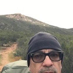

    user_profile
    dtomboc 3 years, 10 months ago
    Lake Baldwin via 2N02 and Burns Canyon Road
    ★ ★

    user_profile
    Dean 3 years, 11 months ago
    Old hwy 38 from mountain home loop with Sissysue
    ★ ★ ★ ★


    user_profile
    rog 3 years, 11 months ago
    Cleghorn Mountain via Cleghorn Fire Road
    ★

    user_profile
    larryhikes17 3 years, 11 months ago
    Track Ontario, Sugarloaf
    ★

    user_profile
    fear7950 3 years, 11 months ago
    Track (10/8/22, 8:30:05AM)
    ★ ★ ★ ★ ★

    user_profile
    Troy 3 years, 11 months ago
    Track (10/8/22, 8:34:22AM)
    ★ ★ ★ ★ ★

    user_profile
    alsacien 3 years, 11 months ago
    Big Bear Lake
    ★ ★ ★ ★ ★

    user_profile
    markzirkelb 3 years, 11 months ago
    Track (9/25/22, 7:23:59AM)
    ★ ★ ★ ★ ★

    user_profile
    santoscarrillo 3 years, 11 months ago
    Pilot rock long way
    ★ ★ ★ ★ ★

    user_profile
    dhop629 3 years, 11 months ago
    PCT - Section C
    ★ ★

    user_profile
    adryruhman 3 years, 11 months ago
    Track (9/30/22, 9:41:41AM)
    ★ ★ ★ ★ ★

    user_profile
    arobison10 3 years, 11 months ago
    Track (10/1/22, 2:00:32PM)
    ★ ★ ★ ★ ★

    user_profile
    jarro78 3 years, 11 months ago
    Track (11/5/20, 10:51:50AM)
    ★ ★ ★ ★ ★

    user_profile
    mrsriosteaches 3 years, 11 months ago
    HL BBL 30
    ★ ★ ★ ★ ★

    user_profile
    RadZ71 3 years, 11 months ago
    Jacoby Spring via 3N61
    ★ ★

    user_profile
    Spikeylola8 3 years, 11 months ago
    Hanna Flat Campground via 3N14
    ★ ★

    user_profile
    christopher.jacob.delatorre 3 years, 11 months ago
    Cucamonga Peak
    ★

    user_profile
    reyeshouseofprod 4 years ago
    Track (8/13/22, 14:10:50)
    ★ ★ ★ ★ ★

    user_profile
    j3c108 4 years ago
    Cleghorn Mountain via Cleghorn Fire Road
    ★ ★ ★ ★ ★

    user_profile
    leafsrule71 4 years ago
    Cucamonga Peak (8/27/22, 9:02:26AM)
    ★ ★ ★ ★ ★

    user_profile
    woodsmanaxe 4 years ago
    FR 3N06A and Lytle Creek Road
    ★ ★ ★ ★ ★

    user_profile
    jhschonfe 4 years ago
    Etiwanda Peak via Cucamonga Peak Trail and Icehouse Canyon Trail
    ★ ★

    user_profile
    Solo Gabriel 4 years ago
    Pista (8/20/22, 9:35:15p.m.)
    ★ ★ ★ ★ ★

    user_profile
    Shane Burdette 4 years ago
    Yellow post 30. 29,28
    ★ ★ ★ ★ ★

    user_profile
    Chockydog 4 years ago
    Track (8/20/22, 6:17:12AM)
    ★ ★ ★ ★ ★

    user_profile
    dblock 4 years ago
    3N69 – Gold Mountain - © Trails Offroad
    ★ ★ ★ ★ ★

    user_profile
    jsmith43 4 years, 1 month ago
    Track (5/10/22, 9:46:46AM)
    ★ ★ ★ ★ ★

    user_profile
    Jay Carney 4 years, 1 month ago
    Gold Fever Trail - © Trails Offroad
    ★ ★ ★ ★ ★

    user_profile
    lukear723 4 years, 1 month ago
    Cleghorn Mountain via Cleghorn Fire Road
    ★

    user_profile
    sacamp14 4 years, 1 month ago
    Greys peak with Moké 8/11/22, 10:56:25AM)
    ★ ★ ★ ★ ★

    user_profile
    drewpereze3 4 years, 1 month ago
    Track (8/6/22, 13:42:44)
    ★ ★ ★ ★ ★

    user_profile
    paul.pejii 4 years, 1 month ago
    Holcomb Valley Campground via 3N16
    ★ ★ ★ ★ ★

    user_profile
    gpheng86 4 years, 1 month ago
    Cleghorn fire road
    ★ ★ ★ ★ ★

    user_profile
    Bportzel 4 years, 1 month ago
    Holcomb Big Bear
    ★ ★ ★ ★ ★

    user_profile
    Bportzel 4 years, 1 month ago
    Willow Creek
    ★ ★ ★ ★ ★

    user_profile
    chandlerwyand1110 4 years, 1 month ago
    Tanglewood Group Campround via Pacific Crest National Scenic Trail #2000
    ★ ★

    user_profile
    michael.giovanni89 4 years, 1 month ago
    Cleghorn Mountain via Cleghorn Fire Road
    ★ ★ ★ ★

    user_profile
    precgm98 4 years, 1 month ago
    1st Jeep Run
    ★ ★ ★ ★ ★

    user_profile
    dkried 4 years, 1 month ago
    Track (7/26/22, 10:50:53AM)
    ★ ★ ★ ★ ★

    user_profile
    jim 4 years, 1 month ago
    Track (7/25/22, 9:16:01AM)
    ★ ★ ★ ★ ★

    user_profile
    Stephen Ulrich 4 years, 1 month ago
    City Creek Trail
    ★ ★ ★ ★

    user_profile
    J 4 years, 2 months ago
    Big Bear Camp hike
    ★ ★ ★ ★ ★

    user_profile
    sal 4 years, 2 months ago
    Thomas Mountain, CA
    ★ ★ ★ ★

    user_profile
    artoftheoctopus 4 years, 2 months ago
    2N09 and Polique Canyon Road
    ★

    user_profile
    cdog117 4 years, 2 months ago
    Sugarloaf Mountain via Sugarloaf Trail - 2E18
    ★

    user_profile
    Bruce Matthes 4 years, 2 months ago
    Alpine Slide Loop
    ★ ★ ★ ★ ★

    user_profile
    caden_wilson08 4 years, 2 months ago
    Track (6/29/22, 5:46:11PM)
    ★ ★ ★ ★

    user_profile
    jfamolare 4 years, 2 months ago
    CGA Gold Mtn (7/4/22, 11:36:0)
    ★ ★ ★ ★ ★

    user_profile
    Blake Schwier 4 years, 2 months ago
    Dogwood Campground Out & Back
    ★ ★ ★ ★ ★

    user_profile
    Riversideguy50 4 years, 2 months ago
    Big Bear day ride with a little side track at the end
    ★ ★ ★ ★

    user_profile
    glennamacher 4 years, 2 months ago
    Cucamonga Peak
    ★ ★

    user_profile
    gchotam 4 years, 2 months ago
    Cucamonga peak
    ★ ★ ★ ★

    user_profile
    hotfootedhiker 4 years, 2 months ago
    Hell Ride 2.0 Big Bear to Redlands
    ★ ★ ★ ★ ★

    user_profile
    raja.ammari 4 years, 2 months ago
    Big Bear Painted Rock
    ★ ★ ★

    user_profile
    gpheng86 4 years, 2 months ago
    Cleghorn Mountain via Cleghorn Fire Road
    ★ ★ ★ ★ ★

    user_profile
    gstoops158 4 years, 2 months ago
    Little Bear #1
    ★ ★ ★ ★ ★

    user_profile
    md2solo 4 years, 2 months ago
    Track (6/9/22, 7:12:15AM)
    ★ ★ ★ ★ ★

    user_profile
    jfamolare 4 years, 2 months ago
    Track (6/25/22, 20:37:2)
    ★ ★ ★ ★ ★

    user_profile
    Gerhard aka Flaco G 4 years, 2 months ago
    Fisherman’s track
    ★ ★ ★ ★

    user_profile
    bradhansen21 4 years, 2 months ago
    2022 Sun 2HW
    ★

    user_profile
    Ranger dad 4 years, 2 months ago
    Track (6/25/22, 9:25:16AM)
    ★ ★ ★ ★ ★

    user_profile
    chenye.666 4 years, 2 months ago
    Timber Mountain via Icehouse Canyon Trail
    ★ ★ ★ ★ ★

    user_profile
    schuckm 4 years, 2 months ago
    Pacific Crest Trail to Holcomb Creek
    ★ ★ ★ ★ ★

    user_profile
    sacamp14 4 years, 2 months ago
    Cougar (5/10/22, 1:38:58PM)
    ★ ★ ★ ★

    user_profile
    kentchen15 4 years, 2 months ago
    Ontario Peak (6/20/22, 6:49:12AM)
    ★ ★ ★ ★ ★

    user_profile
    scottsmh7 4 years, 2 months ago
    Skyline trail
    ★ ★ ★ ★ ★

    user_profile
    domlewis72 4 years, 2 months ago
    Track (6/18/22, 11:23:7)
    ★ ★ ★ ★ ★

    user_profile
    Traviskennedy267 4 years, 3 months ago
    Track (6/18/22, 10:49:22AM)
    ★ ★ ★ ★

    user_profile
    jdinning 4 years, 3 months ago
    Barton Flats Campground to Poop Out Hill
    ★ ★ ★ ★ ★

    user_profile
    J 4 years, 3 months ago
    Big Bear Camp hike
    ★ ★ ★ ★ ★

    user_profile
    roy.seydel 4 years, 3 months ago
    BANANA DANIEL
    ★ ★ ★ ★ ★

    user_profile
    frank 4 years, 3 months ago
    6/11/22 Fawnskin to Apple Valley
    ★ ★ ★ ★ ★

    user_profile
    lrmastertech 4 years, 3 months ago
    Pioneer Town to Big Bear Lake (6/11/22, 9:36:44 AM)
    ★ ★ ★ ★

    user_profile
    TheNotARubicon 4 years, 3 months ago
    Burt Flat (Dead End)
    ★ ★ ★ ★ ★

    user_profile
    hoadley.brian 4 years, 3 months ago
    Big Pine Flat Campground via 3N16
    ★ ★ ★ ★ ★

    user_profile
    Bobby.Digital 4 years, 3 months ago
    Yucca Valley to Big Bear and Holcomb Valley
    ★ ★ ★ ★ ★

    user_profile
    JC Eckert 4 years, 3 months ago
    Exploration Trail
    ★

    user_profile
    macnachtan 4 years, 3 months ago
    Lake Baldwin via 3N69
    ★

    user_profile
    ntell.photo 4 years, 3 months ago
    Lake Baldwin via 3N69
    ★

    user_profile
    egran71 4 years, 3 months ago
    Chill road to camp ground
    ★ ★ ★ ★ ★

    user_profile
    jdinning 4 years, 3 months ago
    Barton Flats Campground to Poop Out Hill
    ★ ★ ★ ★ ★

    user_profile
    Daniela 4 years, 3 months ago
    Track (6/4/22, 5:51:04AM)
    ★ ★ ★ ★ ★

    user_profile
    xovykji 4 years, 3 months ago
    Mt Cucamonga (6/2/22, 07:31:32)
    ★ ★ ★ ★

    user_profile
    guidovillalta 4 years, 3 months ago
    Big bear, first time solo.
    ★ ★ ★ ★ ★

    user_profile
    ceschalin 4 years, 3 months ago
    Castle Rock
    ★

    user_profile
    Mike_Curatola 4 years, 3 months ago
    Antonio Falls trail head to Baldy Notch
    ★ ★ ★ ★

    user_profile
    farah.awan 4 years, 3 months ago
    Track (5/28/22, 7:08:30AM)
    ★

    user_profile
    ranae.gramm 4 years, 3 months ago
    Sugarloaf Mountain via Sugarloaf Trail - 2E18
    ★

    user_profile
    Land crushing trails 4 years, 3 months ago
    Track (5/22/22, 9:05:33AM)
    ★ ★ ★ ★ ★

    user_profile
    Michael 4 years, 3 months ago
    City Creek to Radford
    ★ ★ ★ ★ ★

    user_profile
    Mike Woodster 4 years, 4 months ago
    Icehouse Saddle via Icehouse Canyon Trail
    ★ ★ ★ ★ ★

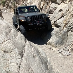
    user_profile
    anilram73 4 years, 4 months ago
    Heartbreak Ridge (5/15/22, 10:08:31AM)
    ★ ★ ★ ★ ★


    user_profile
    skysrf888 4 years, 4 months ago
    Track (5/13/22, 16:56:10)
    ★ ★ ★
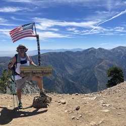
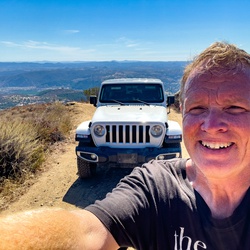
    user_profile
    John322 4 years, 4 months ago
    Track (5/13/22, 11:16:46AM)
    ★

    user_profile
    Hippi 4 years, 4 months ago
    Ice House Saddle
    ★ ★

    user_profile
    Quartermaster 4 years, 4 months ago
    Track (5/9/22, 12:21:54PM)
    ★ ★ ★ ★

    user_profile
    bd90 4 years, 4 months ago
    Big Pine Flats Campground
    ★ ★ ★ ★ ★

    user_profile
    Rod 4 years, 4 months ago
    Track (5/7/22, 7:28:41AM)
    ★ ★ ★

    user_profile
    MotoFreak80 4 years, 4 months ago
    Big Pine Flats Campground
    ★ ★ ★ ★ ★

    user_profile
    deborahlarsen 4 years, 4 months ago
    Tahquitz Peak via South Ridge Trail
    ★

    user_profile
    diazo49.od 4 years, 4 months ago
    Lytle Creek Camp Spots 4/30/22
    ★ ★ ★ ★ ★

    user_profile
    Ricardo 4 years, 4 months ago
    Gold Mountain
    ★ ★ ★ ★ ★

    user_profile
    don.bower 4 years, 4 months ago
    Tip Top Mountain4/30/22
    ★ ★ ★ ★ ★

    user_profile
    vongdo 4 years, 4 months ago
    Cedar Glen Campground via Chapman Trail and Icehouse Canyon Trail
    ★ ★ ★ ★ ★

    user_profile
    mirka.c1501 4 years, 4 months ago
    3n16 4/30
    ★ ★ ★ ★ ★

    user_profile
    georgepamajr 4 years, 4 months ago
    Disphan spring 4/30/22,
    ★ ★ ★ ★ ★

    user_profile
    Solo Gabriel 4 years, 4 months ago
    Couldland truck trail (4/19/22 8:05:37p.m.)
    ★ ★ ★

    user_profile
    marana210201 4 years, 4 months ago
    Lake Baldwin via 2N02 and Burns Canyon Road
    ★ ★ ★ ★ ★

    user_profile
    jennmatiseo 4 years, 4 months ago
    Not fun, no view
    ★

    user_profile
    robl3s 4 years, 4 months ago
    3N34
    ★

    user_profile
    tcirillo 4 years, 5 months ago
    Tahquitz Peak via South Ridge Trail
    ★

    user_profile
    lexx.503 4 years, 5 months ago
    Track (4/12/22, 5:07:33PM)
    ★ ★ ★ ★ ★

    user_profile
    jclausi 4 years, 5 months ago
    Track (4/12/22, 8:00:52AM)
    ★

    user_profile
    bolszewski10 4 years, 5 months ago
    Lake Baldwin via 2N02 and Burns Canyon Road
    ★ ★ ★ ★ ★

    user_profile
    sangbinkim0894 4 years, 5 months ago
    Cleghorn Mountain via Cleghorn Fire Road
    ★

    user_profile
    sangbinkim0894 4 years, 5 months ago
    3N08
    ★ ★

    user_profile
    Irrawaddy 4 years, 5 months ago
    Track (7/10/21, 8:47:25AM)
    ★ ★ ★ ★ ★

    user_profile
    kyle.nickey 4 years, 5 months ago
    Thomas Mountain to Toolbox Springs Campground
    ★ ★ ★ ★

    user_profile
    founder 4 years, 5 months ago
    Track (4/2/22, 9:21:32AM)
    ★ ★ ★ ★

    user_profile
    campos.david85 4 years, 5 months ago
    Track (4/2/22, 11:13:19AM)
    ★ ★ ★

    user_profile
    arnoldomontelongo 4 years, 5 months ago
    Lower Lytle Creek Divide
    ★ ★ ★ ★ ★

    user_profile
    jiffandclean 4 years, 5 months ago
    Gateway Ranch
    ★ ★ ★ ★

    user_profile
    symphonydecks 4 years, 5 months ago
    Track (3/30/22, 10:55:59AM)
    ★ ★ ★ ★ ★

    user_profile
    Bobby 4 years, 5 months ago
    Mill Creek Park to Bluff Lake
    ★ ★ ★ ★ ★

    user_profile
    josephderoxas34 4 years, 5 months ago
    Cleghorn Mountain via Cleghorn Fire Road
    ★

    user_profile
    steve.m.olejnik 4 years, 5 months ago
    Woodland trail (3/26/22, 4:12:50PM)
    ★ ★ ★ ★

    user_profile
    aberg857 4 years, 5 months ago
    Green Valley Lake area 4x4 (3/24/22, 10:14:35)
    ★ ★ ★ ★

    user_profile
    wbfourevrmor 4 years, 5 months ago
    San Saveine Road Lytle Creek(3/23/22, 11:37:56AM)
    ★ ★ ★

    user_profile
    ryanlong1224 4 years, 5 months ago
    Tahquitz via South Ridge
    ★ ★ ★ ★ ★

    user_profile
    jacklatham88 4 years, 5 months ago
    Ontario
    ★ ★ ★ ★ ★

    user_profile
    RobertHuang 4 years, 6 months ago
    Track (3/16/22, 6:08:26AM)
    ★ ★ ★ ★ ★

    user_profile
    jgriff75 4 years, 6 months ago
    Thomas Mountain
    ★

    user_profile
    gross.clayton 4 years, 6 months ago
    Lake Baldwin via 2N02 and Burns Canyon Road
    ★ ★ ★

    user_profile
    cesar.callejas01 4 years, 6 months ago
    Pilot Rock Truck Trail 2N33 and Pilot Rock Truck Trail
    ★ ★

    user_profile
    RobertHuang 4 years, 6 months ago
    Track (3/3/22, 6:08:26AM)
    ★ ★ ★ ★ ★

    user_profile
    DJG 4 years, 6 months ago
    Myers Canyon to Lower Lytle Creek to AppleWhite Road
    ★ ★ ★

    user_profile
    jairmex 4 years, 6 months ago
    Pacific Crest Trail
    ★

    user_profile
    Land crushing trails 4 years, 6 months ago
    New Track 5/25/20 9:33:35 AM
    ★ ★ ★ ★ ★

    user_profile
    rebeccagbryant 4 years, 6 months ago
    Icehouse Canyon solo (2/25/22, 10:41:56AM)
    ★ ★ ★ ★ ★

    user_profile
    Bobby 4 years, 6 months ago
    Hard Hike - A' didn't like
    ★ ★ ★ ★ ★

    user_profile
    apheiion7 4 years, 6 months ago
    Wilbur Grave via Holcomb Valley Road
    ★ ★ ★ ★

    user_profile
    ngallaher 4 years, 6 months ago
    3N31>2N53>3N49
    ★ ★ ★ ★

    user_profile
    reed.bamer 4 years, 6 months ago
    3N16
    ★ ★

    user_profile
    ryry152 4 years, 6 months ago
    Track (5/23/20, 11:48:29AM)
    ★ ★ ★ ★ ★

    user_profile
    LockNLoad765 4 years, 6 months ago
    Track (2/19/22, 06:44:31)
    ★ ★ ★ ★

    user_profile
    girani 4 years, 7 months ago
    BBear - Clark Tr to John Bull X Trail
    ★ ★ ★ ★ ★

    user_profile
    dgdelacruz 4 years, 7 months ago
    Ernie Maxwell Scenic Trail
    ★ ★ ★ ★

    user_profile
    justin_borska 4 years, 7 months ago
    Castle Rock
    ★ ★

    user_profile
    panheadmike87 4 years, 7 months ago
    Cleghorn Mountain via Cleghorn Fire Road
    ★ ★

    user_profile
    tigertchris 4 years, 7 months ago
    Gold Mountain via 3N16 and 3N69
    ★ ★

    user_profile
    kim1327 4 years, 7 months ago
    Cucamonga Peak
    ★

    user_profile
    jfamolare 4 years, 7 months ago
    BAdge of Honor - Gold Mountain Black Diamond
    ★ ★ ★ ★ ★

    user_profile
    ntell.photo 4 years, 7 months ago
    FR 3N06A
    ★

    user_profile
    stacey 4 years, 7 months ago
    John Bull loop
    ★ ★ ★ ★ ★

    user_profile
    googley90039 4 years, 7 months ago
    Timber Mountain via Icehouse Canyon Trail
    ★ ★ ★ ★

    user_profile
    sorr 4 years, 7 months ago
    Track (1/23/22, 10:34:54AM)
    ★ ★ ★ ★

    user_profile
    jamesukusa 4 years, 7 months ago
    Lake Baldwin via 3N69
    ★ ★ ★ ★ ★

    user_profile
    jason.vanwijk 4 years, 8 months ago
    Angelus Oaks to Pioneertown (Forest Way)
    ★ ★ ★ ★ ★

    user_profile
    gosser66 4 years, 8 months ago
    2N33 Pilot Rock Truck Trail with P&D
    ★ ★ ★ ★ ★

    user_profile
    tgraham12 4 years, 8 months ago
    Track (1/16/22, 8:41:11AM)
    ★ ★ ★

    user_profile
    joefasheh 4 years, 8 months ago
    Cleghorn Mountain via Cleghorn Fire Road
    ★ ★ ★ ★ ★

    user_profile
    small.keenan 4 years, 8 months ago
    Indian mountain
    ★ ★ ★ ★ ★

    user_profile
    gabriel.ariaz 4 years, 8 months ago
    3n16 route
    ★ ★ ★ ★ ★

    user_profile
    jeff 4 years, 8 months ago
    2N09 and Polique Canyon Road
    ★

    user_profile
    Austin 4 years, 8 months ago
    8690 Bowen Ranch Road, Apple Valley to Polique Canyon Road, San Bernardino County, CA, USA
    ★ ★ ★ ★ ★

    user_profile
    Bobby 4 years, 8 months ago
    Track (1/4/22, 11:07:01AM)
    ★ ★ ★ ★ ★

    user_profile
    renedizon74 4 years, 8 months ago
    Bee Canyon Truck Trail To Idyllwild with Joeff
    ★ ★ ★ ★ ★

    user_profile
    jeffwhited 4 years, 8 months ago
    Track (1/2/22, 12:06:42PM)
    ★ ★ ★

    user_profile
    mike.owens.ca 4 years, 8 months ago
    Thomas Mountain Road New Years
    ★ ★ ★ ★

    user_profile stars

    Gordon Alexander 4 years, 8 months ago
    Track (12/31/21, 9:36:42AM)
    ★ ★ ★ ★

    user_profile
    sergiojmorenog 4 years, 8 months ago
    FR 3N06A and Lytle Creek Road
    ★

    user_profile
    Juls 4 years, 8 months ago
    Track (2/28/21, 11:53:45AM)
    ★ ★ ★

    user_profile
    drewpereze3 4 years, 8 months ago
    Track (12/26/21, 12:27:9)
    ★ ★ ★ ★ ★

    user_profile
    Chris 4 years, 8 months ago
    Crazy ass trail
    ★ ★ ★ ★

    user_profile
    Chris 4 years, 8 months ago
    Track (3/20/21, 2:52:11PM)
    ★ ★ ★ ★

    user_profile
    Chris 4 years, 8 months ago
    Short cut
    ★ ★ ★

    user_profile
    inthelightofnight 4 years, 8 months ago
    Track (12/23/21, 12:30:24)
    ★ ★ ★

    user_profile
    gosser66 4 years, 8 months ago
    Mill Creek with Leo
    ★ ★ ★ ★

    user_profile
    s6shop 4 years, 8 months ago
    Big Bear 12/17/21
    ★ ★ ★

    user_profile
    haganka 4 years, 8 months ago
    Lower Lytle Creek Divide
    ★ ★

    user_profile
    type2drvr50 4 years, 9 months ago
    Cleghorn Mountain via Cleghorn Fire Road
    ★ ★ ★ ★

    user_profile
    lorenwebb 4 years, 9 months ago
    Gold Mountain
    ★ ★ ★ ★ ★

    user_profile
    fear7950 4 years, 9 months ago
    Pilot Rock(12/12/21, 8:58:48AM)
    ★ ★ ★ ★ ★

    user_profile
    ICE 4 years, 9 months ago
    Track (12/11/21, 6:30:25AM)
    ★ ★ ★ ★ ★

    user_profile
    awhiles43 4 years, 9 months ago
    Track (12/12/21, 11:25:05AM)
    ★ ★ ★ ★ ★

    user_profile
    Matthew.cole 4 years, 9 months ago
    Crafton Hills Ridge Trail
    ★

    user_profile
    Bobby 4 years, 9 months ago
    Track (12/10/21, 9:39:55AM)
    ★ ★ ★ ★ ★

    user_profile
    egran71 4 years, 9 months ago
    Antelope valley 2 bb
    ★ ★ ★ ★ ★

    user_profile
    BarefootBassist 4 years, 9 months ago
    Bighorn Peak through Kelly Camp
    ★ ★ ★ ★

    user_profile
    Edrick 4 years, 9 months ago
    Tony/ Marcelo trail 3n06a (11/28/21, 8:54:00AM)
    ★ ★ ★ ★

    user_profile
    sonny.p.cruz 4 years, 9 months ago
    Green Valley Lake Road, San Bernardino County to 30865 Live Oak Drive, Running Springs, CA, USA
    ★ ★ ★ ★ ★

    user_profile
    meeker-08-stepson 4 years, 9 months ago
    Track (11/23/21, 1:46:33PM)
    ★ ★ ★ ★

    user_profile
    sonny.p.cruz 4 years, 9 months ago
    Crab Flats Campground via 3N08 and 3N16
    ★ ★

    user_profile
    MoisesRodriguez7bc7d74919ae489e 4 years, 9 months ago
    Lake Baldwin via 3N69
    ★ ★

    user_profile
    krystyna.tatarkiewicz 4 years, 9 months ago
    Tahquitz Peak via South Ridge Trail
    ★ ★

    user_profile
    symphonydecks 4 years, 9 months ago
    Track (11/19/21, 10:44:39AM)
    ★ ★ ★ ★ ★

    user_profile
    sean_magill3 4 years, 10 months ago
    3N08
    ★ ★

    user_profile
    cmac1up 4 years, 10 months ago
    Pilot Rock Truck Trail 2N33
    ★

    user_profile
    BarefootBassist 4 years, 10 months ago
    Ontario Peak via Icehouse Canyon
    ★ ★ ★ ★

    user_profile
    BarefootBassist 4 years, 10 months ago
    Ontario Peak via Icehouse Canyon
    ★ ★ ★ ★

    user_profile
    brandonreisinger 4 years, 10 months ago
    Track (10/16/21, 07:29:0)
    ★ ★ ★ ★ ★

    user_profile
    tweddler 4 years, 10 months ago
    Moon ridge and bow valley big bear
    ★ ★ ★

    user_profile
    calvin.leclair 4 years, 10 months ago
    Cucamonga Peak
    ★ ★ ★ ★ ★

    user_profile
    alexandrarutkowski 4 years, 10 months ago
    Vons to Holcomb valley rd camp spot
    ★ ★ ★ ★ ★

    user_profile
    MayhemHikes 4 years, 10 months ago
    Halloween 3 Peak hike
    ★ ★ ★ ★

    user_profile
    safde8 4 years, 10 months ago
    Devils Canyon Road to 18 great sunset route Trail
    ★ ★ ★ ★

    user_profile
    lwoz1977 4 years, 10 months ago
    Crafts Peak #1
    ★

    user_profile
    Mi 4 years, 10 months ago
    Track (10/30/21, 11:24:12AM)
    ★ ★ ★ ★

    user_profile
    Danshaffer 4 years, 10 months ago
    Gold Mtn & Little John Bull
    ★ ★ ★ ★

    user_profile
    contactjoshpaul 4 years, 10 months ago
    Angelus Oaks Trail
    ★ ★ ★ ★ ★

    user_profile
    dyhkim 4 years, 11 months ago
    Big Bear Lake
    ★ ★ ★ ★

    user_profile
    Big Demers 4 years, 11 months ago
    Holcomb
    ★ ★ ★ ★ ★

    user_profile
    drewpereze3 4 years, 11 months ago
    Track (10/10/21, 08:37:57)
    ★ ★ ★ ★ ★

    user_profile
    Jason 4 years, 11 months ago
    Miller Canyon to Pilot Rock to Yamaha trail.
    ★ ★ ★ ★ ★

    user_profile
    Blondee4727 4 years, 11 months ago
    Gold mountain big bear
    ★ ★ ★ ★ ★

    user_profile
    robe719 4 years, 11 months ago
    Track (10/9/21, 7:25:48AM)
    ★ ★ ★ ★ ★

    user_profile
    Daniela 4 years, 11 months ago
    Track (10/3/21, 6:44:55AM)
    ★ ★ ★ ★ ★

    user_profile
    Daniela 4 years, 11 months ago
    Track (8/28/21, 6:21:25AM)
    ★ ★ ★ ★ ★

    user_profile
    223fmjg 4 years, 11 months ago
    cougar trail Cougar Trail with the girls
    ★ ★ ★ ★ ★

    user_profile
    monkeywrench17 4 years, 11 months ago
    Track (9/23/21, 4:39:53PM)
    ★ ★ ★ ★ ★

    user_profile
    cmayyeh 4 years, 11 months ago
    Track (10/2/21, 8:46:09AM)
    ★

    user_profile
    Bobby 4 years, 11 months ago
    Track (9/27/21, 9:32:52AM)
    ★ ★ ★ ★ ★

    user_profile
    MFD 4 years, 11 months ago
    Track (9/27/21, 10:55:14AM)
    ★ ★ ★ ★

    user_profile
    MFD 4 years, 11 months ago
    IDYErnieMaxwellT210927
    ★ ★ ★ ★

    user_profile
    Chris 4 years, 11 months ago
    Crazy ass trail
    ★ ★ ★ ★

    user_profile
    Chris 4 years, 11 months ago
    Short cut
    ★ ★ ★

    user_profile
    Chris 4 years, 11 months ago
    Track (3/20/21, 2:52:11PM)
    ★ ★ ★ ★

    user_profile
    Jack 5 years ago
    3N14 - Coxey Road - © Trails Offroad
    ★ ★ ★ ★ ★

    user_profile
    adamjacobtaylor 5 years ago
    Big Bear Lake
    ★ ★ ★ ★ ★

    user_profile
    Tony Gualtieri 5 years ago
    John Bull backwards, Mottino Wash
    ★ ★ ★ ★ ★

    user_profile
    Laura 5 years ago
    Rover Rendezvous
    ★ ★ ★ ★

    user_profile
    ethanmad10 5 years ago
    Cucamonga Peak
    ★

    user_profile
    Irocc1200s 5 years ago
    Track (8/24/21, 10:07:2)
    ★ ★ ★ ★ ★

    user_profile
    Tony Gualtieri 5 years ago
    Old Pilot Rock to Pilot Rock
    ★ ★ ★ ★ ★

    user_profile
    georgev126 5 years ago
    Track (8/21/21, 10:16:09AM)
    ★ ★ ★ ★ ★

    user_profile
    petereberhardtbmx 5 years ago
    YP#25 via 2N10
    ★

    user_profile
    pacolozano2011 5 years ago
    Ontario Peak (8/15/21, 3:28:42AM)
    ★ ★ ★ ★ ★

    user_profile
    davewallander 5 years, 1 month ago
    Rocky Mountain Trail
    ★

    user_profile
    marynayar 5 years, 1 month ago
    Icehouse Saddle via Icehouse Canyon Trail and Cucamonga Peak Trail
    ★ ★ ★ ★ ★

    user_profile
    bayleeboo 5 years, 1 month ago
    Castle Rock
    ★ ★

    user_profile
    aaa247 5 years, 1 month ago
    Cucamonga Peak Trail
    ★ ★ ★

    user_profile
    drmanbett513jyb 5 years, 1 month ago
    Track (8/8/21, 5:45:17PM)
    ★ ★ ★ ★ ★

    user_profile
    e_guzman013 5 years, 1 month ago
    Track (8/7/21, 10:11:51AM)
    ★ ★ ★ ★ ★

    user_profile
    chadzman 5 years, 1 month ago
    Heart Bar Campground to Wildhorse Creek, San Bernardino County, CA, USA
    ★ ★ ★ ★

    user_profile
    eof240 5 years, 1 month ago
    City creek
    ★ ★ ★ ★

    user_profile
    brandonfranco696 5 years, 1 month ago
    Jenk's Lake via 1E04.1
    ★ ★ ★

    user_profile
    Adam 5 years, 1 month ago
    Track (7/31/21) Cold water canyon 3n06a
    ★ ★ ★ ★

    user_profile
    adam.shanle 5 years, 1 month ago
    LGE-CTS trail run
    ★ ★ ★ ★

    user_profile
    hirokomomiiart 5 years, 1 month ago
    Bluff Lake Loop via Castle Rock Trail
    ★ ★ ★ ★ ★

    user_profile
    james.wrtn 5 years, 1 month ago
    San Jacinto Peak Loop Trail - w/ JT
    ★ ★ ★ ★

    user_profile
    cantoro2000 5 years, 1 month ago
    FR 3N06A
    ★ ★ ★

    user_profile
    makosuzuki0803 5 years, 1 month ago
    Track (7/25/21, 8:01:00AM)
    ★ ★ ★ ★ ★

    user_profile
    e_guzman013 5 years, 1 month ago
    Gobblers Knob, San Bernardino County to 13948 Irving Lane, Lytle Creek, CA, USA
    ★ ★ ★ ★ ★

    user_profile
    jasonhardaker 5 years, 1 month ago
    2N33 - Pilot Rock Truck Trail - © Trails Offroad
    ★ ★ ★ ★ ★

    user_profile
    mike.d1111 5 years, 1 month ago
    Lake Baldwin via 3N69
    ★ ★ ★ ★ ★

    user_profile
    crazyswed14 5 years, 1 month ago
    Lytle Creek Road
    ★ ★ ★ ★

    user_profile
    laurieshappy 5 years, 2 months ago
    1N54 - Clarks Grade - © Trails Offroad
    ★

    user_profile
    jonny5roket 5 years, 2 months ago
    3N34
    ★ ★ ★ ★ ★

    user_profile
    Evan 5 years, 2 months ago
    Track (7/10/21, 9:54:18AM)
    ★ ★ ★ ★ ★

    user_profile
    fredrichallas 5 years, 2 months ago
    Icehouse Saddle via Icehouse Canyon Trail
    ★ ★ ★ ★ ★

    user_profile
    georgeurquidez 5 years, 2 months ago
    John Bull AO Jeep Run.
    ★ ★ ★ ★ ★

    user_profile
    dan 5 years, 2 months ago
    Track (7/4/21, 8:22:15AM)
    ★ ★ ★ ★ ★

    user_profile
    DoranRBrown 5 years, 2 months ago
    Thomas & Little Thomas Mountain Via Yellow Post 1 to Forest Route 6S04
    ★ ★ ★ ★

    user_profile
    kyle.flavin 5 years, 2 months ago
    Cucamonga Peak
    ★ ★ ★ ★ ★

    user_profile
    Ryan 5 years, 2 months ago
    Big Bear Lake
    ★ ★

    user_profile
    daniel.saieh 5 years, 2 months ago
    3N08
    ★

    user_profile
    Tom 5 years, 2 months ago
    66 Pilot Rock Road
    ★ ★ ★ ★ ★

    user_profile
    Randy 5 years, 2 months ago
    Big Bear Lake
    ★ ★ ★ ★ ★

    user_profile
    bbbattag 5 years, 2 months ago
    Happy Hills
    ★ ★ ★

    user_profile
    Katrina 5 years, 2 months ago
    Holcomb Valley Campground via 3N16
    ★ ★ ★ ★ ★

    user_profile
    MFD 5 years, 2 months ago
    BBBristlecone&FernTrailsT210624
    ★ ★ ★ ★

    user_profile
    jordanjc1 5 years, 2 months ago
    Burns canyon
    ★ ★ ★ ★ ★

    user_profile
    RobertHuang 5 years, 2 months ago
    Track (6/22/21, 5:14:42AM)
    ★ ★ ★ ★ ★

    user_profile
    dadame661 5 years, 2 months ago
    Sugarloaf Mountain via Sugarloaf Trail - 2E18
    ★ ★ ★

    user_profile
    lorenwebb 5 years, 2 months ago
    Seven Oaks Reservoir via Warm Creek Road/ Forest Road 1S12
    ★ ★ ★

    user_profile
    jeteraw 5 years, 2 months ago
    2N02 - Burns Canyon - © Trails Offroad
    ★ ★ ★ ★

    user_profile
    DEATHDELAYER 5 years, 2 months ago
    Old Saw Mill Roadbed to 313 San Anselmo Drive, Big Bear City, CA, USA
    ★ ★ ★ ★ ★

    user_profile
    sullivan_kevin14 5 years, 2 months ago
    Track (6/18/21, 12:51:29PM)
    ★ ★ ★ ★ ★

    user_profile
    skycondition 5 years, 2 months ago
    UCLA Arrowhead weekend
    ★ ★ ★ ★ ★

    user_profile
    lorenwebb 5 years, 2 months ago
    Seven Oaks Dam
    ★ ★ ★

    user_profile
    SoCal Original 5 years, 2 months ago
    Old Pilot Rock
    ★ ★ ★ ★ ★

    user_profile
    dannykolts 5 years, 2 months ago
    Track (6/19/21, 9:14:33AM)
    ★ ★

    user_profile
    ashleyantonissen21 5 years, 3 months ago
    Grand View Point via 2N08
    ★ ★ ★

    user_profile
    troyconrad 5 years, 3 months ago
    Track (6/14/21, 10:24:14AM)
    ★ ★ ★ ★ ★

    user_profile
    cdgillman 5 years, 3 months ago
    Sophie and Claire Icehouse Canyon
    ★ ★ ★ ★ ★

    user_profile
    katharine.kimura 5 years, 3 months ago
    Pine Knot Trail to Grand View Point - 6/14/21
    ★ ★ ★ ★ ★

    user_profile
    josegrijalva 5 years, 3 months ago
    Monument Peak via 2N49
    ★ ★ ★

    user_profile
    fear7950 5 years, 3 months ago
    Old City Creek Road
    ★ ★ ★ ★ ★

    user_profile
    Jonc9 5 years, 3 months ago
    Icehouse Creek to Cucamonga Peak
    ★ ★ ★ ★ ★

    user_profile
    icmanforever417 5 years, 3 months ago
    Holcomb creek
    ★ ★ ★ ★ ★

    user_profile
    payan625 5 years, 3 months ago
    42550 Jackson Street, Indio to 3228 West 109th Street, Inglewood, CA, USA
    ★ ★ ★ ★ ★

    user_profile
    Rocko 5 years, 3 months ago
    Black Mountain.
    ★

    user_profile
    symphonydecks 5 years, 3 months ago
    Mojave Freeway to Wagon Train Road, San Bernardino County, CA, USA
    ★ ★ ★ ★ ★

    user_profile
    austin.steenport 5 years, 3 months ago
    Bee canyon Idyllwild
    ★ ★ ★ ★ ★

    user_profile
    SURbIE_909 5 years, 3 months ago
    Holcomb Valley- 2N09
    ★ ★ ★ ★ ★

    user_profile
    rjpuffenbarger 5 years, 3 months ago
    Pioneertown a big bear
    ★ ★ ★ ★ ★

    user_profile
    jenn.pm.tran 5 years, 3 months ago
    Don’t mess with 1.8
    ★ ★ ★ ★

    user_profile
    dm.wendell16 5 years, 3 months ago
    Burns Canyon Rd
    ★ ★ ★ ★

    user_profile
    songjinbiao 5 years, 3 months ago
    Cucamonga Peak
    ★ ★ ★

    user_profile
    symphonydecks 5 years, 3 months ago
    Mojave Freeway to Wagon Train Road, San Bernardino County, CA, USA
    ★ ★ ★ ★ ★

    user_profile
    terryfelix 5 years, 3 months ago
    Casita de Cielo via Deer Springs Trail
    ★

    user_profile
    vanessa61893 5 years, 3 months ago
    Track (5/31/21, 12:39:45)
    ★ ★ ★ ★ ★

    user_profile
    vwbajakid 5 years, 3 months ago
    Lake Baldwin via 2N02 and Burns Canyon Road
    ★ ★ ★ ★ ★

    user_profile
    rbinoc 5 years, 3 months ago
    Mt. Rancho Cucamonga Peak 5/30/21, 6:44:33AM)
    ★ ★ ★ ★

    user_profile
    menamorgan 5 years, 3 months ago
    Etiwanda Peak via Cucamonga Peak Trail and Icehouse Canyon Trail
    ★ ★

    user_profile
    Andrew Waldon 5 years, 3 months ago
    Ernie Maxwell Scenic Trail
    ★ ★ ★ ★

    user_profile
    gwparsons 5 years, 3 months ago
    Cucamonga
    ★ ★ ★ ★ ★

    user_profile
    georgeurquidez 5 years, 3 months ago
    John Bull Sean Jeep Run
    ★ ★ ★ ★ ★

    user_profile
    eamarco165 5 years, 3 months ago
    Woodland Interpretive Trail to Woodland Road, San Bernardino County, CA, USA
    ★ ★ ★ ★ ★

    user_profile
    eamarco165 5 years, 3 months ago
    41911 North Shore Drive to Meadows Edge, San Bernardino County, CA, USA
    ★ ★ ★ ★ ★

    user_profile
    HOTROD 5 years, 3 months ago
    Pilot Rock Truck Trail 2N33 and Pilot Rock Truck Trail
    ★ ★

    user_profile
    trujillore 5 years, 3 months ago
    Cucamonga Peak
    ★ ★

    user_profile
    Bumper 5 years, 3 months ago
    With Jason
    ★ ★ ★ ★

    user_profile
    Bumper 5 years, 3 months ago
    Jason silver wood to arrowhead
    ★ ★ ★ ★ ★

    user_profile
    cnaticch 5 years, 3 months ago
    Cucamonga Peak
    ★ ★ ★ ★ ★

    user_profile
    giorossimail 5 years, 3 months ago
    Grays Peak via Gray's Peak Trail 1W06
    ★ ★ ★ ★ ★

    user_profile
    hmim1774 5 years, 3 months ago
    Etiwanda Peak via Cucamonga Peak Trail and Icehouse Canyon Trail
    ★ ★ ★

    user_profile
    Hannah 5 years, 3 months ago
    Track (5/17/21, 1:16:24PM)
    ★ ★ ★ ★ ★

    user_profile
    markvaldivia04 5 years, 3 months ago
    Pilot Rock Ridge Road
    ★ ★ ★ ★ ★

    user_profile
    Bobby 5 years, 3 months ago
    Back Side of Sugarloaf Mtn
    ★ ★ ★ ★ ★

    user_profile
    RobertHuang 5 years, 3 months ago
    Track (5/20/21, 9:24:53AM)
    ★ ★ ★ ★ ★

    user_profile
    plmoakler 5 years, 3 months ago
    Track (5/15/21, 10:05:59)
    ★ ★ ★ ★ ★

    user_profile
    nathan232 5 years, 3 months ago
    Ernie Maxwell Trail
    ★ ★ ★

    user_profile
    Anonymous User 5 years, 3 months ago
    Lytle Creek Road
    ★

    user_profile
    Paul 5 years, 3 months ago
    2N61Y - Heartbreak Ridge - © Trails Offroad
    ★ ★ ★ ★ ★

    user_profile
    radambenda 5 years, 4 months ago
    Track (5/17/21, 6:55:50PM)
    ★ ★ ★ ★ ★

    user_profile
    gosser66 5 years, 4 months ago
    2N47 Cleghorn with 5150 and Leo
    ★ ★ ★ ★ ★

    user_profile
    fireteamtwo 5 years, 4 months ago
    Track (4/4/21, 13:55:25)
    ★ ★ ★

    user_profile
    ricky.sutter 5 years, 4 months ago
    Track (5/15/21, 10:41:07AM)
    ★ ★ ★ ★ ★

    user_profile
    isaacjackson95 5 years, 4 months ago
    3N34
    ★ ★

    user_profile
    yliu812 5 years, 4 months ago
    Icehouse Saddle via Icehouse Canyon Trail and Cucamonga Peak Trail
    ★ ★

    user_profile
    rw 5 years, 4 months ago
    Cleghorn
    ★ ★ ★ ★ ★

    user_profile
    Joseph 5 years, 4 months ago
    Track (5/8/21, 9:51:51AM)
    ★ ★ ★ ★

    user_profile
    lorenwebb 5 years, 4 months ago
    Holcomb Creek
    ★ ★ ★ ★

    user_profile
    lorenwebb 5 years, 4 months ago
    Clarks Grade
    ★ ★ ★ ★

    user_profile
    owen.monkemeier 5 years, 4 months ago
    Little Thomas Mtn (West)
    ★ ★ ★ ★ ★

    user_profile
    hans4jeeps 5 years, 4 months ago
    Keller Peak
    ★ ★ ★ ★ ★

    user_profile
    runhard12341 5 years, 4 months ago
    Ontario Peak & Cucamonga Peak
    ★ ★ ★

    user_profile
    mashapioffe 5 years, 4 months ago
    Icehouse Saddle via Icehouse Canyon Trail and Cucamonga Peak Trail
    ★

    user_profile
    untx3 5 years, 4 months ago
    Track (2/28/21, 11:31:01AM)
    ★ ★ ★ ★ ★

    user_profile
    Kristian 5 years, 4 months ago
    Track (5/1/21, 8:45:30AM)
    ★ ★ ★ ★ ★

    user_profile
    alicesun99 5 years, 4 months ago
    Icehouse Saddle Loop via Icehouse Canyon Trail and Chapman Trail
    ★

    user_profile
    Kris 5 years, 4 months ago
    Path to super campground
    ★ ★ ★ ★ ★

    user_profile
    Jon 5 years, 4 months ago
    Cleghorn Mountain via Cleghorn Fire Road
    ★ ★ ★ ★

    user_profile
    lol365days 5 years, 4 months ago
    Thunder Mountain Loop via Three Ts Trail
    ★ ★

    user_profile
    c-ordonez2821 5 years, 4 months ago
    Sheep Creek Truck Trail
    ★ ★

    user_profile
    jessehmorrison 5 years, 4 months ago
    Three T’s (Timber and Telegraph only)
    ★ ★ ★ ★ ★

    user_profile
    odub3387 5 years, 4 months ago
    3N16 to 3N16L, San Bernardino County, CA, USA
    ★ ★ ★ ★ ★

    user_profile
    jeff.davidsonca 5 years, 4 months ago
    Aga Ridge Loop Trail
    ★ ★ ★ ★ ★

    user_profile
    mgertz007 5 years, 4 months ago
    Cleghorn with Hard Offshoots
    ★ ★ ★ ★ ★

    user_profile
    DougsRV 5 years, 4 months ago
    Track (5/1/21, 10:57:23AM)
    ★ ★ ★ ★

    user_profile
    ksdurham62 5 years, 4 months ago
    Gold Mountain, Little John Bull, John Bull and Holcombe Creek (4/25/21, 7:28:39AM)
    ★ ★ ★ ★ ★

    user_profile
    pyramid919 5 years, 4 months ago
    Maple Hill Trails
    ★ ★ ★ ★ ★

    user_profile
    richyyrichxd 5 years, 4 months ago
    Jacoby Canyon
    ★ ★ ★ ★ ★

    user_profile
    lorenbecker 5 years, 4 months ago
    Mark’s Red Route #1
    ★ ★ ★ ★

    user_profile
    lorenbecker 5 years, 4 months ago
    Marks Red Route #1
    ★ ★ ★ ★ ★

    user_profile
    founder 5 years, 4 months ago
    Lost Creek and South Fork hike Track (4/25/21, 11:27:53AM)
    ★ ★ ★ ★

    user_profile
    Leo 5 years, 4 months ago
    Big Pine Flat Campground to Crab Flats Road, San Bernardino County, CA, USA
    ★ ★ ★ ★

    user_profile
    ksdurham62 5 years, 4 months ago
    Gold Mountain, Little John Bull, John Bull and Holcombe Creek (4/25/21, 7:28:39AM)
    ★ ★ ★ ★ ★

    user_profile
    qvadamae 5 years, 4 months ago
    5S09 - San Jacinto Ridge - © Trails Offroad
    ★ ★ ★ ★ ★

    user_profile
    founder 5 years, 4 months ago
    Lost Creek and South Fork hike Track (4/25/21, 11:27:53AM)
    ★ ★ ★ ★

    user_profile
    sekstrand3 5 years, 4 months ago
    15051 Hwy 173, Hesperia to Miller Canypn Group Camp, San Bernardino County, CA, USA
    ★ ★ ★ ★ ★

    user_profile
    andrewgolobic 5 years, 4 months ago
    56770 Highway 74 to 59650 Devils Ladder Road, Mountain Center, CA, USA
    ★ ★ ★ ★ ★

    user_profile
    Adam 5 years, 4 months ago
    Track (4/24/21, 11:46:16AM)
    ★ ★ ★ ★ ★

    user_profile
    martin.valadez11 5 years, 4 months ago
    Silverwood Lake via Pacific Crest Trail
    ★

    user_profile
    jrallison4 5 years, 4 months ago
    2no2
    ★ ★ ★ ★ ★

    user_profile
    jamesseitzinger 5 years, 4 months ago
    Icehouse Saddle via Icehouse Canyon Trail
    ★ ★ ★ ★ ★

    user_profile
    Haley 5 years, 4 months ago
    cucamonga peak 4/17
    ★ ★ ★ ★ ★

    user_profile
    bluefin031 5 years, 5 months ago
    Track (4/18/21, 6:46:45AM)
    ★ ★ ★ ★ ★

    user_profile
    Ricardo Flores 5 years, 5 months ago
    Holcomb Creek, Gold Mountain, and John Bull trails. Big Bear, CA
    ★ ★ ★ ★ ★

    user_profile
    esperas.sean 5 years, 5 months ago
    Pine knott/ Grand view peak
    ★ ★ ★ ★

    user_profile
    iraqvet62b 5 years, 5 months ago
    2N70Y
    ★

    user_profile
    thomasjohansen 5 years, 5 months ago
    Idyllwild park trail
    ★ ★ ★ ★ ★

    user_profile
    MadRax 5 years, 5 months ago
    Track (4/13/21, 10:34:10AM)
    ★ ★ ★ ★ ★

    user_profile
    Branden 5 years, 5 months ago
    Big Bear - Branden and Dad
    ★ ★ ★ ★ ★

    user_profile
    littlefyrkyd 5 years, 5 months ago
    Cleghorn Fire Road to Crab Flats Road
    ★ ★ ★ ★ ★

    user_profile
    wrxanol 5 years, 5 months ago
    FR 3N06A and Lytle Creek Road
    ★ ★ ★ ★ ★

    user_profile
    Devon 5 years, 5 months ago
    Track (4/11/21, 9:42:37AM)
    ★ ★ ★ ★ ★

    user_profile
    lmoreno2442 5 years, 5 months ago
    Thunder Mountain Loop via Three Ts Trail
    ★ ★ ★

    user_profile
    skydiveblake 5 years, 5 months ago
    First ebike day of the season!
    ★ ★ ★ ★ ★

    user_profile
    rvs2280 5 years, 5 months ago
    Pacific Crest Trail
    ★ ★ ★

    user_profile
    Alex 5 years, 5 months ago
    Texas Hill via Lytle Creek Canyon Road and Sierra Avenue
    ★

    user_profile
    Mike Bloomenfeld 5 years, 5 months ago
    Cougar crest trail
    ★ ★ ★ ★

    user_profile
    gdwalker05 5 years, 5 months ago
    1697 Angels Camp Road, Big Bear Lake to 100 Yosemite Drive, Big Bear City, CA, USA
    ★ ★ ★ ★ ★

    user_profile
    valenzuela310 5 years, 5 months ago
    FR 3N06A
    ★

    user_profile
    scottlimpus 5 years, 5 months ago
    The Pinnacles via 3N07
    ★ ★ ★

    user_profile
    matthew.tucker2001 5 years, 5 months ago
    Track (3/20/21, 8:14:21AM)
    ★ ★ ★ ★ ★

    user_profile
    smrrawlings 5 years, 5 months ago
    Cougar Crest Trail - Serrano Big Bear
    ★ ★ ★ ★ ★

    user_profile
    Szymon Karl 5 years, 5 months ago
    Road to big bear (faster)
    ★ ★ ★ ★ ★

    user_profile
    cjw1288 5 years, 5 months ago
    Skyline Drive and 2N10D
    ★

    user_profile
    umontez1 5 years, 5 months ago
    Jacoby Spring via 3N61
    ★ ★ ★ ★ ★

    user_profile
    soldo.brandi 5 years, 5 months ago
    Track (4/2/21, 3:41:38PM)
    ★ ★ ★ ★ ★

    user_profile
    apastorturo97 5 years, 5 months ago
    Track (3/30/21, 10:22:24AM)
    ★ ★ ★ ★ ★

    user_profile
    zsbarlow19 5 years, 5 months ago
    Gold mt and John Bull (3/28/21, 8:17:41AM)
    ★ ★ ★ ★ ★

    user_profile
    bigedbass 5 years, 5 months ago
    Pilot Rock 2N33 to Willow Creek 3N34
    ★ ★ ★ ★

    user_profile
    brunstown 5 years, 5 months ago
    Rick D Big 🐻 54 Miles Rippin
    ★ ★ ★ ★ ★

    user_profile
    ocjohn 5 years, 5 months ago
    Track (3/27/21, 2:16:25PM)
    ★ ★ ★ ★ ★

    user_profile
    imatglamis 5 years, 5 months ago
    Delamar Mt 3N12 & Squeeze Delamar Mtn 3N12 & Squeeze 3N07A
    ★ ★ ★ ★

    user_profile
    cmcabinets 5 years, 5 months ago
    3N08
    ★ ★ ★

    user_profile
    mondo619 5 years, 5 months ago
    Cleghorn Mountain via Cleghorn Fire Road
    ★ ★ ★ ★ ★

    user_profile
    buchanantrader2 5 years, 5 months ago
    Track (3/21/21, 11:18:54AM)
    ★ ★ ★ ★ ★

    user_profile
    Tracy 5 years, 5 months ago
    Trip through Pioneer to Big Bear via Burns Canyon 3/21/21
    ★ ★ ★ ★ ★

    user_profile
    JohnEGates 5 years, 5 months ago
    Cougar Crest Trailhead to Cougar Crest Trail, San Bernardino County, CA, USA
    ★ ★ ★ ★ ★

    user_profile
    J-Rad 5 years, 5 months ago
    March 202 SAR Training
    ★ ★ ★ ★

    user_profile
    m.salinas1211 5 years, 5 months ago
    Lytle creek
    ★ ★ ★ ★ ★

    user_profile
    JohnEGates 5 years, 5 months ago
    Big Bear Cabin Loop #1
    ★ ★ ★ ★ ★

    user_profile
    RaymondBarreto 5 years, 6 months ago
    Bautista Road
    ★ ★

    user_profile
    Chris 5 years, 6 months ago
    Crazy ass trail
    ★ ★ ★ ★

    user_profile
    Jim 5 years, 6 months ago
    Keller Peak
    ★ ★

    user_profile
    lovemyge 5 years, 6 months ago
    3N34
    ★ ★ ★ ★

    user_profile
    Vannatu 5 years, 6 months ago
    2N06 Radford trail 5/31/20 11:43:19 AM
    ★ ★ ★ ★

    user_profile
    Jeff 5 years, 6 months ago
    Tool Box Springs Campground via Thomas Mountain Road
    ★

    user_profile
    Ilene 5 years, 6 months ago
    Coxey Truck Trail 3N14 and Coxey Road 3N14
    ★ ★ ★ ★ ★

    user_profile
    SGM Marquez 5 years, 6 months ago
    Over landing
    ★ ★ ★ ★ ★

    user_profile
    cekovach87 5 years, 6 months ago
    Track (3/9/21, 13:23:45)
    ★ ★ ★ ★ ★

    user_profile
    jxbshopping 5 years, 6 months ago
    My. Baldy
    ★ ★ ★ ★ ★

    user_profile
    sandersface 5 years, 6 months ago
    Nice drive along the Santa Ana River
    ★ ★ ★ ★

    user_profile
    anthony.kaigler 5 years, 6 months ago
    Keller Meadows via Old City Creek Road/ Forest Road 1N09
    ★ ★

    user_profile
    icmanforever417 5 years, 6 months ago
    Bees Canyon to idylwild loop
    ★ ★ ★ ★ ★

    user_profile
    Johnny 5 years, 6 months ago
    Lake Arrowhead Ridge
    ★ ★ ★ ★ ★

    user_profile
    kurylowicza 5 years, 6 months ago
    Bee Canyon to Pine Cove
    ★ ★ ★ ★ ★

    user_profile
    1mdvasquez 5 years, 6 months ago
    Cold water trail
    ★ ★ ★ ★ ★

    user_profile
    Adam 5 years, 6 months ago
    Track (3/7/21, 8:15:52AM)
    ★ ★ ★ ★

    user_profile
    Ryan Osga 5 years, 6 months ago
    3N06B Paiute Spur - © Trails Offroad
    ★ ★ ★ ★ ★

    user_profile
    maryhowardmaps 5 years, 6 months ago
    City creek rd - 330 to 38
    ★ ★ ★ ★ ★

    user_profile
    maryhowardmaps 5 years, 6 months ago
    City creek rd - 330 to 38
    ★ ★ ★ ★ ★

    user_profile
    Yeni 5 years, 6 months ago
    2N02 to Missed Spring, San Bernardino County, CA, USA
    ★ ★ ★ ★ ★

    user_profile
    beckman.steven 5 years, 6 months ago
    Grand View Point via 2N08
    ★

    user_profile
    collins.christopher16 5 years, 6 months ago
    Black Mountain
    ★ ★

    user_profile
    Lee Tabor 5 years, 6 months ago
    Polique Canyon Road to Poligue Canyon Road, San Bernardino County, CA, USA
    ★ ★ ★ ★ ★

    user_profile
    matttran05 5 years, 6 months ago
    Holcomb Valley Scout Camp via 3N10
    ★

    user_profile
    La1time 5 years, 6 months ago
    Cleghorn , San Bernardino County, CA, USA
    ★ ★ ★ ★ ★

    user_profile
    jaydenjd5530 5 years, 6 months ago
    Lake Baldwin via 3N69
    ★

    user_profile
    chainring22 5 years, 6 months ago
    7191 Leedom Drive to 7129 Fletcher View Drive, Highland, CA, USA
    ★ ★ ★ ★

    user_profile
    drat308 5 years, 6 months ago
    Lake Baldwin via 2N02 and Burns Canyon Road
    ★

    user_profile
    Fernando 5 years, 6 months ago
    Track (2/21/21, 1:53:56PM)
    ★ ★ ★ ★ ★

    user_profile
    annstree26 5 years, 6 months ago
    Icehouse Saddle via Icehouse Canyon Trail and Cucamonga Peak Trail
    ★

    user_profile
    deerkram1128 5 years, 6 months ago
    Crowder Canyon to Wagon Train Road, San Bernardino County, CA, USA
    ★ ★ ★ ★ ★

    user_profile
    asanchez74 5 years, 6 months ago
    Wild horse trail w booboos
    ★ ★ ★ ★ ★

    user_profile
    asanchez74 5 years, 6 months ago
    Wild horse trail w booboos
    ★ ★ ★ ★ ★

    user_profile
    Ricardo Flores 5 years, 6 months ago
    Bee Canyon
    ★ ★ ★ ★ ★

    user_profile
    43drodriguez 5 years, 6 months ago
    Track (2/2/21, 10:47:24AM)
    ★ ★ ★ ★ ★

    user_profile
    surfinghb1 5 years, 6 months ago
    Cougar Crest Trail
    ★ ★

    user_profile
    eric 5 years, 6 months ago
    Lake Gregory Dog Park via Lake Gregory Trail
    ★ ★

    user_profile
    bigedbass 5 years, 7 months ago
    Bear Creek and Santa Ana Creek
    ★ ★ ★

    user_profile
    leqwst 5 years, 7 months ago
    Big Bear lake Moderste trail
    ★ ★ ★

    user_profile
    mindseye97 5 years, 7 months ago
    2234 W Glen Helen Road, San Bernardino to 490 Lytle Creek Canyon Road, Lytle Creek, CA, USA
    ★ ★ ★ ★ ★

    user_profile
    mojosnv 5 years, 7 months ago
    Cleghorn Mountain via Cleghorn Fire Road
    ★ ★ ★ ★ ★

    user_profile
    egran71 5 years, 7 months ago
    Pilot rock
    ★ ★ ★ ★ ★

    user_profile
    dvrize 5 years, 7 months ago
    Idyllwild run
    ★ ★ ★ ★ ★

    user_profile
    Pertlbrian 5 years, 7 months ago
    Track (2/11/21, 7:24:10AM)
    ★ ★ ★ ★ ★

    user_profile
    lindbergjordan 5 years, 7 months ago
    15 detour
    ★ ★ ★ ★ ★

    user_profile
    jlauer358 5 years, 7 months ago
    Track (2/7/21, 12:36:35PM)
    ★ ★ ★ ★

    user_profile
    mmorada 5 years, 7 months ago
    Track (1/18/21, 8:29:09AM)
    ★ ★ ★ ★

    user_profile
    louie184 5 years, 7 months ago
    3N14 - Coxey Road
    ★ ★ ★ ★ ★

    user_profile
    jbmadriaga 5 years, 7 months ago
    3N07A
    ★

    user_profile
    chrisname340 5 years, 7 months ago
    Track (1/31/21, 6:31:09PM)
    ★ ★ ★ ★ ★

    user_profile
    notoriouslopez 5 years, 7 months ago
    Yellow Post #34 via 3N08
    ★

    user_profile
    kristi 5 years, 7 months ago
    Tanglewood Group Campround via Pacific Crest Trail
    ★

    user_profile
    andyvaldezmagic 5 years, 7 months ago
    Cucamonga Peak
    ★ ★ ★ ★ ★

    user_profile
    David 5 years, 7 months ago
    Cleghorn Road, San Bernardino County to 10911 Hwy 138, Hesperia, CA, USA
    ★ ★ ★ ★ ★

    user_profile
    atkinson.energy 5 years, 7 months ago
    YP#25 via 2N10
    ★

    user_profile
    ricky21torres 5 years, 7 months ago
    3N08
    ★

    user_profile
    lorenwebb 5 years, 7 months ago
    Keller Peak
    ★ ★ ★ ★ ★

    user_profile
    csester8541 5 years, 7 months ago
    Birthday Ride
    ★ ★ ★ ★

    user_profile
    egran71 5 years, 7 months ago
    Back way up to holcrome
    ★ ★ ★ ★ ★

    user_profile
    Jimmy 5 years, 7 months ago
    Cathy’s Birthday Cruise
    ★ ★ ★ ★ ★

    user_profile
    b101bowers 5 years, 7 months ago
    Crab Flats Road to 2N01
    ★ ★ ★ ★

    user_profile
    shaunsaunders92155 5 years, 7 months ago
    3N69 – Gold Mountain - © Trails Offroad
    ★ ★ ★ ★ ★

    user_profile
    Matt 5 years, 7 months ago
    Cedar Glen Campground via Chapman Trail and Icehouse Canyon Trail
    ★ ★ ★ ★ ★

    user_profile
    TheSoloist 5 years, 7 months ago
    Mr Timber 10 mile day hike
    ★ ★ ★ ★ ★

    user_profile
    johannasantos19 5 years, 8 months ago
    Cucamonga Peak
    ★ ★ ★ ★ ★

    user_profile
    HuskyMike 5 years, 8 months ago
    South Ridge Trail with Max
    ★ ★ ★ ★ ★

    user_profile
    jimenezbroscustoms 5 years, 8 months ago
    3N08
    ★ ★

    user_profile
    Ricardo Flores 5 years, 8 months ago
    Gold Mountain and John Bull in Big Bear, CA
    ★ ★ ★ ★ ★

    user_profile
    steven.collens 5 years, 8 months ago
    Ernie Maxwell Scenic Trail
    ★ ★ ★ ★

    user_profile
    shlprk 5 years, 8 months ago
    Track (6/24/20, 10:06:30AM)
    ★ ★ ★

    user_profile
    sjbnxj 5 years, 8 months ago
    Ontario Peak
    ★ ★ ★ ★ ★

    user_profile
    jmassie 5 years, 8 months ago
    Cleghorn Fire road (1/9/21, 9:13:42AM)
    ★ ★ ★ ★ ★

    user_profile
    jadefelix4 5 years, 8 months ago
    Cleghorn trail
    ★ ★ ★ ★ ★

    user_profile
    bigedbass 5 years, 8 months ago
    Deep Creek 2N75 to Devils Hole
    ★ ★ ★

    user_profile
    robinberumen 5 years, 8 months ago
    Coxey Truck Trail 3N14 and Coxey Road 3N14
    ★ ★

    user_profile
    DEATHDELAYER 5 years, 8 months ago
    Gold Mountain
    ★ ★ ★ ★ ★

    user_profile
    findmittens 5 years, 8 months ago
    Grand View Point Loop via 2N17
    ★ ★ ★ ★

    user_profile
    carlos1salazar 5 years, 8 months ago
    Track (1/2/21, 12:42:27PM)
    ★ ★ ★ ★ ★

    user_profile
    Anonymous User 5 years, 8 months ago
    Track (1/3/21, 11:39:28AM)
    ★

    user_profile
    emanuel.rohss 5 years, 8 months ago
    Telescope peak and thunder Mtn via ice house saddle and baldy ski lift
    ★ ★ ★ ★ ★

    user_profile
    rangel2279july 5 years, 8 months ago
    Willow creek
    ★ ★ ★ ★ ★

    user_profile
    Havocwillie 5 years, 8 months ago
    Track (1/3/21, 09:25:44)
    ★ ★ ★ ★ ★

    user_profile
    wfriley76 5 years, 8 months ago
    Yellow Post 1, Riverside County to 60450 Hop Patch Spring Rd, Mountain Center, CA, USA
    ★ ★ ★ ★ ★

    user_profile
    Holeinmysock 5 years, 8 months ago
    Etiwanda Peak via Cucamonga Peak Trail and Icehouse Canyon Trail
    ★ ★ ★ ★ ★

    user_profile
    xxrider1211 5 years, 8 months ago
    Malt Shop Run Snow Day
    ★ ★ ★ ★ ★

    user_profile
    Richard 5 years, 8 months ago
    5S07 Bee Canyon Truck Trail to Fernland Dr
    ★ ★ ★ ★

    user_profile
    brykpeter 5 years, 8 months ago
    YP#25 via 2N10
    ★ ★

    user_profile
    aaron562lb 5 years, 8 months ago
    Track (9/12/20, 5:21:45PM)
    ★ ★ ★ ★ ★

    user_profile
    dariomiguel115 5 years, 8 months ago
    Center Road to Lytle Creek Road
    ★ ★ ★ ★ ★

    user_profile
    andres.galvez.05 5 years, 8 months ago
    Track (12/27/20, 9:01:42AM)
    ★ ★ ★ ★ ★

    user_profile
    bigedbass 5 years, 8 months ago
    Cleghorn plus Armando
    ★ ★ ★ ★

    user_profile
    gusangle 5 years, 8 months ago
    Dishpan to Holcomb
    ★ ★ ★ ★ ★

    user_profile
    grandshane76 5 years, 8 months ago
    Willow Creek Jeep Trail 3N34
    ★ ★ ★ ★ ★

    user_profile
    j.rod1290 5 years, 8 months ago
    Icehouse Canyon Trailhead to Chapman Trail 237W07
    ★ ★ ★ ★ ★

    user_profile
    brykpeter 5 years, 8 months ago
    Cleghorn Mountain via Cleghorn Fire Road
    ★

    user_profile
    ceciliarivasmsw 5 years, 8 months ago
    Etiwanda Peak via Cucamonga Peak Trail and Icehouse Canyon Trail
    ★ ★ ★

    user_profile
    dannyelam 5 years, 8 months ago
    Holcomb Valley Campground via Van Dusen Canyon Road
    ★

    user_profile
    Adam 5 years, 8 months ago
    Lytle creek upper run
    ★ ★ ★ ★ ★

    user_profile
    Pandora92507 5 years, 8 months ago
    Track (12/20/20, 10:28:18AM)
    ★ ★ ★ ★ ★

    user_profile
    cjohnson4516 5 years, 8 months ago
    Willow Creek Jeep Trail 3N34
    ★ ★ ★

    user_profile
    cjohnson4516 5 years, 8 months ago
    Track (12/5/20, 9:15:06AM)
    ★ ★ ★ ★

    user_profile
    Chiharu 5 years, 8 months ago
    Pyramid Peak
    ★ ★ ★ ★ ★

    user_profile
    collin.marchese 5 years, 8 months ago
    Pilot Rock Truck Trail 2N33
    ★ ★ ★ ★

    user_profile
    Doug Martoccia 5 years, 8 months ago
    Deer Creek
    ★ ★ ★ ★ ★

    user_profile
    Jason 5 years, 8 months ago
    Pilot Rock to Crab Flats and back
    ★ ★ ★ ★ ★

    user_profile
    Jason 5 years, 8 months ago
    Lake Baldwin via 3N69 and Holcomb Valley Road
    ★ ★

    user_profile
    zsbarlow19 5 years, 8 months ago
    Track (12/19/20, 12:09:23PM)
    ★ ★ ★ ★ ★

    user_profile
    ALJANABI 5 years, 8 months ago
    Pilot rock 17x
    ★ ★ ★ ★ ★

    user_profile
    bigedbass 5 years, 8 months ago
    Pilot Rock Truck Trail
    ★ ★ ★ ★

    user_profile
    kyler.jones9381 5 years, 8 months ago
    big bear track
    ★ ★ ★ ★ ★

    user_profile
    louie184 5 years, 8 months ago
    Track (12/18/20, 1:52:25PM)
    ★ ★ ★ ★ ★

    user_profile
    Austin21jal 5 years, 9 months ago
    Cleghorn Mountain via Cleghorn Fire Road
    ★ ★ ★ ★ ★

    user_profile
    kadenshipp07 5 years, 9 months ago
    SkyPark
    ★ ★ ★ ★ ★

    user_profile
    bretridesondirt 5 years, 9 months ago
    Pilot Rock to Arrowhead
    ★ ★ ★ ★ ★

    user_profile
    Jeff 5 years, 9 months ago
    Saturday rip
    ★ ★ ★ ★

    user_profile
    seanharwood 5 years, 9 months ago
    Track (12/12/20, 1:06:47PM)
    ★ ★ ★

    user_profile
    mardel511 5 years, 9 months ago
    Track (12/12/20, 9:50:49AM)morning ride “pilot Rock “
    ★ ★ ★ ★ ★

    user_profile
    cortaustin 5 years, 9 months ago
    Little Thomas Mountain Road
    ★ ★ ★ ★ ★

    user_profile
    Gunnar 5 years, 9 months ago
    Black mountain.
    ★ ★ ★ ★ ★

    user_profile
    Tony Gualtieri 5 years, 9 months ago
    3N10 – John Bull
    ★ ★ ★ ★

    user_profile
    emiranda23 5 years, 9 months ago
    2N24
    ★

    user_profile
    Matt 5 years, 9 months ago
    Track (12/6/20, 12:01:36PM)
    ★ ★ ★ ★

    user_profile
    Hellen 5 years, 9 months ago
    16741 Burns Canyon Rd, San Bernardino County to 1301 Midway Blvd, Big Bear City, CA, USA
    ★ ★ ★ ★ ★

    user_profile
    hdchrispy 5 years, 9 months ago
    2N93 Wildhorse MeadowCLOSED
    ★ ★ ★

    user_profile
    bigedbass 5 years, 9 months ago
    Cleghorn proper
    ★ ★ ★ ★

    user_profile
    lorenwebb 5 years, 9 months ago
    Heartbreak Ridge
    ★ ★ ★ ★ ★

    user_profile
    s6shop 5 years, 9 months ago
    Big Bear 11/28/20
    ★ ★ ★ ★ ★

    user_profile
    jlauer358 5 years, 9 months ago
    Track (11/28/20, 1:16:38PM)
    ★ ★ ★ ★ ★

    user_profile
    adio2341 5 years, 9 months ago
    Idylwild b canyon truck trail
    ★ ★ ★ ★ ★

    user_profile
    Nathan 5 years, 9 months ago
    Thomas Mountain
    ★ ★ ★ ★

    user_profile
    Nathan 5 years, 9 months ago
    Onyx Peak via Pipes Road
    ★ ★

    user_profile
    fnitw 5 years, 9 months ago
    Track (11/27/20, 10:56:23AM)
    ★ ★ ★ ★

    user_profile
    daisyflores110 5 years, 9 months ago
    Sheep Creek Truck Trail
    ★

    user_profile
    jtflores102290 5 years, 9 months ago
    Track (5/14/20, 4:47:12PM)
    ★ ★ ★ ★ ★

    user_profile
    cghilty 5 years, 9 months ago
    Butler Peak
    ★ ★ ★ ★ ★

    user_profile
    javi.loc2004 5 years, 9 months ago
    Icehouse Saddle via Icehouse Canyon Trail
    ★

    user_profile
    robertszack44 5 years, 9 months ago
    Big Bear Lake
    ★ ★ ★ ★ ★

    user_profile
    cghilty 5 years, 9 months ago
    Track (11/24/20, 10:27:29AM)
    ★ ★ ★ ★ ★

    user_profile
    cghilty 5 years, 9 months ago
    Delamar Mountain
    ★ ★ ★ ★ ★

    user_profile
    jmphotography07 5 years, 9 months ago
    Banning-Idyllwild Panoramic Highway to Black Mountain Group Campground
    ★ ★ ★ ★ ★

    user_profile
    arsenal6106 5 years, 9 months ago
    Castle Rock Big Bear
    ★ ★ ★ ★

    user_profile
    chicagoboy3454 5 years, 9 months ago
    Yellow Post #5, San Bernardino County, CA, USA
    ★ ★ ★ ★ ★

    user_profile
    Gus 5 years, 9 months ago
    Squeeeeeeeeze
    ★ ★ ★ ★ ★

    user_profile
    Holeinmysock 5 years, 10 months ago
    Icehouse Saddle via Icehouse Canyon Trail and Cucamonga Peak Trail
    ★ ★ ★ ★ ★

    user_profile
    kylenoblado 5 years, 10 months ago
    Track (7/14/18, 1:12:21PM)
    ★ ★ ★ ★ ★

    user_profile
    mpboden 5 years, 10 months ago
    Big Bear (6/27/20, 10:01:00AM)
    ★ ★ ★

    user_profile
    huysinclair76 5 years, 10 months ago
    Track (11/15/20, 12:49:14PM)
    ★ ★ ★

    user_profile
    attilaiklady 5 years, 10 months ago
    Track (11/15/20, 10:46:06AM)
    ★ ★ ★ ★

    user_profile
    fear7950 5 years, 10 months ago
    Holcomb Valley (11/15/20, 9:59:44AM)
    ★ ★ ★ ★ ★

    user_profile
    MJG 5 years, 10 months ago
    Icehouse Canyon & Cucamonga Peak
    ★ ★ ★ ★ ★

    user_profile
    egran71 5 years, 10 months ago
    Bb Holcomb valley trip
    ★ ★ ★ ★ ★

    user_profile
    chrisname340 5 years, 10 months ago
    Dapper big bear view
    ★ ★ ★ ★ ★

    user_profile
    esmie.fern4 5 years, 10 months ago
    2N02
    ★ ★ ★ ★

    user_profile
    norquista 5 years, 10 months ago
    Cucamonga Peak 11-1-20
    ★ ★ ★ ★

    user_profile
    Doug Martoccia 5 years, 10 months ago
    Deer Creek
    ★ ★ ★ ★ ★

    user_profile
    albert.waldo 5 years, 10 months ago
    Track (11/13/20, 9:53:59AM)
    ★ ★ ★ ★ ★

    user_profile
    murphgar 5 years, 10 months ago
    Onyx & Tip Top Mountain
    ★ ★ ★ ★

    user_profile
    cooper408 5 years, 10 months ago
    Big Bear Day 1 (11/13/20, 9:37:13AM)
    ★ ★ ★ ★ ★

    user_profile
    Doug Martoccia 5 years, 10 months ago
    Deer Creek
    ★ ★ ★ ★ ★

    user_profile
    Doug Martoccia 5 years, 10 months ago
    Idyllwild Nature Center to Lilly Creek, Idyllwild-Pine Cove, CA, USA
    ★ ★ ★ ★ ★

    user_profile
    Manx Family Fun 5 years, 10 months ago
    Skyline Trail
    ★ ★ ★

    user_profile
    clark.herrman 5 years, 10 months ago
    Delamar Mountain via 2N71
    ★ ★ ★ ★ ★

    user_profile
    Patrick 5 years, 10 months ago
    2N02 - Burns Canyon FIREROAD
    ★ ★ ★ ★

    user_profile
    Patrick 5 years, 10 months ago
    2N33 - Pilot Rock Truck Trail FIREROAD
    ★ ★ ★

    user_profile
    mistycooldo 5 years, 10 months ago
    Arrowhead pinnacles hike with dogs and Colleen
    ★ ★ ★ ★ ★

    user_profile
    vanessa61893 5 years, 10 months ago
    Cougar Crest Trailhead to Bertha Peak, San Bernardino County, CA, USA
    ★ ★ ★ ★ ★

    user_profile
    ashleyantonissen21 5 years, 10 months ago
    Jenks Lake via Jenks Lake Trail from Barton Flats Visitor Center
    ★ ★ ★ ★ ★

    user_profile
    ctjmartinez 5 years, 10 months ago
    Cedar Glen Campground via Chapman Trail and Icehouse Canyon Trail
    ★

    user_profile
    Blackielance 5 years, 10 months ago
    Bee Canyon
    ★ ★ ★ ★ ★

    user_profile
    haynho637 5 years, 10 months ago
    The Cucamonga Peak Hike via Icehouse Canyon
    ★ ★ ★ ★

    user_profile
    duthieer 5 years, 10 months ago
    Edison Rd to GVL Campground Loop
    ★ ★ ★ ★ ★

    user_profile
    jschavers 5 years, 10 months ago
    Grand View Point via 2N08
    ★ ★ ★ ★ ★

    user_profile
    jimboslice167367 5 years, 10 months ago
    Pin to devil
    ★ ★ ★ ★ ★

    user_profile
    ckdezines 5 years, 10 months ago
    2N70Y
    ★

    user_profile
    nickwilkowske01 5 years, 10 months ago
    Heart break ridge trail
    ★ ★ ★ ★ ★

    user_profile
    Tony Gualtieri 5 years, 11 months ago
    Gold Mt. to John Bull to Holcomb Creek
    ★ ★ ★ ★ ★

    user_profile
    sethcory15 5 years, 11 months ago
    Big Bear: Champion Lodgepole Trail
    ★ ★ ★

    user_profile
    Tony Gualtieri 5 years, 11 months ago
    Gold Mt. to John Bull to Holcomb Creek
    ★ ★ ★ ★ ★

    user_profile
    wtolan37 5 years, 11 months ago
    Green Valley Lake via 3N16
    ★ ★

    user_profile
    Michael 5 years, 11 months ago
    Mt. Cucamonga
    ★ ★ ★ ★

    user_profile
    jesus5405 5 years, 11 months ago
    Track (10/10/20, 1:51:26PM)
    ★ ★ ★ ★ ★

    user_profile
    davidcsmithdp 5 years, 11 months ago
    Nope
    ★

    user_profile
    marilynscheffers 5 years, 11 months ago
    Track (10/8/20, 10:01:00AM)
    ★ ★ ★ ★ ★

    user_profile
    xagentz 5 years, 11 months ago
    3N10 – John Bull
    ★ ★ ★ ★ ★

    user_profile
    jalmendaro 5 years, 11 months ago
    Track (9/26/20, 1:46:13PM)
    ★ ★ ★ ★ ★

    user_profile
    Roger 5 years, 11 months ago
    Thomas Mountain
    ★ ★ ★

    user_profile
    jcaclimb 5 years, 11 months ago
    Icehouse Saddle via Icehouse Canyon Trail
    ★

    user_profile
    edwin 5 years, 11 months ago
    Track (9/20/20, 7:53:10AM)
    ★ ★ ★ ★ ★

    user_profile
    muratet 5 years, 11 months ago
    6762 Randall Ln to 6761 Randall Ln, Highland, CA, USA
    ★ ★ ★ ★ ★

    user_profile
    john.illig18 5 years, 11 months ago
    Track (9/19/20, 7:58:38AM)
    ★

    user_profile
    edwin 6 years ago
    Arrowhead Peak
    ★ ★ ★ ★ ★

    user_profile
    lorenwebb 6 years ago
    Dead end on 2N13
    ★ ★ ★

    user_profile
    pattersonmnm 6 years ago
    Cougar Crest Trailhead to Cougar Crest Trail, San Bernardino County, CA, USA
    ★ ★ ★ ★ ★

    user_profile
    acarlson80 6 years ago
    Bighorn and Ontario peaks
    ★ ★ ★ ★ ★

    user_profile
    Bill.Stephens 6 years ago
    Track (8/15/20, 11:54:01AM)
    ★ ★ ★ ★ ★

    user_profile
    Leon.Hampton 6 years ago
    Track (9/8/20, 9:40:23AM)
    ★ ★ ★ ★

    user_profile
    Robertdgls1234 6 years ago
    3n14 Coxey Truck Trail - 3n16 Holcomb Valley Road
    ★

    user_profile
    Jimmy 6 years ago
    46039 Parkway Dr, Angelus Oaks to Rafferty Court, Big Bear City, CA, USA
    ★ ★ ★ ★ ★

    user_profile
    Tony Gualtieri 6 years ago
    Track (9/7/20, 12:35:49PM)
    ★ ★ ★ ★ ★

    user_profile
    andrew.bazz 6 years ago
    First off road as yin GX (9/7/20, 9:15:08AM)
    ★ ★ ★ ★ ★

    user_profile
    Tony Gualtieri 6 years ago
    1N64 - Seven Pines
    ★

    user_profile
    gotz2ride 6 years ago
    Wilbur Grave via Holcomb Valley Road
    ★

    user_profile
    edwards.mike.a 6 years ago
    50M
    ★ ★ ★ ★ ★

    user_profile
    duffjr 6 years ago
    Track (9/6/20, 10:37:13AM)
    ★ ★ ★ ★ ★

    user_profile
    jesus5405 6 years ago
    Track (9/5/20, 3:49:10PM)
    ★ ★ ★ ★ ★

    user_profile
    Jason Kim 6 years ago
    2W01
    ★ ★ ★ ★

    user_profile
    joshreeder3 6 years ago
    Icehouse Saddle via Icehouse Canyon Trail
    ★ ★

    user_profile
    cghilty 6 years ago
    Track (9/4/20, 2:52:49PM)
    ★ ★ ★ ★ ★

    user_profile
    hans4jeeps 6 years ago
    3N08
    ★ ★ ★ ★ ★

    user_profile
    dest 6 years ago
    Above Big Bear Skyline
    ★ ★ ★ ★ ★

    user_profile
    Robert 6 years ago
    Track (8/29/20, 10:01:03AM)
    ★ ★ ★ ★ ★

    user_profile stars

    Stephen Peach 6 years ago
    Track (8/31/20, 6:14:59AM)
    ★ ★ ★ ★ ★

    user_profile
    kramracing 6 years ago
    Ontario Peak
    ★ ★

    user_profile
    preciado38 6 years ago
    Icehouse Saddle via Icehouse Canyon Trail
    ★ ★ ★ ★ ★

    user_profile
    lounbhold 6 years ago
    Track (8/29/20, 9:23:43AM)
    ★ ★ ★ ★ ★

    user_profile
    daverapp922 6 years ago
    Track (8/26/20, 11:26:09AM)
    ★ ★

    user_profile
    kamac413 6 years ago
    Heart Bar Peak
    ★ ★ ★

    user_profile
    lorenwebb 6 years ago
    Front of Green Valley Lake
    ★ ★ ★ ★

    user_profile
    maggiex1776 6 years ago
    Track (8/28/20, 6:32:16PM)
    ★ ★ ★ ★ ★

    user_profile
    larivijp 6 years ago
    Arrowhead Ridge Road to Arrowhead Ridge Dirt Path, Lake Arrowhead, CA, USA
    ★ ★ ★ ★

    user_profile
    MatthewG 6 years ago
    Willow Creek Jeep Trail 3N34
    ★ ★ ★ ★ ★

    user_profile
    alesanamauga 6 years ago
    Cleghorn Mountain via Cleghorn Fire Road
    ★ ★

    user_profile
    baigriep 6 years ago
    Hike with Micheal - Big Bear
    ★ ★ ★ ★ ★

    user_profile
    rsat454 6 years ago
    Rob's Morning Solo Track
    ★ ★ ★ ★ ★

    user_profile
    canelajc18 6 years ago
    Track (5/31/20, 10:47:29AM)
    ★ ★ ★ ★

    user_profile
    Anonymous User 6 years ago
    Track (8/21/20, 6:22:12AM) Sunrise 52 degrees - calm 57 percent RH
    ★ ★ ★ ★ ★

    user_profile
    hans4jeeps 6 years ago
    27535 St Bernard Ln to 1437 Canterbury Ct, Lake Arrowhead, CA, USA
    ★ ★ ★ ★

    user_profile
    michael12g 6 years, 1 month ago
    Holcomb Valley Campground via 3N16
    ★

    user_profile
    carlosgermancg8 6 years, 1 month ago
    Track (7/26/20, 10:26:41AM)
    ★ ★ ★ ★ ★

    user_profile
    jacobolauson 6 years, 1 month ago
    Church group 8/15/20
    ★ ★ ★

    user_profile
    arlene609 6 years, 1 month ago
    Track (8/14/20, 2:58:12PM)
    ★ ★ ★

    user_profile
    rkjensen 6 years, 1 month ago
    Family hike Lake Arrowhead
    ★ ★ ★

    user_profile
    rkjensen 6 years, 1 month ago
    Adventure drive off road w Connor
    ★ ★ ★

    user_profile
    edgaracc 6 years, 1 month ago
    Track (7/4/20, 11:41:54AM)
    ★ ★ ★ ★

    user_profile
    Jay Carney 6 years, 1 month ago
    Tip top J&C
    ★ ★ ★ ★ ★

    user_profile
    Megan 6 years, 1 month ago
    5S09 - River
    ★ ★ ★ ★ ★

    user_profile
    Stan LeMelle 6 years, 1 month ago
    Big Bear Lake
    ★

    user_profile
    augi79 6 years, 1 month ago
    Santa Ana River
    ★ ★ ★ ★ ★

    user_profile
    OkayDoood 6 years, 1 month ago
    Doood's Icehouse > Cucamonga Peak
    ★ ★ ★ ★ ★

    user_profile
    yyu6788 6 years, 1 month ago
    Cucamonga peak (8/7/20, 7:32:31AM)
    ★ ★ ★ ★ ★

    user_profile
    snakebely9257 6 years, 1 month ago
    Cucamonga Peak
    ★ ★

    user_profile
    gjtaylor52 6 years, 1 month ago
    Track (8/5/20, 3:15:38PM)
    ★ ★ ★ ★ ★

    user_profile
    Maciej 6 years, 1 month ago
    Bee Canyon Truck Trail to San Jacinto Ridge Truck Trail
    ★ ★ ★ ★

    user_profile
    michaelchoromokos 6 years, 1 month ago
    Green Valley Campground via Forest Route 2N19
    ★

    user_profile
    RichWright 6 years, 1 month ago
    Cucamonga Peak 7/23/20
    ★ ★ ★ ★ ★

    user_profile
    cghilty 6 years, 1 month ago
    morning paddle and sail
    ★ ★ ★ ★ ★

    user_profile
    cghilty 6 years, 1 month ago
    Good sail
    ★ ★ ★ ★ ★

    user_profile
    Derek 6 years, 1 month ago
    Big Bear Trip
    ★ ★ ★ ★

    user_profile
    mjsnowwis 6 years, 1 month ago
    Track (8/2/20, 10:00:18)
    ★ ★ ★

    user_profile
    MarkRush 6 years, 1 month ago
    Track (8/1/20, 08:51:8)
    ★ ★ ★ ★ ★

    user_profile
    rotaryhead13b7 6 years, 1 month ago
    Pilot Rock Truck Trail 2N33
    ★ ★

    user_profile
    jess.sexton1201 6 years, 1 month ago
    Track (8/1/20, 12:07:11PM)
    ★ ★ ★

    user_profile
    lordsadra 6 years, 1 month ago
    2N49 - Sugarpine Mountain
    ★ ★ ★ ★ ★

    user_profile
    Megan 6 years, 1 month ago
    Cleghorn (7/25/20, 9:27:50AM)
    ★ ★ ★ ★ ★

    user_profile
    msullivan6353 6 years, 1 month ago
    Track (7/25/20, 9:37:05AM)
    ★ ★ ★ ★

    user_profile
    gurneyjock 6 years, 1 month ago
    Lytle Creek to Lone Pine
    ★ ★ ★ ★

    user_profile
    Tom 6 years, 1 month ago
    Pilot Rock Loveland
    ★ ★ ★ ★ ★

    user_profile
    Vestatio 6 years, 1 month ago
    Holcomb Valley Campground via 3N16
    ★

    user_profile
    berkiley 6 years, 1 month ago
    Ontario and Bighorn Peaks via Icehouse Canyon (7/27/20, 7:18:19AM)
    ★ ★ ★

    user_profile
    Mario 6 years, 1 month ago
    Crestline lake
    ★ ★ ★ ★ ★

    user_profile
    Ronin717 6 years, 1 month ago
    Track (7/26/20, 2:02:24PM)
    ★ ★ ★ ★ ★

    user_profile
    airsimon21 6 years, 1 month ago
    Cucamonga Peak 7-26-20
    ★ ★ ★ ★ ★

    user_profile
    TJFrye 6 years, 1 month ago
    Track (7/25/20, 10:00:21)
    ★ ★ ★ ★

    user_profile
    danram33019 6 years, 1 month ago
    Track (6/28/20, 10:39:49AM)
    ★ ★ ★ ★ ★

    user_profile
    choi.james76 6 years, 1 month ago
    FR 3N06A and Lytle Creek Road
    ★ ★ ★ ★ ★

    user_profile
    evan.p.france 6 years, 1 month ago
    Big Bear 3N16 Run
    ★ ★ ★ ★ ★

    user_profile
    Alonso 6 years, 1 month ago
    Cucamonga Peak
    ★ ★ ★ ★ ★

    user_profile
    tvnealy 6 years, 1 month ago
    Track (7/17/20, 14:01:50)
    ★ ★ ★ ★ ★

    user_profile
    Dennis Vice 6 years, 1 month ago
    Wild Horse Meadow
    ★ ★ ★ ★ ★

    user_profile
    nobrakes15 6 years, 1 month ago
    OTE trail run 7/19/29
    ★ ★ ★ ★

    user_profile
    myacaruso 6 years, 1 month ago
    54750 Tahquitz View Dr, Idyllwild to South Ridge, Riverside County, CA, USA
    ★ ★ ★ ★

    user_profile
    ksell135 6 years, 1 month ago
    Track (7/18/20, 10:24:45AM)
    ★ ★ ★ ★ ★

    user_profile
    jkndog 6 years, 2 months ago
    Couger Crest
    ★ ★ ★

    user_profile
    rapacze 6 years, 2 months ago
    Track (7/18/20, 06:28:6)
    ★ ★ ★ ★

    user_profile
    slemaster09 6 years, 2 months ago
    Track (7/15/20, 10:44:26AM)
    ★ ★ ★ ★ ★

    user_profile
    reina.roberts 6 years, 2 months ago
    scola-bluejay loop
    ★ ★ ★ ★

    user_profile
    edeguzman0811 6 years, 2 months ago
    Pilot Rock Truck Trail 2N33
    ★ ★ ★ ★ ★

    user_profile
    Dennis Vice 6 years, 2 months ago
    Gold Rush Family Escape from COVID 7/12/20
    ★ ★ ★

    user_profile
    Alfred 6 years, 2 months ago
    3N16 - Holcomb Valley
    ★ ★ ★ ★ ★

    user_profile
    lettherebecollars 6 years, 2 months ago
    FunShineJeepGirls(7/11/20)
    ★ ★ ★ ★ ★

    user_profile
    binh.dang 6 years, 2 months ago
    Holcomb valley
    ★ ★ ★

    user_profile
    jergonzsd 6 years, 2 months ago
    South Ridge going down.
    ★ ★ ★ ★ ★

    user_profile
    jergonzsd 6 years, 2 months ago
    South Ridge (San Jacinto)
    ★ ★ ★ ★ ★

    user_profile
    leslie.laalvarez360 6 years, 2 months ago
    Cucamonga Peak
    ★

    user_profile
    leslie.laalvarez360 6 years, 2 months ago
    Etiwanda Peak via Cucamonga Peak Trail and Icehouse Canyon Trail
    ★ ★ ★ ★ ★

    user_profile
    epiqimages 6 years, 2 months ago
    Lyttle
    ★

    user_profile
    Gus 6 years, 2 months ago
    The Squeeze 🥰
    ★ ★ ★ ★ ★

    user_profile
    john.coyan 6 years, 2 months ago
    Track (7/8/20, 5:01:36AM)
    ★ ★ ★ ★

    user_profile
    luhdam 6 years, 2 months ago
    Cucamonga Peak
    ★

    user_profile
    pwruve 6 years, 2 months ago
    Sheep Creek Truck Trail 3N13Y to Lytle Creek 3N06A
    ★ ★ ★

    user_profile
    adamferraralogin 6 years, 2 months ago
    2020-6-7 Woodland Trail
    ★ ★ ★

    user_profile
    hcintokyo12 6 years, 2 months ago
    Cougar Crest Trail
    ★ ★ ★ ★

    user_profile
    hcintokyo12 6 years, 2 months ago
    Bluff Lake Loop via Castle Rock Trail
    ★ ★ ★

    user_profile
    mikevazquez333 6 years, 2 months ago
    Track (7/4/20, 5:53:21PM)
    ★ ★ ★ ★ ★

    user_profile
    devlin48 6 years, 2 months ago
    2N84A to Yellow Post #5, San Bernardino County, CA, USA
    ★ ★ ★ ★

    user_profile
    bayu.setyawan 6 years, 2 months ago
    Lytle Creek | Cold Canyon | Sheep’s Creek
    ★ ★ ★ ★

    user_profile
    thedinah 6 years, 2 months ago
    Track (7/3/20, 12:42:55PM)
    ★ ★ ★ ★ ★

    user_profile
    gurneyjock 6 years, 2 months ago
    Bailey Canyon 2N49
    ★ ★ ★ ★

    user_profile
    julietpisner 6 years, 2 months ago
    Cucamonga Peak
    ★ ★

    user_profile
    dnld 6 years, 2 months ago
    Track (6/21/20, 15:16:55)
    ★ ★ ★ ★ ★

    user_profile
    thedinah 6 years, 2 months ago
    Ramona Trail to Riverside County Fire Department Station #53, Riverside County, CA, USA
    ★ ★ ★ ★ ★

    user_profile
    ekaufmann0428 6 years, 2 months ago
    Cucamonga Peak
    ★ ★

    user_profile
    brandonbosch94 6 years, 2 months ago
    Thomas Mountian
    ★ ★ ★ ★ ★

    user_profile
    Camper Dave 6 years, 2 months ago
    Track (6/13/20, 10:41:15AM)
    ★ ★ ★ ★ ★

    user_profile
    darrinreed32 6 years, 2 months ago
    Cucamonga Peak
    ★

    user_profile
    cpietro45 6 years, 2 months ago
    Track (6/29/20, 10:11:40AM)
    ★ ★ ★ ★ ★

    user_profile
    Ricardo Flores 6 years, 2 months ago
    Cleghorn,San Bernardino County, CA, USA
    ★ ★ ★ ★ ★

    user_profile
    Eseedman 6 years, 2 months ago
    Track (6/27/20, 5:45:42AM)
    ★ ★ ★ ★ ★

    user_profile
    jeremy.valantine 6 years, 2 months ago
    2W01
    ★ ★ ★ ★ ★

    user_profile
    jeremy.valantine 6 years, 2 months ago
    3N34
    ★ ★ ★ ★ ★

    user_profile
    johanjaredpirsch 6 years, 2 months ago
    Grand View Point Loop via 2N17
    ★ ★

    user_profile
    tonybarragan1981 6 years, 2 months ago
    Track (6/20/20, 4:20:03AM)
    ★ ★ ★ ★ ★

    user_profile
    adharshawesome247 6 years, 2 months ago
    Cucamonga Peak
    ★ ★ ★ ★ ★

    user_profile
    drphilthyphil 6 years, 2 months ago
    Mill Creek Road to Yellow Post #30, San Bernardino County, CA, USA
    ★ ★ ★

    user_profile
    cdarti 6 years, 2 months ago
    Track (6/12/20, 5:15:09PM)m
    ★ ★ ★ ★ ★

    user_profile
    hans4jeeps 6 years, 2 months ago
    Bay View Drive to 27625 Meadow Bay Dr, Lake Arrowhead, CA, USA
    ★ ★ ★ ★

    user_profile
    Avila.mike 6 years, 2 months ago
    Track (12/15/19, 1:55:56PM)
    ★ ★ ★ ★ ★

    user_profile
    ocwoodwork 6 years, 2 months ago
    Icehouse Saddle via Icehouse Canyon Trail and Cucamonga Peak Trail
    ★ ★ ★ ★ ★

    user_profile
    Irrawaddy 6 years, 2 months ago
    Track (6/21/20, 2:41:36PM)
    ★ ★ ★ ★ ★

    user_profile
    Megan 6 years, 2 months ago
    Pilot Rock (6/21/20, 9:15:27AM)
    ★ ★ ★ ★ ★

    user_profile
    dzillner 6 years, 2 months ago
    Track (6/21/20, 9:39:21AM)
    ★ ★ ★

    user_profile
    zsbarlow19 6 years, 2 months ago
    Trip with Mikey and Taylor
    ★ ★ ★ ★

    user_profile
    Armygreen_4Runner 6 years, 2 months ago
    Yellow Post #34 via 3N08
    ★ ★

    user_profile
    surfchampnick 6 years, 2 months ago
    Thunder Mountain Loop via Three Ts Trail
    ★ ★ ★ ★ ★

    user_profile
    JC Eckert 6 years, 2 months ago
    Track (6/19/20, 8:33:45AM)
    ★

    user_profile
    jayjones400400 6 years, 2 months ago
    Pinnacles OHV 3W11 To Creek
    ★ ★ ★ ★ ★

    user_profile
    gildiaz89 6 years, 2 months ago
    Silver wood to lake arrowhead
    ★ ★ ★ ★ ★

    user_profile
    jlauer358 6 years, 3 months ago
    Track (6/14/20, 10:58:49AM)
    ★ ★ ★ ★ ★

    user_profile
    anspaugh.sean 6 years, 3 months ago
    Track (6/13/20, 18:51:32)
    ★ ★ ★ ★

    user_profile
    rkjensen 6 years, 3 months ago
    Near Idylwild. Loop trail. Nice.
    ★ ★ ★

    user_profile
    cghilty 6 years, 3 months ago
    Bluff Mesa
    ★ ★ ★ ★ ★

    user_profile
    cghilty 6 years, 3 months ago
    Bluff Mesa
    ★ ★ ★ ★ ★

    user_profile
    Megan 6 years, 3 months ago
    Keller Meadows via Old City Creek Road/ Forest Road 1N09
    ★ ★ ★ ★ ★

    user_profile
    bjslocum 6 years, 3 months ago
    Houston Creek Trail w/ Waterfall
    ★ ★ ★ ★ ★

    user_profile
    Megan 6 years, 3 months ago
    City Creek (6/14/20, 8:40:12AM)
    ★ ★ ★ ★ ★

    user_profile
    chenye.666 6 years, 3 months ago
    Wysup hike
    ★ ★ ★ ★

    user_profile
    Ethan 6 years, 3 months ago
    Cucamonga Peak
    ★

    user_profile
    Giovanni 6 years, 3 months ago
    Holcomb Valley Campground via 3N16
    ★ ★ ★

    user_profile
    Kirk 6 years, 3 months ago
    Big Bear back way Track (6/13/20, 11:23:35)
    ★ ★ ★ ★ ★

    user_profile
    ocfordtrucks 6 years, 3 months ago
    Track (5/22/20, 2:31:45PM)
    ★ ★ ★ ★ ★

    user_profile
    drphilthyphil 6 years, 3 months ago
    Pioneer town to Angeles oaks
    ★ ★ ★ ★

    user_profile
    hwtoro 6 years, 3 months ago
    Cucamonga Peak
    ★

    user_profile
    mrrandy 6 years, 3 months ago
    Icehouse Saddle via Icehouse Canyon Trail and Cucamonga Peak Trail
    ★ ★ ★ ★ ★

    user_profile
    mrrandy 6 years, 3 months ago
    Cucamonga Peak
    ★ ★ ★ ★ ★

    user_profile
    pvega1977 6 years, 3 months ago
    Track (6/11/20, 2:38:12PM)
    ★ ★ ★ ★ ★

    user_profile
    ogilvie.mailbox 6 years, 3 months ago
    1
    ★ ★ ★ ★ ★

    user_profile
    ogilvie.mailbox 6 years, 3 months ago
    1
    ★ ★ ★ ★ ★

    user_profile
    jay.magallan 6 years, 3 months ago
    Cucamonga Peak
    ★ ★

    user_profile
    allenhurff 6 years, 3 months ago
    Damn I sneezed at the cross roads
    ★ ★ ★ ★ ★

    user_profile
    allenhurff 6 years, 3 months ago
    Track (5/10/20, 6:08:30PM)
    ★ ★ ★ ★ ★

    user_profile
    dunerjj48 6 years, 3 months ago
    Track (6/8/20, 11:55:32AM)big bear smarts ranch area
    ★ ★ ★ ★ ★

    user_profile
    jrallison4 6 years, 3 months ago
    Santa Ana divide
    ★ ★ ★ ★

    user_profile
    jesus5405 6 years, 3 months ago
    Crap Flats
    ★ ★ ★ ★ ★

    user_profile
    Corwin1 6 years, 3 months ago
    Indian Creek Truck Trail, Riverside County to Shell, Idyllwild-Pine Cove, CA, USA
    ★ ★ ★ ★ ★

    user_profile
    joshuatiqui 6 years, 3 months ago
    Lytle Creek to Cleghorn
    ★ ★ ★ ★ ★

    user_profile
    CoachDale 6 years, 3 months ago
    Cucamonga and Ontario Peaks, San Bernardino County, CA, USA
    ★ ★ ★ ★ ★

    user_profile
    Zach 6 years, 3 months ago
    John and Zach - Thomas Mountain
    ★

    user_profile
    robert.pelletier2 6 years, 3 months ago
    Cucamonga Peak, Big Horn Peak & Ontario Peak (6/2/20)
    ★ ★ ★ ★ ★

    user_profile
    robert.pelletier2 6 years, 3 months ago
    Icehouse Saddle via Icehouse Canyon Trail and Cucamonga Peak Trail
    ★ ★ ★ ★ ★

    user_profile
    Matt 6 years, 3 months ago
    To dirty tortilla campsite
    ★ ★ ★ ★ ★

    user_profile
    mleblanc427 6 years, 3 months ago
    Marion mountain to San Jacinto Peak
    ★ ★ ★ ★ ★

    user_profile
    mark.r.bryan1 6 years, 3 months ago
    Holcomb Creek
    ★ ★ ★ ★ ★

    user_profile stars
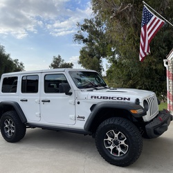
    steverpeac 6 years, 3 months ago
    Ontario Peak
    ★

    user_profile
    kappes.joe 6 years, 3 months ago
    Mount Ontario
    ★ ★ ★ ★

    user_profile
    pyramid919 6 years, 3 months ago
    Balky Hoarse Creek
    ★ ★ ★ ★ ★

    user_profile
    jlauer358 6 years, 3 months ago
    Track (5/30/20, 4:14:17PM)
    ★ ★ ★ ★

    user_profile
    garrett_wade 6 years, 3 months ago
    Track (5/29/20, 8:12:15AM)
    ★ ★ ★ ★ ★

    user_profile
    pwruve 6 years, 3 months ago
    Stockton Flats YP Site via - Lytle Creek, CA
    ★ ★ ★

    user_profile
    bigedbass 6 years, 3 months ago
    Lytle Creek (5/27/20, 9:15:20AM)
    ★ ★

    user_profile
    orangedynamite 6 years, 3 months ago
    Tahquitz Peak via South Ridge Trail
    ★ ★ ★ ★ ★

    user_profile
    jhaze66 6 years, 3 months ago
    1N64
    ★ ★ ★ ★ ★

    user_profile
    info.muratov.ch 6 years, 3 months ago
    супер трейл со сложными путями тру офф роад
    ★ ★ ★ ★ ★

    user_profile
    evan.p.france 6 years, 3 months ago
    Big Bear Night Run
    ★ ★ ★ ★ ★

    user_profile
    jlc2585 6 years, 3 months ago
    Cucamonga Peak 2020
    ★ ★ ★ ★ ★

    user_profile
    Nelson 6 years, 3 months ago
    BB Camping #1
    ★ ★ ★

    user_profile
    evan.p.france 6 years, 3 months ago
    Big Bear Run 2
    ★ ★ ★ ★ ★

    user_profile
    evan.p.france 6 years, 3 months ago
    Big Bear Run 2
    ★ ★ ★ ★ ★

    user_profile
    cghilty 6 years, 3 months ago
    Butler Peak - Fire Lookout
    ★ ★ ★ ★ ★

    user_profile
    epiqimages 6 years, 3 months ago
    Lone Pine Canyon Road to Lone Pines Meadow
    ★

    user_profile
    evan.p.france 6 years, 3 months ago
    Big Bear Run 1
    ★ ★ ★ ★ ★

    user_profile
    Ricardo Flores 6 years, 3 months ago
    50620 Burns Canyon Rd, San Bernardino County to 46094 Vale Dr, Big Bear City, CA, USA
    ★ ★ ★ ★ ★

    user_profile
    terrycronin1 6 years, 3 months ago
    Cougar Cabin to church camp
    ★ ★ ★

    user_profile
    Alex DeShazer 6 years, 3 months ago
    Track (5/24/20, 11:22:12AM)
    ★ ★ ★ ★ ★

    user_profile
    freewillprinting 6 years, 3 months ago
    Track (5/24/20, 8:52:05AM)
    ★ ★ ★ ★ ★

    user_profile
    Christopher 6 years, 3 months ago
    Deep Creek Hot Springs via Pacific Crest Trail
    ★ ★ ★ ★

    user_profile
    dm.wendell 6 years, 3 months ago
    Polique Canyon Road to 41911 North Shore Drive, San Bernardino County, CA, USA
    ★ ★ ★ ★

    user_profile
    wfriley76 6 years, 3 months ago
    Willow Creek Jeep Trail
    ★ ★ ★ ★ ★

    user_profile
    brian 6 years, 3 months ago
    Cabin to little Green Valley Loop
    ★ ★ ★ ★

    user_profile
    amanda_peterson92 6 years, 3 months ago
    2W01
    ★ ★ ★

    user_profile
    FitzHvyMtLX 6 years, 3 months ago
    Track (5/16/20, 11:52:44AM)
    ★ ★ ★ ★

    user_profile
    cdle 6 years, 3 months ago
    Cucamonga Peak
    ★ ★ ★ ★ ★

    user_profile
    g.crickon 6 years, 3 months ago
    Cleghorn Fire Road
    ★ ★ ★ ★ ★

    user_profile
    gbroderick 6 years, 3 months ago
    PCT south off hwy74
    ★ ★ ★ ★

    user_profile
    hpalomino213 6 years, 3 months ago
    Cleghorn Mountain via Cleghorn Fire Road
    ★

    user_profile
    steven22pollock 6 years, 3 months ago
    Big Bear Day Trip 5/15
    ★ ★ ★ ★

    user_profile
    nicholasjgeleng 6 years, 4 months ago
    Monument Peak via 2N49
    ★ ★ ★ ★ ★

    user_profile
    scope 6 years, 4 months ago
    1085 Cherokee St, Fawnskin to 1657 Wamego Trl, Yucca Valley, CA, USA
    ★ ★ ★ ★ ★

    user_profile
    dan 6 years, 4 months ago
    Cleghorn Mountain via Cleghorn Fire Road
    ★ ★ ★ ★ ★

    user_profile
    kevindickens68 6 years, 4 months ago
    Live Oak Landing Picnic Area to Pacific Crest Nat Sc Trail, San Bernardino County, CA, USA
    ★ ★ ★ ★ ★

    user_profile
    jamaica0318 6 years, 4 months ago
    5/16/2020 Big Bear
    ★ ★ ★ ★ ★

    user_profile
    Carlo 6 years, 4 months ago
    Pioneer
    ★ ★ ★ ★

    user_profile
    myek24 6 years, 4 months ago
    Track (5/16/20, 9:38:37AM)
    ★ ★ ★ ★ ★

    user_profile
    1HopefulRoad 6 years, 4 months ago
    Lake Baldwin via 3N69
    ★ ★ ★ ★

    user_profile
    zabquart 6 years, 4 months ago
    Track (5/16/20, 2:44:54PM)
    ★ ★ ★ ★

    user_profile
    leroy.clampitt 6 years, 4 months ago
    Good medium level loop. One hour
    ★ ★ ★ ★ ★

    user_profile
    cjohnson4516 6 years, 4 months ago
    Cleghorn Mountain via Cleghorn Fire Road
    ★

    user_profile
    jmphotography07 6 years, 4 months ago
    Pioneertown to Big Bear (5/12/20, 9:22:37AM)
    ★ ★ ★ ★ ★

    user_profile
    zimprichfamily 6 years, 4 months ago
    Lake Gregory Walk
    ★ ★ ★ ★ ★

    user_profile
    penaracingteam 6 years, 4 months ago
    Track (5/11/20, 17:08:25)
    ★ ★ ★ ★ ★

    user_profile
    Michael 6 years, 4 months ago
    Gold Mountain
    ★ ★ ★ ★ ★

    user_profile
    Ianwingenroth 6 years, 4 months ago
    Pilot Rock Truck Trail 2N33
    ★ ★ ★

    user_profile
    smarble18 6 years, 4 months ago
    Track (5/10/20, 2:54:31PM)
    ★ ★ ★ ★ ★

    user_profile
    chrisname340 6 years, 4 months ago
    Holcomb creek
    ★ ★ ★ ★ ★

    user_profile
    godanman10 6 years, 4 months ago
    Radford to 2N10
    ★ ★ ★

    user_profile
    kahochstadter 6 years, 4 months ago
    Track (5/9/20, 4:04:12PM)
    ★ ★ ★ ★ ★

    user_profile
    cmgomez27 6 years, 4 months ago
    Track (5/9/20, 6:26:07PM)
    ★ ★ ★ ★ ★

    user_profile
    Ricardo Flores 6 years, 4 months ago
    Bee canyon and San Jacinto ridge
    ★ ★ ★ ★ ★

    user_profile
    arlene609 6 years, 4 months ago
    Thomas Mountain
    ★ ★ ★ ★

    user_profile
    Bportzel 6 years, 4 months ago
    Track (1/30/20, 3:03:47PM)
    ★ ★ ★ ★

    user_profile
    Rclark450 6 years, 4 months ago
    Ernie Maxwell Trail
    ★

    user_profile
    reyeshouseofprod 6 years, 4 months ago
    3N16 / Coxey Truck Trail
    ★ ★ ★ ★ ★

    user_profile
    kmaceross 6 years, 4 months ago
    42728 Cedar Ave, Big Bear Lake to 2M51Y, San Bernardino County, CA, USA
    ★ ★ ★ ★ ★

    user_profile
    todd.ream 6 years, 4 months ago
    Track (5/3/20, 10:09:52AM)
    ★ ★ ★ ★ ★

    user_profile
    kkenaga 6 years, 4 months ago
    Lake Baldwin via 3N69
    ★ ★ ★ ★ ★

    user_profile
    lam2958 6 years, 4 months ago
    Big Bear Run 5/2/2020
    ★ ★ ★ ★ ★

    user_profile
    Tyler 6 years, 4 months ago
    3N69 – Gold Mountain
    ★ ★ ★ ★

    user_profile
    Jeff 6 years, 4 months ago
    Pioneertown to big bear
    ★ ★ ★ ★

    user_profile
    kmaceross 6 years, 4 months ago
    2N10, Big Bear Lake to Skyline Road, San Bernardino County, CA, USA
    ★ ★ ★ ★ ★

    user_profile
    kmaceross 6 years, 4 months ago
    42740 Cedar Ave, Big Bear Lake to Pirates, San Bernardino County, CA, USA
    ★ ★ ★ ★

    user_profile
    vmost66 6 years, 4 months ago
    Track (3/21/20, 8:42:28AM)
    ★ ★ ★ ★ ★

    user_profile
    Ronin717 6 years, 4 months ago
    Holcomb Valley Campground via 3N16
    ★ ★ ★ ★ ★

    user_profile
    Mike 6 years, 4 months ago
    3N16 - Holcomb Valley
    ★ ★ ★ ★ ★

    user_profile
    mdorado 6 years, 4 months ago
    Cougar Crest Trail
    ★ ★ ★ ★ ★

    user_profile
    pianojul 6 years, 4 months ago
    Cougar Crest Trail to PCT
    ★ ★ ★ ★ ★

    user_profile
    lratel 6 years, 4 months ago
    Cleghorn Mountain via Cleghorn Fire Road
    ★

    user_profile
    dzeitoun33 6 years, 4 months ago
    Icehouse Saddle via Middle Fork Trail
    ★

    user_profile
    dlalvarado03 6 years, 4 months ago
    Cleghorn Pass (4/26/20, 8:43:34AM)
    ★ ★ ★ ★ ★

    user_profile stars

    Gordon Alexander 6 years, 4 months ago
    Middle Fork of Lytle Creek to 3rd Stream Crossing
    ★ ★ ★ ★

    user_profile
    kmaceross 6 years, 4 months ago
    Wildhorse (4/26/20, 4:34:18PM)
    ★ ★ ★ ★ ★

    user_profile
    kmaceross 6 years, 4 months ago
    2N10, Big Bear Lake to Skyline Trail, San Bernardino County, CA, USA
    ★ ★ ★ ★ ★

    user_profile
    pianojul 6 years, 4 months ago
    Cougar Crest Trail to PCT
    ★ ★ ★ ★ ★

    user_profile
    skydiveblake 6 years, 4 months ago
    First spring ride
    ★ ★ ★ ★ ★

    user_profile
    kmaceross 6 years, 4 months ago
    Cougar Crest Trailhead, San Bernardino County, CA, USA
    ★ ★ ★ ★ ★

    user_profile
    rtjohn1964 6 years, 4 months ago
    Gold Mountain (4/24/20, 10:03:30AM)
    ★ ★ ★ ★ ★

    user_profile
    mdorado 6 years, 4 months ago
    Track (4/22/20, 4:35:34PM)
    ★ ★ ★ ★ ★

    user_profile
    JC Eckert 6 years, 4 months ago
    Alder Cr to Seven Oaks
    ★ ★ ★ ★ ★

    user_profile
    pkskibear 6 years, 4 months ago
    Track (4/21/20, 3:31:25PM)
    ★ ★ ★

    user_profile
    seasonedcotton 6 years, 4 months ago
    Track (4/20/20, 14:09:43)
    ★ ★ ★

    user_profile
    jherylw 6 years, 4 months ago
    Cleghorn Road to Chamise Cove, San Bernardino County, CA, USA
    ★ ★ ★ ★ ★

    user_profile
    thedinah 6 years, 4 months ago
    Big loop
    ★ ★ ★ ★ ★

    user_profile
    osuna_vince 6 years, 5 months ago
    Alder Creek Road/ Forest Road 1N16
    ★ ★ ★ ★

    user_profile
    ducmonstr 6 years, 5 months ago
    Track (4/12/20, 2:13:26PM)
    ★ ★ ★ ★

    user_profile
    Amer 6 years, 5 months ago
    Johnson valley to big bear
    ★ ★ ★ ★ ★

    user_profile
    emarquez194 6 years, 5 months ago
    Track (3/12/20, 11:52:50AM)
    ★ ★ ★ ★ ★

    user_profile
    Tim 6 years, 5 months ago
    Track (9/29/19, 11:26:41AM)
    ★ ★ ★

    user_profile
    mardel511 6 years, 5 months ago
    Track (9/21/19, 6:57:40AM)
    ★ ★ ★ ★ ★

    user_profile
    davidv.sec 6 years, 5 months ago
    Chimney Flats
    ★ ★ ★ ★

    user_profile
    jonrclegg 6 years, 5 months ago
    Willow Creek Jeep Trail 3N34
    ★ ★ ★ ★ ★

    user_profile
    R4x4Toy_Jenna 6 years, 5 months ago
    Track (4/4/20, 11:41:19AM)
    ★ ★ ★ ★

    user_profile
    ecarbajal13 6 years, 5 months ago
    Track (4/2/20, 16:13:18)
    ★ ★ ★ ★ ★

    user_profile
    legmaker76 6 years, 5 months ago
    Pilot Rock Truck Trail 2N33
    ★

    user_profile
    notoriousPIG 6 years, 5 months ago
    Cleghorn Road to Sherwood Lake Vista Point, San Bernardino County, CA, USA
    ★ ★ ★ ★

    user_profile
    Nelson 6 years, 5 months ago
    Track (3/28/20, 4:12:31PM)
    ★ ★ ★ ★ ★

    user_profile
    dondub 6 years, 5 months ago
    Apache - Devils Ladder
    ★ ★ ★ ★ ★

    user_profile
    felipecosme30 6 years, 5 months ago
    3N08
    ★

    user_profile
    notoriousPIG 6 years, 5 months ago
    1N86
    ★ ★ ★

    user_profile
    notoriousPIG 6 years, 5 months ago
    Ciennaga to Camp de Benneville Pines, San Bernardino County, CA, USA
    ★ ★ ★

    user_profile
    Philip 6 years, 5 months ago
    Track (3/18/20, 5:08:19PM)
    ★ ★ ★ ★ ★

    user_profile
    paulemontoya 6 years, 6 months ago
    Track (11/1/19, 11:44:08AM)
    ★ ★ ★ ★ ★

    user_profile
    moralesdouglas8 6 years, 6 months ago
    Track (3/14/20, 4:24:26PM)
    ★ ★ ★ ★ ★

    user_profile
    dddmarsh 6 years, 6 months ago
    3N34
    ★

    user_profile
    notoriousPIG 6 years, 6 months ago
    Black Mountain Creek to Cinco Poses Spring, Riverside County, CA, USA
    ★ ★ ★ ★ ★

    user_profile
    notoriousPIG 6 years, 6 months ago
    1N09 Shooting Range
    ★ ★ ★

    user_profile
    arlpz1987 6 years, 6 months ago
    Oak Spring, Riverside County to El Buen Cacao, Idyllwild, CA, USA
    ★ ★ ★ ★

    user_profile
    arlpz1987 6 years, 6 months ago
    Boulder Basin Campground via Black Mountain Trail
    ★

    user_profile
    Steven 6 years, 6 months ago
    Track (2/26/20, 5:31:35PM)
    ★ ★ ★ ★ ★

    user_profile
    Chris Quimbo 6 years, 6 months ago
    3N08
    ★ ★

    user_profile
    @NINE8LC 6 years, 6 months ago
    Track (2/15/20, 11:56:24AM)
    ★ ★ ★ ★ ★

    user_profile
    Jon Scott 6 years, 7 months ago
    Grandview Point
    ★ ★ ★ ★ ★

    user_profile
    mamendez4 6 years, 7 months ago
    3n34
    ★ ★ ★

    user_profile
    MTN-NEF 6 years, 7 months ago
    38625 Talbot Dr to 38619 Talbot Dr, Big Bear Lake, CA, USA
    ★ ★ ★

    user_profile
    kkenaga 6 years, 7 months ago
    Keller Peak
    ★ ★ ★ ★ ★

    user_profile
    Randy 6 years, 7 months ago
    Deep Creek Hot Springs via Pacific Crest Trail
    ★

    user_profile
    jashuarobles 6 years, 7 months ago
    2W01
    ★

    user_profile
    Subiejunior89 6 years, 7 months ago
    Track (2/9/20, 9:04:19AM)
    ★ ★ ★ ★

    user_profile
    Subiejunior89 6 years, 7 months ago
    Level hard
    ★ ★ ★ ★

    user_profile
    Creative Shift Media 6 years, 7 months ago
    ★ ★ ★ ★ ★

    user_profile
    gershom 6 years, 7 months ago
    Timber Mountain via Icehouse Canyon Trail
    ★ ★ ★ ★

    user_profile
    tvnealy 6 years, 7 months ago
    Lake Baldwin via 3N69
    ★

    user_profile
    supermike46 6 years, 7 months ago
    右转下坡
    ★ ★ ★ ★ ★

    user_profile
    Rob 6 years, 7 months ago
    Juan Diego Flats Road to Cahuilla Mountain Trail #2E45
    ★ ★ ★ ★

    user_profile
    Mark 6 years, 7 months ago
    Track (1/25/20, 09:56:44)
    ★ ★ ★ ★

    user_profile
    toby.a.dingle 6 years, 7 months ago
    Lytle Creek Trail Run
    ★ ★ ★ ★ ★

    user_profile
    Mjmedeiros1 6 years, 7 months ago
    Gold mountain
    ★ ★ ★ ★ ★

    user_profile
    Rodrigo82nd 6 years, 7 months ago
    Cucamonga Peak
    ★ ★

    user_profile
    Chris 6 years, 7 months ago
    ★ ★ ★ ★

    user_profile
    Chris 6 years, 7 months ago
    ★ ★ ★ ★

    user_profile
    Nathan 6 years, 7 months ago
    Third Stream Crossing Trek (1/18-19)
    ★ ★ ★ ★ ★

    user_profile
    Nathan 6 years, 7 months ago
    Third Stream Crossing Trek (1/18-19)
    ★ ★ ★ ★ ★

    user_profile
    davidv.sec 6 years, 7 months ago
    Track (1/18/20, 10:31:3)
    ★ ★ ★ ★ ★

    user_profile
    ymasis2016 6 years, 7 months ago
    Pilot Rock Truck Trail 2N33 and Pilot Rock Truck Trail
    ★ ★ ★ ★ ★

    user_profile
    davidmorris550 6 years, 8 months ago
    Ernie Maxwell Scenic Trail Hike
    ★ ★ ★ ★

    user_profile
    mzagola 6 years, 8 months ago
    5S07 Bee Canyon Truck Trail to Cedar Drive
    ★ ★ ★ ★ ★

    user_profile
    Dillon 6 years, 8 months ago
    Pacific Crest Trail
    ★ ★ ★ ★ ★

    user_profile
    Chris Velardi 6 years, 8 months ago
    2N49
    ★ ★ ★ ★ ★

    user_profile
    mikejheim 6 years, 8 months ago
    Cleghorn Road from i15 to CA 138
    ★ ★ ★ ★

    user_profile
    bbdogger 6 years, 8 months ago
    Track (12/29/19, 1:23:59PM)
    ★ ★ ★ ★

    user_profile
    mzagola 6 years, 8 months ago
    Thomas Mountain 12/29/19
    ★ ★ ★ ★

    user_profile
    claudia.leon15 6 years, 8 months ago
    Lake Baldwin via 2N02 and Burns Canyon Road
    ★ ★ ★ ★ ★

    user_profile
    hbmikenspike 6 years, 8 months ago
    Track (12/21/19, 1:42:32PM)
    ★ ★ ★ ★

    user_profile
    Chris 6 years, 9 months ago
    ★ ★ ★ ★

    user_profile
    dillonwilke 6 years, 9 months ago
    Big Bear Walk
    ★ ★ ★

    user_profile
    petereberhardtbmx 6 years, 9 months ago
    3N16 - Holcomb Valley
    ★ ★ ★ ★

    user_profile
    ecarbajal13 6 years, 9 months ago
    Track (12/8/19, 14:25:43)
    ★ ★

    user_profile
    bmilam4 6 years, 9 months ago
    Monument Peak via 2N49
    ★

    user_profile
    Quyluu88 6 years, 9 months ago
    Cleghorn Mountain via Cleghorn Fire Road
    ★ ★

    user_profile
    395 Expeditions 6 years, 9 months ago
    Lytle Creek
    ★ ★ ★ ★ ★

    user_profile
    Lance616 6 years, 9 months ago
    ★ ★ ★ ★ ★

    user_profile
    rbetts2 6 years, 9 months ago
    Keller Peak Loop
    ★ ★ ★ ★ ★

    user_profile
    mzagola 6 years, 9 months ago
    Berns Canyon (Snow!!!)
    ★ ★ ★ ★

    user_profile
    Randy 6 years, 9 months ago
    Track (7/6/19, 3:08:29PM)
    ★

    user_profile
    samuelsons4 6 years, 9 months ago
    Pilot Rock Truck Trail 2N33 and Pilot Rock Truck Trail
    ★ ★ ★

    user_profile
    Renato 6 years, 9 months ago
    Cleghorn Mountain via Cleghorn Fire Road
    ★ ★ ★

    user_profile
    milorisen 6 years, 9 months ago
    3N10
    ★ ★ ★ ★ ★

    user_profile
    cardsalo 6 years, 9 months ago
    2NO2 Burns Canyon
    ★ ★ ★ ★ ★

    user_profile
    olevesque 6 years, 10 months ago
    Big Bear Lake
    ★

    user_profile
    rdcarter111 6 years, 10 months ago
    Track (11/3/19, 12:05:30PM)
    ★ ★ ★ ★ ★

    user_profile
    GPCHQ1 Adventures 6 years, 10 months ago
    Wild Horse Meadows
    ★ ★

    user_profile
    LPJ24 6 years, 10 months ago
    Telegraph Peak Loop via Mount Baldy Road and Three Ts Trail
    ★ ★

    user_profile
    ynowicki 6 years, 10 months ago
    Jenks Lake, Angelus Oaks (11/13/19, 2:33:45PM)
    ★ ★ ★ ★ ★

    user_profile
    JP 6 years, 10 months ago
    Track (11/12/19, 11:47:29)
    ★ ★ ★ ★

    user_profile
    RockLoverBob 6 years, 10 months ago
    T3N08 (10/22/16, 13:20:12)
    ★ ★ ★ ★

    user_profile
    linasvitkus 6 years, 10 months ago
    Rambynas to Green Valley
    ★ ★ ★ ★

    user_profile
    christopher.robinson 6 years, 10 months ago
    Burns Canyon Rd
    ★ ★ ★ ★ ★

    user_profile
    notoriousPIG 6 years, 10 months ago
    2N10, Big Bear Lake to Deer Campsite, San Bernardino County, CA, USA
    ★ ★ ★ ★

    user_profile
    kelsey.zuppan 6 years, 10 months ago
    Ontario Peak
    ★ ★ ★

    user_profile
    cabotomfox 6 years, 10 months ago
    Track (11/5/19, 1:18:18PM)
    ★ ★ ★ ★

    user_profile
    Rutherford4 6 years, 10 months ago
    8/31/19, 10:26:0)BB to Pioneertown
    ★ ★ ★

    user_profile
    btocalderas619 6 years, 10 months ago
    Cleghorn Mountain via Cleghorn Fire Road
    ★ ★ ★ ★ ★

    user_profile
    Sabastian 6 years, 10 months ago
    Yellow Post 4 via Thomas Mountain Road
    ★ ★ ★ ★ ★

    user_profile
    sanchezjess8 6 years, 10 months ago
    Track (11/3/19, 8:55:04AM)
    ★ ★ ★ ★ ★

    user_profile
    doug.mclaughlin 6 years, 10 months ago
    Jeep squeeze trip
    ★ ★ ★ ★ ★

    user_profile
    gurneyjock 6 years, 10 months ago
    Cleghorn (11/3/19, 10:46:37AM)
    ★ ★ ★ ★ ★

    user_profile
    oceans0ul 6 years, 10 months ago
    Rouse Meadow deer hunt
    ★ ★ ★ ★ ★

    user_profile
    toby.a.dingle 6 years, 10 months ago
    Big Bear Holcomb Part 2
    ★ ★ ★ ★ ★

    user_profile
    visionlirong 6 years, 10 months ago
    航程 (2019/11/2 15:54:26)
    ★ ★ ★ ★ ★

    user_profile
    visionlirong 6 years, 10 months ago
    航程 (2019/11/2 09:56:44)
    ★ ★ ★ ★ ★

    user_profile
    Mark 6 years, 10 months ago
    Hike on Ernie Maxwell Trail - Idyllwild, CA
    ★

    user_profile
    ddunerider 6 years, 10 months ago
    Track (10/27/19, 12:59:02PM)
    ★ ★ ★

    user_profile
    ddunerider 6 years, 10 months ago
    Coxey trail from Hesperian
    ★ ★ ★ ★

    user_profile
    Camper Dave 6 years, 10 months ago
    Juan Diego Flats Road
    ★ ★ ★ ★ ★

    user_profile
    Camper Dave 6 years, 10 months ago
    Track (10/20/19, 9:04:37AM)
    ★ ★ ★ ★

    user_profile
    Allison 6 years, 10 months ago
    Cucamonga Peak
    ★ ★

    user_profile
    smmiliotti 6 years, 10 months ago
    Cleghorn Road to Sherwood Lake Vista Point, San Bernardino County, CA, USA
    ★ ★ ★ ★

    user_profile
    duthieer 6 years, 10 months ago
    GVL Loop
    ★ ★ ★ ★ ★

    user_profile
    hunter2lab 6 years, 11 months ago
    Fisherman's Group Camp via 2W07
    ★ ★

    user_profile
    Camper Dave 6 years, 11 months ago
    Black mount truck trail
    ★ ★ ★ ★ ★

    user_profile
    alex.sidtis 6 years, 11 months ago
    Track (10/12/19, 11:22:21AM)
    ★ ★ ★

    user_profile
    m.finch 6 years, 11 months ago
    Sugarloaf Mountain via Wildhorse Meadows Road
    ★ ★

    user_profile
    dlm1960 6 years, 11 months ago
    Timber Mountain via Icehouse Canyon Trail
    ★ ★ ★

    user_profile
    edward001 6 years, 11 months ago
    Big Bear
    ★ ★ ★ ★ ★

    user_profile
    Bo 6 years, 11 months ago
    Cloudland Truck Trail- 9/28/19
    ★ ★ ★ ★

    user_profile
    tawney.schmitt1 6 years, 11 months ago
    Cloudland Truck Trail
    ★ ★ ★ ★ ★

    user_profile
    dotus1 6 years, 11 months ago
    Lake Arrowhead - Aztec Falls Trail
    ★ ★ ★ ★ ★

    user_profile
    davedevo 6 years, 11 months ago
    Pilot Rock Truck Trail 2N33
    ★

    user_profile
    dotus1 6 years, 11 months ago
    Lake Arrowhead - Aztec Falls Trail
    ★ ★ ★ ★ ★

    user_profile
    Raymond.venzon 6 years, 11 months ago
    Skyline trail with detour at Big Bear (9/22/19, 10:44:53AM)
    ★ ★ ★ ★

    user_profile
    PatriceB60 6 years, 11 months ago
    Cucamonga Peak
    ★ ★ ★ ★

    user_profile
    micrad64 6 years, 11 months ago
    Track (9/20/19, 12:01:05PM)
    ★ ★ ★ ★ ★

    user_profile
    Avila.mike 6 years, 11 months ago
    Track (9/20/19, 2:24:38PM)
    ★ ★ ★

    user_profile
    k.jfitz 7 years ago

    Etiwanda Peak via Cucamonga Peak Trail and Icehouse Canyon Trail
    ★

    user_profile
    tysonca 7 years ago

    Ontario Peak and Bighorn Peak via Ica House Canyon
    ★ ★ ★ ★ ★

    user_profile
    lci.shawn 7 years ago
    Track (9/13/19, 7:11:15AM)
    ★ ★ ★ ★ ★

    user_profile
    Bo 7 years ago
    Long drive home Sheep Creek Cyn
    ★ ★ ★ ★ ★

    user_profile
    Jerry Grenard 7 years ago
    Track (9/11/19, 3:17:48PM)
    ★ ★ ★ ★

    user_profile
    Jpfrieze 7 years ago
    Cleghorn Ridge/Pilot Rock Road
    ★ ★ ★

    user_profile
    josh.nass 7 years ago
    Bertha Peak to Cougar Crest Trailhead, San Bernardino County, CA, USA
    ★ ★ ★ ★

    user_profile
    dunerjj48 7 years ago
    Track (9/8/19, 10:34:07AM)
    ★ ★ ★ ★ ★

    user_profile
    jcanale 7 years ago
    Cucamonga peak Icehouse
    ★ ★ ★ ★

    user_profile
    dunerjj48 7 years ago
    Track (9/7/19, 7:44:57AM)
    ★ ★ ★ ★ ★

    user_profile
    pyramid919 7 years ago
    Track (9/5/19, 7:12:28AM)
    ★ ★ ★ ★ ★

    user_profile
    Omri 7 years ago
    Ontario Peak
    ★ ★ ★ ★ ★

    user_profile
    thedinah 7 years ago
    Deer springs trail 9/1/19
    ★ ★ ★ ★ ★

    user_profile
    Maverick909 7 years ago
    Skyline trail (9/1/19, 16:33:11)
    ★ ★ ★ ★

    user_profile
    cyung 7 years ago
    Track (8/31/19, 11:00:51AM)
    ★ ★ ★ ★ ★

    user_profile
    btocalderas619 7 years ago
    Track (7/4/19, 5:25:30PM)
    ★ ★ ★

    user_profile
    tvnealy 7 years ago
    Track (8/28/19, 16:33:12)
    ★ ★ ★

    user_profile
    jdavisweldfab 7 years ago
    Track (8/30/19, 6:05:00PM)
    ★ ★ ★

    user_profile
    ha4e3m 7 years ago
    Cleghorn
    ★ ★ ★ ★

    user_profile
    phalleropia 7 years ago
    Pinnacles to Splinter 8/28/19
    ★ ★ ★ ★

    user_profile
    Badbob 7 years ago
    Track (8/25/19, 7:41:36AM)
    ★ ★ ★ ★ ★

    user_profile
    cberletich 7 years ago
    Track (8/25/19, 8:40:50AM)
    ★ ★ ★ ★ ★

    user_profile
    giovruiz 7 years ago
    Track (8/24/19, 3:39:44PM)
    ★ ★ ★

    user_profile
    mirko_zizka 7 years ago
    Cucamonga Peak
    ★

    user_profile stars

    rstrittmatter 7 years ago

    Grand viewpoint by pineknot
    ★ ★ ★ ★ ★

    user_profile
    gjaruspini 7 years ago
    Cucamonga Peak
    ★ ★ ★

    user_profile
    georgencopy 7 years ago

    Track (8/22/19, 12:35:52PM)
    ★ ★ ★ ★

    user_profile
    ronthompson123 7 years ago

    Icehouse Saddle via Icehouse Canyon Trail
    ★ ★

    user_profile
    murph2308 7 years ago
    Track (8/21/19, 12:20:31)
    ★ ★ ★ ★

    user_profile
    n2roost 7 years ago

    Track (8/21/19, 9:31:27AM)
    ★

    user_profile
    jessplaincrazy 7 years ago

    Cougar Crest Trail
    ★ ★ ★ ★ ★

    user_profile
    tvnealy 7 years ago

    Big Bear Lake
    ★

    user_profile
    Joel R 7 years ago
    Drive: Cleghorn Road EtoW - Most of the Offshoots
    ★ ★ ★ ★ ★

    user_profile
    Badbob 7 years, 1 month ago
    Track (8/16/19, 10:57:06AM)
    ★ ★ ★ ★ ★

    user_profile
    ryandiazmusic 7 years, 1 month ago
    Track (8/13/19, 11:20:15AM)
    ★ ★ ★ ★ ★

    user_profile
    Ben 7 years, 1 month ago
    Icehouse Canyon to Cucamonga Peak
    ★ ★ ★ ★ ★

    user_profile
    mzagola 7 years, 1 month ago
    Bee Canyon (Part 2)
    ★ ★ ★ ★

    user_profile
    rdcarter111 7 years, 1 month ago
    Track (8/11/19, 12:26:48PM)
    ★ ★ ★ ★

    user_profile
    canyonbumadventures 7 years, 1 month ago
    Tahquitz Peak via South Ridge Trail
    ★ ★ ★ ★ ★

    user_profile
    Greg 7 years, 1 month ago
    Track (8/1/19, 11:39:21)
    ★ ★ ★ ★ ★

    user_profile
    Karen 7 years, 1 month ago
    Cucamonga peak
    ★ ★ ★ ★

    user_profile
    dsullivanstudio 7 years, 1 month ago
    Track (8/10/19, 11:09:18AM)
    ★ ★ ★ ★

    user_profile
    Chin So 7 years, 1 month ago
    Cucamonga Peak via Icehouse Canyon Trailhead
    ★ ★ ★ ★ ★

    user_profile
    balderol 7 years, 1 month ago
    Track (8/4/19, 12:10:45PM)
    ★ ★ ★ ★ ★

    user_profile
    JCouto 7 years, 1 month ago
    Track (8/3/19, 10:22:31AM)
    ★ ★ ★ ★ ★

    user_profile
    allenhurff 7 years, 1 month ago
    First circuit ever walked through church property
    ★ ★ ★ ★ ★

    user_profile
    circajule 7 years, 1 month ago
    Kelly Camp via Icehouse Canyon Trail
    ★ ★ ★ ★

    user_profile
    Mike 7 years, 1 month ago
    YP#25, San Bernardino County to Home Warehouse Design Center, Big Bear Lake, CA, USA
    ★ ★ ★ ★ ★

    user_profile
    georound 7 years, 1 month ago
    Track (7/20/19, 3:12:30PM)
    ★ ★ ★ ★

    user_profile
    joshualoyakin 7 years, 1 month ago
    Track (7/28/19, 8:13:04AM)
    ★ ★ ★ ★ ★

    user_profile
    rickdebjenkins 7 years, 1 month ago
    Track (7/26/19, 2:34:10PM)
    ★ ★ ★

    user_profile
    rickdebjenkins 7 years, 1 month ago
    Track (7/26/19, 2:34:10PM)
    ★ ★ ★

    user_profile
    jcducca 7 years, 1 month ago
    Hike the Three T’s Trail
    ★ ★ ★ ★ ★

    user_profile
    eacook1 7 years, 1 month ago
    2N61Y Heartbreak Ridge
    ★

    user_profile
    Brandon 7 years, 1 month ago
    Track (7/13/19, 08:25:49)
    ★ ★ ★ ★ ★

    user_profile
    cghilty 7 years, 1 month ago
    sailing big bear lake (7/23/19, 9:37:02AM)
    ★ ★ ★ ★ ★

    user_profile
    sophielin55 7 years, 1 month ago
    Cucamonga Peak (7/21/19, 7:56:36AM)
    ★ ★ ★ ★ ★

    user_profile
    yyu6788 7 years, 1 month ago
    Track (7/20/19, 2:39:10PM)from the Norch to ski lift at the
    ★ ★ ★ ★ ★

    user_profile
    lamyers101 7 years, 1 month ago
    Track (7/19/19, 7:07:42AM)
    ★ ★ ★ ★ ★

    user_profile
    d19660101 7 years, 2 months ago
    Deep Greek Track 7/16/19
    ★ ★ ★ ★ ★

    user_profile
    Brandon 7 years, 2 months ago
    Track (7/13/19, 08:25:49)
    ★ ★ ★ ★ ★

    user_profile
    Brandon 7 years, 2 months ago
    Track (7/13/19, 08:25:49)
    ★ ★ ★ ★ ★

    user_profile
    yyu6788 7 years, 2 months ago
    Ontario Peak (7/14/19, 6:12:34AM)
    ★ ★ ★ ★ ★

    user_profile
    nrkaufman 7 years, 2 months ago
    3N08
    ★

    user_profile
    ryan.larkan 7 years, 2 months ago
    22 Miles
    ★ ★ ★ ★ ★

    user_profile
    Austin 7 years, 2 months ago
    Big Bear trail
    ★ ★ ★ ★ ★

    user_profile
    bsconnelly 7 years, 2 months ago
    Cucamonga Peak via Icehouse Canyon (7/6/19, 6:36:18AM)
    ★ ★ ★ ★

    user_profile
    jvlb06 7 years, 2 months ago
    Icehouse Saddle Loop via Icehouse Canyon Trail and Chapman Trail
    ★ ★ ★ ★ ★

    user_profile
    bbdogger 7 years, 2 months ago
    Big Bear John Bull
    ★ ★ ★ ★ ★

    user_profile
    ariamiran@gmail.com 7 years, 2 months ago
    Pioneertown to Big Bear City
    ★ ★ ★ ★

    user_profile
    Derek 7 years, 2 months ago
    Greenspot Road to Thomas Hunting Ground Road/ Forest Road 1N12
    ★ ★ ★

    user_profile
    nick 7 years, 2 months ago
    Big Bear run with ProTaco17 (6/29/19, 12:29:09PM)
    ★ ★ ★ ★

    user_profile
    Anthony 7 years, 2 months ago
    South Coast Region Track 11
    ★ ★ ★ ★ ★

    user_profile
    1love2run81 7 years, 2 months ago
    Cucamonga Peak
    ★

    user_profile
    Cpbronco 7 years, 2 months ago
    Cucamonga Peak (6/26/19, 07:18:53)
    ★ ★ ★ ★ ★

    user_profile
    noelproj 7 years, 2 months ago
    Icehouse Canyon Trailhead to Cucamonga Peak Trail
    ★ ★ ★ ★ ★

    user_profile
    Ben 7 years, 2 months ago
    Wildhorse Creek Trail to Sugarloaf Mountain
    ★ ★ ★ ★

    user_profile
    adamferraralogin 7 years, 2 months ago
    2NO2 Burns Canyon
    ★ ★ ★ ★

    user_profile
    chrisdbond 7 years, 2 months ago
    South Old Toll Road to 27456 Pinewood Dr, Lake Arrowhead, CA, USA
    ★ ★ ★ ★ ★

    user_profile
    wildpanda86 7 years, 2 months ago
    Devils Hole
    ★ ★ ★ ★

    user_profile
    giegarb 7 years, 2 months ago
    ★

    user_profile
    mikekahrs 7 years, 2 months ago
    Track (6/19/19, 10:00:16AM)
    ★ ★ ★ ★

    user_profile
    Ali 7 years, 3 months ago
    Track (6/16/19, 8:16:38AM)
    ★ ★ ★ ★ ★

    user_profile
    btocalderas619 7 years, 3 months ago
    Cleghorn Road to Sherwood Lake Vista Point, San Bernardino County, CA, USA
    ★ ★ ★ ★ ★

    user_profile
    glennnewcomer 7 years, 3 months ago
    Sugarloaf trailhead to home
    ★ ★ ★ ★ ★

    user_profile
    Dan 7 years, 3 months ago
    15 Miles
    ★ ★ ★ ★ ★

    user_profile
    David 7 years, 3 months ago
    2NO2 Burns Canyon
    ★ ★ ★ ★ ★

    user_profile
    jaypers1 7 years, 3 months ago
    Hooks Creek, Lake Arrowhead to Rim of the World Drive, San Bernardino County, CA, USA
    ★ ★ ★ ★ ★

    user_profile
    gerardjsanchez 7 years, 3 months ago
    Kelly Camp via Icehouse Canyon Trail
    ★ ★ ★ ★ ★

    user_profile
    Ben 7 years, 3 months ago
    Wildhorse Creek Trail Family Day Hike
    ★ ★ ★ ★ ★

    user_profile
    cameronzr 7 years, 3 months ago
    44595 Seven Oaks Rd to 37879 Upper Road, San Bernardino County, CA, USA
    ★ ★ ★ ★ ★

    user_profile
    zsbarlow19 7 years, 3 months ago
    Pilot Rock Truck Trail 2N33 and Pilot Rock Truck Trail
    ★

    user_profile
    don.bower 7 years, 3 months ago
    Holcomb Valley Road to Polique Canyon Road, San Bernardino County, CA, USA
    ★ ★ ★ ★

    user_profile
    kirakosyan.ara 7 years, 3 months ago
    Big Bear Area Regional Wastewater Agency, Big Bear City to Polique Canyon Road, San Bernardino County, CA, USA
    ★ ★ ★ ★

    user_profile
    scotthamiltoncpa 7 years, 3 months ago
    Track (4/14/19, 10:01:59AM)
    ★ ★ ★ ★

    user_profile
    john.coyan 7 years, 3 months ago
    Track (6/3/19, 4:01:11AM)
    ★ ★ ★ ★ ★

    user_profile
    Derek 7 years, 3 months ago
    Track (6/2/19, 3:36:55PM)
    ★ ★ ★ ★

    user_profile
    slimjoey14t 7 years, 3 months ago
    SoCal Overland trip Big Bear 1-2 June
    ★ ★ ★ ★ ★

    user_profile
    steve.hurlbut 7 years, 3 months ago
    tocamp
    ★ ★ ★ ★ ★

    user_profile
    Jccbrrr600 7 years, 3 months ago
    Etiwanda falls
    ★ ★ ★ ★ ★

    user_profile
    Paul 7 years, 3 months ago
    Icehouse Canyon Trailhead to Cucamonga Peak Trail
    ★ ★ ★ ★ ★

    user_profile
    Byars 7 years, 3 months ago
    Yellow Post #5 to Polique Canyon Road, San Bernardino County, CA, USA
    ★ ★ ★ ★ ★

    user_profile
    werner.zorman 7 years, 3 months ago
    Etiwanda Preserve - Unnamed Peak
    ★ ★ ★ ★

    user_profile
    allenhurff 7 years, 3 months ago
    Ever day duo
    ★ ★ ★ ★ ★

    user_profile
    Fran Serna 7 years, 3 months ago
    Castle Rock Trail
    ★ ★ ★

    user_profile
    DylanVB 7 years, 3 months ago
    Track (3/24/19, 2:55:05PM)
    ★ ★ ★ ★ ★

    user_profile
    Anonymous User 7 years, 3 months ago
    Cleghorn Road to Wells Road, San Bernardino County, CA, USA
    ★ ★ ★ ★ ★

    user_profile
    riosluis 7 years, 3 months ago
    HOLCOMB VALLEY & BIG BEAR
    ★ ★ ★ ★

    user_profile
    jwlinthicum 7 years, 3 months ago
    Grand View Point Loop via 2N17
    ★ ★ ★ ★

    user_profile
    Steve 7 years, 3 months ago
    Big Bear - 3N69 Gold Mnt
    ★ ★ ★ ★ ★

    user_profile
    chainring22 7 years, 3 months ago
    Track (5/24/19, 1:02:43PM)
    ★ ★ ★ ★ ★

    user_profile
    chainring22 7 years, 3 months ago
    Track (5/19/19, 1:40:48PM)
    ★ ★ ★ ★ ★

    user_profile
    dunale710 7 years, 3 months ago
    ★ ★ ★

    user_profile
    lousbear 7 years, 3 months ago
    Snow Summit to Chair 7, San Bernardino County, CA, USA
    ★ ★

    user_profile
    Wonderoffroad 7 years, 4 months ago
    Track (5/18/19, 10:45:05AM)
    ★ ★ ★ ★ ★

    user_profile
    Wonderoffroad 7 years, 4 months ago
    Camp Good News, San Bernardino County, CA, USA
    ★ ★ ★

    user_profile
    chainring22 7 years, 4 months ago
    Track (5/17/19, 10:19:51AM)
    ★ ★ ★ ★ ★

    user_profile
    chainring22 7 years, 4 months ago
    Track (5/14/19, 10:20:36AM)
    ★ ★ ★ ★ ★

    user_profile
    Mike 7 years, 4 months ago
    Track (5/13/19, 5:50:08PM)
    ★ ★ ★ ★ ★

    user_profile
    goliver72918 7 years, 4 months ago
    Seven Oaks Mountain Resort
    ★

    user_profile
    allenhurff 7 years, 4 months ago
    23074 Cedar Way to Cedar Lane, Crestline, CA, USA
    ★ ★ ★ ★ ★

    user_profile
    steveoliver3 7 years, 4 months ago
    Seven Oaks Mountain Cabins to Converse Creek, San Bernardino County, CA, USA
    ★ ★ ★ ★ ★

    user_profile
    doug.mclaughlin 7 years, 4 months ago
    Hike-Up Clubview down Fallline - Mother’s Day
    ★ ★ ★ ★

    user_profile
    jazran 7 years, 4 months ago
    27th Annual Big Bear Jeep Jamboree - Blue Group - Super Modified - Day 1
    ★ ★ ★ ★ ★

    user_profile
    HikerRn 7 years, 4 months ago
    Icehouse Creek to Icehouse Canyon Trailhead
    ★ ★ ★ ★

    user_profile
    batwingvictor 7 years, 4 months ago
    Cleghorn Ridge Fire Road
    ★ ★ ★ ★ ★

    user_profile
    Bo 7 years, 4 months ago
    Lost with Pacific4Wheelers

    ★ ★ ★ ★

    user_profile
    Sam A 7 years, 4 months ago

    Wedding Planning
    ★ ★ ★ ★ ★

    user_profile
    brianrichardjackson 7 years, 4 months ago
    Track (6/1/17, 6:12:35AM)
    ★ ★ ★ ★ ★

    user_profile
    Bo 7 years, 4 months ago
    3N29 Sharpless Ranch_California
    ★ ★ ★ ★

    user_profile
    lngbdrsfr 7 years, 5 months ago
    ★ ★ ★ ★

    user_profile
    billjedwards6 7 years, 5 months ago
    ★

    user_profile
    oliversulek 7 years, 6 months ago
    ★ ★ ★