United States
›
New Mexico
›
Bandelier National Monument

Best Hiking Trails in Bandelier National Monument

26 reviews


link Copy Link email Email directions Driving Directions

Seasonal Popularity

Overview

Bandelier National Monument is a national park in New Mexico.


Resources

  • nps.gov
  • wikipedia

Land Info

  • Camping: fee required

  • Hiking Trails (20)
  • Reviews (26)
  1. 1
    Frijoles Canyon Overlook Loop via Main Ruin Loop
    ★ ★ ★ ★ ★ EASY 2.8 mi
  2. 2
    Tsankawi Pueblo Trail
    ★ ★ ★ ★ ★ EASY 1.6 mi
  3. 3
    Cottonwood Picnic Area via Frey Trail
    ★ ★ ★ ★ ★ EASY 2.1 mi
  4. 4
    Cerro Grande Trailhead Parking Lot Loop via Blue Trail
    ★ ★ ★ ★ ★ EASY 4.8 mi
  5. 5
    Cottonwood Picnic Area Loop via Long Trail and Burro Trail
    ★ ★ ★ ★ ★ EASY 2.5 mi
  6. 6
    Alcove House via Main Ruin Loop
    ★ ★ ★ ★ ★ EASY 1.9 mi
  7. 7
    Cottonwood Picnic Area via Middle Alamo Trail and Long Trail
    ★ ★ ★ ★ DIFFICULT 12.0 mi
  8. 8
    Frijoles Canyon Viewpoint via Upper Frijoles Canyon Overlook Ski Trail
    ★ ★ ★ ★ ★ EASY 2.0 mi
  9. 9
    Visitor Center via Frijoles Trail
    ★ ★ ★ ★ MODERATE 7.7 mi
  10. 10
    Ponderosa Trailhead Parking Lot via Ponderosa Trail
    ★ ★ ★ ★ EASY 1.3 mi
    user_profile
    Jay Yos 2 years, 11 months ago
    Cerro Grande
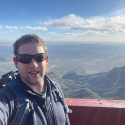
    One of my favorite hikes of all time. The route isn’t too long, and the views along the way are majestic, especially at the summit 😎
    ★ ★ ★ ★ ★

    user_profile
    chell 2 years, 11 months ago
    Hike w/ Evs (6/6/23, 10:29:38AM)
    beautiful, but a bit gravely and the valley was rather humid. great hike to do on a day without thunder!
    ★ ★ ★ ★

    user_profile
    jochenette 3 years, 2 months ago
    Bandelier Middle Alamo and Yapashi Pueblo out & back (3/29/23, 10:04:31AM)
    Scenic hike to a remote, mostly unexcavated pueblo site with many potsherds on the ground (not for the taking!) Mostly the trail rises and falls gently after the initial 400-foot ascent out of Frijoles Canyon. Alamo Canyon, though, requires a descent and ascent of about 500 to 600 feet each direction on a well-engineered grade involving 22 to 23 switchbacks. Alamo Canyon’s walls and rock formations are dramatic. Two smaller canyons of 100+ feet and two minor drainages complete the primary vertical relief. The many views of mountain ranges in several directions are a great payoff of this hike. So is the oasis-like quality of middle Alamo Canyon, where the stream ran energetically and clearly on our day there (late March).
    ★ ★ ★ ★

    user_profile
    jblakey102 4 years, 6 months ago
    Cottonwood Picnic Area via Middle Alamo Trail and Long Trail
    We hiked the Yapashi Ruins/Stone Lions trail in mid-November. Due to sun exposure, summer hikes would be very hot, so are not recommended. Vegetation was unremarkable at this time of year and high desert terrain was typical brown and dusty. The canyons had lusher vegetation and much appreciated shade. Rock formations in the canyons were spectacular. The stone lions were underwhelming, but archeological interesting. Elevation gain was over 2500 feet over the course of the hike.
    ★ ★ ★ ★

    user_profile
    Bruce59 4 years, 6 months ago
    Track (11/9/21, 11:30:45AM)
    The painted cave is worth the effort.
    ★ ★ ★

    user_profile
    NittanyLion_1 5 years, 10 months ago
    Cerro Grande South (7/31/20, 8:18:34AM)
    Parked at Cerro Grande Trail lot at 8am on Friday (0 cars). Crossed 4 and headed south on small trail. First half of hike is in pine first with burned trees. Trail is close to a forest service road with some traffic noise. Then you get to a loop in new aspen growth. The trail has no views here and gets claustrophobic. Signs or deer/elk but saw none. This trail is not worth doing again.
    ★ ★

    user_profile
    robertlguenther5 1 year, 10 months ago
    Cerro Grande
    ★ ★ ★ ★

    user_profile
    Kiran Hill 3 years ago
    Track (5/13/23, 1:38:20PM)
    ★ ★ ★ ★

    user_profile
    jamieorc 3 years, 3 months ago
    Cerro Grande Burros Snow
    ★ ★ ★ ★

    user_profile
    robertlguenther5 3 years, 5 months ago
    Ponderosa/Frijoles Canyon
    ★ ★ ★ ★

    user_profile
    russellfory 3 years, 7 months ago
    Cerro Grande
    ★ ★ ★ ★ ★

    user_profile
    jamieorc 3 years, 10 months ago
    Bobcat ting the Cerro Grande
    ★ ★ ★ ★ ★

    user_profile
    bfsandoval 4 years, 6 months ago
    Cerro Grande
    ★ ★ ★ ★

    user_profile
    robertlguenther5 4 years, 6 months ago
    Sawyer Mesa
    ★ ★ ★

    user_profile
    robertlguenther5 4 years, 6 months ago
    Ponderosa trail, Bandelier
    ★ ★ ★ ★

    user_profile
    robertlguenther5 4 years, 7 months ago
    Ponderosa trail, Bandelier
    ★ ★ ★ ★

    user_profile
    robertlguenther5 4 years, 7 months ago
    Ponderosa trail, Bandelier
    ★ ★ ★ ★

    user_profile
    mwillms 4 years, 7 months ago
    WW Cerro Grande Peak (10/10/21, 2:34:11PM)
    ★ ★ ★ ★ ★

    user_profile
    gvanmoor 5 years, 3 months ago
    Stone Lions Alamo Canyon lower and upper crossing loop
    ★ ★ ★ ★ ★

    user_profile
    john.berg.44 5 years, 6 months ago
    Track (7/12/15, 11:59:51AM)
    ★

    user_profile
    mwillms 5 years, 6 months ago
    Track (11/14/20, 10:02:56AM)
    ★ ★ ★ ★ ★

    user_profile
    NittanyLion_1 5 years, 10 months ago
    Cerro Grande (7/22/20, 8:39:13AM)
    ★ ★ ★ ★ ★

    user_profile
    mholmes 6 years, 2 months ago
    ★ ★ ★ ★ ★

    user_profile
    patchett2002 6 years, 4 months ago
    Apache Springs Trailhead Parking Lot, Los Alamos County, NM, USA
    ★ ★ ★ ★

    user_profile
    akusantafe 6 years, 6 months ago
    Mid Alamo loop
    ★ ★ ★ ★ ★

    user_profile
    othompson002 7 years, 2 months ago
    ★ ★ ★ ★ ★