United States
›
North Carolina
›
Pisgah National Forest

Best Hiking Trails in Pisgah National Forest

1147 reviews


link Copy Link email Email directions Driving Directions

Seasonal Popularity

Overview

With more than 500,000 acres, Pisgah National Forest sprawls across multiple management units. Traversed by the iconic Appalachian Trail, the park is characterized by whitewater rivers, waterfalls, and hardwood forests.

The forest offers a full spectrum of hikes, ranging from quick trips such as the 5-mile hike up to John Rock to longer, more strenuous hikes, including a popular blip on the Appalachian Trail up Max Patch Mountain, offering hikers a glimpse at the wondrous rigors of thru-hiking.

Getting Started

Hiking in national forests is easy and loosely regulated. Hikers can find a trail on this page, gear up, and drive to the appropriate parking spot.

For hikers wanting more information, there are three main ranger districts to research: Appalachian, Grandfather, and Pisgah. It's a huge forest, so there is a lot to learn about the various entry points and regions. With more knowledge, hikers can choose a region, a trail, and develop their own ideas for an ideal route. There are over 1600 miles of trails in the Forest, allowing hikers easy access. Just park and go!

Hikers with kids may want to visit the ranger station and visitor center, located inside the Brevard entrance to the National Forest.

When to Go

Pisgah is most popular in April/May, and October/November, when the weather is more temperate. As with many National Forests, Pisgah isn't particularly crowded, allowing hikers to enjoy the forest anytime they like.

Permits

Permits are not required for hiking or backpacking in Pisgah National Forest.

Dog Info

Dogs are allowed in Pisgah with few restrictions (typical of National Forestland).


  • Hiking Trails (518)
  • Reviews (1,147)
  1. 1
    Looking Glass Rock
    ★ ★ ★ ★ ★ MODERATE 2.7 mi
  2. 2
    Babel Tower Trail (in Linville Gorge)
    ★ ★ ★ ★ ★ EASY 2.2 mi
  3. 3
    Graveyard Fields Loop including Upper Falls
    ★ ★ ★ ★ ★ EASY 3.1 mi
  4. 4
    Roan Mountain Highlands on the AT: Carver's Gap to Hwy 19E
    ★ ★ ★ ★ ★ DIFFICULT 13.6 mi
  5. 5
    Mount Mitchell from Black Mountain CG via Mount Mitchell Trail
    ★ ★ ★ ★ ★ DIFFICULT 11.0 mi
  6. 6
    Pink Beds Loop
    ★ ★ ★ ★ ★ MODERATE 5.1 mi
  7. 7
    Cold Mountain via Art Loeb Trail (from Daniel Boone Scout Camp)
    ★ ★ ★ ★ ★ DIFFICULT 10.0 mi
  8. 8
    Catawba Falls
    ★ ★ ★ ★ ★ EASY 2.1 mi
  9. 9
    Shining Rock Wilderness - Deep Gap from the Black Balsam TH via Art Loeb Trail
    ★ ★ ★ ★ ★ DIFFICULT 9.3 mi
  10. 10
    Tennent Mountain Loop via Ivestor Gap Trail
    ★ ★ ★ ★ ★ EASY 4.7 mi
    user_profile
    jmoorethomas 1 year, 10 months ago
    Moore Cove Falls via Moore Cove Trail
    I really had a nice time on this hike. The beginning is the most difficult and the waterfall is beautiful. Check it out.
    ★ ★ ★ ★

    user_profile
    Wodora 1 year, 11 months ago
    Carvers Gap to 19E - Appalachian Trail
    E
    ★ ★ ★ ★

    user_profile
    teck83 1 year, 11 months ago
    Art Loeb Trail to Tennant Mtn.
    Amazing hike with lots to see. Mountains and meadows as far as the eye can see. Wild blue and blackberries everywhere so plenty of natures snacks to chow on along the way. Awesome spots to camp along the way and near the summit.
    ★ ★ ★ ★ ★

    user_profile
    teck83 1 year, 11 months ago
    Art Loeb Trail to Tennant Mtn.
    Amazing hike with lots to see. Mountains and meadows as far as the eye can see. Wild blue and blackberries everywhere so plenty of natures snacks to chow on along the way. Awesome spots to camp along the way and near the summit.
    ★ ★ ★ ★ ★

    user_profile
    teck83 1 year, 11 months ago
    Sam Knob Trail to Summit
    Absolutely Beautiful! The hike with all the wildflowers and the vast view with the varying depths are equally amazing. Tons of blackberry bushes and blueberries all over the place. Loads of good spots for pictures along the way as well as at the summit.
    ★ ★ ★ ★ ★

    user_profile
    teck83 1 year, 11 months ago
    Caney Bottom Trail (8/29/24, 14:04:13)
    Nice hike, lots of different scenery. Multiple waterfalls along the way and some smaller water features too. Very shady throughout the whole trip. Approx 5.5miles total.
    ★ ★ ★ ★ ★

    user_profile
    wyattcartwright 1 year, 11 months ago
    Mount Mitchell
    Great hike!
    ★ ★ ★ ★ ★

    user_profile
    fathersonduo 1 year, 11 months ago
    Black Balsam Knob via Art Loeb Trail
    Disregard the easy rating for the hike. The trail head has this listed as a difficult hike and the terrain reflects that. But, the views are phenomenal, and the hike is rewarding. Bring something to protect yourself against bears, and wear good hiking shoes.
    ★ ★ ★ ★ ★

    user_profile
    Suzanne 1 year, 11 months ago
    Shining Rock Loop via Ivestor Gap Trail and Art Loeb Trail
    I did this hike yesterday solo. It was definitely worth the effort and distance. I actually hiked a half mile more, for a total of 10 miles, because I parked on Black Balsam Road and had to road walk back to my car. I definitely recommend hiking this counterclockwise, saving the much easier Ivestor Gap trail for your return. This is one of my top 3 hikes - views are almost constant, and while the views along Ivestor Gap aren't quite as spectacular as the first 3 miles on Art Loeb, they are still impressive, and in August (when I went), there are lots of blueberries and blackberries to snack on! After over 4 miles of up and down, rolling hiking on Art Loeb (no super steep ascents, but the descent down the backside of Tennent is quite steep and rocky, though with spectacular views to the south and east), you will finally reach the white quartz boulders (you have to turn onto the Old Butt Knob trail, which will be on the right), and it is truly surreal to see them up against the dark green of the evergreen forest around them. There are lots of side trails at the various gaps, and they aren't always marked, so bringing a map or GPS is definitely a must if you don't know this area. A word of caution - if you go in summer, the Art Loeb is a bit overgrown and even bushwhacky in spots, especially once you're past the wilderness sign, so wear long pants- or wait until a different season. There are also a couple of spots where the trail seems to disappear. The Ivestor Gap trail is well maintained and always easy to follow, but is also very wet, with numerous seeps that cross over it. All in all, I can't recommend this hike enough. There's a little bit of everything here, and the views are probably the most spectacular I've seen outside of the Roan Highlands.
    ★ ★ ★ ★ ★

    user_profile
    bllmulvey89 2 years ago
    Track (7/3/24, 3:54:07PM)
    Stellar ride.
    ★ ★ ★ ★ ★

    user_profile
    Trevor 2 years, 1 month ago
    Trace Ridge Ride - NC
    Very rocky and rough downhill after the steep uphill. I shuttled this to cut off the road section.
    ★ ★ ★

    user_profile
    domvu45v2 2 years, 2 months ago
    Mount Mitchell summit push
    Super rocky, prepare accordingly
    ★ ★ ★ ★

    user_profile
    jim8.hill 2 years, 3 months ago
    Table rock with Re and Echo
    Took my wife and Dog. The views are amazing and we kept the elevation gain to a minimum by driving up to park at the TableRock parking lot. It was very busy as it was perfect weather. Our parking space was taken as soon as I pulled out, so go early.
    ★ ★ ★ ★ ★

    user_profile
    rain-return-0y 2 years, 3 months ago
    Black Balsam Knob via Art Loeb Trail
    Hardly any water first half, very challenging trail. Beyond worth it views on the knobs. Gorgeous trail!
    ★ ★ ★ ★ ★

    user_profile
    mrmjcrn 2 years, 3 months ago
    Linville Gorge Wolf Pit Trail Head out and back (4/5/24, 05:49:15)
    Started before daylight at Wolf Pit, hiked to almost the Chimneys, and then back. Used the red light when I arrived to the camping locations so I didn’t disturb sleeping campers. Rugged terrain at many parts, such as rocky paths, steep steps sometimes, and also connected by sections of very flat pathway. The entire trail is well marked, white circles either tacked to the trees, or painted on, to help keep you directed down the right path. There are occasional signs early in the hike but once you’re on top of the mountain then I don’t recall seeing any. Very steep portions of trail at times. Flat camping areas along the path at times. It was dry this day with very little mud. Wonderful location. Beautiful scenery. Challenging hike from this direction but rewarding on a clear day.
    ★ ★ ★ ★ ★

    user_profile
    quinn23456 2 years, 4 months ago
    Black Balsam Knob via Art Loeb Trail
    Went North to South for 3 days, 2 nights in late March. I knew it was a tough hike but it was harder than expected. Overall loved the experience but wish there were more blazes, especially the first 10 miles or so from the North terminus. Saw some volunteers keeping the trail up - THANK YOU to everyone who works on the trail and for those that built the new shelters. The shelters were perfect! Great hike, tough but worth the experience. The views are spectacular.
    ★ ★ ★ ★ ★

    user_profile
    quinn23456 2 years, 4 months ago
    Looking Glass Rock
    Nice hike with a spectacular view. It’s a 6 mile up and back. Almost exactly 3 miles each way.
    ★ ★ ★ ★ ★

    user_profile
    headclimbit 2 years, 5 months ago
    Track (2/17/24, 9:49:05AM)
    Mostly flat multiple water crossings great view at Pisgah
    ★ ★ ★ ★

    user_profile
    quinn23456 2 years, 5 months ago
    Cove Creek Trail Loop
    Easy hike with lots of creek crossings.
    ★ ★ ★ ★ ★

    user_profile
    mziegler308 2 years, 6 months ago
    Mount Mitchell
    This hike turned out better than expected yet I underestimated the difficulty and distance over terrain during cold temps. The trail is very well marked. First half seemed to be on the high end of a moderate level and the second half was difficult due to ice, wind, chillier temps at altitude. Micro spikes are a must on the trail just past half way point. Lots of ice on the rocks and frozen standing water. Started the trail at 9:00 am in 17*F and warmed up when the sun came out yet cloud cover and wind toward the top made for lower temps. Be aware of footing on the way back down as lots of rock and tree roots spread along the trail over a great distance and your legs are pretty smoked. Hiked with a 35 lb backpack in under 7 hours round trip and my Garmin showed 13.50 miles.
    ★ ★ ★ ★ ★

    user_profile
    bbblueeyes77 2 years, 6 months ago
    Roan Mountain via Appalachian Trail
    Good for over nighter. Sunset from Hump mtn was amazing.
    ★ ★ ★ ★ ★

    user_profile
    mitchwells69 2 years, 7 months ago
    Brandon Baxter Memorial Hike - Linville Gorge
    Probably the hardest 3 day trip most people will ever do, especially in the rain, but completely worth it.
    ★ ★ ★ ★ ★
    user_profile
    Kelly Langston 2 years, 8 months ago
    Pink Beds Loop
    This was a nice loop hike with slight ups and downs. It is pretty rooty, and in wetter weather I can see where it would be muddy. On a chilly, but clear November day, it was lovely to get out, breath the fresh air. I also like the visibility with all the leaves off the trees. If you want an easy hike, this is one for you.
    ★ ★ ★ ★

    user_profile
    scook 2 years, 8 months ago
    Wilson Creek, roseboro and 105
    This is a great ride starting at Lake James go on over to John‘s river Wilson Creek Edgemont Roseboro Road then south on the parkway down 105.
    ★ ★ ★ ★ ★

    user_profile
    waldovin 2 years, 9 months ago
    Black mountain campground to mount Mitchel and back
    Great hike the water fountains at the top where off at because of freezing temps. So you had to fill water bottles in the bathroom sinks. Not fun since there motion sensor ones.
    ★ ★ ★ ★

    user_profile
    thomasajohnson05 2 years, 9 months ago
    Track (10/28/23, 5:53:18PM)
    Speaks for itself.
    ★ ★ ★ ★ ★

    user_profile
    Kelly Langston 2 years, 9 months ago
    Looking Glass Rock
    Gorgeous day, amazing weather, height of leaf change. The trail is clear and not too difficult. We didn’t start until after 12:00 pm and the parking lot and roadsides were pretty full; we saw lots of people coming down and when we got to the lookout, it was perfect. There were some people up there, but not too bad. This hike is worth it! The fall leaves are beautiful, but it is also beautiful in the spring — just a little different.
    ★ ★ ★ ★ ★

    user_profile
    mail4robyn 2 years, 9 months ago
    LookingGlass Summit (10/23/23, 11:09:18AM)
    Favorite fall hike for beautiful color, and scenic views.
    ★ ★ ★ ★ ★

    user_profile
    mail4robyn 2 years, 9 months ago
    LookingGlass Summit (10/23/23, 11:09:18AM)
    Favorite fall hike for beautiful color, and scenic views.
    ★ ★ ★ ★ ★

    user_profile
    coyotechild2001 2 years, 9 months ago
    Big Ivy(10/20/23, 12:57:29PM)
    This section of the Pisgah National Forest called Big Ivy is a vast area of trails that borders the Blue Ridge Parkway. I began the hike around noon and was the only vehicle parked at the Trailhead. Took Walker Creek to Perkins. Caught In a thunderstorm and decided to take Laurel Gap to Bear Pen and loop back to Walker. Added some miles but much easier plateau to traverse in rain.
    ★ ★ ★ ★ ★

    user_profile
    litespeeder.neil 2 years, 9 months ago
    Looking Glass Rock
    As others have noted this is a solid 7mi round trip hike. The last mile is the toughest with lots of step ups, rock ledges etc to negotiate. It is worth the view for sure. Recommend hiking boots and poles.
    ★ ★ ★ ★ ★

    user_profile
    dayhiker7 2 years, 9 months ago
    #152: Pisgah Ridge-Pink Beds
    Super nice trail. Mostly downhill. Several bridge water crossings.
    ★ ★ ★ ★

    user_profile
    Biscuiteater40 2 years, 9 months ago
    Laurel Mountain Trail to Slate Rock Falls
    I guess this would be a moderate hike. No real views, but a nice hike.
    ★ ★ ★ ★ ★

    user_profile
    natemac13 2 years, 10 months ago
    Lovers Leap Loop
    This was really fun! There are some steep rocky climbs to get to the scenic views. Beautiful view from Lover’s Leap (minus the ill-placed solar farm across the river) and other rocks jutting out the mountainside. Watch out for falling acorns as they Plinko down the mountainside! One might get whacked in the head. Signs of bears taking food bags are posted, so there is a chance to see bears. When you park in the small parking lot by the river you can start the trail by the French Broad River and go counterclockwise. I recommend walking down the road a bit to the trailhead and go clockwise so you finish the loop along the river. The loop intersects with the larger A.T. But it is signed so you don’t end up on a 1,000 mile hike you didn’t intend.
    ★ ★ ★ ★ ★

    user_profile
    natemac13 2 years, 10 months ago
    Rocky Bluff Campground via Spring Creek Nature Trail
    This was a fun loop. Mostly easy but the campground is closed (not sure how long it has been closed but the camp site is overgrown) and the trail has become a little more challenging. Several trees are lying across the trail that need to be traversed. Nothing impassible though. Lots of chances to see wildlife here: bears, deer, fox, snakes, birds, bugs, fungi, etc. We came across a chill black and blue rat snake that was lying across the path. When you get to Spring Creek there are some amazing views as you are able to walk out on the rocks in the middle of the creek. Highly recommend taking the time to do this. There is a locked gate at the front of the campsite so you have to park and walk down to the site to start the trail.
    ★ ★ ★ ★ ★

    user_profile
    natemac13 2 years, 10 months ago
    Max Patch Mountain Loop via Appalachian Trail
    An easy going hike with beautiful panoramic views of the surrounding mountains when you get to the top. Highly recommend taking the time to visit. Went on a Thursday morning and only came across 3 other hikers. The drive to the parking lot is a fun one up the mountain with a chance to see black bears. No such luck for us but did come across some white tailed deer.
    ★ ★ ★ ★ ★

    user_profile
    jtraincavs 2 years, 10 months ago
    Overmountain Shelter to Doll Flats AT
    Absolutely gorgeous! Amazing 360 views from multiple balds.
    ★ ★ ★ ★ ★

    user_profile
    jtraincavs 2 years, 10 months ago
    Carver’s Gap to Hughes Gap AT
    No views to speak of. Just a nice stretch of the legs.
    ★ ★ ★

    user_profile
    janonan59 2 years, 11 months ago
    Moore cove coon tree shuttle
    N BBBnn BBC. Co n B
    ★ ★ ★ ★ ★

    user_profile
    Barbwire111 2 years, 11 months ago
    Pink Beds Loop
    A very pretty, level hike through laurel, pines , and meadow. Lots of stream crossings with well maintained bridges. Not crowded on a Saturday in August. The picnic area looks pleasant and ample, though the supposed toilets were not in evidence.
    ★ ★ ★ ★

    user_profile
    cjbryant94 3 years ago
    Looking Glass Rock
    More like 7 miles there and back. I clocked 1776.08ft elevation gain. Terrain gets fairly muddy after a rain. Go when dry.
    ★ ★ ★ ★ ★

    user_profile
    Trevor 3 years ago
    Black Balsam Hike - NC
    Fantastic hike. Moderate to high sun exposure.
    ★ ★ ★ ★ ★

    user_profile
    kevinasbury 3 years ago
    Sunburst 95b to switch
    Nice hike up old logging road.
    ★ ★ ★ ★ ★

    user_profile
    narayan.ram 3 years, 1 month ago
    Going great trail at Camp Daniel Boone, NC 2023
    It’s a simple hike of about 950ft elevation gain over 2.5miles. Great for little kids and family. A good intro to the Smoky Mountains. Older kids may not like like the lack of challenge here.
    ★ ★

    user_profile
    Kelly Langston 3 years, 1 month ago
    Cove Creek Falls
    This hike was about a 3.5-3.75…we walked the loop to see Caney Bottom Falls (meh), and ended at Cove Creek Falls, which was lovely and made the hike. There were a few places in the trail that were a bit overgrown, but not bad. Best things were: Cove Creek Falls, the quiet, just being outside on a beautiful day (temp about 72). If you want a decent workout and walk of 5+ miles, do this, but go right at the Y (counter clockwise) and end with Cove Creek Falls.
    ★ ★ ★ ★

    user_profile
    kevin07 3 years, 1 month ago
    Stone Depot Approach
    Accurate route for Stone Depot. Don't forget your approach shoes for the 4th/low 5th scramble up the slab.
    ★ ★ ★ ★
    user_profile
    burgess827 3 years, 1 month ago
    Roaring Fork Falls
    Short hike, but very nice falls
    ★ ★ ★ ★ ★

    user_profile
    trailrunningfool 3 years, 1 month ago
    Track (6/18/22, 9:10:42AM)
    Amazing wildflowers and views. Lots of people
    ★ ★ ★ ★ ★

    user_profile
    Kelly Langston 3 years, 2 months ago
    John Rock Loop
    This was a great hike. We went counter-clockwise at the loop bc I had read going clockwise was super steep, and it def minutely felt that way coming down. Great view from the overlook, good, challenging hike. Lots of Mountain Laurel blooming. We did see a copperhead, though, about 1/4 Mi from the lookout. 😬
    ★ ★ ★ ★

    user_profile
    eischlag1 3 years, 2 months ago
    Pink Beds
    Truly hit peak mountain Laurel and flame azalea on this hike today!
    ★ ★ ★ ★ ★

    user_profile
    SoulGrowth 3 years, 2 months ago
    Track (5/27/23, 11:48:15AM)
    Nice easy loop. Trails well marked, and well maintained. Got to see the mountain laurel blooming (end of May).
    ★ ★ ★ ★

    user_profile
    burgess827 3 years, 2 months ago
    Dismal falls
    We never made it to the base of the falls as you had to take a rope ladder. We never made it to the top of the falls. We did see some smaller Falls along the way not a very well marked hike.
    ★ ★ ★ ★

    user_profile
    burgess827 3 years, 2 months ago
    Old Mitchell Trail and part deep gap and balsam trail
    I think this was the steep hike. It was very difficult and not great. There’s another hike from the top we should take next time.
    ★ ★ ★

    user_profile
    Trevor 3 years, 2 months ago
    Fletcher Creek Ride Pisgah Forest - NC
    Lots of steep uphill. Technical downhill.
    ★ ★ ★ ★

    user_profile
    kendralbrown2010 3 years, 3 months ago
    Moore Cove and Little Moore Cove Falls
    Short and easy. Low ascent and easy for my small children.
    ★ ★ ★ ★ ★

    user_profile
    ktarduaa 3 years, 3 months ago
    Track (4/10/23, 8:54:56AM)
    Perfect hike, only3 climbs not too bad. Not too steep up or downhill
    ★ ★ ★ ★ ★
    user_profile
    bookishbackcountrybelle 3 years, 4 months ago
    Daffodil Flatts
    Make sure you go Mid to Late February to see peak Daffodil Blooms! You can also see the river through the vegetation at the end of Winter. Hard hike. It's down the mountain in the beginning and since it's out and back, that means it's up the mountain to leave.
    ★ ★ ★ ★ ★

    user_profile
    jared.holland1 3 years, 5 months ago
    Roan Mountain High Knob
    Very easy, very beautiful. Probably average 10% grade. Stay on trail, keep this area beautiful.
    ★ ★ ★ ★ ★

    user_profile
    jared.holland1 3 years, 5 months ago
    Roan Mountain High Knob
    Very easy, very beautiful. Probably average 10% grade. Stay on trail, keep this area beautiful.
    ★ ★ ★ ★ ★

    user_profile
    jared.holland1 3 years, 5 months ago
    Roan Mountain High Knob
    Very easy, very beautiful. Probably average 10% grade. Stay on trail, keep this area beautiful.
    ★ ★ ★ ★ ★

    user_profile
    Bill 3 years, 6 months ago
    Cat Gap Loop
    The John Rock loop is a great hike with some challenging elevation gain to a rocky overlook. Great views at the outcropping including Looking gGass Rock. The trail itself offers a wide variety of landscapes - streams and cascades, Davidson River, and mature coves.
    ★ ★ ★ ★ ★

    user_profile
    pjshappy2 3 years, 6 months ago
    Track (1/1/23, 12:20:12PM)
    Awesome trail for beginners and advanced riders. Great exercising trail for horses! Beautiful views all around!! One of my new favorite places to do!
    ★ ★ ★ ★ ★

    user_profile
    malinakpa 3 years, 7 months ago
    PNF Daniel Ridge wide loop
    Trail wet with light rain. 3 Rock hops due to rain but easy. Davidson River running strong with impressive cascades having developed after Hurricane Fred. Course of the River changed with several swim holes.
    ★ ★ ★ ★ ★

    user_profile
    wingertchristina 3 years, 8 months ago
    Art Loeb Trail
    The trail could have been more well maintained. It was covered over with leaves and fallen down trees so it was often very hard to follow. It is only marked on the way back as well making it very difficult to navigate. The time estimate here is very inaccurate it took about 4 hours one way without even reaching the top. The trail is very deep in the woods with few spots where you can see the view. There were signs of recent bear sightings as well. Overall, probably wouldn’t do it again.
    ★ ★ ★

    user_profile
    alan_travis66 3 years, 8 months ago
    Looking Glass Rock
    I don’t have a Garmin to track, but it appears to be around 6 miles round trip. Terrific View as the Reward.
    ★ ★ ★ ★ ★

    user_profile
    Bob and Liz 3 years, 9 months ago
    Track (10/16/22, 13:48:0)
    Parkway to Old NC 105 to look at the fall colors. Beautiful ride. Only 20ish miles on dirt but a great date trip.
    ★ ★ ★ ★ ★

    user_profile
    teddavidcox 3 years, 9 months ago
    Table Rock and Devils Cellar
    Tough 7 mile gravel road today to parking area. Final very steep 1.5 miles is beautifully paved. Taking the side trail to the Devils Cellar is well worth the extra steps. At the top it is worth the scrambling to get to the end of the trail where I took a 360 degree panoramic video.
    ★ ★ ★ ★ ★

    user_profile
    pelliot1 3 years, 11 months ago
    Old Mitchell Trail
    It can be as much of a scramble as a hike. We did this with a six-year-old grandchild and she did fine but some areas definitely required extra caution
    ★ ★ ★ ★

    user_profile
    Berndawg 3 years, 11 months ago
    Mt.Craig
    Wow Craig had to be the toughest hike I’ve been on in a long time. Lot’s of wet rock and steep slopes. Some muddy spots. But my bud and I did it celebrating my 70th birthday!
    ★ ★ ★ ★

    user_profile
    pelliot1 3 years, 11 months ago
    Old Mitchell Trail
    It can be as much of a scramble as a hike. We did this with a six-year-old grandchild and she did fine but some areas definitely required extra caution
    ★ ★ ★ ★

    user_profile
    teddavidcox 3 years, 11 months ago
    Almost to China Creek
    No views. Woodsy. Lots of switchbacks.
    ★ ★ ★

    user_profile
    wbrchief4 4 years ago
    Goat Trail Up Hill
    A fairly easy trail with a creek crossing near the end.
    ★ ★ ★ ★ ★

    user_profile
    lcrotts 4 years ago
    Jonas Ridge
    Gingercake roads are on private property. The trail head to access the Jonas Ridge Trail originates at the Sitting Bear trailhead off of Table Rock Road/Forest Service Road 210.
    ★

    user_profile
    dawn.mlp3 4 years, 1 month ago
    Avery creek one way
    I hiked this yesterday and the gnats are intense! Some of the double log foot bridges are washed away. I had to cross through at least 6 inches of water twice and over a foot right off the bat. I covered myself in mosquito spray but the gnats didn’t seem to care. I had to keep moving to keep them off my face. Had the gnats not been so bad it would have been very enjoyable. The water fall was really pretty and so was the narrow wooded trail. It was quite muddy but passable. Will hike it again in early fall.
    ★ ★ ★

    user_profile
    dawn.mlp3 4 years, 1 month ago
    Looking Glass Rock
    This is not an EASY hike. This is labeled wrong. I hiked this trail a few years back and it was very difficult for me. I’m a little short and had to climb spot with my hands. The trail is very washed out leaving large rocks and roots to navigate. Very rough terrain in a lot of spots and the elevation gain is challenging. 1,700 feet in less than 4 miles is intense if you aren’t use to high elevation. With all that said; it was beautiful and fun. I started the hike in the wee hours of the morning so I had it almost to myself. I stopped and took many pictures, had a little lunch and then trail ran back down most of the way. I would highly recommend. Just don’t be fooled by that “easy” label.
    ★ ★ ★ ★

    user_profile
    johnhines1 4 years, 1 month ago
    John’s Rock trail, Pisgah National Forest
    Beautiful hike with lots of creeks and scenic view from John’s Rock.
    ★ ★ ★ ★

    user_profile
    Steve 4 years, 1 month ago
    Looking Glass Trail
    Great hike on a beautiful day. Few people up and back along with a few snakes. One black snake but two rattlers on trail. Got a little more challenging after the helicopter clearing but overall an exceptional hike.
    ★ ★ ★ ★ ★

    user_profile
    farris.carlen 4 years, 2 months ago
    Looking Glass Rock
    It’s actually 3.3 one way!!! Gorgeous views
    ★ ★ ★ ★ ★

    user_profile
    cescazul 4 years, 2 months ago
    168 Loop via Buncombe Horse Trail
    I left to take this hike at 3 PM in the afternoon. I spent way too long during the first third of the trip marveling how beautiful it was and taking in the scenery and snapping photos and thinking “this isn’t too difficult at all”… only to turn a corner at one point and realize the rest of the hike is pure elevation gain and scrambling, with rocks and ropes… I was tired and worried that dusk was going to fall so I really had to push myself and put my survival brain into action to get out in time! I was definitely worried at one point… I was tired and it was tough… I was so exhausted that I kind of just wanted to lay down… instead I pushed myself like A gazelle flying up the mountain…… it was up snd up.. my legs were shaky every time I rested… If I hadn’t had my GPS guide with me I definitely would not have made it out as I ventured off the trail a couple of times and was able to notice that immediately… luckily I made it in time to enjoy a beautiful golden-hour drive back to Asheville. Apart from the heart pumping sensation of having made a rookie mistake and not observed the map properly to anticipate the elevation gain, this was probably one of my favorite hikes ever and I would love to do it again. There are some beautiful camping spots along the way as well. (If I hadn’t been worried about darkness approaching and would not have minded the difficult hike I would’ve been able to do it without much stress… But having to do it unexpectedly and before nightfall was a whole different story😆.)
    ★ ★ ★ ★ ★

    user_profile
    tombruce3 4 years, 4 months ago
    Davidson Rvr fish hatchery to Ranger Sta
    Took alt FS road to Art Loeb Tr because of washouts then to N Slope tr to River and Ranger Sta
    ★ ★ ★ ★

    user_profile
    rgrfla 4 years, 4 months ago
    Butter Gap Trail
    Steep climbing for first 15 minutes, then levels out. Very nice with 2 falls, tree tunnels, flat lands, hardwood & clearings
    ★ ★ ★ ★

    user_profile
    Bryanhaslam 4 years, 4 months ago
    Track (3/13/22, 3:14:52PM)
    Great relatively flat out and back with beautiful views of Laurel Creek rapids the whole way.
    ★ ★ ★

    user_profile
    mail4robyn 4 years, 5 months ago
    Looking Glass Summitt
    Looking Glass Summitt is one of my favorite trails in Pisgah. The summit trail veers off well before you get to Looking Glass Rock. There aren’t any markers or blazes. You’ll find access to the trail when you reach the top, on the left, where there is a huge rock face. But the unmarked trail snakes around to access to the summit rock face. The serenity and views are fantastic. Once you visit the summit, you’ll never want to hike to the overcrowded and anticlimactic Looking Glass Rock.
    ★ ★ ★ ★ ★

    user_profile
    mrgrantabbott 4 years, 6 months ago
    Hurricane Creek Road and National Forest Road
    I didn’t hike it but my family and I went off-roading and it was nice. Good obstacles. 4x4 required for sure (for those thinking otherwise). Went ask the way through and let the kiddos play in the creek.
    ★ ★ ★ ★ ★

    user_profile
    segoudy49 4 years, 6 months ago
    Short Off Mtn
    Start out with a long incline followed by a flat top. Later a long downhill. Round trip
    ★ ★ ★ ★ ★

    user_profile
    coolsp01 4 years, 6 months ago
    Track (1/1/22, 10:40:50AM)
    First time driving the trail. I have a stock 2015 jeep Cherokee trail hawk and it was like it was nothing. Some areas worse than others
    ★ ★ ★ ★ ★

    user_profile
    hekarpen 4 years, 7 months ago
    Looking Glass Rock Trail, Pisgah National Forest
    This is a lovely hike up a trail that switchbacks through a heavily forested trail filled with a ton of old native rhododendrons and azaleas, which must be amazing in the spring!it’s actually a fairly hike except the last 0.3 miles which is moderate at most. The view from the top of Looking Glass Rock is killer, just don’t get too close to the edge😂😉
    ★ ★ ★ ★

    user_profile
    wdavet 4 years, 8 months ago
    Black balsam Art Loeb to Tennent
    Beautiful, very busy. Grassy Cove Top trail is closed permanently
    ★ ★ ★ ★ ★

    user_profile
    mikebarry657 4 years, 8 months ago
    Beautiful hike up to Looking Glass rock in Pisgah national forest in North Carolina a little bit south west of Asheville. The trail was extremely easy footing with only a short stretch with some rocks to hop and some roots grades were moderate and it is just a great about 6 mile out and back hike with awesome views.
    ★ ★ ★ ★ ★

    user_profile
    smithandrew209 4 years, 9 months ago
    Track (10/23/21, 4:03:57PM)
    Kids area to learn about 120 years of forestry service
    ★ ★ ★ ★

    user_profile
    smithandrew209 4 years, 9 months ago
    Track (10/23/21, 4:03:57PM)
    Kids area to learn about 120 years of forestry service
    ★ ★ ★ ★

    user_profile
    mbmx538 4 years, 9 months ago
    Hurricane Creek Road and National Forest Road
    Great
    ★ ★ ★ ★

    user_profile
    honeysuckle 4 years, 9 months ago
    Pink Beds Loop Pisgah 400 with kids
    Beautiful loop with spring ephemerals and ferns.
    ★ ★ ★ ★

    user_profile
    gxarora 4 years, 10 months ago
    Black Balsam Knob via Art Loeb Trail
    The parking area at Daniel Boone is unavailable. The hike was spectacular! Challenging and rewarding!
    ★ ★ ★ ★ ★

    user_profile
    collinariley97 4 years, 11 months ago
    Old NC 105
    This was another great beginner “offroad” trail that a good FWD vehicle could have accomplished. It was very heavy on gravel and had many bumps and small ruts in the road giving it a little “rougher feel” to it. It offers many designated smaller campsites accessible to vehicles, some of which offer great views. Took just over an hour to complete driving at moderate speeds between 10-15mph.
    ★ ★ ★ ★
    user_profile
    Sumner 4 years, 11 months ago
    Little Sam's Knob Loop via Sam Knob and Flat Laurel Creek Trail/Old Railroad Grade
    Great swimming hole where trail crosses the creek. Water crystal clear.
    ★ ★ ★ ★

    user_profile
    Sumner 4 years, 11 months ago
    Sam Knob
    Started around 1130, on a Tuesday, 3 parking spots open. Tons of wild flowers & bumble bees. Peaceful at the top with sweeping views.
    ★ ★ ★ ★ ★

    user_profile
    Paul 5 years ago
    Buck Creek to 006954 Buck Paul mountain stream to crab tree and back Creek Road, McDowell County, NC, USA
    Great fun trails and back roads for my small motorcycle
    ★ ★ ★ ★

    user_profile
    jcjson55 5 years ago
    Pisgah National Forest Hike
    Babel Tower is an amazing hike, but I would not describe it as easy. There’s a saying about Linville Gorge, “What goes down into the gorge, must come back up.” -(can’t remember who’s quote it is)
    ★ ★ ★ ★

    user_profile
    tonyj678 5 years ago
    Track (7/15/21, 2:04:05PM)
    Slightly challenging ascent to the Green Knob lookout tower. The sign for trail is small so it’s easy to miss driving. Well worth the hike.
    ★ ★ ★ ★
    user_profile
    dcbigley 5 years ago
    Bard Falls via North Harper Creek Trail and North Harper Shortcut
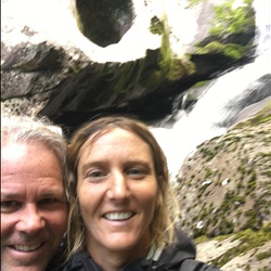
    Easy and beautiful. Heart shape in rock. No one else there. Water was perfect coolness. ❤️
    ★ ★ ★ ★ ★

    user_profile
    Benjamin Krokosky 5 years ago
    Art Loeb Trail - Black Balsam Knob
    Very beautiful but crowded trail. After about a mile the crowds die way down and you have some solitude. You’re still not alone though. A lot of erosion and overuse problems too.
    ★ ★ ★ ★

    user_profile
    Benjamin Krokosky 5 years ago
    Art Loeb Trail - Black Balsam Knob
    Very beautiful but crowded trail. After about a mile the crowds die way down and you have some solitude. You’re still not alone though. A lot of erosion and overuse problems too.
    ★ ★ ★ ★

    user_profile
    tombruce3 5 years, 1 month ago
    Frying pan Tower from Pisgah picnic area loop
    A great hike, just hard enough but not too hard. Do not understand why it is not on maps.
    ★ ★ ★ ★

    user_profile
    dmertens1109 5 years, 2 months ago
    AT (Hot Springs) to RoundTop Ridge Trail
    Challenging and beautiful loop with gorgeous views, stream crossings, and open meadows. Highly discourage hikers from doing the RoundTop Ridge trail. Still recovering from a forest fire five years ago, the trail is in disarray and overgrown. Our family removed several ticks after passing through overgrowth. The AT is always well groomed and a wonderful stretch
    ★ ★ ★ ★

    user_profile
    Terrywso 5 years, 2 months ago
    Track (5/29/21, 6:13:03PM)
    Fairly difficult for about a mile of the hike closest to the Linville Gorge. Lots climbing of rocks in that section.
    ★ ★ ★

    user_profile
    csb.wtia 5 years, 2 months ago
    Track (5/23/21, 12:04:18PM)
    Beautiful hike. Don’t take the trail on the left down to the river — it’s very overgrown and steep. Much better to cut down to the road past outward bound then head down to the river. Great swimming hole but the bridge is out at the bottom. Saw some people cliff jumping into the water but it was a little too shallow for me to trust it.
    ★ ★ ★ ★

    user_profile
    swstrungis 5 years, 2 months ago
    Snooks Nose
    In ininihhhuhihuhbu I uhuhh hhb hung in in nihiunohju I my h. Hong. Nun J n N us os were
    ★ ★ ★ ★

    user_profile
    tombruce3 5 years, 3 months ago
    FS74 from Walker Creek trail to Douglas Falls. 9.4 miles round trip.
    Good hike on FS74 and Douglas Fall trail. Good views and wildflowers. 9.4 miles round trip.
    ★ ★ ★ ★

    user_profile
    allison.grier 5 years, 3 months ago
    Billy branch and high falls attempt
    Couldn’t find high falls
    ★ ★ ★

    user_profile
    allison.grier 5 years, 3 months ago
    Billy branch and high falls attempt
    Couldn’t find high falls
    ★ ★ ★

    user_profile
    allison.grier 5 years, 3 months ago
    Billy branch and high falls attempt
    Couldn’t find high falls
    ★ ★ ★

    user_profile
    tylerlchristina 5 years, 3 months ago
    Roan Mountain via Appalachian Trail
    We started at the station at 19e and parked the car overnight. They dropped us at the trail head which was so nice since it’s a pretty busy highway. They called us crazy for starting at 19 and headed south instead of starting at carvers but we trooped through the 5 miles straight uphill to come out to that beautiful first open view about 2 hours later. We’re a stop and smell the flowers type of hiking crew. Planned to go to the barn at over mountain but it was so windy on the knolls we pulled over early and set up in the enchanted forest looking spot right before little hump. Walked up to little hump for the sunset. No wind problems in the woods and great view through the trees this time of year. Crossed lots of they hikers going north. Had a beer back at station at 19. Great folks.
    ★ ★ ★ ★ ★

    user_profile stars
    Clowman 5 years, 4 months ago
    Wolf pit to Short off
    Parking is very limited. The trail offer gorgeous view after view. Bring your sunscreen.
    ★ ★ ★ ★

    user_profile
    Timothy 5 years, 4 months ago
    Old NC 105
    A nice drive off the pavement with incredible views. Lots of places to camp off the road. The road was easily done in my factory 2009 Honda Pilot EX-L and only used VTM-4 for the steep uphill climbs although I didn’t need it.
    ★ ★ ★ ★ ★

    user_profile
    Bill 5 years, 5 months ago
    Curtis Creek Campground via Hickory Branch Trail
    A fantastic hike that follows Hickory Branch and features waterfalls and cascades. The trail gets steep toward the end and climbs to the Lead Mine Gap Trail.
    ★ ★ ★ ★ ★

    user_profile
    caleballanb 5 years, 6 months ago
    Track (1/9/21, 10:36:45AM)
    This trip was on Old Nc Highway 105. Great trip... we went after it snowed. Minor ice, some more advance climbs but all in all this is a great trip to take with a group of people! Great places to stop and take pictures as well as to pull off and camp for the night. It has a little bit of everything! Mud, snow, ice, rocks, big climbs and steep descents.
    ★ ★ ★ ★ ★

    user_profile
    sonyaperez00 5 years, 6 months ago
    Daniel Ridge Loop
    We took our twin 4 year olds. This was a great hike and they were able to do it. Took us 4 hrs but we stopped for lunch.
    ★ ★ ★ ★ ★

    user_profile
    Shamus Roff 5 years, 6 months ago
    John Rock Loop
    Nice loop hike. Crowded and muddy. I’d do it again.
    ★ ★ ★

    user_profile
    tatejj03 5 years, 8 months ago
    Steele's Creek Road to Buck Creek
    This is a easy going trail that is easily traversed in a stock 4WD vehicle. Deeper into the trail, the camp sites get more serene as the creek opens up, and makes for a great spot to explore, fish and camp.
    ★ ★ ★ ★ ★

    user_profile
    William 5 years, 8 months ago
    My Mitchell Hike (11/14/20, 8:43:10AM)
    It was a beautiful day, the hike was arduous but well worth the effort.
    ★ ★ ★ ★ ★
    user_profile stars
    Jerry Ellsworth 5 years, 8 months ago
    Rich Mountain via Appalachian Trail
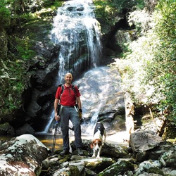
    Did this hike 10/31/2020, except we returned on Roundtop Ridge Trail to make it a loop. Excellent hike, and the views from the fire tower are stunning. In the past, Roundtop Ridge Trail has been terribly overgrown, but somebody has recently done extensive work to clear it. We paid it forward by clearing numerous downed branches and small trees from the hurricane remnants that came through last week. Hopefully this trail will get enough use to remain clear.
    ★ ★ ★ ★ ★

    user_profile
    tylerlchristina 5 years, 9 months ago
    Bee Mountain Loop via Lost Cove Creek Trail
    Didn’t do the whole loop. Started over near big lost cove cliffs, hiked up there for first camping spot, moved over to lower part of this loop counter clockwise. Swim spot at hunt fish falls 2nd day then camping near Gragg prong (not many tent spots up that way but needed to get back to the car in good time on the 3rd day) Could have been a 2 day instead of 3 day but we were hoping for better weather/more swim time.
    ★ ★ ★ ★

    user_profile
    tylerlchristina 5 years, 9 months ago
    Pisgah National Forest Hike
    My go-to for swimming and view. Difficult enough of a trail to get away from crowds and families. Continue straight over the rocks to access a ladder-like path to the top of the “tower” for a view of both directions of the river below.
    ★ ★ ★ ★

    user_profile stars
    Jerry Ellsworth 5 years, 9 months ago
    Little Bald Mountain Loop via Pilot Rock Trail
    Led this hike for a group on 10/17, and the weather was perfect. The colors near the parkway were pretty, but appeared to be a little past peak. We did have 1 experienced hiker injure an ankle coming down Pilot Rock Trail.
    ★ ★ ★ ★

    user_profile
    Sumstead72 5 years, 9 months ago
    Maple Sally Rd - FS 187
    Super easy/accessible trail with a couple campsites. Campsites might require 4x4 to get to.
    ★ ★ ★ ★ ★

    user_profile
    gerittb 5 years, 9 months ago
    When shining rock was too crowded
    Great alternative to the overcrowded black balsam area. More wooded and secluded, lots of water available on the trail for dogs.
    ★ ★ ★ ★ ★

    user_profile
    tmwilhelm1002 5 years, 9 months ago
    Lover’s Leap Loop (10/16/20, 5:19:54PM)
    Was a nice hike after rafting 5 miles on the French Broad River. Great views but is a bit of a steep incline and decline to get to the views.
    ★ ★ ★ ★
    user_profile
    jlalhvac 5 years, 9 months ago
    Skinny dip falls trail
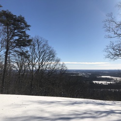
    Stop at looking glass rock overlook and cross the street to find the trail head.
    ★ ★ ★ ★

    user_profile
    jdt589 5 years, 9 months ago
    Brown Mountain ohv
    I took a stock JLU on trail 1 and it was a blast. I went almost 4 miles in before turning around only due to time constraints. Here are a few tips I gathered from my excursion: 1. Go with others - You shouldn't do this trail alone, at least not without proper lift/tires and even then, it's way more fun with friends. 2. Radios/walkies are a must 3. There are some difficult parts that require a spotter - back to point number 1 4. 4-low is your friend. I used this on difficult parts when ascending. Make sure you can easily get into 4 - low as climbing these obstacles is so much easier in 4-low. I used 4-High for all other areas of the trail. 5-Have fun & be safe I'm adding some pictures and videos here. I made a much more in-depth video on youtube so feel free to check that out if you're curious. I also explored some forest service roads while in the area - those are always a good time as well. https://youtu.be/7Su5rjiwRPg
    ★ ★ ★ ★ ★

    user_profile
    Larry 5 years, 9 months ago
    Daniel Ridge (10/7/20, 9:11:05AM)
    Beautiful early autumn day. Led by Zimmer’s with Em and Kathleen.
    ★ ★ ★ ★ ★

    user_profile
    Anonymous User 5 years, 9 months ago
    Roan Mountain via Appalachian Trail
    I’ve thru hiked the Appalachian Trail, twice. This 15 mile section is in the top 5 at least for me out of the whole 2,192 miles. Don’t miss it, a perfect weekend trip! Plenty of water, cruise climbs, awe inspiring views, wildflowers, unique shelter, shuttle access, it checks every single box.
    ★ ★ ★ ★ ★

    user_profile
    Miles 5 years, 10 months ago
    Great Balsams
    Beautiful
    ★ ★ ★ ★ ★

    user_profile
    henryhampton 5 years, 10 months ago
    Mount Mitchell - North Carolina
    Varying conditions along this hike made it challenging and mental the whole way up and down.. not a lot of flats.. constant foot chess.. the conditions on the mountain were probably great with all the water, but that water made most of the trail a tributary and had me wishing I brought my swim fins and floaties.. happy to be jon top of North Carolina.. views were clear and awesome
    ★ ★

    user_profile
    kimdwats 5 years, 10 months ago
    Brown Mtn OHV 9/19/2020
    Fairly easy 4x4 trail for Jeep Wranglers. Be prepared for side by sides , bikes and 4 wheelers.
    ★ ★ ★ ★

    user_profile
    henryhampton 5 years, 10 months ago
    Mount Mitchell - North Carolina
    Varying conditions along this hike made it challenging and mental the whole way up and down.. not a lot of flats.. constant foot chess.. the conditions on the mountain were probably great with all the water, but that water made most of the trail a tributary and had me wishing I brought my swim fins and floaties.. happy to be on top of North Carolina.. views were clear and awesome 👏🏻
    ★ ★

    user_profile
    the Grinch 5 years, 10 months ago
    Art Loeb Trail
    This trail is very well maintained. I assume the Boy Scouts have a lot to do with this. Hiked this directly after Hurricane Sally remnants and trail was not “sloppy” like most in Pisgah area. Easily navigated plenty of water along way. Lots of fungus especially some nice reishi growing off an oak blowdown that trail maintenance had sawn thru. Wildflowers in abundance as well but not so many blueberries. I have 11.5 miles for distance. With a clear trail the whole way I would rate as moderate.
    ★ ★ ★ ★

    user_profile
    rjwiley101 5 years, 10 months ago
    Dobson Knob, McDowell County, NC, USA
    Quick little hike to the knob. Easy.
    ★ ★ ★

    user_profile
    ben.girkins 5 years, 10 months ago
    Black Balsam Knob via Art Loeb Trail
    never disappoints
    ★ ★ ★ ★ ★

    user_profile
    Rob DeHollander 5 years, 10 months ago
    Black Balsam Knob
    Pretty hike with good elevation change. Nice diversity from bald knob with no trees down to heavily wooded areas. A lot of springs on the mountain so quite a bit of water. Trail head was very busy but once on the trail not too many people. Would definitely do this hike again.
    ★ ★ ★ ★

    user_profile
    Rob DeHollander 5 years, 10 months ago
    Black Balsam Knob
    Pretty hike with good elevation change. Nice diversity from bald knob with no trees down to heavily wooded areas. A lot of springs on the mountain so quite a bit of water. Trail head was very busy but once on the trail not too many people. Would definitely do this hike again.
    ★ ★ ★ ★

    user_profile
    Rob DeHollander 5 years, 10 months ago
    Black Balsam Knob
    Pretty hike with good elevation change. Nice diversity from bald knob with no trees down to heavily wooded areas. A lot of springs on the mountain so quite a bit of water. Trail head was very busy but once on the trail not too many people. Would definitely do this hike again.
    ★ ★ ★ ★

    user_profile
    Rob DeHollander 5 years, 10 months ago
    Black Balsam Knob
    Pretty hike with good elevation change. Nice diversity from bald knob with no trees down to heavily wooded areas. A lot of springs on the mountain so quite a bit of water. Trail head was very busy but once on the trail not too many people. Would definitely do this hike again.
    ★ ★ ★ ★

    user_profile
    the Grinch 5 years, 11 months ago
    Mount Hardy
    Trails follows old grade most of the way til mount Hardy summit trail. Very nice
    ★ ★ ★ ★ ★

    user_profile
    Miles 5 years, 11 months ago
    Cold Mountain via Art Loeb Trail
    Great trail with an amazing payoff at the summit. The climb of 2700’ is significant, but not terrible. Very enjoyable day out.
    ★ ★ ★ ★ ★

    user_profile
    StsFdx 5 years, 11 months ago
    Greentown Shortcut
    Hiked on 16 Aug 20. Had a great time on this hike with challenges. I think Kathryn's review has good points, but think it was her mood that put her off. I should say, this trail is rugged, parts a little overgrown (where's my machete?) but you can still see the trail with a little effort. 1. Spiders do make a lot of webs. I've been hiking more this summer than ever, usually a dry fall hiker. This was a Sunday and i think Saturday had lots of rain. With the trail somewhat overgrown all the leaves etc with water on them = you get wet. Also about 20 minutes in I grabbed a stick and held it in front of me to hit the cobwebs first. 2. Off and on the trail is narrow and very sloped. So this in addition to the rugged overgrown part, makes it slow going, you will be at a slower pace, About 2/3rd way a tree has fallen on the trail parallel, you have to cut up the mountain about 10 yards, then forward 10ish yards, then back down to the trail. Also about 3/4 way i got on a sidetrack - it looked like the trail but was either a trail to a cool rock area/pee spot. I half slid down on hands etc and popped back on the trail. Think on the way back i saw where i got off the path. 3. I didn't see any orange tags at all on trail. At end you cross a small section of water, i did not need water shoes, was able to rock hop. As soon as you cross an open are and fire pit are there. Go to the right about 20 yards, you'll see the falls sorta, there's trees branches vines in way, but you see it, and hear it. Go down to the water, then you have to work your way up rocks to it. I did not see any type of trail left or right of falls to get to it. I got there at maybe 4p on a sunday, left at 5p maybe. No one was there, and no one on trail. 4. On way back about halfway point there is a set of smaller falls/ really cool rock water area. I had to shimmy down, and slid about 5' almost to water. Was able to carefully walk around on rocks. Going back up had to use shrub branches to get up to a point for footing to get back to trail. 5. Probably only 10 minutes from parking theres a cool area to walk off trail to, just 100', makeshift camp area, cool spot. 6. I would recommend a single trek pole or walking stick. Since a good part of the hike is at an angle and rock hopping etc, i was glad i had the stick. I'm an avid hiker, used trek poles before. Normally don't. Like i say this hike have one, or a stick. (also for the spider webs)
    ★ ★ ★ ★
    user_profile
    Daniel 5 years, 11 months ago
    Mount Mitchell
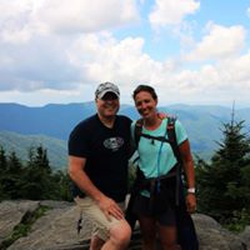
    Tough hike but amazing views from each of the peaks. Tough terrain—-be prepared.
    ★ ★ ★ ★ ★

    user_profile
    julesb910 5 years, 11 months ago
    Brushy Ridge Falls to Kistler Memorial Highway, Burke County, NC, USA
    The trail itself was fine. Very steep ascent at the end. The falls were small and barely visible from the trail and no good views. Would not recommend.
    ★ ★

    user_profile
    julesb910 5 years, 11 months ago
    Brushy Ridge Falls to Kistler Memorial Highway, Burke County, NC, USA
    The trail itself was fine. Very steep ascent at the end. The falls were small and barely visible from the trail and no good views. Would not recommend.
    ★ ★

    user_profile
    julesb910 5 years, 11 months ago
    Brushy Ridge Falls to Kistler Memorial Highway, Burke County, NC, USA
    The trail itself was fine. Very steep ascent at the end. The falls were small and barely visible from the trail and no good views. Would not recommend.
    ★ ★

    user_profile
    tesblg121 5 years, 11 months ago
    Big Laurel Creek to Cook Branch
    Nice hike along Laurel Creek to French Broad River. Some private property when you start trail. No issues as long as you stay on trail. There is no trespassing on the private property.
    ★ ★ ★ ★

    user_profile
    Daniel 5 years, 11 months ago
    Mount Mitchell
    Very challenging but well worth the views.
    ★ ★ ★ ★ ★

    user_profile
    legalizepottery 6 years ago
    Track (7/25/20, 6:41:04AM)
    Very difficult, did it in two days. Loved it
    ★ ★ ★ ★ ★

    user_profile
    mavera 6 years ago
    Blowing Rock to Linville
    This is a scenic jeep ride right south from Blowing Rock and then west on Anthony Creek Road. Two beautiful waterfalls along Anthony Creek Road.
    ★ ★ ★ ★

    user_profile
    weezie60 6 years ago
    Track (7/17/20, 6:03:43AM)
    This hike is very challenging due to the overgrowth and rocky terrain. We had to take it slow since most of the time we were wading through weeds and couldn’t see the trail. Black Balsam and Tennent were amazing!
    ★ ★ ★ ★ ★

    user_profile
    dd1zz 6 years ago
    Big East Fork of Pigeon River off Hwy 276
    Hike along a beautiful clear rocky river. Trail has rocks and roots so poles recommended. Shady all the way. Elevation not much greater than Asheville so expect about the same temperature.
    ★ ★ ★ ★

    user_profile
    Henry 6 years ago
    Track (7/11/20, 11:08:01AM)
    We started out at black balsam trailhead cut down through a black balsam forest and came to the flat laurel creek trail it in surrounded by blueberry bushes with amazing views then descended into a young forest with many creek side campsites we turned around and came back the way we came.
    ★ ★ ★ ★ ★

    user_profile
    cjle3747 6 years ago
    Track (7/10/20, 11:22:0)
    The majority of this hike is through overgrown trail. There isn’t much of a cure o except at key peaks which are gorgeous if you are looking to get off the beaten path and some solitude this loop is for you. It is actually 6.5 and not 5 miles as some websites state.
    ★ ★ ★

    user_profile
    mrodgers 6 years ago
    Stack Rock Parking Area via FS 192 and Edgemont Road
    Completed the trail going. North to south as suggested and had a blast. Once we passed Old House Gap progress slowed but had no problems in a stock JL Rubicon. Lots of neat places to stop and eat lunch along the way.
    ★ ★ ★ ★ ★

    user_profile
    dd1zz 6 years ago
    Big Creek in Mills River Rec area (7/5/20, 9:54:45AM)
    The 1st mile and a half down to the old Hendersonville reservoir is just a gravel road. It is mostly shady but still gravel and hilly. After you cross the bridge at the reservoir (see photo) onto the big creek trail you walk along big creek on a real forest trail that is nice and level and very shady.
    ★ ★ ★

    user_profile
    dd1zz 6 years ago
    Green Knob from Rough Butt O/L
    July 3, 2020 — Trail from MST to Green Knob in terrible shape - difficult to follow; very overgrown; views not worth the trouble. Disappointing.
    ★

    user_profile
    mollyschneidewend 6 years ago
    Bennet Gap (7/2/20, 3:49PM)
    Pretty moderate/difficult hike— a lot of going up, had to step off the trail about 4 times for mountain bikers, but then a quick descend back down. Thought there would be some sort of overlook once nearing Cooper Mtn. but there wasn’t. Took a nice dip in the creek before leaving— a nice attribute to the hike.
    ★ ★ ★

    user_profile
    rickharrison2000 6 years, 1 month ago
    Track (6/27/20, 7:43:40AM)
    Moderate hike. Climbs climbs are modest. Beautiful trail. Highly recommended.
    ★ ★ ★ ★ ★

    user_profile
    rickharrison2000 6 years, 1 month ago
    Bearwallow Brook to Biltmore Campus
    Very easy hike. Definitely should not rated as difficult. Beautiful trail!
    ★ ★ ★ ★ ★

    user_profile
    burgess827 6 years, 1 month ago
    Rhododendrum garden and Roan bluff
    Easy hike with Rhododendrum‘s in bloom during mid to late June. Nice view at Roan bluff. Interesting old cloud hotel site. Can make more difficult if you hike up from Carvers gap or hike on AT over to bear town mountain
    ★ ★ ★ ★

    user_profile stars
    Jerry Ellsworth 6 years, 1 month ago
    Shining Rock Loop via Shining Creek Path and Old Butt Knob Trail
    Did this hike yesterday with a small group, and it was beautiful. We did it in the other direction, going up Shining Creek Path, which is nicer in some ways, since you get a better view of the waterfalls along the creek going up. We did see two large rattlesnakes at a sunny, rocky spot along Old Butt Knob trail, so be careful!
    ★ ★ ★ ★ ★

    user_profile
    andrewkeithlamb 6 years, 2 months ago
    Stack Rock Parking Area via FS 192 and Edgemont Road
    If you want a challenging 4-Wheeling experience this is a good one. Start at the north end and come down. About half of it is improved dirt road. When you get to old house gap, you better kick in the 4 wheel drive and have some traction boards. We went after a week of rain so it was super wet.
    ★ ★ ★ ★ ★

    user_profile
    gregbailey785 6 years, 2 months ago
    Track (5/23/20, 12:32:28PM)
    Decent trail. Good camping and fishing. Some rocky spots but no too bad.
    ★ ★ ★ ★

    user_profile
    thebrewsterhome 6 years, 2 months ago
    Looking Glass Rock 5/21/20
    The hike is invigorating and the view is stunning!
    ★ ★ ★ ★ ★

    user_profile
    jmagz1963 6 years, 2 months ago
    Hawksbill 5-10-20
    Awesome view at the top! I must see in the fall.
    ★ ★ ★ ★ ★

    user_profile
    jmagz1963 6 years, 2 months ago
    Gragg Prong 5/8/20
    Not good. Too small. No fish. N
    ★

    user_profile
    taygoodson1 6 years, 2 months ago
    Thunderhole Trail from downtown BR
    Great hike, very hardcore and strenuous, but very pretty.
    ★ ★ ★ ★

    user_profile
    jmagz1963 6 years, 3 months ago
    Walnut Bottom 4-45-20
    Creek too small. I did not go up.
    ★

    user_profile
    mail4robyn 6 years, 3 months ago
    Slate Rock Pilot Cove (4/11/20, 10:44:01AM)
    Second time doing this hike. You can go counter clockwise and have the views towards the end of the hike or go clockwise and get to Slate Rock near the beginning. We went counter clockwise both times. That direction provides a cardio climb over 600ft then you level off towards the lookout. Slate Rock views are awesome. Many people hike to Slate Rock clockwise and return same way. Depends on your fitness level. Parking area is about 6.6 miles on right from where the gravel forest road begins.
    ★ ★ ★ ★ ★

    user_profile
    mail4robyn 6 years, 4 months ago
    Sam Knob
    The hike starts at the parking lot off Black Balsam Knob Road. The trail starts out fairly level. Then you go down a set of wooden platforms and stairs to the meadow. At the end of the meadow, turn right to stay on Sam's Knob trail. The trail soon ascends. This part of the trail is narrower and has lots of roots and rocks. It's an easy trail to follow to the summit of Sam's Knob. Great views await.
    ★ ★ ★ ★ ★

    user_profile
    haileynmcghee 6 years, 4 months ago
    Shining Creek to Big East Fork Loop
    This is definitely a beautiful hike and quite a journey. Gorgeous waterfalls throughout the hike up and down and once on the Art Loeb, the Mountain View’s are breathtaking. Shining Rock is a large area of quartzite that is so cool! Definitely unexpected in a forest of evergreens. This was the hardest hike we’ve done in a day- it was long but also very strenuous. We were required to cross the stream several times, basically climb up rocks in some areas and steep declines were also a big element. Shining creek is the hardest of the entire hike- it’s worth getting that one over with in the beginning as the Big East Fork is much flatter.
    ★ ★ ★ ★ ★

    user_profile
    lpatterson 6 years, 5 months ago
    Flat Laurel Creek Trail/Old Railroad Grade Loop
    Hiked on 2/22/20. Snow was on the ground and it was beautiful! Highly recommend!
    ★ ★ ★ ★ ★

    user_profile
    chandler.r2 6 years, 5 months ago
    1915 Climax Locomotive Loop via Pink Beds Loop
    Beautiful hike with lots of laurel and rhododendron. Distance might be an issue for some hikers, but I would in no way rate this as difficult. Relatively little elevation change.
    ★ ★ ★

    user_profile
    Anonymous User 6 years, 6 months ago
    Roan Mountain via Appalachian Trail
    We hiked this section back in September 2019. What was to be a 2 day split overnight trip, we ended up crushing in a single day. Two of us were rookies, and two of our group were veteran hikers. We had a great time and the views are awesome.
    ★ ★ ★ ★ ★

    user_profile
    beamazed00 6 years, 6 months ago
    Start of dirt road Old NC 105 1/17/20 13:18:47
    Beautiful area. 4X4 probably a good idea especially if it’s wet.
    ★ ★ ★ ★

    user_profile
    cwilli4 6 years, 6 months ago
    Mtn to seas trail and blue ridge pkwy
    Blue ridge parkway was closed so we made a loop hiking mtn seas to trail then back on blue ridge parkway. Would not recommend hiking blue ridge parkway when there’s traffic.
    ★ ★ ★ ★ ★

    user_profile
    David McVicker 6 years, 6 months ago
    Rich Mountain Fire Tower
    Hiked this on New Years Day, which may have attributed to a crowded trail. The hike starts and ends steep, but the trail is well-maintained. There is a gravel road that also leads to the tower, so you may encounter non-hikers at the top. The view from the tower is fantastic on a clear day.
    ★ ★ ★

    user_profile
    jason 6 years, 6 months ago
    Old House Gap Road
    Great OHV trail. Made it relatively easy in a Raptor but full flex in some areas. Would recommend going when it’s been dry for at least a few days.
    ★ ★ ★ ★ ★

    user_profile
    chandler.r2 6 years, 7 months ago
    MST Hike (12/25/19, 11:42:29AM)
    We were closing the MST from 276 to the Arboretum. Beautiful hike on a beautiful day with a beautiful woman.
    ★ ★ ★ ★ ★
    user_profile
    janearthdance 6 years, 10 months ago
    Black Balsam Road
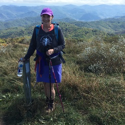
    Very busy parking lot. Started the hike a bit later than usual, around 1:30. Still had plenty of time to do the trail to Black Balsam Knob. Beautiful views even though clouds rolled in during the hike. Quite a few rocky climbs but not too strenuous.
    ★ ★ ★ ★ ★

    user_profile
    mikethomas 7 years ago
    Looking Glass Rock
    Actually a 3-mile hike (2.95 on Garmin and iPhone). First two mikes a moderate climb. Then a bit more rocky and rigorous. Nothing too bad. I’m 65 with an arthritic knee. View is tremendous!
    ★ ★ ★ ★ ★

    user_profile
    Kelsey 7 years ago
    Art Loeb Trail
    Great hike, close to town, easy to navigate, with a rewarding view. There are toilets and hand washing in the camp right past the bridge just beyond the trail head. Not great for running, since it's covered, moderately rocky, slick, steep, and with downed trees. Many streams en route, bring a steri-pen. Glad we used Gaia- we got a few hundred feet down a trail offshoot on the way down and had to backtrack. Some bushwhacking near the summit but underneath a clear path. Is the view to the SE an old volcano crater?
    ★ ★ ★ ★ ★

    user_profile
    thomasfmabry 7 years ago
    gingercake middle
    Seq
    ★ ★ ★ ★

    user_profile
    harmonkeys 7 years, 1 month ago
    Art Loeb Spur Trail, Haywood County, NC, USA
    Hike to the top of Sam’s Knob was totally worth it. Nice boggy area near Flat Laurel Creek. All stream crossings were rock-hop-able.
    ★ ★ ★ ★

    user_profile
    rdcole71 7 years, 1 month ago
    Linville Gorge Wilderness Hike
    This hike is not for the faint of heart. Had to end up calling emergency services for an assist. The rim trail on the east is worth the trip but unless you really want a challenge avoid the gorge trail. Lots of steep descents and ascents around stream crossings, lots of rocks on the trail and trail easy to lose in places.
    ★ ★ ★

    user_profile
    jamatt 7 years, 1 month ago
    Crazy 8
    Epic Pisgah gnar.
    ★ ★ ★ ★ ★

    user_profile
    burgess827 7 years, 1 month ago
    Track (6/20/19, 9:48:46AM)
    Excellent hike through Rhododendron‘s,mountain laurel,fields of ferns along streams. Relatively flat. Some beautiful areas. Not much elevation changes
    ★ ★ ★ ★ ★

    user_profile
    luck 7 years, 1 month ago
    Old NC 105
    Great scenic drive completely gravel. Saw plenty of 2wd cars. Not sure how cars make it as there are lots of exposed rocks and deep ruts! Definitely worth an overnight.
    ★ ★ ★ ★ ★

    user_profile
    jamatt 7 years, 1 month ago
    Sunburst 25
    Not a hike. 26 mile gravel ride.
    ★ ★ ★ ★ ★

    user_profile
    luck 7 years, 1 month ago
    Old NC 105
    Great scenic drive completely gravel. Saw plenty of 2wd cars. Not sure how cars make it as there are lots of exposed rocks and deep ruts! Definitely worth an overnight.
    ★ ★ ★ ★ ★

    user_profile
    adamhand 7 years, 3 months ago
    The difference between this hike and the identically named trail marked as “easy” is that this one includes the Johns Rock Loop. Even with that included I wouldn’t rate this as hard, maybe moderate. I’m not in great shape and didn’t think it was that tough. Well worth doing. Cool river views, waterfalls, and the lookout on Johns Rock is awesome.
    ★ ★ ★ ★ ★

    user_profile
    adamhand 7 years, 3 months ago
    Very steep in the second half. Avoid when raining, as the descent could be quite dangerous. Awesome view though.
    ★ ★ ★ ★ ★

    user_profile
    danielccampana 7 years, 4 months ago
    I didn’t hike this trail. I accidentally tapped a star and now I can’t delete it.
    ★ ★ ★

    user_profile
    shellderulz 7 years, 4 months ago
    This trail was seriously tough with the high elevation change, and actually its 3 miles in 3 miles out not 2.7. However this trail was also very cool. I did it on a cool, wet and foggy day and it made for some spectacular views of the mountains in the fog. The higher up the mountains i got, the foggier it got! Near zero visibility at the top! Made trying to look out off of looking glass rock at the top impossible but thats also what made it cool! Sloughed my cooler up the mountain with me and had lunch as i stared out into the foggy abyss. 10/10 would do it again, just on a dryer day. Since it was so wet, it was a mudhole going up the mountain and made some of the fallen trees difficult to navigate without slipping off the face of the trail. I was pretty muddy by the time i got down.
    ★ ★ ★ ★ ★
    user_profile
    Jagriffith7 7 years, 5 months ago
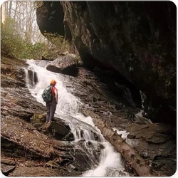
    Nice trail and beautiful waterfall
    ★ ★ ★ ★ ★

    user_profile
    blake.martinson 7 years, 6 months ago
    Early winter mornings are perfect for this hike. Complete solitude with my pup on the way up and at the top! Met many groups coming up as we were descending. Some of the granite surfaces were very slick from the freeze/thaw cycle.
    ★ ★ ★ ★ ★

    user_profile
    bbynum2 7 years, 7 months ago
    This is a good walk for some exercise but not much in the way of scenery hence the four star rating. It starts an ends at the Davidson River Campground parking lot and is 5.6 miles long. Across the bridge the left onto the exercise trail along the Davidson River for a mile then right at the Art Loeb trailhead. The trail is initially steep and steadily uphill before it moderates somewhat after about half a mile. The Art Loeb section is 1.7 miles and intersects FR 5002 where you turn right and head downhill for a pleasant stroll that will bring you to a gate across the road at the Schenk job corps property. There's a sign depicting a hiker with No Throughfare written on it. Through the gate take an immediate right onto a grassy road which almost immediately becomes dirt and gravel and follow that until you see a trail on your right that will reconnect with the exercise trail on the Davidson and then left and return to the parking lot. There are a few trails connecting to the exercise trail from the Schenk property so if you miss the first one you'll still have a few more opportunities. This is a pleasant walk with a nice up and then a gradual downhill and good trail conditions throughout with no stream crossings or obstacles.
    ★ ★ ★ ★

    user_profile
    mcclellan.mike 7 years, 8 months ago
    A challenging climb to the summit but the view makes it well worth the effort. I was a little disappointed in that I missed the fall color change but that aside it’s a great hike... When you finish be sure to travel towards sliding rock and view the Looking Glass Waterfall...
    ★ ★ ★ ★ ★

    user_profile
    lancelassiter 7 years, 8 months ago
    10.8 miles, 3000 foot elevation gain, very steep climbs/descents, tough terrain, very remote - no cell service, beautiful scenery and views of river and gorge. Recommend counter-clockwise route. Take GPS map, free download availabe from Avenza maps app. Can be occassionally easy to lose trail if not careful and have GPS.
    ★ ★ ★ ★

    user_profile
    TDP1222 7 years, 9 months ago
    Hiked on 10-7-18. Was hoping for more fall color but it is a little later this year. Hiked this same hike a few years back on first Friday of October and colors were at peak. Easy hike. Mostly flat. Very muddy after any rain at all. A lot of secondary trails have been made by hikers to go around the bigger mud holes. Falls had much less water on this trip compared to a few years back. Can get crowded on weekends. I hiked out to falls about 4:30 PM and passed more people than I could even count who were returning from the falls. When I arrived there were only two couples at the base and a few people above the falls. Within 10 minutes they were all gone and I had it to myself.
    ★ ★ ★

    user_profile
    danielle_evans05 7 years, 10 months ago
    Great trail. I’ve been hiking this one for years, teook my nine-year-old daughter for the first time this past weekend. Trail is still well-maintained. Challenging with a nice view at the end.
    ★ ★ ★ ★ ★

    user_profile stars
    Jerry Ellsworth 7 years, 10 months ago
    This is a very pretty waterfall, and a nice, short walk from the parking area. On this trip, we went at too busy of a time, and it was nearly impossible to get a photo without other people in it. Still, make a point to take the user trail over to Little Moore Cove Falls, which is much less crowded.
    ★ ★ ★ ★

    user_profile
    Timothy 1 year, 9 months ago
    Sunday Lunch Activity
    ★ ★ ★ ★ ★

    user_profile
    averymck 1 year, 10 months ago
    Track (9/29/23, 7:24:58AM)
    ★ ★ ★ ★ ★

    user_profile
    jayshef 1 year, 10 months ago
    Bowlens Creek to Celo Knob
    ★ ★ ★ ★

    user_profile
    Cecilia 1 year, 10 months ago
    19E to Carvers Gap
    ★ ★ ★ ★ ★

    user_profile
    mail4robyn 1 year, 10 months ago
    Looking Glass Summit
    ★ ★ ★ ★ ★

    user_profile
    jhinkle0628 1 year, 10 months ago
    Mountain to Sea Trail
    ★ ★ ★ ★

    user_profile
    lynwood.wright 1 year, 10 months ago
    Shortoff Mountain via Table Rock Summit Trail
    ★ ★ ★ ★

    user_profile
    lynwood.wright 1 year, 10 months ago
    Shortoff Mountain via Table Rock Summit Trail
    ★ ★ ★ ★

    user_profile
    lynwood.wright 1 year, 10 months ago
    Shortoff Mountain via Table Rock Summit Trail
    ★ ★ ★ ★

    user_profile
    lynwood.wright 1 year, 10 months ago
    Shortoff Mountain via Table Rock Summit Trail
    ★ ★ ★ ★

    user_profile
    Ben 1 year, 11 months ago
    Sams knob backpack from campsite
    ★ ★ ★ ★

    user_profile
    Ben 1 year, 11 months ago
    Sams knob backpack from campsite
    ★ ★ ★ ★

    user_profile
    ken_shoff76 1 year, 11 months ago
    Camp Creek Overlook via NC 181
    ★ ★

    user_profile
    Chris 1 year, 11 months ago
    Track (8/19/24, 6:14:33PM)
    ★ ★ ★

    user_profile
    jbowen6116 1 year, 11 months ago
    Hawksbill Trail, Burke County, NC, USA
    ★ ★ ★ ★

    user_profile
    engsetter25 1 year, 11 months ago
    Track (8/18/24, 12:58:29PM)
    ★ ★ ★ ★ ★

    user_profile
    johnwadeinc 1 year, 11 months ago
    Track (8/13/24, 11:44:42AM)
    ★ ★ ★ ★ ★

    user_profile
    brian8510 1 year, 11 months ago
    Mount Mitchell
    ★ ★

    user_profile
    zcube.nc 1 year, 11 months ago
    Hawksbill peak, Linville gorge wilderness
    ★ ★ ★ ★

    user_profile
    david.angelus 1 year, 11 months ago
    Three Peaks Black Balsum
    ★ ★ ★ ★ ★

    user_profile
    gary.dunn 1 year, 11 months ago
    NBWNC day 4
    ★ ★ ★ ★ ★

    user_profile
    sandt38 2 years ago
    Tennent Mountain Loop via Ivestor Gap Trail
    ★ ★ ★ ★ ★

    user_profile
    ajduvall34 2 years ago
    Art Loeb Trail
    ★

    user_profile
    Joseph.T.Ferruzza 2 years ago
    Hurricane Creek Road
    ★

    user_profile
    seymour3chris 2 years ago
    Track (8/2/22, 12:02:33)
    ★ ★ ★ ★ ★

    user_profile
    rvnfan 2 years ago
    Coleman Boundry Disbursed Campsite
    ★ ★ ★ ★

    user_profile
    Half_Paddle7109 2 years ago
    Black Balsam Knob via Art Loeb Trail
    ★ ★ ★ ★ ★

    user_profile
    yomenenglish 2 years ago
    High Knob via Art Loeb Trail
    ★ ★ ★

    user_profile
    flyfisher98 2 years ago
    Cabin Trail, Burke County, NC, USA
    ★ ★ ★ ★ ★

    user_profile
    magnessbrandon 2 years ago
    Maple Camp Bald Loop
    ★ ★ ★ ★ ★

    user_profile
    montyent 2 years ago
    Coontree
    ★ ★ ★

    user_profile
    Michael 2 years ago
    Butt Knob - JMQ (7/4/24)
    ★ ★

    user_profile
    sir_eller 2 years, 1 month ago
    Summer 263 mile route
    ★ ★ ★ ★ ★

    user_profile
    bwetmore54 2 years, 1 month ago
    Track (6/26/24, 2:23:36PM) Coontree loop up east side
    ★ ★ ★ ★

    user_profile
    bwetmore54 2 years, 1 month ago
    Track (6/26/24, 2:23:36PM) Coontree loop up east side
    ★ ★ ★ ★

    user_profile
    winntmarie 2 years, 1 month ago
    Track (6/23/24, 1:11:15PM)
    ★ ★ ★ ★ ★

    user_profile
    winntmarie 2 years, 1 month ago
    Track (6/23/24, 1:11:15PM)
    ★ ★ ★ ★ ★

    user_profile
    emilydianehoover 2 years, 1 month ago
    Roan Mountain via Appalachian Trail
    ★ ★

    user_profile
    christiandg 2 years, 1 month ago
    Black Balsam Knob via Art Loeb Trail
    ★ ★ ★ ★ ★

    user_profile
    jcfripp72 2 years, 1 month ago
    Morning Hike, Thompson Creek via Little Bald
    ★ ★ ★ ★

    user_profile
    jcfripp72 2 years, 1 month ago
    Morning Hike, Thompson Creek via Little Bald
    ★ ★ ★ ★

    user_profile
    jcfripp72 2 years, 1 month ago
    Morning Hike, Thompson Creek via Little Bald
    ★ ★ ★ ★

    user_profile
    jcfripp72 2 years, 1 month ago
    Morning Hike, Thompson Creek via Little Bald
    ★ ★ ★ ★

    user_profile
    gary.dunn 2 years, 1 month ago
    Day 3 NB
    ★ ★ ★ ★ ★

    user_profile
    Barbwire111 2 years, 1 month ago
    Jarrett Creek Rd, Old Fort
    ★ ★ ★ ★ ★

    user_profile
    jhpullen53 2 years, 1 month ago
    Black Balsam Knob via Art Loeb Trail
    ★ ★ ★

    user_profile
    jbencrumpler 2 years, 1 month ago
    Return to my First
    ★ ★ ★ ★ ★

    user_profile
    bradleywhall 2 years, 1 month ago
    Horse Camp to Twin Falls
    ★ ★ ★ ★ ★

    user_profile
    joshuasmith4 2 years, 1 month ago
    Sams Knob
    ★ ★ ★ ★ ★

    user_profile
    mbtqt2006 2 years, 2 months ago
    Black Balsam Knob via Art Loeb Trail
    ★ ★

    user_profile
    rbadilla 2 years, 2 months ago
    Pisgah National Forest Hike
    ★ ★ ★ ★

    user_profile
    velophoto 2 years, 2 months ago
    Track (5/25/24, 10:25:56AM)
    ★ ★ ★ ★

    user_profile
    breannalai 2 years, 2 months ago
    Pisgah National Forest Hike
    ★ ★

    user_profile
    jhinkle0628 2 years, 2 months ago
    MST Black Mtn CG to Mt Mitchell
    ★ ★ ★

    user_profile
    jhinkle0628 2 years, 2 months ago
    MST Black Mtn CG - Hwy 80
    ★ ★ ★

    user_profile
    thetravelingraisch 2 years, 2 months ago
    Black Balsam Knob via Art Loeb Trail
    ★ ★ ★ ★ ★

    user_profile
    info 2 years, 2 months ago
    Track (5/11/24, 11:34:20AM)
    ★ ★ ★ ★ ★

    user_profile
    shepherdgeorge 2 years, 2 months ago
    Tanyard Gap to Rich Mt. Track (2/16/22, 11:14:38AM)
    ★ ★ ★ ★ ★

    user_profile
    danandgailsc 2 years, 2 months ago
    Campsite via Spence Ridge Trail
    ★ ★ ★ ★ ★

    user_profile
    claudettewillett 2 years, 3 months ago
    Track (3/24/24, 2:50:49PM)
    ★ ★ ★ ★ ★

    user_profile
    tgraden1433 2 years, 3 months ago
    Bill hike
    ★ ★ ★ ★ ★

    user_profile
    Michael 2 years, 3 months ago
    Black Balsam, Tennent, and Grassy Cove Top SB6K hike with Emily
    ★ ★ ★ ★ ★

    user_profile
    syrupmill 2 years, 3 months ago
    Celo Knob via Black Mountain Crest Trail
    ★ ★

    user_profile
    baxmedic 2 years, 3 months ago
    Track (4/22/24, 12:39:53PM)
    ★ ★ ★ ★ ★

    user_profile
    snowarobert 2 years, 3 months ago
    Linville gorge east side line
    ★ ★ ★ ★

    user_profile
    brian1marci1 2 years, 3 months ago
    Track (4/20/24, 2:40:15PM)
    ★ ★ ★ ★ ★

    user_profile
    Thomas 2 years, 3 months ago
    Balsam Cone via Black Mountain Crest Trail
    ★ ★

    user_profile stars
    Hiker33 2 years, 3 months ago
    Laurel Creek (4/15/24)
    ★ ★ ★ ★

    user_profile
    annababbitt 2 years, 3 months ago
    Big Bald via Mountains-to-Sea Trail
    ★ ★ ★ ★ ★

    user_profile
    Unturnedrock 2 years, 3 months ago
    Track (4/13/24, 11:36:33AM)
    ★ ★

    user_profile
    tommthompson74 2 years, 3 months ago
    Rocky Bluff Campgrounds trails
    ★ ★ ★ ★ ★

    user_profile
    wisteriarae 2 years, 4 months ago
    Art loeb
    ★ ★ ★ ★ ★

    user_profile
    rlledford 2 years, 4 months ago
    Track (3/30/24, 11:58:16AM)
    ★ ★ ★ ★ ★

    user_profile
    knauba 2 years, 4 months ago
    Chimney Branch to Linville Falls Visitor Center Parking, Burke County, NC, USA
    ★

    user_profile
    kimberlymm 2 years, 4 months ago
    Pilot Rock via Pilot Cove-Slate Rock
    ★ ★

    user_profile
    gary 2 years, 4 months ago
    Laurel River Trail
    ★ ★

    user_profile
    tommthompson74 2 years, 4 months ago
    Track (3/28/24, 2:03:12PM)
    ★ ★ ★ ★ ★

    user_profile
    syrupmill 2 years, 4 months ago
    Mount Mitchell
    ★

    user_profile
    erin.bushrn 2 years, 4 months ago
    Track (3/24/24, 10:16:48AM)
    ★ ★ ★ ★ ★

    user_profile
    Jesse Francis 2 years, 4 months ago
    Skinny Dip Falls & Looking Glass Trail
    ★ ★ ★ ★ ★

    user_profile
    jnmorton2005 2 years, 4 months ago
    Rich Mountain Loop
    ★

    user_profile
    robbiea128 2 years, 4 months ago
    FS 496
    ★

    user_profile
    quinn23456 2 years, 4 months ago
    Track (3/17/24, 7:29:31AM)
    ★ ★ ★ ★ ★

    user_profile
    npg 2 years, 4 months ago
    Hurricane Creek Road and National Forest Road
    ★ ★ ★

    user_profile
    Matthew 2 years, 5 months ago
    Lovers Leap
    ★ ★ ★ ★ ★

    user_profile
    annababbitt 2 years, 5 months ago
    Shortoff Mountain via Wolf Pit
    ★ ★ ★ ★ ★

    user_profile
    Aaronkoch 2 years, 5 months ago
    Carver’s gap
    ★ ★ ★ ★ ★

    user_profile
    robslade6 2 years, 5 months ago
    Shortoff Mountain via Table Rock Summit Trail
    ★ ★

    user_profile
    slcole1013 2 years, 5 months ago
    Track (2/18/24, 9:47:39AM)
    ★ ★ ★ ★ ★

    user_profile
    pastryprimadonna 2 years, 5 months ago
    Looking Glass Rock
    ★ ★

    user_profile
    quinn23456 2 years, 5 months ago
    Cat Gap Loop
    ★

    user_profile
    jbowen6116 2 years, 5 months ago
    Track (2/2/24, 8:40:18AM)Mount Mitchell Trail (MST)
    ★ ★ ★ ★ ★

    user_profile
    mail4robyn 2 years, 6 months ago
    Cathy’s Creek Hike (1/29/24, 11:30:37AM)
    ★ ★ ★ ★

    user_profile
    Ben 2 years, 6 months ago
    Lost Cove Snow Hike
    ★ ★ ★ ★ ★

    user_profile
    4egret2 2 years, 6 months ago
    Mt. Mitchell- Bald Point Trail
    ★ ★ ★ ★ ★

    user_profile
    GrizzlyRunner 2 years, 6 months ago
    Track (1/11/24, 11:55:22AM)
    ★ ★ ★ ★ ★

    user_profile
    neusewader 2 years, 6 months ago
    Cathey's Creek Falls via Catheys Creek Road
    ★

    user_profile
    edeange 2 years, 6 months ago
    Black Balsam Knob via Art Loeb Trail
    ★ ★ ★ ★ ★

    user_profile
    Barbwire111 2 years, 7 months ago
    Trace Ridge partial
    ★ ★ ★ ★ ★

    user_profile
    officialziotza 2 years, 7 months ago
    Cat Gap Loop
    ★ ★

    user_profile
    shariburger 2 years, 7 months ago
    Avery Creek to Buckhorn Gap to Twin Falls
    ★ ★ ★ ★ ★

    user_profile
    Frank 2 years, 7 months ago
    Rich Mountain Fire Tower
    ★ ★ ★ ★ ★

    user_profile
    greeneied 2 years, 8 months ago
    Hike out
    ★ ★

    user_profile
    rtadrowski 2 years, 8 months ago
    Black Balsam Knob via Art Loeb Trail
    ★ ★

    user_profile
    sdunker1952 2 years, 8 months ago
    North Harper Creek Trail
    ★ ★ ★ ★ ★

    user_profile
    peakbagger 2 years, 8 months ago
    Mount Hardy Summit From NC Hwy 215
    ★ ★ ★ ★

    user_profile
    Jamie 2 years, 8 months ago
    Laurel River Trail w/C & M (not to end)
    ★ ★ ★ ★

    user_profile
    sir_eller 2 years, 8 months ago
    Eller’s fall loop 1
    ★ ★ ★ ★ ★

    user_profile
    jfairbaugh 2 years, 8 months ago
    November Sabbath
    ★ ★ ★ ★ ★

    user_profile
    hanorah_alapati 2 years, 8 months ago
    day 1 sobo fall 2023
    ★ ★ ★ ★

    user_profile
    hanorah_alapati 2 years, 8 months ago
    fall sobo day 4
    ★ ★ ★ ★ ★

    user_profile
    hanorah_alapati 2 years, 8 months ago
    fall sobo day 2
    ★ ★ ★ ★ ★

    user_profile
    jfitzgerald 2 years, 8 months ago
    Sunday Walk Around Boomer (11/5/23, 11:08:58AM)
    ★ ★ ★ ★ ★

    user_profile
    Kelly Langston 2 years, 8 months ago
    Bridges Camp Trail to Big East Fork Trail
    ★ ★ ★ ★ ★

    user_profile
    Patricia 2 years, 9 months ago
    Phillips Branch Falls (10/31/23, 1:19:27PM)
    ★ ★ ★ ★ ★

    user_profile
    thomasajohnson05 2 years, 9 months ago
    Balsam plus
    ★ ★ ★ ★ ★

    user_profile
    averygrahamwhite 2 years, 9 months ago
    Ballad of Oatmeal Toes
    ★ ★ ★ ★ ★

    user_profile
    hatton7 2 years, 9 months ago
    Track (10/23/23, 11:42:25AM)
    ★ ★ ★ ★ ★

    user_profile
    jeremyringham 2 years, 9 months ago
    Art Loeb Trail death
    ★ ★ ★ ★

    user_profile
    t13strange 2 years, 9 months ago
    Rich mtn fire tower 2/22/23
    ★ ★ ★ ★ ★

    user_profile
    jamcaud 2 years, 9 months ago
    2023 Linville Gorge South Loop
    ★ ★ ★ ★ ★

    user_profile
    aleone1976 2 years, 9 months ago
    Pisgah National Forest Hike
    ★ ★ ★

    user_profile
    jeremyringham 2 years, 9 months ago
    Black Balsam Knob via Art Loeb Trail
    ★ ★ ★ ★ ★

    user_profile
    thedingo18 2 years, 9 months ago
    Dogback Mountain
    ★ ★

    user_profile
    daniellehazelip 2 years, 9 months ago
    Black balsam
    ★

    user_profile
    jhinkle0628 2 years, 9 months ago
    Laurel Creek Trail
    ★ ★ ★ ★ ★

    user_profile
    Barbwire111 2 years, 9 months ago
    John Rock via Cat Gap Loop
    ★ ★ ★ ★ ★

    user_profile
    이희우 2 years, 9 months ago
    Track (10/3/23, 9:45:52AM)
    ★ ★ ★ ★ ★

    user_profile
    sparatikness 2 years, 9 months ago
    Table Rock
    ★ ★ ★ ★ ★

    user_profile
    triithigh 2 years, 10 months ago
    john's hill
    ★ ★ ★ ★ ★

    user_profile
    jhinkle0628 2 years, 10 months ago
    Lovers Leap Loop
    ★ ★ ★

    user_profile
    ballardtim2 2 years, 10 months ago
    Roan Mountain via Appalachian Trail
    ★ ★

    user_profile
    Trevor 2 years, 10 months ago
    Moore Cove Falls Pisgah - NC
    ★ ★ ★ ★

    user_profile
    Trevor 2 years, 10 months ago
    Ivestor Gap Trail to Art Loeb Spur Trail - NC
    ★ ★

    user_profile
    hyattjessie 2 years, 10 months ago
    Hawksbill Trail Pisgah (9/22/23, 2:28:39PM)
    ★ ★ ★ ★ ★

    user_profile
    sir_eller 2 years, 10 months ago
    Hurricane crk/max patch/Tn gulf
    ★ ★ ★ ★

    user_profile
    jpshaloiko 2 years, 10 months ago
    Bad fork, wash Creek Rd., Spencer, gap, Fletcher creek, trace ridge, wash creek to Campground
    ★ ★ ★ ★ ★

    user_profile
    timkovich 2 years, 10 months ago
    Track (9/10/23, 10:24:15AM)
    ★ ★ ★ ★

    user_profile
    NurseyPaula 2 years, 10 months ago
    Balsam Nature Trail
    ★ ★ ★ ★ ★

    user_profile
    NurseyPaula 2 years, 10 months ago
    Track (9/1/23, 10:19:57AM)
    ★ ★ ★ ★ ★

    user_profile
    josephshaughn 2 years, 10 months ago
    Hawksbill Mountain
    ★ ★

    user_profile
    jfairbaugh 2 years, 10 months ago
    BroCamp 2023 Day 2
    ★ ★ ★ ★ ★

    user_profile
    stefungus 2 years, 11 months ago
    John Rock (8/30/23, 8:45:17AM)
    ★ ★ ★ ★

    user_profile
    rfullbright_eagle 2 years, 11 months ago
    There ain’t shit to see that the devils hole
    ★ ★ ★ ★ ★

    user_profile
    jwensel1970 2 years, 11 months ago
    Buzzard Roost via Forest Service Rd 288 and Harmon Den Road
    ★

    user_profile
    choua_d_vang 2 years, 11 months ago
    168 Loop via Buncombe Horse Trail
    ★ ★

    user_profile
    Bob and Liz 2 years, 11 months ago
    Pinnacle Loop via Linville Gorge Trail and Kistler Memorial highway
    ★

    user_profile
    ncwild 2 years, 11 months ago
    Linville Gorge Wilderness Track (8/19/23, 7:58:13AM)
    ★ ★ ★ ★ ★

    user_profile
    zackgreen.nc 2 years, 11 months ago
    Schoolhouse / 21 jumps loop
    ★ ★ ★ ★ ★

    user_profile
    nathan.brajer 2 years, 11 months ago
    Balsam Cone via Black Mountain Crest Trail
    ★ ★ ★ ★ ★

    user_profile
    keegana 2 years, 11 months ago
    Track (8/5/23, 7:14:25PM)
    ★ ★ ★ ★ ★

    user_profile
    brenthudson7 2 years, 11 months ago
    Mount Mitchell
    ★ ★ ★ ★ ★

    user_profile
    Stephen 2 years, 11 months ago
    Hurricane Creek Road and National Forest Road
    ★ ★

    user_profile
    Michael 3 years ago
    Track (7/26/23, 10:06:7)
    ★ ★ ★ ★ ★

    user_profile
    smauk10197 3 years ago
    Looking Grass Rock 07/25/2023
    ★ ★ ★ ★ ★

    user_profile
    rick31594 3 years ago
    Black Balsam Knob via Art Loeb Trail
    ★ ★ ★ ★ ★

    user_profile
    ethancracker 3 years ago
    Track (6/17/22, 2:03:28PM)
    ★ ★ ★ ★ ★

    user_profile
    e.handley1 3 years ago
    Looking Glass Rock
    ★ ★ ★

    user_profile
    cirrusowner37 3 years ago
    Track (7/22/23, 10:39:33AM)
    ★ ★ ★ ★ ★

    user_profile
    michaelredman 3 years ago
    Looking Glass Rock
    ★ ★ ★ ★ ★

    user_profile
    runNride 3 years ago
    Mills River Forest - reversed
    ★ ★ ★ ★ ★

    user_profile
    laportegamboni1977 3 years ago
    Track (7/16/23, 2:52:39PM)
    ★ ★ ★ ★ ★

    user_profile
    runNride 3 years ago
    Mills River Forest
    ★ ★ ★ ★ ★

    user_profile
    espeer99 3 years ago
    Art Loeb Trail
    ★

    user_profile
    emilydianehoover 3 years ago
    Walker Knob Overlook via Mountains-to-Sea Trail
    ★

    user_profile
    grantdetrick 3 years ago
    Big Tom via Black Mountain Crest Trail
    ★

    user_profile
    Dave 3 years ago
    Hurricane Creek Road and National Forest Road
    ★ ★ ★ ★

    user_profile
    Jerry.connelly@stanfordalumni.org 3 years ago
    Black balsam with baby Claire first ever hike!
    ★ ★ ★ ★ ★

    user_profile
    Sebastian Lindquist 3 years ago
    Track (7/8/23, 1:05:48PM)
    ★ ★ ★

    user_profile
    kranderson4 3 years ago
    Western NC Drive 1 (7/3/23, 10:36:29AM)
    ★ ★ ★ ★ ★

    user_profile
    rrgerber2001 3 years ago
    Track (6/30/23, 6:31:22PM)
    ★

    user_profile
    jtraincavs 3 years ago
    Shortoff Mountain
    ★ ★ ★ ★

    user_profile
    jtraincavs 3 years ago
    Little Lost Cove Cliffs to N Harper Falls Loop
    ★ ★ ★ ★ ★

    user_profile
    ruthwamack22 3 years, 1 month ago
    Black Balsam Knob via Art Loeb Trail
    ★ ★ ★ ★ ★

    user_profile
    tom 3 years, 1 month ago
    2023-06-20: Chimney Rock Park, Chimney Rock Village to Campground Access Road, Ashe County, NC, USA
    ★ ★ ★ ★ ★

    user_profile
    erichansley 3 years, 1 month ago
    New Track 7/7/16 8:44:55 AM
    ★ ★ ★ ★ ★

    user_profile
    chad.wamack 3 years, 1 month ago
    Black Balsam Knob via Art Loeb Trail
    ★

    user_profile
    mattacox 3 years, 1 month ago
    Track (6/16/23, 21:18:48)
    ★ ★ ★ ★ ★

    user_profile
    chlover567 3 years, 1 month ago
    Black Balsam Knob via Art Loeb Trail
    ★ ★ ★ ★

    user_profile
    saikia.kashmiri 3 years, 1 month ago
    Roan Mountain via Appalachian Trail
    ★ ★ ★

    user_profile
    clemsontericspam 3 years, 1 month ago
    Track (6/9/23, 4:17:14PM)
    ★ ★ ★ ★ ★

    user_profile
    matticus930 3 years, 1 month ago
    Goat Trail Up Hill
    ★ ★ ★ ★ ★

    user_profile
    cpurcell0987 3 years, 1 month ago
    Sign: Wolf Pit Trail (Right, NW), Faulkner Flats (Trailhead, Left, SW) to Shortoff Mountain, Burke County, NC, USA
    ★ ★ ★ ★ ★

    user_profile
    cirrusowner37 3 years, 1 month ago
    Track (6/7/23, 11:49:19AM)6/7/23 hike w/ Char
    ★ ★ ★ ★

    user_profile
    adventure77 3 years, 1 month ago
    South Harper Creek Falls via Harper Creek Trail
    ★ ★ ★ ★ ★

    user_profile
    labushman1 3 years, 1 month ago
    Max Patch Mountain Loop via Appalachian Trail
    ★ ★ ★

    user_profile
    jasmiller600 3 years, 1 month ago
    Green Knob Overlook via Snook's Nose
    ★ ★

    user_profile
    jbowen6116 3 years, 2 months ago
    Lower River Loop/Devils Den
    ★ ★ ★ ★ ★

    user_profile
    Feng Song 3 years, 2 months ago
    Track (5/23/23, 12:07:01PM)
    ★ ★ ★ ★

    user_profile
    BikeTN 3 years, 2 months ago
    Bellcow Mountain via Shad Road
    ★

    user_profile
    christoph 3 years, 2 months ago
    Pink Beds Trail
    ★ ★ ★ ★ ★

    user_profile
    wahhky 3 years, 2 months ago
    MTS. 181
    ★

    user_profile
    holden.lewis 3 years, 2 months ago
    Art Loeb Trail
    ★ ★ ★ ★

    user_profile
    cpurcell0987 3 years, 2 months ago
    Hawksbill
    ★ ★ ★ ★ ★

    user_profile
    burgess827 3 years, 2 months ago
    Track (6/25/21, 9:16:29AM)carvers gap to roan balds
    ★ ★ ★ ★ ★

    user_profile
    kg4rue 3 years, 2 months ago
    Pink Beds Loop Trail to Bearwallow Brook, Transylvania County, NC, USA
    ★

    user_profile
    cpeaches713 3 years, 2 months ago
    Track (5/12/23, 2:19:54PM)
    ★ ★ ★ ★ ★

    user_profile
    lvaletos1971 3 years, 2 months ago
    Track (5/6/23, 3:01:36PM)
    ★ ★ ★ ★ ★

    user_profile
    buckdignan 3 years, 2 months ago
    Pilot Rock Trail
    ★ ★ ★ ★ ★

    user_profile
    donnalscott58 3 years, 2 months ago
    Looking Glass Rock
    ★ ★

    user_profile
    jbona2011 3 years, 2 months ago
    Mount Mitchell
    ★ ★ ★ ★

    user_profile
    SoulGrowth 3 years, 3 months ago
    Daniel Ridge Loop
    ★ ★ ★ ★ ★

    user_profile
    SoulGrowth 3 years, 3 months ago
    Lemon Gap to Max Patch via Appalachian Trail
    ★ ★ ★ ★ ★

    user_profile
    smittoid 3 years, 3 months ago
    Track (4/27/23, 9:34:04AM)
    ★ ★ ★ ★ ★

    user_profile
    kimrosencrance 3 years, 3 months ago
    Track (4/22/23, 10:56:41AM)
    ★ ★ ★ ★

    user_profile
    tkthorpe1 3 years, 3 months ago
    Track (4/21/23, 9:17:55AM)
    ★ ★ ★ ★ ★

    user_profile
    kendralbrown2010 3 years, 3 months ago
    Track (3/7/21, 4:00:27PM)
    ★ ★ ★

    user_profile
    hdavis 3 years, 3 months ago
    Looking Glass Rock
    ★ ★

    user_profile
    mylonitejy 3 years, 3 months ago
    Track (4/18/23, 09:32:46)
    ★ ★ ★ ★ ★

    user_profile
    ashlensmith10 3 years, 3 months ago
    Big East Fork
    ★ ★ ★ ★ ★

    user_profile
    aokelley 3 years, 3 months ago
    Table Rock Mountain via Table Rock Summit Trail
    ★

    user_profile
    waberkeley 3 years, 3 months ago
    Babel Tower to Linville Trail and back
    ★ ★ ★ ★ ★

    user_profile
    streamline.by.design 3 years, 3 months ago
    Black Balsam Knob via Art Loeb Trail
    ★ ★ ★ ★ ★

    user_profile
    d.bernhardt0804 3 years, 3 months ago
    Black Balsam Knob via Art Loeb Trail
    ★

    user_profile
    BigPete 3 years, 3 months ago
    Little Sam's Knob Loop via Flat Laurel Creek Trail/Old Railroad Grade
    ★

    user_profile
    john.bluesky.nc 3 years, 3 months ago
    Mount Mitchell to Winter Star Mountain
    ★ ★ ★ ★

    user_profile
    davidwbanks 3 years, 3 months ago
    Track (4/4/23, 11:30:11AM)
    ★ ★ ★ ★ ★

    user_profile
    joanna.lee.hart 3 years, 3 months ago
    Track (4/4/23, 11:51:35AM)
    ★ ★ ★ ★ ★

    user_profile
    john.edgerly 3 years, 3 months ago
    Shortoff Mountain via Wolf Pit and Olson
    ★ ★ ★ ★ ★

    user_profile
    stanleyms.823 3 years, 4 months ago
    Little Sam's Knob Loop via Sam Knob and Flat Laurel Creek Trail/Old Railroad Grade
    ★ ★ ★ ★ ★

    user_profile
    colbycarr16 3 years, 4 months ago
    Art loeb fcmr
    ★ ★ ★ ★ ★

    user_profile
    benbru98 3 years, 4 months ago
    Hawksbill Mountain w Alexis (3/25/23, 1:06:00PM)
    ★ ★ ★ ★ ★

    user_profile
    southernboy336 3 years, 4 months ago
    Track (3/26/23, 12:16:08PM)
    ★ ★ ★ ★ ★

    user_profile
    candrews5150 3 years, 4 months ago
    Old NC 105 & Roses Creek
    ★

    user_profile
    curator5748 3 years, 4 months ago
    Courthouse Creek
    ★ ★ ★ ★ ★

    user_profile
    tgraden1433 3 years, 4 months ago
    MST-Green Mtn.
    ★ ★

    user_profile
    dpragusa 3 years, 4 months ago
    Longarm Mountain via Forest Service Rd 288 and Harmon Den Road
    ★

    user_profile
    dayhiker7 3 years, 4 months ago
    Track (3/20/23, #57 Horse Ford Rd.
    ★ ★ ★ ★

    user_profile
    bdlsmoran 3 years, 4 months ago
    Max Patch Mountain via Appalachian Trail
    ★ ★ ★ ★ ★

    user_profile
    asplattebills 3 years, 4 months ago
    Mt. Mitchell Hike
    ★ ★ ★ ★ ★

    user_profile
    shepherdgeorge 3 years, 4 months ago
    Track (3/9/23, 9:54:51AM)
    ★

    user_profile
    Bill 3 years, 4 months ago
    Herrin Knob via Lake Logan Road
    ★ ★ ★ ★ ★

    user_profile
    Daniel Norton 3 years, 5 months ago
    Allen Gap to Hot Springs
    ★ ★ ★ ★

    user_profile
    Trevor 3 years, 5 months ago
    Road in to Log Hollow falls Pisgah - NC
    ★ ★ ★

    user_profile
    Trevor 3 years, 5 months ago
    Upper and lower Log Hollow Falls Pisgah - NC
    ★ ★ ★

    user_profile
    Trevor 3 years, 5 months ago
    Discovery Falls Pisgah Forest - NC
    ★ ★ ★ ★

    user_profile
    Kelly 3 years, 5 months ago
    Jonas Up Rock Creek to Buncombe Horse
    ★ ★ ★ ★ ★

    user_profile
    tkthorpe1 3 years, 5 months ago
    Track (2/24/23, 9:12:31AM)
    ★ ★ ★ ★ ★

    user_profile
    sampsr 3 years, 5 months ago
    CMC Fonta Flora Gateway Trails hike (2/22/23, 9:56:17AM)
    ★ ★ ★ ★

    user_profile
    moondood17 3 years, 5 months ago
    Art loeb
    ★

    user_profile
    Thebreeze 3 years, 5 months ago
    TORR New Years 2023
    ★ ★ ★ ★

    user_profile
    davydconjura 3 years, 5 months ago
    Log Hollow hike
    ★ ★ ★

    user_profile
    cookaphillip 3 years, 5 months ago
    Track (8/28/22, 4:46:52PM)
    ★

    user_profile
    achang 3 years, 5 months ago
    Case Camp Seniard Ridge loop
    ★ ★ ★ ★ ★

    user_profile
    Shamus Roff 3 years, 5 months ago
    Black Balsam Knob via Art Loeb Trail
    ★ ★ ★

    user_profile
    emilydianehoover 3 years, 5 months ago
    Green Knob Overlook via Snook's Nose
    ★ ★

    user_profile
    Matthew 3 years, 5 months ago
    Lover’s Leap and Pump Gap Trails
    ★ ★ ★ ★ ★

    user_profile
    BShep 3 years, 5 months ago
    Looking Glass Trail
    ★ ★ ★ ★ ★

    user_profile
    nancykubale 3 years, 5 months ago
    Looking glass/ graveyard fields
    ★ ★ ★ ★ ★

    user_profile
    robertvcampbell 3 years, 5 months ago
    Track (1/26/23, 9:54:17AM)
    ★ ★ ★ ★

    user_profile
    Henry 3 years, 6 months ago
    Track (10/15/22, 9:44:55AM)
    ★ ★ ★ ★ ★

    user_profile
    Franko 3 years, 6 months ago
    Murphy place Ride 01/27/23
    ★ ★ ★ ★ ★

    user_profile
    Kelly 3 years, 6 months ago
    Jonas Up Rock Creek to Buncombe Horse
    ★ ★ ★ ★ ★

    user_profile
    sharonhbell 3 years, 6 months ago
    Twin falls Brevard NC
    ★ ★ ★ ★ ★

    user_profile
    a.lyakhu 3 years, 6 months ago
    Track (1/14/23, 12:50:11)
    ★ ★ ★ ★

    user_profile
    Kathy Jooss 3 years, 6 months ago
    Shortoff Mountain via Wolf Pit
    ★ ★

    user_profile
    hdavis 3 years, 6 months ago
    Pink beds 1
    ★ ★ ★ ★ ★

    user_profile
    msburrage74 3 years, 6 months ago
    Track (12/28/22, 10:08:44AM)
    ★ ★ ★ ★ ★

    user_profile
    46rswdunbar 3 years, 6 months ago
    Track (1/2/23, 1:18:06PM)
    ★ ★ ★ ★ ★

    user_profile
    bookishbackcountrybelle 3 years, 6 months ago
    Hawksbill Trail
    ★ ★ ★ ★ ★

    user_profile
    vlromine 3 years, 7 months ago
    Road 469D?
    ★ ★ ★ ★ ★

    user_profile
    tgknight 3 years, 7 months ago
    Lost Cove Hike Pisgah 12.29.22
    ★ ★ ★ ★

    user_profile
    Paul 3 years, 7 months ago
    Brushy Ridge Falls via Brushy Ridge Trail
    ★

    user_profile
    Nemophilist 3 years, 7 months ago
    Stone Mtn
    ★ ★ ★

    user_profile
    bonnieelizabeth24 3 years, 7 months ago
    Art Loeb/Ivestor Gap in Shining Rock Wilderness w Micalyn and Jeanelle
    ★ ★ ★ ★

    user_profile
    mail 3 years, 7 months ago
    nc Table Rock MountainNC, shortoff mtn
    ★ ★ ★ ★ ★

    user_profile
    gregg.puthoff 3 years, 8 months ago
    Track (11/24/22, 9:32:35AM)
    ★ ★ ★ ★ ★

    user_profile
    bryce.sheehan00 3 years, 8 months ago
    Track (6/25/22, 11:32:49AM)
    ★ ★ ★ ★ ★

    user_profile
    mark 3 years, 8 months ago
    Track (11/21/22, 11:56:48AM)
    ★ ★ ★

    user_profile
    sjinsc 3 years, 8 months ago
    Looking Glass Rock
    ★

    user_profile
    Paul 3 years, 8 months ago
    Campsite via Spence Ridge Trail
    ★ ★ ★ ★ ★

    user_profile
    bdswenson79 3 years, 8 months ago
    Campsite Loop via Wolf Pit
    ★ ★ ★

    user_profile
    sara.n.sherrill 3 years, 8 months ago
    Shining Rock Loop via Shining Creek Path and Old Butt Knob Trail
    ★

    user_profile
    sumerford.don2 3 years, 8 months ago
    Roan Mt
    ★ ★ ★ ★ ★

    user_profile
    Shenight 3 years, 8 months ago
    Cat Gap Loop and John Rock
    ★ ★ ★ ★ ★

    user_profile
    ilich.reyes 3 years, 9 months ago
    Ilich epic
    ★ ★ ★ ★ ★

    user_profile
    aidanpeairs 3 years, 9 months ago
    Mount Mitchell and Mount Craig
    ★ ★ ★ ★

    user_profile
    mickey.nowak 3 years, 9 months ago
    Track (10/24/22, 11:40:36AM)
    ★ ★ ★ ★ ★

    user_profile
    jjmmmmckay 3 years, 9 months ago
    Track (10/22/22, 1:36:44PM)
    ★ ★ ★ ★ ★

    user_profile
    vance.waggener 3 years, 9 months ago
    Track (10/22/22, 9:10:39AM)
    ★

    user_profile
    richard_ball 3 years, 9 months ago
    Track (10/20/22, 11:23:51AM)
    ★ ★ ★ ★ ★

    user_profile
    killerkid08 3 years, 9 months ago
    Hurricane Creek Road and National Forest Road
    ★ ★

    user_profile
    robertvcampbell 3 years, 9 months ago
    Table Rock Mountain via Table Rock Summit Trail
    ★ ★ ★ ★ ★

    user_profile
    jenhop60 3 years, 9 months ago
    Max Patch to Phil’s Gap campground
    ★ ★ ★ ★ ★

    user_profile
    teddavidcox 3 years, 9 months ago
    The Chimneys
    ★ ★ ★ ★ ★

    user_profile
    derekeb1 3 years, 9 months ago
    Track (10/18/21, 1:00:52PM)
    ★ ★ ★ ★ ★

    user_profile
    teddavidcox 3 years, 9 months ago
    Carver's Gap, Mitchell County, NC to Jane Ridge, Carter County, TN, USA
    ★ ★ ★ ★ ★

    user_profile
    emilydianehoover 3 years, 9 months ago
    Big ridge to roaring fork falls
    ★ ★ ★ ★ ★

    user_profile
    thecodydyer 3 years, 10 months ago
    Track (9/23/22, 8:56:28PM)
    ★ ★ ★ ★

    user_profile
    qsbroom 3 years, 10 months ago
    Daniel Ridge Loop
    ★ ★

    user_profile
    mail4robyn 3 years, 10 months ago
    Mnt Mitchell (9/21/22, 11:04:33AM)
    ★ ★ ★ ★

    user_profile
    r0beddi310 3 years, 10 months ago
    Dogback Mountain
    ★ ★ ★ ★ ★

    user_profile
    tgraden1433 3 years, 10 months ago
    Sam knob/flat laurel creek
    ★ ★ ★ ★

    user_profile
    GlennM 3 years, 10 months ago
    Hawksbill Mountain
    ★ ★ ★ ★ ★

    user_profile
    david.angelus 3 years, 10 months ago
    Old Fort Gateway Trail
    ★ ★ ★ ★ ★

    user_profile
    willbbooks 3 years, 10 months ago
    Partial Art Loeb yo-yo (9/30/21, 8:45:59PM)
    ★ ★ ★ ★

    user_profile
    Bob and Liz 3 years, 10 months ago
    Overland Bob and Liz
    ★ ★ ★ ★ ★

    user_profile
    vjensen56 3 years, 10 months ago
    Shortoff Mountain via Wolf Pit
    ★ ★ ★ ★ ★

    user_profile
    patrick9595 3 years, 10 months ago
    Lettered mountain summit
    ★ ★ ★ ★ ★

    user_profile
    rsboyd 3 years, 10 months ago
    Track (8/27/22, 9:58:46AM)
    ★ ★ ★ ★ ★

    user_profile
    rsboyd 3 years, 10 months ago
    Track (8/27/22, 9:58:46AM)
    ★ ★ ★ ★ ★

    user_profile
    statman.reeves 3 years, 10 months ago
    Cold Mountain via Art Loeb- scout camp
    ★ ★ ★ ★

    user_profile
    bradborden13 3 years, 10 months ago
    Hurricane Creek Road
    ★ ★ ★ ★ ★

    user_profile
    Jake 3 years, 10 months ago
    Looking Glass Rock
    ★ ★ ★

    user_profile
    john.f.shafer 3 years, 10 months ago
    Flat Laurel Creek Trail/Old Railroad Grade Loop
    ★ ★

    user_profile
    jpotwora 3 years, 11 months ago
    Middle prong
    ★ ★ ★ ★ ★

    user_profile
    pwitty1 3 years, 11 months ago
    Haywood Gap Trail
    ★

    user_profile
    Derek 3 years, 11 months ago
    Roan Mountain via Appalachian Trail
    ★ ★ ★ ★ ★

    user_profile
    rsboyd 3 years, 11 months ago
    Track (8/27/22, 9:58:46AM)
    ★ ★ ★ ★ ★

    user_profile
    wdellamaestra 3 years, 11 months ago
    Art Loeb Trail From Black Balsam Trailhead
    ★ ★ ★ ★ ★

    user_profile
    vjtrupin 3 years, 11 months ago
    Trace ridge coffee pot to Spenser gap
    ★ ★ ★ ★ ★

    user_profile
    vjtrupin 3 years, 11 months ago
    Cat Gap Butter Gap Art Loeb Cat gap
    ★ ★ ★ ★ ★

    user_profile
    teddavidcox 3 years, 11 months ago
    Hawksbill Trail
    ★ ★ ★ ★ ★

    user_profile
    stublytee 3 years, 11 months ago
    Devils courthouse-Tennent MT
    ★ ★ ★ ★ ★

    user_profile
    ckallina4 3 years, 11 months ago
    Roan Mountain via Appalachian Trail
    ★ ★ ★ ★ ★

    user_profile
    beardmanguyadventures 3 years, 11 months ago
    Hurricane Creek Road and National Forest Road
    ★ ★ ★ ★ ★

    user_profile
    maria.osiier 3 years, 11 months ago
    Track (8/11/22, 1:44:07PM)
    ★ ★ ★ ★

    user_profile
    Out & About 3 years, 11 months ago
    Black Balsam Knob from MST (7/24/22, 7:30:55PM)
    ★ ★ ★ ★ ★

    user_profile
    46rswdunbar 3 years, 11 months ago
    Track (8/7/22, 9:08:38AM)Carvers Gap to Grassy Ridge Bald, back to Carvers Gap, then to Roan High Knob and back to Carver’s Gap.
    ★ ★ ★ ★

    user_profile
    chad 3 years, 11 months ago
    Linville Gorge loop 2022
    ★ ★ ★ ★ ★

    user_profile
    tylerslebeau 3 years, 11 months ago
    Black Balsam Knob via Art Loeb Trail
    ★ ★

    user_profile
    stokes.shaun13 3 years, 11 months ago
    Track (8/4/22, 9:26:30AM)
    ★ ★ ★ ★ ★

    user_profile
    tdhill89 3 years, 11 months ago
    Appalachian Trail - Roan Mt
    ★ ★ ★ ★ ★

    user_profile
    Janet 3 years, 11 months ago
    Moore Cove Falls via Moore Cove Trail
    ★ ★ ★ ★

    user_profile
    abcdcrump 3 years, 11 months ago
    Track (7/26/22, 8:06:32AM) Day 2
    ★ ★

    user_profile
    ftr4 4 years ago
    Track (7/25/20, 11:04:34)
    ★ ★ ★ ★ ★

    user_profile
    kevinross0468 4 years ago
    Black Balsam Knob via Art Loeb Trail
    ★ ★ ★ ★ ★

    user_profile
    nmgyongyl 4 years ago
    Linville Gorge 2022
    ★ ★ ★ ★ ★

    user_profile
    diego17a 4 years ago
    New Track 7/19/22 3:50:35 PM
    ★ ★ ★ ★ ★

    user_profile
    1010w3k 4 years ago
    Black Balsam Knob via Art Loeb Trail
    ★ ★ ★ ★

    user_profile
    Lostfleas 4 years ago
    Overmountain Victory National Historic Trail
    ★ ★ ★ ★ ★

    user_profile
    chardavis156 4 years ago
    Black Balsam Knob via Art Loeb Trail
    ★ ★ ★ ★

    user_profile
    tkthorpe1 4 years ago
    Track (5/27/22, 9:21:26AM)
    ★ ★ ★

    user_profile
    puychie 4 years ago
    Looking Glass Rock
    ★ ★

    user_profile
    Aimee 4 years ago
    Cat Gap Loop
    ★ ★

    user_profile
    jeremy.putnam 4 years ago
    Hawksbill Mountain
    ★

    user_profile
    eevans27 4 years ago
    Dogback Mountain Loop via Kistler Memorial highway
    ★ ★ ★ ★ ★

    user_profile stars
    Jerry Ellsworth 4 years ago
    Big Bald via Mountains-to-Sea Trail
    ★ ★ ★ ★ ★

    user_profile
    pkasmiley 4 years, 1 month ago
    Track (6/29/22, 1:01:25PM)
    ★

    user_profile
    vmjim 4 years, 1 month ago
    ★ ★ ★ ★ ★

    user_profile
    kalee.vargo 4 years, 1 month ago
    AT Hughes Gap to 19E
    ★ ★ ★ ★ ★

    user_profile
    phinze 4 years, 1 month ago
    Roan Mountain via Appalachian Trail
    ★

    user_profile
    patrick9595 4 years, 1 month ago
    Linville Gorge loop
    ★ ★ ★ ★

    user_profile
    deckerpair 4 years, 1 month ago
    S Blue Ridge Parkway
    ★ ★ ★ ★ ★

    user_profile
    Nick 4 years, 1 month ago
    Old NC 105
    ★ ★ ★

    user_profile
    Jared Willis 4 years, 1 month ago
    Linville Gorge Loop
    ★ ★ ★ ★ ★

    user_profile
    NHRef 4 years, 1 month ago
    Mount Mitchell
    ★ ★ ★ ★

    user_profile
    Jared Willis 4 years, 1 month ago
    Roan Mountain via Appalachian Trail
    ★ ★ ★ ★ ★

    user_profile
    Kate 4 years, 1 month ago
    Pink beds
    ★ ★ ★ ★ ★

    user_profile
    flock300 4 years, 1 month ago
    Cold Mountain (6/8/22, 8:58:15AM)
    ★ ★ ★ ★

    user_profile
    riedmayer 4 years, 1 month ago
    Black Balsam Knob via Art Loeb Trail
    ★

    user_profile
    Jlh1218 4 years, 1 month ago
    Looking Glass Rock
    ★ ★ ★ ★ ★

    user_profile stars

    Victor Mariano 4 years, 1 month ago
    Looking Glass Rock
    ★ ★ ★

    user_profile
    TonyaCarinelli 4 years, 1 month ago
    Looking Glass w Smith (6/4/22, 9:55:14AM)
    ★ ★ ★ ★ ★

    user_profile
    Lauren 4 years, 1 month ago
    Pinnacle Loop via Linville Gorge Trail and Kistler Memorial highway
    ★ ★

    user_profile
    salershenry 4 years, 1 month ago
    Old House Gap Road
    ★ ★

    user_profile
    allison.grier 4 years, 2 months ago
    Dismal, lower dismal etc
    ★ ★ ★ ★ ★

    user_profile
    nfleet01 4 years, 2 months ago
    Track (5/26/22, 10:04:21AM)
    ★ ★ ★ ★ ★

    user_profile
    jmmccarley91 4 years, 2 months ago
    Black Balsam Knob via Art Loeb Trail
    ★ ★ ★ ★ ★

    user_profile
    Bobby 4 years, 2 months ago
    Black Balsam Knob via Art Loeb Trail
    ★ ★

    user_profile
    armstrwa 4 years, 2 months ago
    Raspberry ridge, greentown, sinkhole
    ★ ★ ★ ★ ★

    user_profile
    wessels.hempys 4 years, 2 months ago
    Grassy Cove Top Loop via Graveyard Ridge Trail and Art Loeb Trail
    ★ ★

    user_profile
    joe.a.lewis 4 years, 2 months ago
    Hurricane creek trip
    ★ ★ ★ ★ ★

    user_profile
    wpmacgregor468 4 years, 2 months ago
    Pinch in loop with bushwhacking
    ★ ★ ★ ★ ★

    user_profile
    updegrovea 4 years, 2 months ago
    Track (4/29/22, 8:17:44AM)
    ★ ★ ★ ★ ★

    user_profile
    jowo411 4 years, 3 months ago
    Track (4/28/22, 10:31:46AM)
    ★ ★ ★ ★ ★

    user_profile
    wbrchief4 4 years, 3 months ago
    Track (10/8/15, 12:17:23PM)
    ★ ★ ★ ★ ★

    user_profile
    FreshJourneyJenn 4 years, 3 months ago
    Mount Mitchell
    ★ ★

    user_profile
    blocke689 4 years, 3 months ago
    Dismal
    ★ ★

    user_profile
    Wjack45 4 years, 3 months ago
    Track (4/15/22, 1:04:33PM)
    ★ ★ ★ ★ ★

    user_profile
    stan.crane 4 years, 3 months ago
    19 miles Super Fun!
    ★ ★ ★ ★ ★

    user_profile
    ncwild 4 years, 3 months ago
    Cold Mountain Track (3/28/22, 8:14:49AM)
    ★ ★ ★ ★ ★

    user_profile
    Jared Willis 4 years, 3 months ago
    Art Loeb Trail
    ★ ★ ★ ★ ★

    user_profile
    Evan 4 years, 3 months ago
    Table Rock and Chimney via Spence Ridge
    ★ ★ ★ ★ ★

    user_profile
    Kris 4 years, 3 months ago
    Star Gap
    ★ ★ ★ ★ ★

    user_profile
    John Anderson 4 years, 4 months ago
    Round Bald at Carver’s Gap
    ★ ★ ★ ★ ★

    user_profile
    Sky Pilot 4 years, 4 months ago
    Track (3/21/22, 6:27:27PM)
    ★ ★ ★ ★ ★

    user_profile
    lisa.m.breece 4 years, 4 months ago
    Looking glass rock
    ★ ★ ★ ★

    user_profile
    cauthen.jack 4 years, 4 months ago
    Skinny Dip Falls via Mountains to Sea Trail
    ★

    user_profile
    George.Agamaite 4 years, 4 months ago
    Campsite via Spence Ridge Trail
    ★ ★ ★ ★

    user_profile
    jgates296 4 years, 4 months ago
    Hurricane Creek Road and National Forest Road
    ★

    user_profile
    salershenry 4 years, 5 months ago
    FS 496
    ★ ★

    user_profile
    salershenry 4 years, 5 months ago
    Hurricane Creek Road and National Forest Road
    ★

    user_profile
    sbeener 4 years, 5 months ago
    Track (2/19/22, 09:34:31)
    ★ ★ ★ ★

    user_profile
    nbgreene33 4 years, 5 months ago
    Dobson Knob Road
    ★ ★ ★ ★ ★

    user_profile
    Jagriffith7 4 years, 5 months ago
    Shortoff Mountains
    ★ ★ ★ ★ ★

    user_profile
    cmswain1 4 years, 5 months ago
    Track (2/7/22, 11:58:19AM)
    ★ ★ ★ ★ ★

    user_profile stars

    Jerry Ellsworth 4 years, 5 months ago
    Rich Mountain Loop via 127
    ★ ★ ★ ★ ★

    user_profile
    michael.wheat39 4 years, 5 months ago
    Colbert Ridge Trail
    ★ ★ ★ ★ ★

    user_profile
    rjudice 4 years, 5 months ago
    Coontree Loop
    ★ ★ ★ ★

    user_profile
    nathan.burks 4 years, 6 months ago
    Clawhammer
    ★ ★ ★ ★

    user_profile
    fmarchie 4 years, 6 months ago
    Black Balsam Knob via Art Loeb Trail
    ★ ★ ★ ★ ★

    user_profile
    kenhur629 4 years, 7 months ago
    Looking Glass Rock
    ★ ★

    user_profile
    will665544 4 years, 7 months ago
    Track (12/25/21, 1:58:44PM)
    ★ ★ ★ ★ ★

    user_profile
    billypcc 4 years, 7 months ago
    Brown Mountain Torture Trail
    ★ ★ ★ ★ ★

    user_profile
    Hiking Mike 4 years, 7 months ago
    1915 Climax Locomotive Loop via Pink Beds Loop
    ★ ★ ★ ★ ★

    user_profile
    makotoinu33 4 years, 7 months ago
    Hawksbill Mountain
    ★ ★ ★ ★ ★

    user_profile
    pedersenbriane 4 years, 7 months ago
    Pisgah National Forest Hike
    ★ ★ ★ ★ ★

    user_profile
    christianmfilms 4 years, 7 months ago
    Cold Springs Picnic Area via Cold Springs Creek Road
    ★ ★ ★

    user_profile
    garrettrobbins95 4 years, 7 months ago
    Wilson Creek, Caldwell County to 128 Morganton Heights Boulevard, Morganton, NC, USA
    ★ ★ ★ ★ ★

    user_profile
    david.allen.personal1 4 years, 8 months ago
    Hurricane Creek Road and National Forest Road
    ★ ★ ★ ★

    user_profile
    tillwill 4 years, 8 months ago
    Track (11/20/21, 1:16:30PM)
    ★ ★ ★ ★ ★

    user_profile
    jwdicken80 4 years, 8 months ago
    Mount Mitchell Trail (Blue Diamond Blaze from Black Mountain Campground - Out & Back)
    ★ ★ ★ ★ ★

    user_profile
    mbsurfer70 4 years, 8 months ago
    Fall Hike 1 -pisgah
    ★ ★ ★ ★ ★

    user_profile
    scotgus 4 years, 8 months ago
    Track (11/15/21, 12:26:01PM)
    ★ ★ ★ ★ ★

    user_profile
    mommatmaki 4 years, 8 months ago
    Track (11/9/21, 3:49:39PM)
    ★ ★ ★ ★ ★

    user_profile
    Luna 4 years, 8 months ago
    Stony Bald via Shut-In
    ★ ★ ★ ★ ★

    user_profile
    kirk.friedland 4 years, 8 months ago
    Linville Gorge Wilderness Cabin Trail
    ★ ★ ★ ★ ★

    user_profile
    davidbroussard 4 years, 8 months ago
    Art Loeb Trail
    ★ ★

    user_profile
    Joe 4 years, 8 months ago
    Track (11/27/20, 2:21:39PM)
    ★ ★ ★ ★

    user_profile
    jgp1997 4 years, 8 months ago
    Day 1 Sam Knob Trailhead to shining rock (art loebe)
    ★ ★ ★ ★ ★

    user_profile
    HikerBob 4 years, 9 months ago
    Pisgah 5 6000’ peaks
    ★ ★ ★ ★ ★

    user_profile
    Raymond 4 years, 9 months ago
    The Cradle of Forestry Overlook via Mountains-to-Sea Trail
    ★ ★ ★ ★ ★

    user_profile
    jeremyringham 4 years, 9 months ago
    Track (10/23/21, 8:55:10AM) Art Loeb Trail
    ★ ★ ★ ★ ★

    user_profile
    wjbrown1994 4 years, 9 months ago
    Campsite Loop via Wolf Pit
    ★ ★ ★

    user_profile
    Charlie 4 years, 9 months ago
    Bee Mountain Loop via Lost Cove Trail and Timber Ridge Trail
    ★ ★ ★ ★ ★

    user_profile
    jasnorment 4 years, 9 months ago
    Mount Mitchell Campground Loop via Old Mitchell Trail
    ★

    user_profile
    ooglesby89 4 years, 9 months ago
    Art Loeb Trail
    ★ ★ ★ ★ ★

    user_profile
    honeysuckle 4 years, 9 months ago
    Daniel Ridge Loop/Tom Branch Falls Pisgah 400, 100 Best Hikes
    ★ ★ ★ ★

    user_profile
    honeysuckle 4 years, 9 months ago
    Track (10/28/20, 2:17:58PM)
    ★ ★

    user_profile
    TonyaCarinelli 4 years, 9 months ago
    Looking Glass Falls (8/14/21, 10:20:56AM)
    ★ ★ ★ ★ ★

    user_profile
    christopher.k.hall 4 years, 9 months ago
    Track (1/1/20, 10:41:30)
    ★ ★ ★ ★ ★

    user_profile
    willbbooks 4 years, 10 months ago
    Mt. Mitchell (6/30/20, 9:43:10AM)
    ★ ★ ★ ★ ★

    user_profile
    willbbooks 4 years, 10 months ago
    Shortoff + MST to River, Linville Gorge (3/22/20, 12:37:08PM)
    ★ ★ ★ ★ ★

    user_profile
    willbbooks 4 years, 10 months ago
    Shortoff Mountain, Linville Gorge (3/14/20, 1:50:44PM)
    ★ ★ ★ ★ ★

    user_profile
    Ofir Hackmon 4 years, 10 months ago
    Mt Mitchell
    ★ ★ ★ ★ ★

    user_profile
    Ofir Hackmon 4 years, 10 months ago
    Mt Mitchell
    ★ ★ ★ ★ ★

    user_profile
    chd.hayden 4 years, 10 months ago
    Buzzard Roost - The Goat Trail
    ★ ★ ★ ★

    user_profile
    chd.hayden 4 years, 10 months ago
    Hurricane Creek-QCOT Trail Ride
    ★ ★ ★ ★

    user_profile
    travelmunkis 4 years, 10 months ago
    Track (9/26/21, 10:09:46AM)
    ★ ★ ★ ★

    user_profile
    sisira1207 4 years, 10 months ago
    Balsam Cone via Black Mountain Crest Trail
    ★ ★ ★ ★ ★

    user_profile
    joshgambrel 4 years, 10 months ago
    Old NC 105
    ★ ★ ★ ★ ★

    user_profile
    Anonymous User 4 years, 10 months ago
    The Pink Beds Loop
    ★ ★ ★ ★ ★

    user_profile
    vtfan11111 4 years, 10 months ago
    Mount Mitchell
    ★ ★ ★ ★ ★

    user_profile
    Mark 4 years, 10 months ago
    Track (5/17/21, 1:30:07PM)
    ★ ★ ★ ★ ★

    user_profile
    csb.wtia 4 years, 10 months ago
    Track (9/16/21, 5:00:58PM)
    ★ ★

    user_profile
    bjys.email 4 years, 10 months ago
    Shining Rock via Art Loeb Trail
    ★ ★ ★ ★

    user_profile
    john_haggerty 4 years, 10 months ago
    Chestnut Knob Loop via Buncombe Horse Range Trail
    ★

    user_profile
    jpotwora 4 years, 10 months ago
    Mount Mitchell Loop via Old Mitchell Trail and Commissary
    ★ ★ ★

    user_profile
    bscoleman 4 years, 11 months ago
    Track (8/28/21, 09:42:38)
    ★ ★ ★ ★ ★

    user_profile
    Shenight 4 years, 11 months ago
    Track (10/26/17, 1:28:09PM) 215 middle prong wilderness MST opposite mst trail to flat laurel loop
    ★ ★ ★ ★ ★

    user_profile
    Neal.Pringle 4 years, 11 months ago
    Laurel River Trail
    ★

    user_profile
    mscimone3 4 years, 11 months ago
    Deep Gap via Black Mountain Crest Trail
    ★ ★ ★ ★

    user_profile
    manewman 4 years, 11 months ago
    The Cradle of Forestry Overlook via Mountains-to-Sea Trail
    ★ ★

    user_profile
    jcamwilsoniv 4 years, 11 months ago
    Mount Mitchell
    ★ ★ ★ ★ ★

    user_profile
    Dwight Wyatt 4 years, 11 months ago
    Track (8/12/21, 11:35:06AM)
    ★ ★ ★ ★ ★

    user_profile
    tristaydwan 4 years, 11 months ago
    Black Balsam/Shining Rock Loop (8/8/21, 3:14:46PM)
    ★ ★ ★ ★ ★

    user_profile
    Javier Camino Allendesalazar 4 years, 11 months ago
    NC Sat hike
    ★ ★ ★ ★ ★

    user_profile
    g.will.long 4 years, 11 months ago
    1915 Climax Locomotive Loop via Pink Beds Loop
    ★ ★ ★ ★ ★

    user_profile
    tombruce3 4 years, 11 months ago
    Mount MtMitchell-HorseRange-all MST I I
    ★ ★ ★ ★

    user_profile
    andrew.rampey 4 years, 11 months ago
    Track (10/17/20, 1:17:28PM)
    ★ ★ ★ ★ ★

    user_profile
    andrew.rampey 4 years, 11 months ago
    Track (10/17/20, 1:17:28PM)
    ★ ★ ★ ★ ★

    user_profile
    marianunez87 4 years, 11 months ago
    Track (7/31/21, 5:28:36AM)
    ★ ★ ★ ★ ★

    user_profile
    matthewtalle 5 years ago
    Campsite Loop via Wolf Pit
    ★ ★ ★ ★ ★

    user_profile
    alexandersabol1 5 years ago
    Balsam Cone via Black Mountain Crest Trail
    ★ ★ ★ ★ ★

    user_profile
    femiller10_3 5 years ago

    Dogback Mountain
    ★ ★ ★ ★ ★

    user_profile
    jdavidson1012 5 years ago
    Art Loeb Trail
    ★

    user_profile
    doug27 5 years ago
    4/11/2021 Mitchell guyot - copy
    ★ ★ ★

    user_profile
    Paul 5 years ago
    Shining Rock Loop via Shining Creek Path and Old Butt Knob Trail
    ★ ★ ★

    user_profile
    tombruce3 5 years ago
    AT from Max Patch Rd to Lemon Gap
    ★ ★ ★ ★

    user_profile
    Jagriffith7 5 years ago
    Looking Glass Rock
    ★ ★

    user_profile
    patrick9595 5 years ago
    Lost Cove Wilderness 2021-07-12 thru 14
    ★ ★ ★ ★ ★

    user_profile
    Jake 5 years ago
    Hurricane Creek Road
    ★ ★ ★

    user_profile
    Garrett Craig 5 years ago
    Track (7/11/21, 9:37:28AM)
    ★ ★ ★ ★ ★

    user_profile
    lisaloveslearning123 5 years ago
    Big East Fork
    ★ ★ ★ ★ ★

    user_profile
    jimmy.smedley 5 years ago
    Dogback Mountain Loop via Kistler Memorial highway
    ★

    user_profile
    jimus888 5 years ago
    Table rock loop with Vivian
    ★ ★ ★ ★ ★

    user_profile
    evija.kleshnika 5 years ago
    Shortoff Mountain via Table Rock Summit Trail
    ★ ★ ★ ★ ★

    user_profile
    danp 5 years ago
    Cedar Rock Loop via Butter Gap
    ★ ★

    user_profile
    san 5 years ago
    Big Day.
    ★ ★ ★ ★ ★

    user_profile
    mommatmaki 5 years, 1 month ago
    Dogback Mountain
    ★ ★

    user_profile
    bscoleman 5 years, 1 month ago
    Track (6/19/21, 08:26:20)
    ★ ★ ★ ★ ★

    user_profile
    bscoleman 5 years, 1 month ago
    Track (6/19/21, 12:10:54)
    ★ ★ ★ ★ ★

    user_profile
    steve7rant 5 years, 1 month ago
    Roan Mountain via Appalachian Trail
    ★ ★ ★ ★ ★

    user_profile
    allison.grier 5 years, 1 month ago
    Track (6/18/21, 10:53:01AM)
    ★ ★ ★ ★ ★

    user_profile
    bradyw1969 5 years, 1 month ago
    Skinny Dip Falls
    ★ ★ ★ ★ ★

    user_profile
    frank 5 years, 1 month ago
    Track (6/15/21, 2:50:13PM)
    ★ ★ ★ ★

    user_profile
    denny 5 years, 1 month ago
    Roan Mountain with Jon and Hank
    ★ ★ ★ ★ ★

    user_profile
    mjwilliams121 5 years, 1 month ago
    Goat Trail NC, USA
    ★ ★ ★ ★ ★

    user_profile
    eischlag1 5 years, 1 month ago
    Silvermine Bald Loop via Art Loeb Trail and Flat Laurel Creek Trail
    ★ ★ ★ ★ ★

    user_profile
    hensell 5 years, 1 month ago
    Art Loeb Trail
    ★ ★ ★ ★

    user_profile
    artizunc 5 years, 1 month ago
    Green mountain gauntlet
    ★ ★ ★ ★ ★

    user_profile
    cakesbyginny 5 years, 1 month ago
    Moore Cove Falls via Moore Cove Trail
    ★

    user_profile
    ballentinehenry 5 years, 1 month ago
    Mount Mitchell
    ★ ★ ★ ★

    user_profile
    bscoleman 5 years, 1 month ago
    Track (5/31/21, 09:41:46)
    ★ ★ ★ ★ ★

    user_profile
    allison.grier 5 years, 2 months ago
    Upper Kiesee falls
    ★ ★ ★ ★ ★

    user_profile
    rgaynor 5 years, 2 months ago
    Shortoff Mountain
    ★

    user_profile
    3699droid 5 years, 2 months ago
    Gingercake Mountain via FS 210
    ★ ★

    user_profile
    jrwashatka 5 years, 2 months ago
    Little Bald Mountain Loop
    ★ ★

    user_profile
    jassimcox 5 years, 2 months ago
    Green knob solo
    ★ ★ ★ ★

    user_profile
    ggmcd34 5 years, 2 months ago
    Black Mountain Campground via Mount Mitchell Trail
    ★

    user_profile
    Daniel 5 years, 2 months ago
    Black Mountain Crest Trail
    ★ ★ ★ ★ ★

    user_profile
    N8XC 5 years, 2 months ago
    Looking Glass Loop Overnighter
    ★ ★ ★ ★ ★

    user_profile
    tbeverhart13 5 years, 2 months ago
    Polecat Knob Loop via Edgemont Road
    ★ ★ ★ ★ ★

    user_profile
    Katie 5 years, 2 months ago
    Richards Fire Tower (5/16/21, 11:46:05AM)
    ★ ★ ★ ★ ★

    user_profile
    kershnerjr73 5 years, 2 months ago
    Track (5/15/21, 10:14:30AM)
    ★ ★ ★ ★ ★

    user_profile
    troy_thacker 5 years, 2 months ago
    Mount Mitchell Loop via Old Mitchell Trail and Commissary
    ★ ★ ★

    user_profile
    Bill.Brown 5 years, 2 months ago
    37th Anniversary Trip (4/12/21, 10:46:01AM)
    ★ ★ ★ ★ ★

    user_profile
    allison.grier 5 years, 2 months ago
    Mount hardy falls base and from afar
    ★ ★ ★ ★ ★

    user_profile
    allison.grier 5 years, 2 months ago
    Lower Sam branch falls and wash hollow falls
    ★ ★ ★ ★ ★

    user_profile
    allison.grier 5 years, 2 months ago
    Lower wildcat falls
    ★ ★ ★ ★ ★

    user_profile
    allison.grier 5 years, 2 months ago
    The Potholes
    ★ ★ ★ ★ ★

    user_profile
    freizeitreiter 5 years, 2 months ago
    Brushy Falls / Linville Gorge w/ Jim &
    ★ ★ ★

    user_profile
    david 5 years, 2 months ago
    Track (5/5/21, 11:49:44AM)
    ★ ★ ★

    user_profile
    00h2itr 5 years, 2 months ago
    Linville Gorge Grand Loop
    ★ ★ ★ ★ ★

    user_profile
    sacresneph 5 years, 2 months ago
    Track (4/21/21, 9:15:28AM)
    ★ ★ ★ ★ ★

    user_profile
    c-ward 5 years, 3 months ago
    168 Loop via Buncombe Horse Trail
    ★

    user_profile
    jeremyringham 5 years, 3 months ago
    Track (4/25/21, 9:38:22AM)
    ★ ★ ★ ★

    user_profile
    joshuamann3 5 years, 3 months ago
    Track (4/25/21, 2:39:04PM)
    ★ ★ ★ ★ ★

    user_profile
    jessebarnum 5 years, 3 months ago
    Hike near Pisgah Inn with Lisa
    ★ ★ ★ ★

    user_profile
    martin 5 years, 3 months ago
    Derrick Creek Falls (04/25/2021)
    ★ ★ ★ ★

    user_profile
    Cody 5 years, 3 months ago
    Hurricane Creek Road and National Forest Road
    ★ ★ ★ ★ ★

    user_profile
    wdsewade 5 years, 3 months ago
    Cedar Rock Loop via Butter Gap
    ★ ★

    user_profile
    reidquinn96 5 years, 3 months ago
    Rockhouse Creek, Avery County to Wiseman's View Road, Burke County, NC, USA
    ★ ★ ★ ★ ★

    user_profile
    maximovincente 5 years, 3 months ago
    Slick Rock Falls Loop
    ★ ★

    user_profile
    sushislapper 5 years, 3 months ago
    Forest Discovery Center via Avery Creek Road
    ★

    user_profile
    manuel 5 years, 3 months ago
    NC 03
    ★ ★ ★ ★ ★

    user_profile
    rsaperstein 5 years, 3 months ago
    Black Balsam Knob via Art Loeb Trail
    ★

    user_profile
    Jael 5 years, 3 months ago
    Cold Mountain from Daniel Boone
    ★ ★ ★ ★ ★

    user_profile
    allison.grier 5 years, 3 months ago
    Twin Falls
    ★ ★ ★ ★ ★

    user_profile
    doug_murph 5 years, 3 months ago
    Black Balsam Knob via Art Loeb Trail
    ★

    user_profile
    elihuneycutt 5 years, 3 months ago
    Rock Jock Trail to The Chimneys
    ★ ★ ★ ★

    user_profile
    patreimann 5 years, 3 months ago
    Track (4/8/21, 4:03:54PM)
    ★ ★ ★

    user_profile
    elihuneycutt 5 years, 3 months ago
    Rock Jock Trail to The Chimneys
    ★ ★ ★ ★

    user_profile
    wilkes704 5 years, 3 months ago
    Campsite Loop via Wolf Pit
    ★

    user_profile
    irwindrew 5 years, 3 months ago
    Art Loeb Trail
    ★

    user_profile
    myelton275 5 years, 3 months ago
    Goat Trail
    ★ ★ ★ ★

    user_profile
    bscoleman 5 years, 3 months ago
    Track (4/4/21, 09:46:45)
    ★ ★ ★

    user_profile
    jphenderson71 5 years, 3 months ago
    Wolf Pit Road
    ★

    user_profile
    wahhky 5 years, 3 months ago
    Aragon Trail to Shortoff Mountain, Burke County, NC, USA
    ★ ★

    user_profile
    bu2ericdavis 5 years, 4 months ago
    Track (3/27/21, 14:04:36)
    ★ ★ ★ ★ ★

    user_profile
    dyobbi 5 years, 4 months ago
    Black Mountain Campground via Neals Creek Road and Curtis Creek Road
    ★ ★ ★

    user_profile
    Marcus Everlead 5 years, 4 months ago
    Hurricane Creek 03/24/2021
    ★ ★ ★ ★ ★

    user_profile
    Timothy 5 years, 4 months ago
    NC 276 Brevard To Blue Ridge Parkway
    ★ ★ ★ ★ ★

    user_profile
    lohinsigors 5 years, 4 months ago
    Track (3/21/21, 11:47:30AM)
    ★ ★ ★ ★ ★

    user_profile
    allison.grier 5 years, 4 months ago
    Track (3/21/21, 2:39:31PM)
    ★ ★ ★ ★ ★

    user_profile
    Lee Smith 5 years, 4 months ago
    Track (3/21/21, 2:42:40PM)
    ★ ★ ★ ★ ★

    user_profile
    allison.grier 5 years, 4 months ago
    Bernies Falls
    ★ ★ ★ ★ ★

    user_profile
    3myp84dldp0t 5 years, 4 months ago
    Black Balsam Knob via Art Loeb Trail and Ivestor Gap Trail
    ★ ★

    user_profile
    drewcox11 5 years, 4 months ago
    Stack Rock Parking Area via FS 192 and Edgemont Road
    ★ ★ ★

    user_profile
    jib_ford 5 years, 4 months ago
    Track (3/15/21, 11:30:20)
    ★ ★ ★ ★

    user_profile
    wdellamaestra 5 years, 4 months ago
    Hawksbill Summit Trail
    ★ ★ ★ ★ ★

    user_profile
    kimberlytrott7 5 years, 4 months ago
    Linville Gorge Pinch in Trail Head
    ★ ★ ★ ★ ★

    user_profile
    churchellis 5 years, 4 months ago
    Track (3/9/21, 1:42:59PM)
    ★ ★ ★ ★ ★

    user_profile
    malet1 5 years, 4 months ago
    Track (3/6/21, 1:12:42PM)
    ★ ★ ★

    user_profile
    bnache 5 years, 4 months ago
    Track (3/5/21, 12:52:29PM)
    ★ ★ ★ ★

    user_profile
    jasonh32388 5 years, 4 months ago
    Hurricane Creek Road and National Forest Road
    ★ ★ ★ ★ ★

    user_profile
    mrarwood 5 years, 4 months ago
    Black Balsam Knob via Art Loeb Trail
    ★ ★ ★ ★ ★

    user_profile
    erichowe8 5 years, 4 months ago
    Looking Glass Rock
    ★ ★

    user_profile
    keenerrob 5 years, 4 months ago
    Woods
    ★ ★ ★ ★ ★

    user_profile
    kevin 5 years, 5 months ago
    Art Loeb Track 4
    ★ ★ ★ ★ ★

    user_profile
    Kim 5 years, 5 months ago
    Track (2/28/21, 7:34:07AM)
    ★ ★ ★ ★ ★

    user_profile
    wahhky 5 years, 5 months ago
    Old fort. Heartbreak
    ★ ★ ★ ★ ★

    user_profile
    mfadams2014 5 years, 5 months ago
    1915 Climax Locomotive Loop via Pink Beds Loop
    ★ ★ ★ ★ ★

    user_profile
    patronsaintofpie 5 years, 5 months ago
    Track (2/23/21, 11:21:20AM)
    ★ ★ ★ ★ ★

    user_profile
    missyavl 5 years, 5 months ago
    Club to Buckwheat
    ★ ★ ★ ★

    user_profile
    bscoleman 5 years, 5 months ago
    Track (10/24/20, 09:46:0)
    ★ ★ ★

    user_profile
    Amras 5 years, 5 months ago
    Hawksbill Mountain
    ★ ★ ★ ★ ★

    user_profile
    robert.arcejr 5 years, 5 months ago
    Winter safari 2021
    ★ ★ ★ ★ ★

    user_profile
    bikerj11 5 years, 5 months ago
    Old House Gap Road
    ★ ★ ★ ★ ★

    user_profile
    emilymtp 5 years, 5 months ago
    Looking Glass Rock Trail
    ★ ★ ★ ★ ★

    user_profile
    kzeren53 5 years, 5 months ago
    Track (2/4/21, 11:57:12AM)
    ★ ★ ★ ★ ★

    user_profile
    Rob 5 years, 5 months ago
    Max patch long way
    ★ ★ ★

    user_profile
    Isaac Abkes 5 years, 5 months ago
    Carvers gap up
    ★ ★ ★ ★ ★

    user_profile
    3myp84dldp0t 5 years, 5 months ago
    Cat Gap Loop
    ★ ★

    user_profile
    yowanawamala 5 years, 6 months ago
    Track (1/30/21, 11:25:11AM)
    ★ ★ ★ ★ ★

    user_profile
    ke4fxi 5 years, 6 months ago
    Pilot Rock via Pilot Cove-Slate Rock
    ★ ★ ★

    user_profile
    Trevor 5 years, 6 months ago
    Seasonal Loop
    ★ ★ ★ ★

    user_profile
    zachary.lee.king.12 5 years, 6 months ago
    Hurricane Creek Road and National Forest Road
    ★ ★

    user_profile
    mas92107 5 years, 6 months ago
    Mt Mitchell
    ★ ★ ★ ★ ★

    user_profile
    bradley 5 years, 6 months ago
    Cat Gap - John Rock
    ★ ★ ★

    user_profile
    bscoleman 5 years, 6 months ago
    Track (12/19/20, 11:25:56)
    ★ ★ ★ ★ ★

    user_profile
    bscoleman 5 years, 6 months ago
    Track (1/9/21, 09:05:12)
    ★ ★ ★ ★ ★

    user_profile
    Tommy 5 years, 6 months ago
    Hurricane Creek Road and National Forest Road
    ★

    user_profile
    kc.shandip 5 years, 6 months ago
    Shining Rock Loop via Shining Creek Path and Old Butt Knob Trail
    ★ ★ ★ ★ ★

    user_profile
    jshaffer0525 5 years, 6 months ago
    Old House Gap Rd
    ★ ★ ★ ★ ★

    user_profile
    allison.grier 5 years, 6 months ago
    Daniel Ridge Loop
    ★ ★ ★ ★ ★

    user_profile stars

    kohee 5 years, 6 months ago
    Hawksbill to Gingercake & Back
    ★ ★ ★ ★ ★

    user_profile
    HikerBob 5 years, 6 months ago
    Pisgah cedar mt john rock
    ★ ★ ★ ★ ★

    user_profile
    bkbunn 5 years, 6 months ago
    Shortoff Mountain via Wolf Pit
    ★ ★ ★ ★ ★

    user_profile
    clineback 5 years, 6 months ago
    Roan Mountain via Appalachian Trail
    ★

    user_profile
    allison.grier 5 years, 6 months ago
    Daniel creek trail and many falls along trail
    ★ ★ ★ ★ ★

    user_profile
    mas92107 5 years, 6 months ago
    Big East Fork - Old Butt Knob - Shining Rock - ALT - Grassy Cove Loop
    ★ ★ ★ ★

    user_profile
    eamendoz 5 years, 6 months ago
    Asheville Mountain trail
    ★ ★ ★ ★ ★

    user_profile
    allison.grier 5 years, 6 months ago
    Wildcat Falls
    ★ ★ ★ ★ ★

    user_profile
    lukesagur 5 years, 7 months ago
    Gemini Falls
    ★ ★ ★

    user_profile
    sbflythe 5 years, 7 months ago
    Mt Mitchell Museum via Commissary and NC 128
    ★

    user_profile
    daniel.lucky.swanson 5 years, 7 months ago
    Roan Mountain via Appalachian Trail
    ★ ★ ★ ★ ★

    user_profile
    sacresneph 5 years, 7 months ago
    Big East Fork and MTS
    ★ ★ ★ ★

    user_profile
    skcaver 5 years, 7 months ago
    View Cherry Cove via Case Camp Ridge Trail
    ★ ★ ★ ★ ★

    user_profile
    sacresneph 5 years, 7 months ago
    Big East Fork and MTS
    ★ ★ ★ ★

    user_profile
    sacresneph 5 years, 7 months ago
    Big East Fork and MTS
    ★ ★ ★ ★

    user_profile
    Chad 5 years, 7 months ago
    Stack Rock Parking Area via FS 192 and Edgemont Road
    ★

    user_profile stars

    kohee 5 years, 7 months ago
    Wolf Pit to The Chimneys & Back (12/21/20, 4:46:24AM)
    ★ ★ ★ ★ ★

    user_profile
    Larry 5 years, 7 months ago
    Daniel Ridge Loop (12/18/20, 12:07:36PM)
    ★ ★ ★ ★ ★

    user_profile
    Austin 5 years, 7 months ago
    Yellow Gap Road
    ★ ★ ★ ★

    user_profile
    jib_ford 5 years, 7 months ago
    Track (12/19/20, 08:57:47)
    ★ ★ ★ ★ ★

    user_profile
    WB-AVL 5 years, 7 months ago
    Middle Prong - Green Knob loop via Green Mnt Trail
    ★ ★ ★ ★ ★

    user_profile
    John 5 years, 7 months ago
    Dales Creek Falls
    ★ ★

    user_profile
    Ian_simonton 5 years, 7 months ago
    Mount Mitchell
    ★ ★ ★

    user_profile
    vtrull69 5 years, 7 months ago
    Hurricane Creek
    ★ ★ ★ ★ ★

    user_profile
    Maegan 5 years, 8 months ago
    Looking Glass Rock
    ★ ★ ★ ★ ★

    user_profile
    Jim 5 years, 8 months ago
    Cat Gap/John Rock 11/27/20
    ★ ★ ★ ★ ★

    user_profile
    allison.grier 5 years, 8 months ago
    Cove Creek Falls
    ★ ★ ★ ★ ★

    user_profile
    kianmbutler 5 years, 8 months ago
    Tennent Mountain Loop via Ivestor Gap Trail
    ★ ★

    user_profile
    themc1596 5 years, 8 months ago
    Alt entrance
    ★ ★ ★ ★ ★

    user_profile
    themc1596 5 years, 8 months ago
    Old house gap Rd from the top side
    ★ ★ ★ ★ ★

    user_profile
    Andy Coburn 5 years, 8 months ago
    MST - Tennent
    ★ ★ ★ ★ ★

    user_profile
    leballard 5 years, 8 months ago
    Track (11/17/20, 10:47:48AM)
    ★ ★ ★ ★

    user_profile
    leighfi 5 years, 8 months ago
    Track (11/14/20, 10:25:26AM)
    ★ ★ ★ ★ ★

    user_profile
    mmccrork 5 years, 8 months ago
    Honey moon
    ★ ★ ★ ★ ★

    user_profile
    sethtblank 5 years, 8 months ago
    Old Nc 105
    ★ ★ ★ ★ ★

    user_profile
    hartigan.brennan 5 years, 8 months ago
    Mitchell to Big Tom to Horse Trail
    ★ ★ ★ ★

    user_profile
    Wil 5 years, 8 months ago
    Bynum Bluff/Linville Trail
    ★ ★ ★ ★

    user_profile
    kc.shandip 5 years, 8 months ago
    Shining Rock (11/12/20, 9:34:08AM)
    ★ ★ ★ ★

    user_profile
    alexanderyoung17 5 years, 8 months ago
    Hurricane Creek Road and National Forest Road
    ★ ★ ★ ★

    user_profile
    kc.shandip 5 years, 8 months ago
    Looking Glass Rock
    ★ ★ ★ ★

    user_profile
    Wil 5 years, 8 months ago
    Bynum Bluff/Linville Trail
    ★ ★ ★ ★

    user_profile
    46rswdunbar 5 years, 8 months ago
    Balsam Cone via Black Mountain Crest Trail
    ★ ★ ★ ★

    user_profile
    Shenight 5 years, 8 months ago
    Don Davies Bartlett branch
    ★ ★ ★ ★

    user_profile stars

    scott.matthew.carlson 5 years, 8 months ago
    Linville Gorge - Table Rock Loop
    ★ ★ ★ ★ ★

    user_profile
    Raul 5 years, 8 months ago
    Tennent Mountain Loop via Ivestor Gap Trail
    ★ ★ ★ ★

    user_profile
    ethanjgibbs 5 years, 8 months ago
    Track (11/2/20, 08:33:37)
    ★ ★ ★ ★ ★

    user_profile
    yosadow 5 years, 9 months ago
    Track (10/30/20, 8:05:14AM)
    ★ ★ ★ ★ ★

    user_profile
    tony.strimple 5 years, 9 months ago
    Setrock Creek Falls
    ★ ★ ★ ★ ★

    user_profile
    wjarney 5 years, 9 months ago
    Track (10/17/20, 6:00:09PM)
    ★ ★ ★ ★

    user_profile
    NC Old Man Overland 5 years, 9 months ago
    Old NC Hwy 105
    ★ ★ ★ ★ ★

    user_profile
    zorecchi 5 years, 9 months ago
    John Rock via Cat Gap Loop
    ★ ★ ★ ★ ★

    user_profile
    Larry 5 years, 9 months ago
    Looking Glass base+ (10/26/20, 11:48:28AM)
    ★ ★ ★ ★ ★

    user_profile
    Louis 5 years, 9 months ago
    Daniel Ridge Loop
    ★ ★ ★ ★ ★

    user_profile
    bscoleman 5 years, 9 months ago
    Track (10/18/20, 11:49:50)
    ★ ★ ★ ★

    user_profile
    bscoleman 5 years, 9 months ago
    Track (10/4/20, 13:57:54)
    ★ ★ ★ ★

    user_profile
    bscoleman 5 years, 9 months ago
    Track (9/27/20, 09:57:13)
    ★ ★ ★ ★

    user_profile
    bscoleman 5 years, 9 months ago
    Track (10/3/20, 09:30:3)
    ★ ★ ★ ★ ★

    user_profile
    bscoleman 5 years, 9 months ago
    Track (10/4/20, 10:48:52)
    ★ ★ ★ ★

    user_profile
    bscoleman 5 years, 9 months ago
    Track (10/10/20, 10:24:34)
    ★ ★ ★

    user_profile
    bscoleman 5 years, 9 months ago
    Track (10/11/20, 12:10:46)
    ★ ★ ★

    user_profile
    jenmichael.keupp 5 years, 9 months ago
    Seger Search
    ★

    user_profile
    ssmith.411 5 years, 9 months ago
    John’s Rock
    ★ ★ ★ ★ ★

    user_profile
    Chris 5 years, 9 months ago
    Northern Black Mountains (SB6K)
    ★ ★ ★ ★ ★

    user_profile
    sleepzdayz74 5 years, 9 months ago
    Pisgah National Forest Hike
    ★ ★ ★ ★ ★

    user_profile
    ms.aspland 5 years, 9 months ago
    Lost cove 10/20/20
    ★ ★ ★ ★ ★

    user_profile
    Chris 5 years, 9 months ago
    Great Balsams (SB6K)
    ★ ★ ★ ★ ★

    user_profile
    scotgus 5 years, 9 months ago
    Pink Beds 10/18/20, 1:00:26PM)
    ★ ★ ★ ★ ★

    user_profile
    jason.andrico 5 years, 9 months ago
    Max Patch Mountain via Appalachian Trail
    ★ ★ ★ ★

    user_profile
    jeremyringham 5 years, 9 months ago
    Pilot Rock via Pilot Cove-Slate Rock
    ★ ★

    user_profile
    keith 5 years, 9 months ago
    Glenn Burney Trail
    ★ ★ ★ ★ ★

    user_profile
    CampingRandy 5 years, 9 months ago
    No lo day
    ★ ★ ★ ★ ★

    user_profile
    ajhaller01 5 years, 9 months ago
    Craig Creek Rd FS 982
    ★

    user_profile
    jlalhvac 5 years, 9 months ago
    Skinny dip falls trail
    ★ ★ ★ ★

    user_profile
    Miles 5 years, 9 months ago
    Mount Hardy via MST and Mount Hardy Trails from Lake Logan Road
    ★ ★ ★ ★

    user_profile
    jacobaugustsward 5 years, 9 months ago
    Campsite Loop via Wolf Pit
    ★ ★ ★ ★ ★

    user_profile
    mashy40 5 years, 9 months ago
    Deep Gap via Black Mountain Crest Trail
    ★ ★

    user_profile
    ekguju 5 years, 9 months ago
    Black Mountain Campground via NC 80
    ★ ★ ★ ★

    user_profile
    jeremyringham 5 years, 9 months ago
    Cedar Rock Loop via Butter Gap
    ★

    user_profile
    sue_yant 5 years, 9 months ago
    Tennent Mountain Loop via Ivestor Gap Trail
    ★ ★

    user_profile
    jeremyringham 5 years, 9 months ago
    Track (10/4/20, 4:19:09PM)
    ★ ★ ★ ★

    user_profile
    andrewramsay 5 years, 9 months ago
    Pisgah National Forest (Tryon)
    ★ ★ ★ ★ ★

    user_profile
    jeremyringham 5 years, 9 months ago
    Track (10/5/20, 8:48:58AM)
    ★ ★ ★ ★

    user_profile
    mstansell 5 years, 9 months ago
    Snooks nose
    ★ ★ ★

    user_profile
    ccollins2212 5 years, 9 months ago
    Balsam Cone via Black Mountain Crest Trail
    ★ ★ ★ ★ ★

    user_profile
    Ahmed 5 years, 9 months ago
    Looking glass
    ★ ★ ★ ★ ★

    user_profile
    Chris 5 years, 9 months ago
    Roan Mountains (SB6K)
    ★ ★ ★ ★ ★

    user_profile
    jim8.hill 5 years, 9 months ago
    Linville Gorge 9/5/2020
    ★ ★ ★ ★ ★

    user_profile
    Matt 5 years, 9 months ago
    Art Loeb Trail
    ★ ★ ★

    user_profile
    mbmx538 5 years, 9 months ago
    Black Balsam Knob via Art Loeb Trail
    ★ ★ ★ ★

    user_profile
    bradmc.imc 5 years, 10 months ago
    Laurel River
    ★ ★ ★ ★ ★

    user_profile
    rayburn3_2002 5 years, 10 months ago
    Sam Knob (9/27/20, 11:49:2)
    ★ ★ ★ ★

    user_profile
    Veloruche 5 years, 10 months ago
    Track (9/27/20, 12:29:10PM)
    ★ ★ ★ ★

    user_profile
    Veloruche 5 years, 10 months ago
    Track (9/27/20, 12:29:10PM)
    ★ ★ ★ ★

    user_profile
    rchappellhome 5 years, 10 months ago
    Jane Bald
    ★ ★ ★ ★ ★

    user_profile
    Veloruche 5 years, 10 months ago
    Track (9/27/20, 12:29:10PM)
    ★ ★ ★ ★

    user_profile
    ncwild 5 years, 10 months ago
    Linville Gorge Devil's Hole Trail (9/27/20, 7:54:49AM)
    ★ ★ ★ ★ ★

    user_profile
    alissastarr 5 years, 10 months ago
    1915 Climax Locomotive Loop via Pink Beds Loop
    ★

    user_profile
    Ryan 5 years, 10 months ago
    Roan Mountain via Appalachian Trail
    ★ ★ ★ ★ ★

    user_profile
    BrandG_Hikes 5 years, 10 months ago
    Manway to Funneltop
    ★ ★ ★ ★

    user_profile
    bracwebb 5 years, 10 months ago
    Table Rock Summit
    ★ ★ ★ ★ ★

    user_profile
    nathancharlier 5 years, 10 months ago
    Hurricane Gap
    ★ ★ ★ ★ ★

    user_profile
    jeremyringham 5 years, 10 months ago
    Black Balsam Knob via Art Loeb Trail
    ★

    user_profile
    hazelschifferle 5 years, 10 months ago
    Roaring Fork Falls
    ★ ★ ★ ★ ★

    user_profile
    hazelschifferle 5 years, 10 months ago
    Set rock creek falls
    ★ ★ ★ ★ ★

    user_profile
    wjarney 5 years, 10 months ago
    Big East Fork to Old Butt Knob
    ★ ★ ★ ★

    user_profile
    rfoor1136 5 years, 10 months ago
    Track (9/19/20, 1:45:15PM)
    ★ ★ ★

    user_profile
    benrseidl 5 years, 10 months ago
    Pisgah NC - Avery Creek & Yellow Gap
    ★ ★ ★ ★ ★

    user_profile
    jpotwora 5 years, 10 months ago
    Little east fork shining rock Charles Dial
    ★ ★ ★ ★ ★

    user_profile
    scott.trew 5 years, 10 months ago
    Carver Gap with Lauren
    ★ ★ ★ ★ ★

    user_profile
    Michael 5 years, 10 months ago
    Day 1 part one
    ★ ★ ★ ★ ★

    user_profile
    awwhitaker 5 years, 10 months ago
    AT from Cloudland Mountain to Ash Gap (9/5/20, 1:41:17PM)
    ★ ★ ★

    user_profile
    wdellamaestra 5 years, 10 months ago
    Table Rock Summit Trail
    ★ ★ ★ ★ ★

    user_profile stars

    stephenncollins 5 years, 10 months ago
    1st Mt Mitchell Hike
    ★ ★ ★ ★

    user_profile
    montyent 5 years, 10 months ago
    #15 Cedar Rock Mountain Circle
    ★ ★ ★ ★ ★

    user_profile
    Travis 5 years, 10 months ago
    Hurricane Creek Road and National Forest Road
    ★

    user_profile
    wdblake 5 years, 11 months ago
    Commissary Hill
    ★ ★ ★ ★ ★

    user_profile
    Joe 5 years, 11 months ago
    Track (8/29/20, 3:44:40PM)
    ★ ★ ★ ★

    user_profile
    Rob DeHollander 5 years, 11 months ago
    Black Balsam Knob
    ★ ★ ★ ★

    user_profile
    paynekasey05 5 years, 11 months ago
    168 Loop via Buncombe Horse Trail
    ★ ★ ★ ★ ★

    user_profile
    jch0325 5 years, 11 months ago
    Cat Gap Loop/Johns Rock
    ★ ★ ★ ★

    user_profile
    daryllkostyk 5 years, 11 months ago
    Linville Gorge Wilderness Hike
    ★ ★ ★ ★

    user_profile
    anacratch1918 5 years, 11 months ago
    Hunt Fish Via Gragg Prong
    ★ ★ ★ ★

    user_profile
    gordon 5 years, 11 months ago
    Claw Hammer Cove Twin Falls Avery Creek
    ★ ★ ★ ★

    user_profile
    willreid86 5 years, 11 months ago
    Shining Rock Loop via Ivestor Gap Trail and Art Loeb Trail
    ★ ★ ★ ★ ★

    user_profile
    bmw3365 5 years, 11 months ago
    Mount Hardy Loop via Green Mountain Trail
    ★ ★ ★ ★ ★

    user_profile
    kfsutton 5 years, 11 months ago
    Track (8/17/20, 3:31:38PM)
    ★ ★ ★ ★

    user_profile
    concordein 5 years, 11 months ago
    Tennant
    ★ ★

    user_profile
    qhancock04 5 years, 11 months ago
    Max Patch AT
    ★ ★ ★ ★ ★

    user_profile
    endurojamie 5 years, 11 months ago
    Brown Mountain Gnar 8/16/20
    ★ ★ ★ ★ ★

    user_profile
    Yonifox1 5 years, 11 months ago
    Roan Mountain via Appalachian Trail
    ★

    user_profile
    dd1zz 5 years, 11 months ago
    MST - Mt. Hardy from 215 (8/10/20, 9:04:12AM)
    ★ ★ ★

    user_profile
    mrhoad 5 years, 11 months ago
    Art Loeb
    ★ ★ ★ ★ ★

    user_profile
    afspalaw 5 years, 11 months ago
    Colbert Ridge Trail (1/6/19 started @ 7:41am)
    ★ ★ ★ ★

    user_profile
    qmwatkins 5 years, 11 months ago
    Bottom of the Gorge and Back via Brushy Trail
    ★ ★ ★ ★ ★

    user_profile
    qmwatkins 5 years, 11 months ago
    From the house to Hawksbill Mountain
    ★ ★ ★ ★ ★

    user_profile
    j.epaskert 5 years, 11 months ago
    Black Balsam Knob via Art Loeb Trail
    ★

    user_profile
    chrismwagner 5 years, 11 months ago
    Looking glass
    ★ ★ ★ ★ ★

    user_profile
    VA Runner 5 years, 11 months ago
    20200807ArtLoeb
    ★ ★ ★ ★ ★

    user_profile
    shelly.hamiltonshasha 5 years, 11 months ago
    Track (8/7/20, 11:24:38AM)
    ★ ★ ★ ★ ★

    user_profile
    doug27 5 years, 11 months ago
    Looking Glass Rock
    ★ ★ ★

    user_profile
    claiborne86 5 years, 11 months ago
    New Track 7/29/20 5:41:05 PM
    ★ ★ ★ ★ ★

    user_profile
    Sobo 5 years, 11 months ago
    Silvermine trail to AT SOBO loop
    ★ ★ ★ ★

    user_profile
    kevinwadley 5 years, 11 months ago
    Track (7/23/20, 3:08:35PM)
    ★ ★ ★ ★

    user_profile
    rkerian 5 years, 11 months ago
    Art Loeb
    ★ ★ ★ ★ ★

    user_profile
    Andy Coburn 5 years, 11 months ago
    Tennent
    ★ ★ ★ ★ ★

    user_profile
    Dunn.isaac 6 years ago
    Track (7/11/20, 4:04:16PM)
    ★ ★ ★ ★

    user_profile
    jconner 6 years ago

    Track (7/29/20, 5:22:29PM)
    ★ ★ ★ ★ ★

    user_profile
    Ahmad 6 years ago
    Campsite Loop via Wolf Pit
    ★ ★ ★ ★ ★

    user_profile
    Martin 6 years ago
    Mount Mitchell
    ★ ★ ★ ★ ★

    user_profile
    Ahmad 6 years ago
    Wolf Pit Trail, Burke County to 8085 Nc 181, Morganton, NC, USA
    ★ ★ ★ ★ ★

    user_profile
    trey.ruch 6 years ago
    Big Ivy Road
    ★

    user_profile
    bscoleman 6 years ago
    Track (6/7/20, 11:53:13)
    ★ ★ ★ ★ ★

    user_profile
    bscoleman 6 years ago
    Track (6/25/20, 10:33:5)
    ★ ★ ★ ★ ★

    user_profile
    edleykam 6 years ago
    Track (7/19/20, 2:52:31PM) Coontree Loop Part 2
    ★ ★ ★ ★ ★

    user_profile
    kimanilong 6 years ago
    HeartBreak Ridge
    ★

    user_profile
    mikehike 6 years ago
    DG-Deep Gap Trail
    ★ ★ ★

    user_profile
    Scott 6 years ago
    With Ken, Diane, Barb, and Gayle! 15 Jul 20, 8:31:12AM)
    ★ ★ ★ ★ ★

    user_profile
    dd1zz 6 years ago
    Sam Knob and Loop from Pkg. Area 7/14/20, 9:37:54AM)
    ★ ★ ★

    user_profile
    nancywrobins 6 years ago
    Track (7/14/20, 8:00:52AM)Cat Gap/ Bracken/Cat Gap
    ★ ★ ★ ★ ★

    user_profile
    jdrewelow 6 years ago
    Balsam Knob and Tennant Mtn Loop
    ★ ★

    user_profile stars

    Allison Richmond 6 years ago
    Track (7/11/20, 12:30:46)
    ★ ★ ★

    user_profile
    lynch.chad 6 years ago
    168 Loop via Buncombe Horse Trail
    ★ ★ ★

    user_profile
    nfrost1300 6 years ago
    Butter Gap to Art Loeb to Long Creek
    ★ ★ ★ ★ ★

    user_profile
    justinanorris26 6 years ago
    Hurricane Creek Road and National Forest Road
    ★ ★

    user_profile
    mavera 6 years ago
    Track (7/3/20, 13:01:57)
    ★ ★ ★ ★

    user_profile
    Chandler Collins 6 years ago
    Roan Mountain via Appalachian Trail
    ★ ★ ★ ★ ★

    user_profile
    brandi75ell 6 years ago
    Tough hill 2
    ★ ★

    user_profile
    lynne.dunn04 6 years ago
    Roan Knob, Roan High Bluff & Grassy Bald (7/3/20, 8:12:21AM)
    ★ ★ ★ ★ ★

    user_profile
    snapdragonbfly 6 years ago
    Hallback via Buncombe Horse Range Trail
    ★ ★ ★

    user_profile
    janearthdance 6 years, 1 month ago
    Roaring Fork Shelter, Madison County to Pounding Mill Branch, Haywood County, NC, USA
    ★ ★ ★ ★ ★

    user_profile
    rickharrison2000 6 years, 1 month ago
    Slick Rock Falls via 475B
    ★

    user_profile
    riverbear 6 years, 1 month ago
    Rhodedendron Garden (6/24/20, 3:16:25PM)
    ★ ★

    user_profile
    Roaming_Taco 6 years, 1 month ago
    Ivestor Gap- Shining Rock Sign (6/22/20)
    ★ ★ ★ ★ ★

    user_profile
    philshiv 6 years, 1 month ago
    Track (6/20/20, 12:16:34PM)
    ★ ★ ★ ★ ★

    user_profile
    dwlopez1995 6 years, 1 month ago
    Shinning Rock (6/20/20, 9:07:58AM)
    ★ ★ ★ ★ ★

    user_profile
    OperationContingency 6 years, 1 month ago
    Old house gap Road to Blowing Rock
    ★ ★ ★ ★ ★

    user_profile
    burkhartje 6 years, 1 month ago
    6-20-20 brown
    ★ ★ ★ ★ ★

    user_profile
    Victor 6 years, 1 month ago
    Track (6/17/20, 11:46:57AM)
    ★ ★ ★

    user_profile
    philshiv 6 years, 1 month ago
    Roan peaks
    ★ ★ ★ ★ ★

    user_profile
    mcam777 6 years, 1 month ago
    Hurricane Creek Road and National Forest Road
    ★ ★ ★ ★

    user_profile
    Mel 6 years, 1 month ago
    Looking Glass Rock
    ★ ★ ★ ★ ★

    user_profile
    ericcross 6 years, 1 month ago
    Courthouse Creek to Little East Fork Trail
    ★ ★ ★ ★ ★

    user_profile
    nannas 6 years, 2 months ago
    Brown Gap to Max Patch
    ★ ★ ★ ★ ★

    user_profile
    dmay 6 years, 2 months ago
    Commissary Hill Loop via Buncombe Horse Trail
    ★

    user_profile
    Nick 6 years, 2 months ago
    Dogback Mountain Loop via Kistler Memorial highway
    ★ ★

    user_profile
    ugagrad 6 years, 2 months ago
    Mount Mitchell - Big Tom Loop Hike
    ★ ★ ★ ★ ★

    user_profile
    tyler.amendolare 6 years, 2 months ago
    Yellow Gap Rd / FS 1206
    ★ ★ ★ ★ ★

    user_profile
    gregbailey785 6 years, 2 months ago
    Investor to tennett mt big balsam knob loop
    ★ ★ ★

    user_profile
    Brad 6 years, 2 months ago
    Log hollow falls / discovery Falls
    ★ ★ ★ ★ ★

    user_profile
    Brad 6 years, 2 months ago
    Cedar rock falls / Grogan creek falls
    ★ ★ ★ ★ ★

    user_profile
    Ethan 6 years, 2 months ago
    Big Ivy Road
    ★ ★ ★ ★ ★

    user_profile
    drelkins 6 years, 2 months ago
    Track (5/23/20, 13:08:0)
    ★ ★ ★ ★

    user_profile
    OperationContingency 6 years, 2 months ago
    FS210 on to FSR982
    ★ ★ ★ ★ ★

    user_profile
    jamesl450 6 years, 2 months ago
    Black Balsam Knob via Art Loeb Trail
    ★ ★

    user_profile
    eholland 6 years, 2 months ago
    Johns Rock via Bypass
    ★ ★ ★ ★ ★

    user_profile
    shutts 6 years, 2 months ago
    Mountains-to-Sea Trail: Segment 4
    ★ ★ ★ ★ ★

    user_profile
    harmonkeys 6 years, 2 months ago
    Track (10/5/18, 12:22:00PM)
    ★ ★ ★ ★ ★

    user_profile
    mail4robyn 6 years, 2 months ago
    Coontree Loop to Coontree Mountain
    ★ ★ ★ ★

    user_profile
    cgtanner 6 years, 3 months ago
    Cold Mountain Track (4/25/20, 11:37:22AM)
    ★ ★ ★ ★

    user_profile
    tbjohnson2 6 years, 3 months ago
    Mount Mitchell
    ★ ★ ★ ★ ★

    user_profile
    fbrammer 6 years, 3 months ago
    Old House Gap Road
    ★ ★ ★

    user_profile
    Bartlett.ryan25 6 years, 3 months ago
    Track (4/11/20, 9:09:37AM)
    ★ ★ ★ ★

    user_profile
    Bartlett.ryan25 6 years, 3 months ago
    Track (4/11/20, 9:09:37AM)
    ★ ★ ★ ★

    user_profile
    cgtanner 6 years, 3 months ago
    Roan Mountains SB6K
    ★ ★ ★ ★ ★

    user_profile
    Fisher 6 years, 3 months ago
    Track (4/3/20, 3:48:44PM)
    ★ ★ ★ ★ ★

    user_profile
    Cameron Hendrixson 6 years, 3 months ago
    Tom Creek Falls
    ★ ★ ★ ★ ★

    user_profile
    Cameron Hendrixson 6 years, 3 months ago
    Hawksbill Mtn Trail
    ★ ★ ★ ★ ★

    user_profile
    sarahemoser135 6 years, 4 months ago
    Pilot Mountain
    ★ ★ ★ ★

    user_profile
    Tanner 6 years, 4 months ago
    Roan High Knob via Appalachian Trail
    ★ ★ ★ ★ ★

    user_profile
    El_Griego 6 years, 4 months ago
    Shortoff Mountain (M2S Trail) from Table Rock
    ★ ★ ★ ★

    user_profile
    dwlopez1995 6 years, 4 months ago
    Max Patch loop (3/26/20, 10:52:28AM)
    ★ ★ ★ ★ ★

    user_profile
    cgtanner 6 years, 4 months ago
    Sam Knob & Chestnut Bald Loop SB6K (3/26/20, 3:30:57PM)
    ★ ★ ★ ★ ★

    user_profile
    cgtanner 6 years, 4 months ago
    Shining Rock Loop SB6K (3/21/20, 2:14:13PM)
    ★ ★ ★ ★ ★

    user_profile
    jimmytheh 6 years, 4 months ago
    Black Balsam Knob via Art Loeb Trail
    ★ ★ ★ ★

    user_profile
    rickharrison2000 6 years, 4 months ago
    Green Knob Trail to Sweetwater Ridge Road
    ★ ★ ★ ★

    user_profile
    jpplatus 6 years, 4 months ago
    168 Loop via Buncombe Horse Trail
    ★ ★ ★

    user_profile
    Mike Trimble 6 years, 4 months ago
    Track (3/11/20, 9:42:54AM)
    ★ ★ ★ ★

    user_profile
    Mike Trimble 6 years, 4 months ago
    Blk Mtn #1
    ★ ★ ★ ★ ★

    user_profile stars

    Jerry Ellsworth 6 years, 4 months ago
    Dogback Mountain
    ★ ★ ★ ★ ★

    user_profile
    k_beason 6 years, 4 months ago
    Harper Creek Falls via Harper Creek Trail and Raider Camp Creek Trail
    ★ ★ ★ ★ ★

    user_profile
    klavorgna2 6 years, 4 months ago
    Roan Mountain via Appalachian Trail
    ★ ★ ★ ★ ★

    user_profile
    fbrammer 6 years, 4 months ago
    Buzzard Roost & Hurricane Creek (3/1/2020)
    ★ ★ ★ ★ ★

    user_profile
    GizmoII 6 years, 4 months ago
    HWY 105 Route.
    ★ ★ ★ ★ ★

    user_profile
    Richie 6 years, 5 months ago
    Track (2/29/20, 1:42:02PM)
    ★ ★

    user_profile
    rtbzrh 6 years, 5 months ago
    Shining Rock Loop via Ivestor Gap Trail and Art Loeb Trail
    ★ ★ ★ ★ ★

    user_profile
    Appalachia Wander Wagon 6 years, 5 months ago
    Buzzard Roost to Big Creek - FS 288 to FS 3537 to FS 289
    ★ ★ ★ ★ ★

    user_profile
    genebarreau 6 years, 5 months ago
    22 FEB 2020 ToMST
    ★ ★ ★ ★ ★

    user_profile
    rickharrison2000 6 years, 5 months ago
    Mount Mitchell
    ★ ★ ★ ★

    user_profile
    eric 6 years, 5 months ago
    Track (1/18/20, 11:57:18AM)
    ★ ★ ★ ★ ★

    user_profile
    rejester 6 years, 5 months ago
    Black Balsam Knob via Art Loeb Trail
    ★ ★ ★ ★ ★

    user_profile
    rejester 6 years, 5 months ago
    Art Loeb Trail
    ★

    user_profile
    Carla.fulton 6 years, 5 months ago
    Looking glass
    ★ ★ ★ ★

    user_profile
    Lori.lockhart 6 years, 5 months ago
    Looking Glass Rock
    ★ ★ ★ ★

    user_profile
    Scott 6 years, 6 months ago
    Green Knob Loop
    ★ ★ ★ ★ ★

    user_profile
    sms2739 6 years, 6 months ago
    Shortoff mtn via wolf pitt
    ★ ★ ★ ★

    user_profile
    enr 6 years, 6 months ago
    Track (1/10/20, 10:58:57AM)
    ★

    user_profile
    johnturleygeo 6 years, 6 months ago
    215 to Devils Courthouse
    ★ ★ ★ ★ ★

    user_profile
    dwscott11 6 years, 6 months ago
    North Harper Creek Trail
    ★ ★ ★ ★

    user_profile
    bdeckard24 6 years, 6 months ago
    Table Rock Mountain via Table Rock Summit Trail
    ★ ★ ★ ★ ★

    user_profile
    nathancharlier 6 years, 7 months ago
    Track (12/29/19, 4:32:28PM)
    ★ ★ ★

    user_profile
    koconnor11 6 years, 7 months ago
    Campsite Loop via Wolf Pit
    ★ ★ ★ ★ ★

    user_profile
    zorecchi 6 years, 7 months ago
    Buckhorn Gap (and Twin Falls)
    ★ ★ ★ ★ ★

    user_profile
    gibb2300 6 years, 7 months ago
    1915 Climax Locomotive Loop via Pink Beds Loop
    ★ ★ ★ ★ ★

    user_profile
    dmeredith0 6 years, 7 months ago
    Track (12/15/19, 11:37:56AM)
    ★ ★ ★ ★ ★

    user_profile
    dwhike 6 years, 7 months ago
    Lower Haywood Gap Trail, NC
    ★ ★ ★

    user_profile
    dwhike 6 years, 7 months ago
    Scout Camp/The Narrows/Little East Fork Loop, NC
    ★ ★ ★ ★ ★

    user_profile
    dwhike 6 years, 7 months ago
    Buckhorn Gap Trail (South Section), NC
    ★ ★

    user_profile
    dwhike 6 years, 7 months ago
    Art Loeb Trail (Black Balsam to Gloucester Gap w/ Shuck Ridge Creek Falls), NC
    ★ ★ ★ ★ ★

    user_profile
    dwhike 6 years, 7 months ago
    Art Loeb Trail - Gloucester Gap to Davidson River (w/ Cedar Rock Mt), NC
    ★ ★ ★

    user_profile
    dwhike 6 years, 7 months ago
    South Mills River Trail via Pink Beds, NC
    ★ ★ ★

    user_profile
    mcrutchfield2016 6 years, 7 months ago
    Black Balsam Knob via Art Loeb Trail
    ★

    user_profile
    jakegillis97 6 years, 7 months ago
    1915 Climax Locomotive Loop via Pink Beds Loop
    ★ ★ ★ ★ ★

    user_profile
    mmzoc 6 years, 7 months ago
    Pink Beds Loop, Transylvania County, NC, USA
    ★ ★ ★ ★ ★

    user_profile
    rkkordsm 6 years, 7 months ago
    Buzzard Roost via Forest Service Rd 288 and Harmon Den Road
    ★ ★ ★

    user_profile
    Roger 6 years, 8 months ago
    Flat Laurel Creek waterfalls
    ★ ★ ★ ★ ★

    user_profile
    Daniel Gonzalez 6 years, 8 months ago
    Track (11/11/19, 10:25:48AM)
    ★ ★ ★ ★ ★

    user_profile
    drew 6 years, 8 months ago
    Art Loeb, tennent mountain and back
    ★ ★ ★ ★ ★

    user_profile
    dwscott11 6 years, 8 months ago
    High Knob via Forest Service Road
    ★ ★

    user_profile
    eviken 6 years, 8 months ago
    Black Balsam Knob via Art Loeb Trail
    ★ ★ ★

    user_profile
    Roger 6 years, 8 months ago
    Teacups Falls - return
    ★ ★ ★ ★ ★

    user_profile
    stumpy 6 years, 9 months ago
    Brown Mountain (10/30/19, 11:59:27AM)
    ★ ★ ★ ★

    user_profile
    George Thompson III 6 years, 9 months ago
    Graveyard
    ★ ★ ★ ★ ★

    user_profile
    raymondcurtisroth 6 years, 9 months ago
    Track (10/27/19, 12:22:28PM)
    ★ ★ ★ ★ ★

    user_profile
    jwm.cvs 6 years, 9 months ago
    Jane Bald at Roan Mtn
    ★ ★ ★ ★ ★

    user_profile
    mvarbero 6 years, 9 months ago
    Campsite Loop via Wolf Pit
    ★

    user_profile
    dhesslerjr 6 years, 9 months ago
    Mount Mitchell Campground Loop via Old Mitchell Trail
    ★ ★ ★ ★ ★

    user_profile
    jmsand97 6 years, 9 months ago
    Old House Gap Road
    ★ ★ ★

    user_profile
    Alanjacobsonpe 6 years, 9 months ago
    Roan Mountain via Appalachian Trail
    ★ ★ ★ ★ ★

    user_profile
    jhuntjr59 6 years, 9 months ago
    Art Loeb Trail
    ★

    user_profile
    dwhike 6 years, 9 months ago
    Leadmine-Pinchin Loop to Daffodil Flats, NC
    ★ ★ ★ ★ ★

    user_profile
    dwhike 6 years, 9 months ago
    Slate Rock Creek Loop, NC
    ★ ★ ★

    user_profile
    dwhike 6 years, 9 months ago
    Trace Ridge-Spencer Gap-North Mills River Loop, NC
    ★ ★ ★ ★

    user_profile
    dwhike 6 years, 9 months ago
    Shining Creek-Old Butt Knob Loop, NC
    ★ ★ ★ ★ ★

    user_profile
    dwhike 6 years, 9 months ago
    Pink Beds - East Loop, NC
    ★ ★ ★ ★

    user_profile
    dwhike 6 years, 9 months ago
    Trace Ridge-Wash Creek Loop, NC
    ★

    user_profile
    dwhike 6 years, 9 months ago
    Cantrell Creek-Squirrel Gap Loop, NC
    ★ ★ ★ ★

    user_profile
    dwhike 6 years, 9 months ago
    Trace Ridge - Fletcher Creek/Middle Fork Loop, NC
    ★ ★

    user_profile
    dwhike 6 years, 9 months ago
    Graveyard Ridge-Greasy Cove Loop (w/ Grassy Cove Top), NC
    ★ ★ ★ ★ ★

    user_profile
    dwhike 6 years, 9 months ago
    Barnett Branch-Buck Spring Loop, NC
    ★ ★

    user_profile
    dwhike 6 years, 9 months ago
    Green Mountain Trail (Pisgah NF), NC
    ★ ★ ★ ★ ★

    user_profile
    dwhike 6 years, 9 months ago
    Yellow Gap Trail Loop, NC
    ★ ★

    user_profile
    dwhike 6 years, 9 months ago
    Wolf Ford-Buckhorn Gap Loop, NC
    ★ ★ ★

    user_profile
    dwhike 6 years, 9 months ago
    Babel Tower, Linville Gorge, NC
    ★ ★ ★ ★ ★

    user_profile
    dwhike 6 years, 9 months ago
    Big Creek Trail (Lower), NC
    ★ ★ ★ ★

    user_profile
    dwhike 6 years, 9 months ago
    Funneltop/Wolf Ford Loop, NC
    ★ ★ ★

    user_profile
    dwhike 6 years, 9 months ago
    Laurel Mountain Trail Lower Loop, NC
    ★ ★ ★

    user_profile
    dwhike 6 years, 9 months ago
    Big Creek/Laurel Mountain Upper Loop, NC
    ★ ★ ★

    user_profile
    dwhike 6 years, 9 months ago
    MST - Cherry Cove Gap to Pisgah Inn, NC
    ★ ★ ★

    user_profile
    dwhike 6 years, 9 months ago
    Fork Mountain Trail (via Black Balsam Knob), NC
    ★ ★ ★ ★ ★

    user_profile
    dwhike 6 years, 9 months ago
    MST - Pisgah Inn to Bent Creek Gap, NC
    ★ ★ ★ ★

    user_profile
    dwhike 6 years, 9 months ago
    Caney Bottom/Cove Creek Loop, NC
    ★ ★ ★ ★

    user_profile
    dwhike 6 years, 9 months ago
    Cat Gap Loop Trail, NC
    ★ ★ ★

    user_profile
    TrailRunner Overland 6 years, 9 months ago
    Old NC 105
    ★ ★ ★ ★ ★

    user_profile
    janelleglass 6 years, 10 months ago
    Track (10/6/18, 11:13:08AM)
    ★

    user_profile
    genghis.guevara 6 years, 10 months ago
    Roan Mountain via Appalachian Trail
    ★ ★ ★ ★ ★

    user_profile
    Kimberly 6 years, 10 months ago
    Track (9/21/19, 9:31:29AM) sunburst trail to green knob back to sunburst
    ★ ★ ★ ★ ★

    user_profile
    LSU3517 6 years, 10 months ago
    Track (8/31/19, 1:35:58PM)
    ★ ★ ★ ★ ★

    user_profile
    Gary 6 years, 10 months ago
    Cove Creek Trail Loop
    ★ ★ ★ ★

    user_profile
    crandolphbock 6 years, 10 months ago
    Table Rock Road FS 210 to Table Rock Gap Trail (#243)
    ★ ★ ★ ★

    user_profile stars
    Jerry Ellsworth 6 years, 10 months ago
    GNHA-prehike-GreenKnob-Sunburst
    ★ ★ ★ ★

    user_profile
    Hans Panza (G) 6 years, 10 months ago
    AGG Leg 1
    ★ ★

    user_profile
    ryancaleb2796 6 years, 10 months ago
    Wilson Creek, Caldwell County to 8564 Nc 183, Burke County, NC, USA
    ★ ★ ★ ★ ★

    user_profile
    cogleya 6 years, 11 months ago
    Shortoff
    ★ ★ ★ ★ ★

    user_profile
    Andrew 6 years, 11 months ago
    2019 KUA Company Camping Trip
    ★ ★ ★ ★ ★

    user_profile
    tomwojo5 6 years, 11 months ago
    Track (8/25/19, 11:47:04AM)
    ★ ★ ★ ★ ★

    user_profile
    shpcparks 6 years, 11 months ago
    Mount Mitchell Loop via Old Mitchell Trail and Commissary
    ★ ★ ★

    user_profile
    jaxiejosie 6 years, 11 months ago
    Looking Glass Rock Trail
    ★ ★ ★ ★ ★

    user_profile
    Eric Heyneker 6 years, 11 months ago
    Gorge
    ★ ★ ★ ★ ★

    user_profile
    jaxiejosie 6 years, 11 months ago
    Track (8/12/19, 11:47:23AM)
    ★ ★ ★ ★ ★

    user_profile
    Bill 6 years, 11 months ago
    Mt Craig (8/11/19, 12:38:37PM)
    ★ ★ ★ ★ ★

    user_profile
    Arden Barnett 6 years, 11 months ago
    Mount Mitchell (6/13/19, 10:34:48AM)
    ★ ★ ★ ★

    user_profile
    zirokou 6 years, 11 months ago
    Black B 08/10/2019
    ★ ★ ★ ★ ★

    user_profile
    mcmanuscopper 6 years, 11 months ago
    Big Mountain Branch to Jason Branch, Transylvania County, NC, USA
    ★ ★ ★ ★ ★

    user_profile
    Kristin 7 years ago

    Tennent Mountain Loop via Ivestor Gap Trail
    ★ ★ ★ ★ ★

    user_profile
    Weavman 7 years ago

    Art Loeb Trail
    ★

    user_profile
    Overlanding Tundra 7 years ago
    Track (7/27/19, 12:22:10PM)
    ★ ★ ★ ★ ★

    user_profile
    agreenfield1 7 years ago
    Commissary Hill Loop via Buncombe Horse Trail
    ★ ★ ★ ★

    user_profile
    Keith Rudge 7 years ago
    Track (7/25/19, 11:12:22AM)Fred, Brian , Keith
    ★ ★ ★ ★ ★

    user_profile
    bigpapa05 7 years ago
    Sunrise Rock (8/9/17, 6:18:06AM)
    ★ ★ ★ ★ ★

    user_profile
    wendy 7 years ago
    Beaver Dam Overlook Loop
    ★

    user_profile stars
    Hiker33 7 years ago
    Sam Knob 7/21/19
    ★ ★ ★

    user_profile
    jtnicks 7 years ago
    AT 19 E
    ★ ★ ★ ★ ★

    user_profile
    Jason Buttress 7 years ago
    Track (7/20/19, 1:49:13PM)
    ★ ★ ★ ★

    user_profile
    mavera 7 years ago
    Linville to Coffey General Store
    ★ ★ ★ ★ ★

    user_profile
    Scott 7 years ago
    Black Balsam with my Wednesday class.
    ★ ★ ★ ★ ★

    user_profile
    bhonts2 7 years ago
    Tennent Mountain Loop via Ivestor Gap Trail
    ★ ★ ★ ★

    user_profile
    jimmytheh 7 years ago
    Flat Laurel Creek Trail/Old Railroad Grade Loop
    ★ ★ ★ ★

    user_profile
    carolinatrekker 7 years ago
    Track (7/14/19, 9:19:38AM)
    ★ ★ ★ ★ ★

    user_profile
    agreenfield1 7 years ago
    Table Rock Mountain via Wolf Pit
    ★ ★ ★ ★ ★

    user_profile stars

    Hiker33 7 years ago
    Shining Rock Loop via Shining Creek Path and Old Butt Knob Trail
    ★ ★ ★ ★

    user_profile stars

    Hiker33 7 years ago

    Shining Rock Wilderness 7/7/19
    ★ ★ ★ ★

    user_profile
    jdjoyner 7 years ago
    Track (7/4/19, 15:55:29)
    ★ ★ ★ ★

    user_profile
    Appalachia Wander Wagon 7 years ago
    Hurricane Creek - FS 233
    ★ ★ ★ ★ ★

    user_profile
    davekoller63 7 years, 1 month ago
    Celo Knob via Black Mountain Crest Trail
    ★ ★

    user_profile
    burgess827 7 years, 1 month ago
    Investor gap loop to art loeb
    ★ ★ ★ ★ ★

    user_profile
    R 7 years, 1 month ago
    Avery Creek Twin Falls Loop

    ★ ★ ★ ★ ★

    user_profile
    patrickcardel 7 years, 1 month ago
    Art Loeb Trail
    ★ ★ ★

    user_profile
    bryant.jackson 7 years, 1 month ago
    Daniel Ridge Loop
    ★ ★ ★ ★ ★

    user_profile
    kjshep1267 7 years, 1 month ago
    Hurricane Creek Road and National Forest Road
    ★ ★ ★ ★

    user_profile
    cjmlangley 7 years, 1 month ago
    Bigtom via Mount Mitchell Trail
    ★

    user_profile
    bryant.jackson 7 years, 1 month ago
    Looking Glass Rock
    ★ ★ ★ ★ ★

    user_profile
    msellsrn1 7 years, 1 month ago
    Table Rock Mountain via Little Table Rock Trail
    ★

    user_profile
    thomasfmabry 7 years, 1 month ago
    Gingercake Creek Waterfalls
    ★

    user_profile
    richard 7 years, 1 month ago
    Looking Glass Rock
    ★ ★ ★ ★ ★

    user_profile
    tony.fritts 7 years, 1 month ago
    Straight Creek
    ★ ★ ★ ★ ★

    user_profile
    carllfield 7 years, 2 months ago
    Black Mountain Crest Trail to Little Mountain Creek
    ★ ★ ★ ★ ★

    user_profile
    PhillyV 7 years, 2 months ago
    Black Balsam Knob/Art Loeb trail
    ★ ★ ★ ★

    user_profile
    christopher_793 7 years, 2 months ago
    Track (5/25/19, 12:10:11PM)
    ★ ★ ★ ★ ★

    user_profile
    andrewkcrouch 7 years, 2 months ago
    National Forest Road - 225 - Brevard, NC
    ★ ★ ★ ★ ★

    user_profile
    amandak.bailey 7 years, 2 months ago
    Shiny rock via Art Loeb tr
    ★ ★ ★ ★ ★

    user_profile
    ericmcduffie 7 years, 2 months ago
    Cold Spring Creek Rd
    ★

    user_profile
    Jordan Bennett 7 years, 2 months ago
    Little Sam's Knob Loop via Sam Knob and Flat Laurel Creek Trail/Old Railroad Grade
    ★ ★ ★ ★ ★

    user_profile
    jimmytheh 7 years, 2 months ago
    ★ ★ ★ ★ ★

    user_profile
    jimmytheh 7 years, 2 months ago
    ★ ★ ★ ★ ★

    user_profile
    jbg1736 7 years, 3 months ago
    ★ ★ ★ ★

    user_profile
    robertmcrouch 7 years, 3 months ago
    ★ ★

    user_profile
    elkin.rebecca 7 years, 3 months ago
    ★ ★ ★ ★

    user_profile
    cm.hamby 7 years, 3 months ago
    ★ ★ ★

    user_profile
    mtnbkrphil 7 years, 3 months ago
    ★ ★ ★ ★ ★

    user_profile
    jimmytheh 7 years, 3 months ago
    ★ ★ ★ ★ ★

    user_profile
    meganfitzpatrick2007 7 years, 4 months ago
    ★ ★ ★ ★

    user_profile
    danielccampana 7 years, 4 months ago
    ★ ★

    user_profile
    Alexandra 7 years, 4 months ago
    ★ ★ ★