United States
›
Tennessee
›
Cherokee National Forest

Best Hiking Trails in Cherokee National Forest

278 reviews


link Copy Link email Email directions Driving Directions

Seasonal Popularity

Overview

Located in southeastern Tennessee, Cherokee National Forest is home to over 600 miles of hiking trails, as well as dozens of lakes, streams, and waterfalls. Raft or kayak the Ocoee River, backpack a section of the Appalachian Trail, or pick a dayhike through the delicate pink blooms of rhododendron bushes in summertime.

Getting Started

For a short-but-sweet introductory hike, try the easy out and back to Benton Falls or tour the Rhododendron Gardens on Roan Mountain.

If you have more time, stage a full-value day trip to Roan Mountain along the Appalachian Trail. The route wanders through mossy forests, crosses open balds with 360-degree views of the surrounding hillcountry, and passes the historic Overmountain Shelter (a.k.a The Big Red Barn), one of the largest and most iconic shelters on the AT.

More ambitious backpackers can cross the forest from end to end on the Benton MacKaye Trail or the Appalachian Trail, 150 miles of which lie within the borders of Cherokee National Forest.

When to Go

Cherokee National Forest is most popular between April and October, though intrepid snowshoers and cross-country skiers can find trails available to them in winter. Check for seasonal road closures here.

Consider planning your trip to coincide with summer wildflowers (rhododendron bloom in June) or the fall color change for even more memorable scenery.

Permits

Frequent visitors should consider getting a forest service-issued Annual Pass or an America the Beautiful Pass. For information on other acceptable passes, visit the USFS passes web page.

Dog Info

Leashed dogs are welcome in most areas of the national forest. Contact your local ranger station to confirm prior to your trip.


Resources

  • wikipedia

  • Hiking Trails (313)
  • Reviews (278)
  1. 1
    Roan Mountain Highlands on the AT: Carver's Gap to Hwy 19E
    ★ ★ ★ ★ ★ DIFFICULT 13.6 mi
  2. 2
    Roan Mtn: Grassy Ridge Bald via Appalachian Trail
    ★ ★ ★ ★ ★ EASY 4.9 mi
  3. 3
    Little Firescald Knob via Appalachian Trail
    ★ ★ ★ ★ ★ DIFFICULT 15.6 mi
  4. 4
    McCamy Dam via Benton Falls
    ★ ★ ★ ★ ★ EASY 3.2 mi
  5. 5
    Carver's Gap to Grassy Ridge Bald Spur via Appalachian Trail at Roan Highlands
    ★ ★ ★ ★ ★ EASY 3.6 mi
  6. 6
    Hump Mountain via Appalachian Trail
    ★ ★ ★ ★ ★ DIFFICULT 11.8 mi
  7. 7
    Roan Mountain via Appalachian Trail
    ★ ★ ★ ★ ★ MODERATE 5.6 mi
  8. 8
    Hump Mountain via Appalachian Trail
    ★ ★ ★ ★ ★ DIFFICULT 11.9 mi
  9. 9
    Potato Top via Appalachian Trail
    ★ ★ ★ ★ ★ DIFFICULT 8.2 mi
  10. 10
    Coldspring Mountain Loop via Appalachian Trail and Headwaters Trail
    ★ ★ ★ ★ DIFFICULT 15.0 mi
    user_profile
    doug27 1 year, 10 months ago
    Wildcat and lower falls
    Headed home. Glf
    ★ ★ ★ ★

    user_profile
    christy_mcmakin 2 years ago
    Track (5/5/24, 11:41:14AM)
    Love this trail. Lots to see in a 6 mile trek
    ★ ★ ★ ★ ★

    user_profile
    bobbiswenson 2 years, 3 months ago
    Burnett’s Gap w Jane (2/4/24)
    Great ride; a lot of steep climbs and descent. 2800 ft elevation at highest point. Fabulous views of the French Broad River below. Good places to water horses. Well marked trail; well maintained.
    ★ ★ ★ ★ ★

    user_profile
    ckallina4 2 years, 8 months ago
    Devil Fork Gap via Appalachian Trail
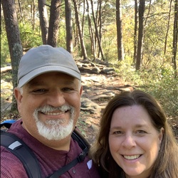
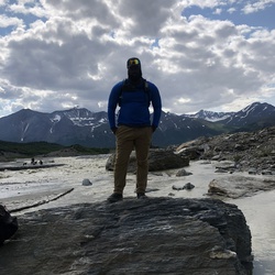
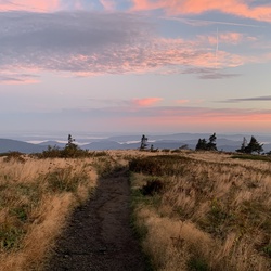
    This was a moderately challenging hike with beautiful views. Water was present at appropriate intervals. The mountain ridge portion included gorgeous 360° views of NC and Tn.
    ★ ★ ★ ★

    user_profile
    jtraincavs 2 years, 9 months ago
    Laurel Falls to Watauga Lake AT
    No views to speak of. Good exercise. Watch out for yellow jackets.
    ★ ★ ★

    user_profile
    mary-ballard 2 years, 11 months ago
    Track (7/4/23, 12:13:34PM)
    Nice hiking trail with a cool canopy of foliage and a creek that leads to a waterfall. We didn’t do the whole hike. The hike to the waterfall is strenuous but not difficult.
    ★ ★ ★ ★ ★

    user_profile
    wilconwel 3 years, 1 month ago
    Track (4/15/23, 14:53:44)
    Grueling. Not many views. But if you come with that understanding, it’s a great mind and body test.
    ★ ★ ★ ★

    user_profile
    OhYouTeaKAST 3 years, 2 months ago
    Track (3/9/23, 3:16:02PM)
    Extremely easy walk to Firescald. Very underrated views, and one of the Top 5 in TN/NC in my opinion. The drive up to Jones meadow can get pretty rough but if you have a high clearance vehicle and take it slow it’s no big deal. Plenty of parking and tons of stealth camp sites.
    ★ ★ ★ ★ ★

    user_profile
    haphill 3 years, 4 months ago
    Turtletown Creek Falls Trail
    I’ve not done much hiking this winter and I found this challenging. It’s truly beautiful. I took the right fork of the lollipop. Pretty steep grade both up and down. There is a spur up to Shinbone ridge which I took. Not really much there, at least as far as I went. Continued on to the lower and larger falls. Gorgeous! Had some difficulty finding the return trail that stays nearer the creek. It’s not we’ll marked. You go up the way you came and it’s off to the right about 209 yards or so.
    ★ ★ ★ ★

    user_profile
    jaymaxvenable 3 years, 9 months ago
    Dennis cove falls
    Great camping area for overnights right at base of upper Dennis cove falls…5 star camping
    ★ ★ ★ ★ ★

    user_profile
    aniesen 4 years, 1 month ago
    Long Branch Road to Dick Creek, Unicoi County, TN, USA
    Stock Tacoma, easy trail.
    ★ ★ ★ ★

    user_profile
    Nathan 4 years, 11 months ago
    Track (4/25/21, 3:16:49PM)
    Simple little hike with views of the Hiawassee Lake/ Nottely River. Trail is maintained and marked with blue tags. Several off shoot hikes as well.
    ★ ★ ★ ★ ★

    user_profile
    daniel 5 years ago
    Wolf Creek Trail to Wolf Creek
    This app tracked this trail 4.25 miles one way. Hiked on an overcast afternoon. Canopy was thick and made the trail feel dark and foreboding. Several mud pit crossings and Several creek crossings. Got my boots soaked after the 3rd crossing. Gave up on keeping my feet dry after that. All but the last mile was super easy, mostly level trail. Last mile was a not-so-bad uphill climb. Waterfall was worth the hike. Return hike was super fast as it was all downhill.
    ★ ★ ★

    user_profile
    rossgaudet85 5 years, 2 months ago
    BMT HWY 64 to Hiwasse Outfitters
    Great hike ! first day a lot of elevation gain but after that smooth sailing!!!!
    ★ ★ ★ ★

    user_profile
    htparavt 5 years, 2 months ago
    Track (3/6/21, 2:26:41PM)
    This hike was alright. I would rate it moderate to hard depending on ability. The terrain was varied and there were a couple of difficult spots but was well worth it. Totally would do this again.
    ★ ★ ★ ★

    user_profile
    jakjonest 5 years, 3 months ago
    Exploring (3/5/21, 12:47:57PM)
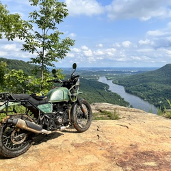
    Great ride, however made a couple wrong turns but found my way!
    ★ ★ ★ ★

    user_profile
    akjblizz 5 years, 4 months ago
    Track (1/27/21, 2:45:53PM)
    A great hike if you’re looking for vipers. Copperheads and timber rattlers like the rock outcrops and can be viewed even on a warm winter day.
    ★ ★ ★

    user_profile
    kspetaln 5 years, 7 months ago
    Loop C to Slick Rock Naked Widow Loop, Polk County, TN, USA
    A nice loop off the beaten Benton path. 500 ft climb max. Includes the falls.
    ★ ★ ★ ★

    user_profile
    Trailmaster 5 years, 7 months ago
    Track (11/2/20, 9:51:25AM)
    Good hike!
    ★ ★ ★ ★

    user_profile
    kspetaln 5 years, 7 months ago
    Loop C to Slick Rock Naked Widow Loop, Polk County, TN, USA
    A nice loop off the beaten Benton path. 500 ft climb max. Includes the falls.
    ★ ★ ★ ★

    user_profile
    jerry7864 5 years, 7 months ago
    Track (10/18/20, 10:48:13AM)
    Steep climb to see Lowry Falls. Up and back with a dog took 30 minutes.
    ★ ★ ★ ★

    user_profile
    Steve 5 years, 8 months ago
    Rock Creek to Bear Paw Loop, Polk County, TN, USA
    Very enjoyable hike, well marked and lots of options regarding distance. You can make it as long or as short as you want. Some rocky spots but very manageable
    ★ ★ ★ ★ ★

    user_profile
    Walter Cross II 5 years, 8 months ago
    Searchmwe
    J k w Ltff
    ★ ★

    user_profile
    Laury 5 years, 9 months ago
    Track (8/21/19, 4:37:28PM)
    Long ride with no water crossings. We were on horses and it took all day. A lot of hills but trails were well maintained. Best time to ride here is fall, winter or early spring
    ★ ★ ★

    user_profile
    Steve 5 years, 9 months ago
    Clemmer Trail (8/6/20, 09:06:57)
    Great hike, lots of rocks and roots so watch you footing. A few water crossings but this hike they were no problem. We changed routes on the return trip and added about half a mile
    ★ ★ ★ ★ ★

    user_profile
    Edward 6 years, 4 months ago
    Crowder Branch (84) ➡️ Fodderstack (95) ➡️ Mill Branch (96) loop
    Trail is rugged due to low traffic and low maintenance. Map skills my be of good use. I rate this hike as rugged Because of many blow downs, stream crossings (trail sometimes becomes part of the stream), uneven/slanting trail, trail is over grown and easy to get turned around on. Positive highlights: Lots of Rhododendrons. complete solitude. Lots of green moss and the feeling of being deep into the wilderness. Water sources looked to be plentiful most or all year and camping is leave no trace. P.S. road to get to the trail head is dirt/gravel. Lots of pot holes, and narrow. Take caution and enjoy 😉
    ★ ★ ★

    user_profile
    juliehumberger 6 years, 10 months ago
    Willis Springs with Doug
    Absolutely beautiful ride along the banks of the Conesauga River. Rode to the Picnic Area at the Conesauga Blue Hole. Be aware of the giant black horse flies, and many deer flies throughout the ride. Fly mask or bonnets are highly recommended, especially for lead horse.
    ★ ★ ★ ★ ★

    user_profile
    bodierad 7 years ago
    Scales via Appalachian Trail
    The Scales are a magical place. An enclosed fenced area and well taken of. The AT goes thru the Scales and there is also a rough 4-wheel road, about 4 miles in length that provides access.
    ★ ★ ★ ★ ★

    user_profile stars
    glockwork9 7 years, 6 months ago
    The trail itself is nothing to talk about, but the waterfall is pretty good. If your looking for an adventure this isn't the place for you. The best way I can describe it is generic.
    ★ ★ ★

    user_profile
    Brady 1 year, 8 months ago
    Benton Falls Trail
    ★ ★ ★ ★ ★

    user_profile
    Brady 1 year, 8 months ago
    Benton Falls Trail
    ★ ★ ★ ★ ★

    user_profile
    ireadthisonmonday 1 year, 8 months ago
    Track (9/13/24, 3:49:13PM)
    ★ ★ ★ ★ ★

    user_profile
    walker.pinnacle 1 year, 8 months ago
    Saturday Sept 7 Drive
    ★ ★ ★

    user_profile
    Ben 1 year, 9 months ago
    Indian Boundary drive
    ★ ★ ★ ★ ★

    user_profile
    Josh 1 year, 9 months ago
    Track (8/18/24, 7:38:32AM)
    ★ ★ ★ ★ ★

    user_profile
    Grits4Jim 1 year, 9 months ago
    Oswald Road (77) Reliance to Parksville Lake(8/10/24)
    ★ ★ ★ ★

    user_profile
    caracameron 1 year, 10 months ago
    Track (4/27/24, 2:09:23PM)
    ★ ★ ★ ★ ★

    user_profile
    cseago1 1 year, 11 months ago
    We’d Tellico out and back
    ★ ★ ★ ★

    user_profile
    Ann 1 year, 11 months ago
    Track (6/8/24, 2:39:28PM)
    ★ ★ ★ ★

    user_profile
    rbaker1270 1 year, 11 months ago
    Rock Creek Campground to Rock Creek, Unicoi County, TN, USA
    ★ ★ ★ ★

    user_profile
    estahl15 1 year, 11 months ago
    Citico ride with Joel
    ★ ★ ★ ★ ★

    user_profile
    aniesen 2 years ago
    Coldspring Mountain via Horse Creek Road
    ★ ★ ★ ★

    user_profile
    brothermike3 2 years ago
    Jeffries He’ll (5/11/24, 12:48:22PM)
    ★ ★ ★ ★

    user_profile
    rt234332 2 years ago
    Scales via Appalachian Trail
    ★ ★ ★ ★ ★

    user_profile
    billet4u2 2 years ago
    ACTIVE LOG 001
    ★

    user_profile
    Nat 2 years, 1 month ago
    Track (4/28/24, 3:26:49PM)
    ★ ★ ★ ★

    user_profile
    KokoMoe OverLand 2 years, 1 month ago
    Benton Falls hike (4/17/24, 11:37:57)
    ★ ★ ★ ★

    user_profile
    krugewal 2 years, 1 month ago
    Rock creek trail to TVA3
    ★ ★ ★ ★ ★

    user_profile
    hillsdalejcman14 2 years, 2 months ago
    McFarland Road
    ★

    user_profile
    Ronald Bayens 2 years, 2 months ago
    Flint Mill Trail, Sullivan County, TN, USA
    ★ ★ ★ ★ ★

    user_profile
    jobottini 2 years, 4 months ago
    T6: Big Frog Mtn - Licklog & Benton McKaye Loop
    ★

    user_profile
    atlistes 2 years, 5 months ago
    Rock Creek Falls
    ★ ★ ★

    user_profile
    Terrymartindale 2 years, 5 months ago
    Smith Mountain
    ★ ★ ★ ★

    user_profile
    Terrymartindale 2 years, 6 months ago
    Mad Dog Trail
    ★ ★ ★ ★ ★

    user_profile
    heltonelectric 2 years, 6 months ago
    Track (11/15/23, 11:54:56)
    ★ ★ ★ ★

    user_profile
    bkweathe 2 years, 6 months ago
    Big Frog Mountain Loop via Big Frog
    ★

    user_profile
    jfitzgerald 2 years, 7 months ago
    Sunday Walk Around Boomer (11/5/23, 11:08:58AM)
    ★ ★ ★ ★ ★

    user_profile
    Daniel Worley 2 years, 7 months ago
    Benton MacKaye Trail - Mud Gap to Whigg Meadow (10/22/23, 4:16:31PM)
    ★ ★ ★ ★

    user_profile
    Trevor 2 years, 8 months ago
    Laurel Fork Trail
    ★ ★ ★

    user_profile
    Trevor 2 years, 8 months ago
    Track (6/11/23, 9:55:33AM)
    ★ ★ ★

    user_profile
    Trevor 2 years, 8 months ago
    Laurel Falls - TN
    ★ ★ ★ ★

    user_profile
    pjshappy2 2 years, 10 months ago
    Track (8/1/23, 4:19:37PM)
    ★ ★ ★ ★ ★

    user_profile
    firestonem 2 years, 10 months ago
    Track (7/22/23, 7:34:59AM)
    ★ ★ ★ ★ ★

    user_profile
    Jerry.connelly@stanfordalumni.org 2 years, 10 months ago
    Big Firescald knob
    ★ ★ ★ ★ ★

    user_profile
    GmanCDP 2 years, 10 months ago
    sm500 yel v8
    ★ ★ ★ ★

    user_profile
    mary-ballard 2 years, 11 months ago
    Clemmer
    ★

    user_profile
    jtraincavs 2 years, 11 months ago
    Mud Gap to Whigg Meadow
    ★ ★ ★

    user_profile
    rayrokni 2 years, 11 months ago
    TAT 2023 Day4
    ★ ★ ★ ★ ★

    user_profile
    Bw80200 2 years, 11 months ago
    Track (10/7/22, 10:29:15AM)
    ★ ★ ★ ★ ★

    user_profile
    David Blanken 3 years ago
    Backbone Falls Trail
    ★ ★ ★

    user_profile
    BikeTN 3 years ago
    Bellcow Mountain via Shad Road
    ★

    user_profile
    danlee865 3 years ago
    Gravel Route: Waucheesi lookout
    ★ ★ ★ ★ ★

    user_profile
    kcissna 3 years, 1 month ago
    Thunder Rock Express to Chestnut Mtn to BMT
    ★ ★ ★ ★ ★

    user_profile
    danlee865 3 years, 1 month ago
    Toqua to Citico Creek
    ★ ★ ★ ★ ★

    user_profile
    rnbaker18 3 years, 2 months ago
    walked to random places off of our normal trail
    ★ ★ ★ ★ ★

    user_profile
    travismull77 3 years, 2 months ago
    Track (3/5/23, 16:53:48)
    ★ ★ ★ ★ ★

    user_profile
    preston_king 3 years, 2 months ago
    Track (3/15/23, 12:32:33PM)
    ★ ★ ★ ★ ★

    user_profile
    ashleyrn80 3 years, 2 months ago
    Indian Boundary loop trail
    ★ ★ ★ ★ ★

    user_profile
    ashleyrn80 3 years, 2 months ago
    Indian Boundary loop trail
    ★ ★ ★ ★ ★

    user_profile
    Knapper13 3 years, 3 months ago
    Bakers Grave Mountain via Witt Road
    ★

    user_profile
    jonversnick 3 years, 3 months ago
    Smokey Mountain 500 Yellow track
    ★ ★ ★ ★ ★

    user_profile
    rockwoodp 3 years, 3 months ago
    Campbell Mine, Johnson County, TN to 26575 Karsch Road, Boerne, TX, USA
    ★

    user_profile
    pjshappy2 3 years, 3 months ago
    Track (1/15/23, 12:43:11PM)
    ★

    user_profile
    bdurden44 3 years, 4 months ago
    Track (3/12/22, 11:57:52AM)
    ★ ★ ★ ★ ★

    user_profile
    pjshappy2 3 years, 4 months ago
    Track (1/7/23, 1:10:52PM)
    ★ ★ ★ ★ ★

    user_profile
    pjshappy2 3 years, 5 months ago
    Track (12/17/22, 12:50:33PM)
    ★ ★ ★ ★ ★

    user_profile
    gretchenkirkland 3 years, 5 months ago
    C141 johns knob
    ★

    user_profile
    mikepilvinsky 3 years, 5 months ago
    Old Copper Road
    ★ ★ ★ ★ ★

    user_profile
    dougfisher67 3 years, 7 months ago
    Track (8/25/22, 16:41:4)
    ★ ★ ★ ★

    user_profile
    1969wtf 3 years, 7 months ago
    Horse Creek Road to Squibb Creek Trail
    ★ ★ ★ ★ ★

    user_profile
    david.e.geiger 3 years, 7 months ago
    FIVE: DUAL SPORT clockwise
    ★ ★ ★ ★ ★

    user_profile
    actionhero7 3 years, 7 months ago
    Chestnut Mountain Bluff
    ★ ★ ★ ★ ★

    user_profile
    philshiv 3 years, 7 months ago
    Track (8/27/22, 9:46:59AM)
    ★ ★ ★ ★ ★

    user_profile
    firemedic415 3 years, 8 months ago
    Track (12/12/21, 13:27:39)
    ★ ★ ★ ★

    user_profile
    lottamurray.59 3 years, 8 months ago
    Longarm branch
    ★ ★

    user_profile
    danielbv 3 years, 8 months ago
    Flats Mountain Trail (6/12/22, 2:39:13PM)
    ★ ★ ★ ★

    user_profile
    allison.grier 3 years, 8 months ago
    Falls branch falls
    ★ ★ ★ ★ ★

    user_profile
    sjcarothers 3 years, 9 months ago
    Rocky Fork Trail and Whitehouse Cliffs Trail/Route Loop
    ★

    user_profile
    OhYouTeaKAST 3 years, 9 months ago
    Track (8/28/22, 5:46:52PM)
    ★ ★ ★ ★ ★

    user_profile
    GeezerEnduro 3 years, 9 months ago
    Max Patch Ride 8.20.2022
    ★ ★ ★ ★ ★

    user_profile
    kris 3 years, 9 months ago
    Rocky fork
    ★ ★ ★ ★

    user_profile
    davidsmith918 3 years, 10 months ago
    David, Gena Squibb Crk Falls 7-28-22
    ★ ★ ★

    user_profile
    kris 3 years, 10 months ago
    Paint creek
    ★ ★ ★ ★

    user_profile
    bilyana.bangieva 3 years, 10 months ago
    Track (7/20/22, 11:05:52AM)
    ★ ★ ★ ★ ★

    user_profile
    richard_ball 3 years, 10 months ago
    Track (7/6/22, 10:15:24AM)
    ★ ★

    user_profile
    adamreiss95 3 years, 10 months ago
    Adam’s Trail Ride 1
    ★ ★ ★ ★ ★

    user_profile
    grayfam1 4 years ago
    Track (5/31/22, 11:17:52AM)
    ★ ★ ★ ★ ★

    user_profile
    dent9 4 years ago
    Ocoee Camp Spot
    ★ ★ ★ ★ ★

    user_profile
    mikefontinell 4 years ago
    Track (5/29/22, 9:06:36AM)
    ★ ★ ★ ★ ★

    user_profile
    charlieg6352 4 years ago
    Rattlesnake Rock
    ★ ★ ★

    user_profile
    jedmaho 4 years, 1 month ago
    Hike to mine
    ★ ★ ★ ★ ★

    user_profile
    juliehumberger 4 years, 1 month ago
    Track (4/27/22, 9:42:13AM)
    ★ ★ ★ ★ ★

    user_profile
    dpeschio 4 years, 1 month ago
    Track (3/20/22, 11:44:24AM)
    ★ ★ ★ ★ ★

    user_profile
    Wjack45 4 years, 1 month ago
    Track (4/15/22, 1:04:33PM)
    ★ ★ ★ ★ ★

    user_profile
    jvalladareswood 4 years, 2 months ago
    #1 - Witt Rd/Old Furnace Rd/FSR 384 & 126
    ★ ★ ★ ★ ★

    user_profile
    rnmsnyd86 4 years, 2 months ago
    Citicorp Creek.
    ★ ★

    user_profile
    myiggi 4 years, 2 months ago
    Beautybeast/pleasant gardens (3/19/22, 9:38:40AM)
    ★ ★ ★ ★ ★

    user_profile
    davidsmith918 4 years, 3 months ago
    Coldspring Mountain via Horse Creek Road
    ★ ★ ★ ★ ★

    user_profile
    myiggi 4 years, 3 months ago
    Rocky fork.block stand creek trail >block stand creek access trail
    ★ ★ ★ ★ ★

    user_profile
    bcook198727 4 years, 3 months ago
    Track (1/16/22, 4:03:24PM)
    ★ ★ ★ ★

    user_profile
    dwrusch 4 years, 3 months ago
    Rocky Fork river trail
    ★ ★ ★ ★

    user_profile
    myiggi 4 years, 4 months ago
    Cross Mtn/Double Springs Shelter (1/31/22, 9:48:58AM)
    ★ ★ ★ ★ ★

    user_profile
    maynardt 4 years, 4 months ago
    Track (1/29/22, 1:06:56PM)
    ★ ★ ★ ★ ★

    user_profile
    maynardt 4 years, 5 months ago
    McQueens Gap Rd. (1/5/22, 1:02:55PM)
    ★ ★ ★

    user_profile
    smokymtnjonny 4 years, 5 months ago
    Big Frog Mountain
    ★ ★ ★ ★ ★

    user_profile
    maynardt 4 years, 5 months ago
    Wheeler Spur (12/30/21)
    ★ ★ ★ ★

    user_profile
    bartleymcmurray 4 years, 5 months ago
    Cherohala Skyway
    ★

    user_profile
    Sky Pilot 4 years, 5 months ago
    Track (12/16/21, 11:45:36AM)
    ★ ★ ★ ★ ★

    user_profile
    Shelley 4 years, 6 months ago
    Miller’s Ridge, Tellico Plains (12/1/21, 11:16:17AM)
    ★ ★ ★ ★ ★

    user_profile
    nicholas.r.dyson 4 years, 7 months ago
    Rattlesnake Ridge Trail
    ★ ★ ★

    user_profile
    Rob Bush 4 years, 7 months ago
    Track (10/13/21, 11:54:26AM)
    ★ ★ ★ ★

    user_profile
    chris 4 years, 7 months ago
    Track (2/2/20, 1:10:16PM)
    ★ ★ ★ ★ ★

    user_profile
    jfcampbell485 4 years, 7 months ago
    SM500 Day one
    ★ ★ ★ ★ ★

    user_profile
    mwilliams 4 years, 8 months ago
    FR 220 & 297 btwn 44 & SR39
    ★

    user_profile
    rpate55 4 years, 8 months ago
    Penstock (23B)
    ★ ★ ★ ★ ★

    user_profile
    chrisskalet 4 years, 8 months ago
    Bob Bald
    ★ ★ ★ ★

    user_profile
    dpmills1984 4 years, 8 months ago
    Round Mountain Campground
    ★ ★ ★ ★ ★

    user_profile
    kjbriscoe1 4 years, 9 months ago
    Bald Mountain via Round Knob Road
    ★ ★ ★ ★ ★

    user_profile
    zackarycaserta 4 years, 9 months ago
    White Rock Upper to White Rock Loop, Washington County, TN, USA
    ★ ★ ★ ★ ★

    user_profile
    bscoleman 4 years, 9 months ago
    Track (8/14/21, 09:21:51)
    ★ ★ ★ ★

    user_profile
    mzackpearson 4 years, 9 months ago
    Track (8/9/21, 5:44:37PM)
    ★ ★

    user_profile
    lynnelemmonsdesigns 4 years, 10 months ago
    Ellie Mae back at Willis springs
    ★ ★ ★ ★ ★

    user_profile
    mrnickzel 4 years, 10 months ago
    Driving
    ★ ★ ★

    user_profile
    mrnickzel 4 years, 10 months ago
    Walk at Dam, next to Ricer
    ★ ★ ★

    user_profile
    rykilg 4 years, 10 months ago
    SR 68
    ★ ★

    user_profile
    schu9914 4 years, 10 months ago
    Fly fishing 7/24/21
    ★ ★ ★ ★

    user_profile
    Jonathan 4 years, 10 months ago
    McCamy Dam via Benton Falls
    ★ ★

    user_profile
    infidel556 4 years, 10 months ago
    Benton Falls
    ★ ★ ★ ★ ★

    user_profile
    sparling.nick 4 years, 11 months ago
    Big Laurel Branch Scouting
    ★ ★ ★ ★

    user_profile
    Dankaiser02 4 years, 11 months ago
    TAT - NC, TN & GA
    ★ ★ ★ ★ ★

    user_profile
    sparling.nick 4 years, 11 months ago
    Big Laurel Branch Scouting
    ★ ★ ★ ★

    user_profile
    sparling.nick 4 years, 11 months ago
    Big Laurel Branch Scouting
    ★ ★ ★ ★

    user_profile
    sparling.nick 4 years, 11 months ago
    Big Laurel Branch Scouting
    ★ ★ ★ ★

    user_profile
    sparling.nick 4 years, 11 months ago
    Big Laurel Branch Scouting
    ★ ★ ★ ★

    user_profile
    sparling.nick 4 years, 11 months ago
    Big Laurel Branch Scouting
    ★ ★ ★ ★

    user_profile
    sparling.nick 4 years, 11 months ago
    Big Laurel Branch Scouting
    ★ ★ ★ ★

    user_profile
    standardyouth 4 years, 11 months ago
    Miracle 1..
    ★ ★ ★

    user_profile
    mikefontinell 4 years, 11 months ago
    Track (6/6/21, 7:45:41AM)
    ★ ★ ★ ★ ★

    user_profile
    rexgodfrey 5 years ago
    Laurel Falls TN.
    ★ ★ ★ ★ ★

    user_profile
    Mason 5 years ago
    Track (5/22/21, 9:20:53AM)
    ★ ★ ★ ★ ★

    user_profile
    Everglades Rover 5 years ago
    Overland trip 2021 5/23/21-5/25/21
    ★ ★ ★ ★ ★

    user_profile
    Janie 5 years ago
    Track (5/23/21, 9:12:06AM)
    ★ ★ ★ ★

    user_profile
    terri.haver 5 years ago
    Track (5/21/21, 9:03:23AM)
    ★ ★ ★ ★ ★

    user_profile
    jenkinstd7 5 years, 1 month ago
    Little Dark Hollow to Rock Creek Elementary School
    ★ ★ ★ ★ ★

    user_profile
    Lesli 5 years, 1 month ago
    Dicks Creek
    ★ ★ ★ ★

    user_profile
    Bailey Kessing 5 years, 1 month ago
    Track (4/20/21, 9:50:46AM)
    ★ ★ ★ ★

    user_profile
    lynnelemmonsdesigns 5 years, 1 month ago
    Track (4/20/21, 10:23:49AM)
    ★ ★ ★ ★ ★

    user_profile
    ben_hinze 5 years, 1 month ago
    Benton Falls Loop Trail 4/18/21
    ★ ★ ★ ★

    user_profile
    scott.trew 5 years, 1 month ago
    Dellas and Trews
    ★ ★ ★ ★ ★

    user_profile
    jenkinstd7 5 years, 1 month ago
    Rock Creek to Unaka Mountain Scenic Trail, Unicoi County, TN, USA
    ★ ★ ★ ★ ★

    user_profile
    jenkinstd7 5 years, 1 month ago
    Rock Creek to Unaka Mountain Scenic Trail, Unicoi County, TN, USA
    ★ ★ ★ ★ ★

    user_profile
    tommyhodge48 5 years, 1 month ago
    Track (4/9/21, 1:22:18PM)
    ★ ★ ★ ★ ★

    user_profile
    jbasil1978 5 years, 1 month ago
    Round Mountain via Star Mountain Road and Starr Mountain Road
    ★ ★ ★ ★ ★

    user_profile
    jhowton 5 years, 2 months ago
    Hurricane Gap
    ★ ★ ★ ★

    user_profile
    randy.greenway 5 years, 2 months ago
    Reliance, Hiwassee and Buck Bald
    ★ ★ ★ ★

    user_profile
    gburl3 5 years, 2 months ago
    The Grand Adv(3/13/21, 3:10:01PM)
    ★ ★ ★ ★ ★

    user_profile
    bdurden44 5 years, 2 months ago
    Track (2/28/21, 1:17:47PM)
    ★ ★ ★ ★

    user_profile
    bdurden44 5 years, 2 months ago
    Track (2/28/21, 10:30:00AM)
    ★ ★ ★ ★

    user_profile
    falcon13 5 years, 2 months ago
    Indian Boundary Road
    ★ ★ ★ ★

    user_profile
    MixFixDave 5 years, 2 months ago
    MMM2019 #1 - 115 Miles / 5hr
    ★

    user_profile
    netduffer 5 years, 2 months ago
    Rocky Fork
    ★ ★ ★ ★ ★

    user_profile
    gretchenkirkland 5 years, 2 months ago
    C141 from mud gap x2
    ★

    user_profile
    Ian P. 5 years, 2 months ago
    Cherry Log Gap ➡️ Mill Branch Campsite
    ★ ★ ★ ★ ★

    user_profile
    Shelley 5 years, 2 months ago
    Miller’s Ridge, Tellico Plains (2/24/21, 10:29:53AM)
    ★ ★ ★ ★ ★

    user_profile
    Shelley 5 years, 2 months ago
    Miller’s Ridge, Tellico Plains (3/12/21, 10:33:32AM)
    ★ ★ ★ ★ ★

    user_profile
    harleyoffshore 5 years, 2 months ago
    Firescald Knob via Walnut Mountain Road
    ★ ★ ★ ★ ★

    user_profile
    Swaygo 5 years, 3 months ago
    Laurel Falls
    ★ ★ ★ ★

    user_profile
    bdurden44 5 years, 3 months ago
    Track (2/21/21, 11:17:35AM)
    ★ ★ ★ ★

    user_profile
    jedmaho 5 years, 3 months ago
    Track (2/20/21, 8:28:32AM)
    ★ ★ ★ ★ ★

    user_profile
    lynnelemmonsdesigns 5 years, 4 months ago
    Track (2/3/21, 11:33:39AM)
    ★ ★ ★ ★ ★

    user_profile
    karl 5 years, 4 months ago
    Coffee branch 105 to Chestnut Mt 110
    ★ ★ ★ ★

    user_profile
    clineback 5 years, 4 months ago
    South Holston Lake via Big Creek Road
    ★ ★

    user_profile
    Joshua Daniels 5 years, 4 months ago
    Track (5/16/20, 2:44:45PM)
    ★ ★ ★ ★ ★

    user_profile
    scott.trew 5 years, 5 months ago
    Track (1/4/21, 10:07:57AM)
    ★ ★ ★ ★ ★

    user_profile
    Nancy 5 years, 5 months ago
    Old Furnace Road
    ★ ★ ★

    user_profile
    wakesurfmc 5 years, 5 months ago
    Rock Creek Falls 12/29/20
    ★ ★ ★

    user_profile
    Isaac Abkes 5 years, 5 months ago
    Doe River RR
    ★ ★ ★ ★ ★

    user_profile
    msbalfrey 5 years, 5 months ago
    Benton Mackaye day 8
    ★ ★ ★ ★ ★

    user_profile
    bscoleman 5 years, 5 months ago
    Track (12/13/20, 10:46:31)
    ★ ★ ★ ★

    user_profile
    The Roaming Dad 5 years, 6 months ago
    Falls Branch Falls
    ★ ★ ★ ★ ★

    user_profile
    Bailey Kessing 5 years, 6 months ago
    Laurel Falls Tennessee
    ★ ★ ★ ★

    user_profile
    bmoses19 5 years, 6 months ago
    Track (12/3/20, 6:54:09PM)
    ★ ★ ★ ★ ★

    user_profile
    wolfpackrobert2012 5 years, 6 months ago
    Track (11/27/20, 12:19:40PM)
    ★ ★ ★ ★

    user_profile
    walk6602 5 years, 6 months ago
    House on ridge12:53:12PM)
    ★ ★ ★

    user_profile
    RockLander620 5 years, 6 months ago
    Lost Creek to Powehouse from Hwy 30
    ★ ★ ★

    user_profile
    dhsmith 5 years, 6 months ago
    Big Frog Mountain via Hemp Top
    ★ ★ ★

    user_profile
    garrettmd 5 years, 6 months ago
    AT over emerald forest from the SW on Beauty Spot Hap Rd
    ★ ★ ★ ★ ★

    user_profile
    tthompson833 5 years, 6 months ago
    Section Hike Day 3
    ★ ★ ★ ★

    user_profile
    David McVicker 5 years, 6 months ago
    Buzzard Rock Loop - Rocky Fork State Park
    ★ ★ ★ ★ ★

    user_profile
    Brian 5 years, 6 months ago
    Smoky Mount ride (11/6/20, 9:29:28AM)
    ★ ★ ★ ★ ★

    user_profile
    tom.aloi 5 years, 7 months ago
    McCamy Dam via Benton Falls
    ★ ★ ★ ★ ★

    user_profile
    tdavis1011 5 years, 7 months ago
    Peach State Ride
    ★ ★ ★ ★ ★

    user_profile
    drelkins 5 years, 7 months ago
    AT - Labor Day 2020
    ★ ★ ★ ★ ★

    user_profile
    turbostrat17 5 years, 7 months ago
    Track (10/15/20, 12:35:04PM)
    ★ ★ ★ ★ ★

    user_profile
    thedaddybadger 5 years, 7 months ago
    2020 FCR STAGE 3 - 4WD ONLY! NO EXCEPTIONS.
    ★ ★ ★ ★ ★

    user_profile
    thedaddybadger 5 years, 7 months ago
    2020 FCR STAGE 3 - 4WD ONLY! NO EXCEPTIONS.
    ★ ★ ★ ★ ★

    user_profile
    thedaddybadger 5 years, 7 months ago
    2020 FCR STAGE 3 - 4WD ONLY! NO EXCEPTIONS.
    ★ ★ ★ ★ ★

    user_profile
    thedaddybadger 5 years, 7 months ago
    2020 FCR STAGE 3 - 4WD ONLY! NO EXCEPTIONS.
    ★ ★ ★ ★ ★

    user_profile
    gmartin200 5 years, 7 months ago
    Rock Creek Falls
    ★ ★ ★ ★ ★

    user_profile
    drelkins 5 years, 8 months ago
    AT - Labor Day 2020
    ★ ★ ★ ★ ★

    user_profile
    juliehumberger 5 years, 8 months ago
    Willis Springs with Pattie, Cecilia, Noel and Lynn
    ★ ★ ★ ★ ★

    user_profile
    nathancharlier 5 years, 8 months ago
    Hurricane Gap
    ★ ★ ★ ★ ★

    user_profile
    bradyhodges 5 years, 8 months ago
    Track (9/7/20, 12:37:32PM)
    ★ ★ ★ ★

    user_profile
    tyrone.simerly 5 years, 9 months ago
    Laurel Fork Falls
    ★ ★ ★ ★ ★

    user_profile
    ruey.ricker 5 years, 9 months ago
    VA track (8/26/20)
    ★ ★ ★

    user_profile
    Isaac Abkes 5 years, 9 months ago
    Rocky Fork State Park, Flag Pond, TN, USA
    ★ ★ ★ ★ ★

    user_profile
    Isaac Abkes 5 years, 9 months ago
    Rocky Fork State Park, Flag Pond, TN, USA
    ★ ★ ★ ★ ★

    user_profile
    blakebxj 5 years, 9 months ago
    Tellico plains raptor
    ★ ★ ★ ★ ★

    user_profile
    Isaac Abkes 5 years, 9 months ago
    Rocky Fork State Park, Flag Pond, TN, USA
    ★ ★ ★ ★ ★

    user_profile
    joe32224 5 years, 9 months ago
    McCamy Lake to Cherokee National Forest, Polk County, TN, USA
    ★ ★ ★ ★

    user_profile
    12notch 5 years, 9 months ago
    Wolf Creek Waterfall
    ★ ★ ★ ★ ★

    user_profile
    kyle.t.foley 5 years, 9 months ago
    TN 08
    ★ ★ ★ ★

    user_profile
    bscoleman 5 years, 10 months ago
    Track (7/25/20, 09:04:5)
    ★ ★ ★

    user_profile
    Isaac Abkes 5 years, 10 months ago
    Track (8/3/20, 4:42:57PM)
    ★ ★ ★ ★ ★

    user_profile
    zackarybowenap 5 years, 10 months ago
    Horse Creek Trail 4x4
    ★ ★ ★ ★ ★

    user_profile
    Michael 5 years, 10 months ago
    Falls Branch Falls
    ★ ★ ★

    user_profile
    lynnelemmonsdesigns 5 years, 10 months ago
    Track (7/23/20, 10:36:38AM)
    ★ ★ ★ ★ ★

    user_profile
    philshiv 5 years, 10 months ago
    Red Fork
    ★ ★ ★ ★ ★

    user_profile
    wrhawkins51 5 years, 10 months ago
    robbinsville tellico plains
    ★ ★ ★ ★ ★

    user_profile
    chuck37323 5 years, 11 months ago
    Campbell Branch to 127 Meridith Dr, Polk County, TN, USA
    ★ ★ ★

    user_profile
    blakebxj 5 years, 11 months ago
    Tellico
    ★ ★ ★ ★ ★

    user_profile
    blakebxj 5 years, 11 months ago
    Tellico Plains Multiple routes
    ★ ★ ★ ★ ★

    user_profile
    Kris 5 years, 11 months ago
    Cherohala skyway to river road
    ★ ★ ★ ★ ★

    user_profile
    ratherbflyin 5 years, 11 months ago
    Headwaters/Blockstand/Access/Flint Creek
    ★ ★

    user_profile
    Dwight Wyatt 5 years, 11 months ago
    Track (6/7/20, 9:41:34AM)
    ★ ★ ★ ★ ★

    user_profile
    pillarmatthew 6 years ago
    Coldspring Mountain via Horse Creek Road
    ★ ★ ★ ★ ★

    user_profile
    Alex 6 years ago
    Track (5/24/20, 12:34:18PM)
    ★ ★ ★ ★

    user_profile
    SixthManKid 6 years ago
    Track (5/16/20, 3:08:05PM)
    ★ ★ ★ ★

    user_profile
    greggbev 6 years ago
    McCamy Dam via Benton Falls
    ★ ★ ★ ★

    user_profile
    Alex 6 years, 1 month ago
    Track (5/2/20, 12:59:03PM)
    ★ ★ ★ ★ ★

    user_profile
    Bo 6 years, 1 month ago
    Track (3/30/20, 2:52:09PM)
    ★ ★ ★ ★ ★

    user_profile
    SixthManKid 6 years, 1 month ago
    Track (4/11/20, 3:05:22PM)
    ★ ★ ★ ★

    user_profile
    Joshua Daniels 6 years, 1 month ago
    Track (3/30/20, 10:46:40AM)
    ★ ★ ★ ★ ★

    user_profile
    SixthManKid 6 years, 1 month ago
    Track (4/5/20, 11:33:51AM)
    ★ ★ ★ ★

    user_profile
    SixthManKid 6 years, 1 month ago
    Track (4/4/20, 12:06:07PM)
    ★ ★ ★ ★

    user_profile
    juliehumberger 6 years, 2 months ago
    Starr Mountain on Tex with Annette
    ★ ★ ★ ★ ★

    user_profile
    rbaker1270 6 years, 3 months ago
    Unaka Mtn
    ★ ★ ★ ★

    user_profile
    lsluss1 6 years, 4 months ago
    Coldspring Mountain via Horse Creek Road
    ★ ★ ★ ★

    user_profile
    lynnelemmonsdesigns 6 years, 4 months ago
    Green trail lost boot
    ★

    user_profile
    stevehahn70 6 years, 4 months ago
    Blockstand Creek Loop
    ★ ★ ★

    user_profile
    ronflesch 6 years, 4 months ago
    ★ ★ ★ ★ ★

    user_profile
    backer323mx 6 years, 5 months ago
    Track (11/2/19, 3:25:04PM)
    ★ ★ ★ ★

    user_profile
    vdavej 6 years, 5 months ago
    Track (12/28/19, 10:57:01AM)
    ★ ★ ★ ★ ★

    user_profile
    edbapinc 6 years, 5 months ago
    Track (12/26/19, 1:00:12PM)
    ★ ★ ★ ★ ★

    user_profile
    jeffavannoy 6 years, 5 months ago
    Flint mill trail
    ★ ★ ★ ★

    user_profile
    dawnfosterot 6 years, 5 months ago
    Jesse’s First hike Rhododendron Trail
    ★ ★ ★ ★ ★

    user_profile
    Christie 6 years, 6 months ago
    Track (11/25/19, 11:54:25AM)
    ★ ★ ★ ★

    user_profile
    Christie 6 years, 6 months ago
    Track (11/25/19, 12:32:05PM)
    ★

    user_profile
    vdavej 6 years, 7 months ago
    Track (9/7/19, 1:30:44PM)
    ★ ★ ★

    user_profile
    davidhallx2 6 years, 7 months ago
    Chimneytop Loop via Big Frog
    ★ ★

    user_profile
    davidhallx2 6 years, 7 months ago
    Brock Mountain via Kimsey Mountain Highway
    ★ ★

    user_profile
    davidsmith918 6 years, 8 months ago
    Horse Creek to Civil War Graves
    ★ ★ ★

    user_profile
    juliehumberger 6 years, 10 months ago
    Track (7/31/19, 10:40:56AM)
    ★ ★ ★ ★ ★

    user_profile
    juliehumberger 6 years, 10 months ago
    Lost Corral With Noel on Tex
    ★ ★ ★

    user_profile
    Hunter 6 years, 10 months ago
    Beauty Spot
    ★ ★ ★ ★ ★

    user_profile
    Jeff 7 years ago
    Potato Top via Appalachian Trail
    ★ ★ ★ ★

    user_profile
    Jayneskk 7 years, 1 month ago
    Horse Creek Trail Greeneville, TN
    ★ ★ ★ ★ ★

    user_profile
    mtnbkrphil 7 years, 2 months ago
    ★ ★ ★ ★ ★