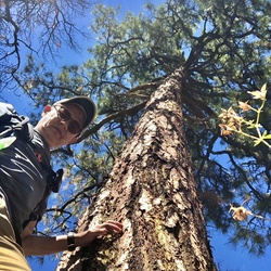
A freakin forest…in the desert! Pine trees, pine cones, leaves…sometimes I felt like I was walking a trail in Arkansas or Alabama. Incredible. Majestic. Highly recommend.
★
★
★
★
★
A freakin forest…in the desert! Pine trees, pine cones, leaves…sometimes I felt like I was walking a trail in Arkansas or Alabama. Incredible. Majestic. Highly recommend.
★
★
★
★
★
A freakin forest…in the desert! Pine trees, pine cones, leaves…sometimes I felt like I was walking a trail in Arkansas or Alabama. Incredible. Majestic. Highly recommend.
★
★
★
★
★

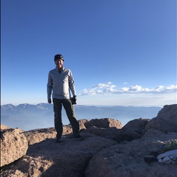
Following the example of another hiker who climbed yesterday, I left at 5:30 AM with my headlamp (which I only needed for the first 3 miles). There’s plenty of elevation gain on this climb so plan accordingly and give yourself time if you’re not used to these type of hikes. I made it to the top in 2 hours and enjoyed a lovely sunrise. Fairly strong Westerly winds at the top that decreases as soon as you’re on the other side. Overall it was a super enjoyable hike with a beautiful 360 view at the top. What are you waiting for? Get up there already!
★
★
★
★
★

Pretty hike, waterfall was flowing. Area around waterfall was well shaded; perfect for a picnic lunch.
I hiked starting at sunrise, did the loop counterclockwise.
★
★
★
★

Nice little walk to the stagecoach stop in Guadalupe National Park. Start at the park offices and gift shop.
★
★
★

It was a great workout, be prepared for any weather. About 16 degrees cooler, and add 15 knots to the wind speed at the visitor center .
★
★
★
★

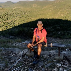
Gorgeous mountains and fall colors on a mostly flat, well maintained trail. The Grotto is worth the extra couple of miles.
★
★
★
★
★
It was a great workout, be prepared for any weather. About 16 degrees cooler, and add 15 knots to the wind speed at the visitor center .
★
★
★
★
It was a great workout, be prepared for any weather. About 16 degrees cooler, and add 15 knots to the wind speed at the visitor center .
★
★
★
★

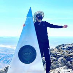
First push was brutal, however once you get past that it’s a breeze up until you get just a few feet away from the peak. You have to basically climb your way up. Hike down was much more enjoyable than the one up, as one would assume. Scenery was absolutely beautiful. 10/10 hike definitely recommend.
My only suggestions are to bring trekking poles, a backpack, foods high in carbohydrates and plenty of water.
Be prepared for some rough terrain. On the way down I jokingly counted how many times I rolled my ankle, and it was eleven. 😂
★
★
★
★
★

This was a nice hike on a beautifully maintained trail. Views from the top are worth the effort. Don’t listen to the horror stories from novices saying had hard and poor the trail is they are clueless beginners.
★
★
★
★


Very challenging hike with great views. Started early and it was very cool though warmed up to about 82 in the afternoon. The dry, cool climate make the ascent much more manageable than would be the case if it were hotter. View from the peak is well worth the trip. Downhill goes fast but can be rough on the toes. Lace those shoes tight. Can be crowded on weekends.
★
★
★
★

I came into this hike pretty unprepared. I do barre often, and I walk a lot for my job. However, I should have done lunges and bleachers. Here we are.
We started our hike at 8am, and we finished at 1:00pm (trailhead to peak and back). It was in the 50s when we began and around 75 when we reached the parking lot.
While the first 2.5 miles were horrifically uphill and technical, it stands to mention that it really is all uphill. There’s very little relief from switchbacks and climb. However, once you hit mile 3, you begin to get shade from Douglas firs and are provided gorgeous views.
I was stressed for a whole week before the hike, but it was entirely worth it. Though my legs are sore now, I loved the experience and would hike it again. Be sure to bring light layers as it’s windy up top, and have shoes with good traction.
★
★
★
★
★

We went on January 17. 34° at the trail head and 25° at the peak with 30 mph winds. We started hiking at 0145 to make the peak by sunrise with was 0700 that day. We made it for a full dark to full sun experience. 4 hours is a realistic hike time. We trained by doing bleachers at the local high school with an elevation of 465 feet. We were not ready for the altitude difference. Our average was a bit over 1 mile per hour with frequent stops to rest, water and snack.
The trail between the trail head and the woods is the toughest stretch. However, the trail never really gets easy at any point.
The wooden bridge is not "near the top" as just about every internet review says. Yes, it is a bit over a mile from the top but the going is still strenuous after the bridge. Just use it as a marker for mile 3 completed. Mentally, you will be better off.
I'm glad we made the entire hike in the dark to see the sunrise. However, just below the summit the switch back trail turn takes you to a "window" with cairns of stacked rocks on each side. You stick your head out and the wind slams you in the face. You look again and see nothing but black emptiness and a little bitty ledge of angled down rock ledge as the trail. I pulled out my iPhone to check my Gaia GPS downloaded map to make sure that little bitty ledge was actually the trail. It was. Once out on the ledge, it was one more switch back turn and the summit.
Going back down in day light the ledge and "window" didn't seem so bad. But at night it was kind of unnerving.
9 hours trail head, summit and back to trail head.
★
★
★
★
Hiked on 11/28/2020 as a day hike wearing a light pack and hiking boots. Conditions were cold, windy, but dry. Trail was dry and easy to follow for first half, with moderate trail-finding necessary in the second half. Autumn colors were largely past peak, but in the latter half of the hike colors were more prominent.
First half of the trail is a rock/dirt path following parallel to the wash, and is easy hiking. Second half of the trail enters the wash and is choose-your-own adventure, requiring some trail-finding. Final portion of the trail traverses stone formations that have been worn very smooth by foot traffic, and can be slippery.
Beautiful pay-off at the end with the eponymous Devils Hall.
https://www.gaiagps.com/public/PYfjPW6GklNswhbDqPo4V0Ox
★
★
★
★
★
Used for the ascent and descent during a 2-night backpacking trip this Thanksgiving. Weather was clear, but cold, which made for dry trail conditions. The majority of the trail is composed of crushed stone/scree. This can make for unsure footing on steep slopes where it may shift under foot. I used hiking poles to improve my stability and avoid unnecessary falls with my heavy backpacking load.
Most hikers are wearing masks, but the trail is not wide enough to maintain 6ft distance in most sections.
Ascent: https://www.gaiagps.com/public/qNAsNK0r4FWlZB6XEw4H2aYX
Descent: https://www.gaiagps.com/public/7IxYERMpJzMhDnZ7ULfNCj1h
★
★
★
★
★